Manscombe Plantation

Wood, Forest in Devon

England

Manscombe Plantation

Houses, Livermead From the Torbay-Totnes Trail following Cockington Lane. The house undergoing renovation on the right is on Hennapyn Road.
Houses, Livermead Credit: Derek Harper

Manscombe Plantation is a picturesque woodland located in the county of Devon, England. Situated in the heart of the Dartmoor National Park, it covers an expansive area and is well-known for its lush greenery and diverse flora and fauna.

The plantation is predominantly composed of dense forests, with towering oak, beech, and pine trees dominating the landscape. These majestic trees provide a dense canopy that creates a serene and tranquil ambiance. The forest floor is covered with a thick carpet of moss and ferns, adding to the enchanting atmosphere.

Manscombe Plantation is a haven for wildlife enthusiasts and nature lovers alike. The dense vegetation provides a natural habitat for a variety of species, including rare birds, such as the Dartford warbler and the nightjar. Visitors often spot deer, foxes, and squirrels roaming freely amidst the trees. The plantation is also home to a rich diversity of plant life, with wildflowers, bluebells, and various species of fungi adding bursts of color to the landscape.

The woodland offers a range of recreational activities for visitors to enjoy. Numerous walking trails meander through the plantation, allowing visitors to explore its hidden gems and take in the stunning views. The plantation also has designated picnic areas, making it an ideal spot for families to enjoy a day outdoors.

Manscombe Plantation is not only a natural treasure but also a vital part of the local ecosystem. Its preservation ensures the conservation of Devon's natural heritage and provides a peaceful retreat for all who venture into its leafy embrace.

If you have any feedback on the listing, please let us know in the comments section below.

Manscombe Plantation Images

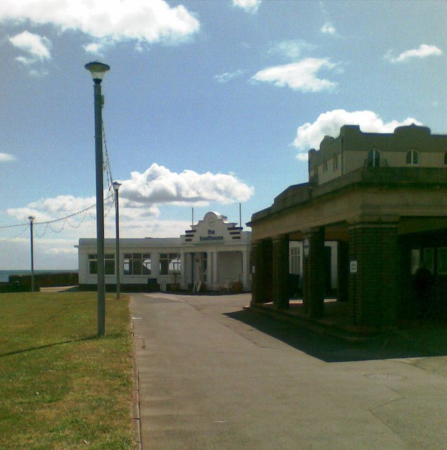
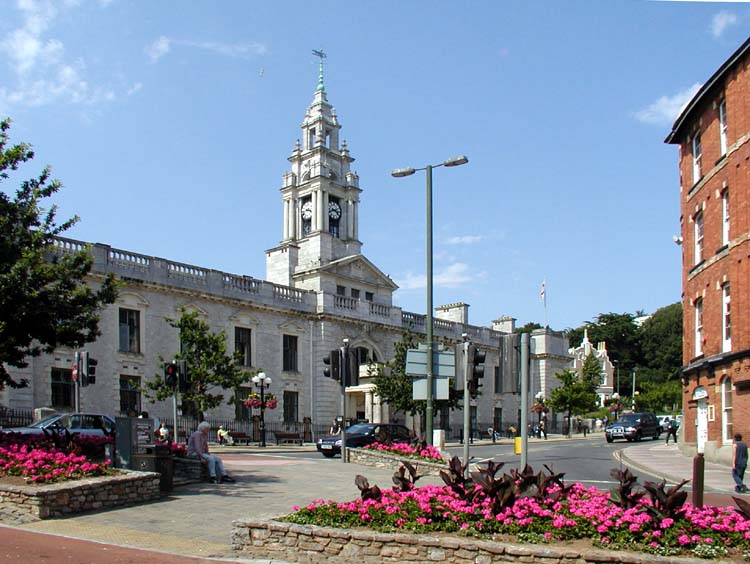
Images are sourced within 2km of 50.459144/-3.5621878 or Grid Reference SX8963. Thanks to Geograph Open Source API. All images are credited.

Houses, Livermead From the Torbay-Totnes Trail following Cockington Lane. The house undergoing renovation on the right is on Hennapyn Road.
Houses, Livermead
From the Torbay-Totnes Trail following Cockington Lane. The house undergoing renovation on the right is on Hennapyn Road.
Cockington Almshouses A row of seven almshouses built in 1840 to replace C17 almshouses <span class="nowrap"><a title="http://www.britishlistedbuildings.co.uk/en-390552-cockington-almshouses-torquay" rel="nofollow ugc noopener" href="http://www.britishlistedbuildings.co.uk/en-390552-cockington-almshouses-torquay">Link</a><img style="margin-left:2px;" alt="External link" title="External link - shift click to open in new window" src="https://s1.geograph.org.uk/img/external.png" width="10" height="10"/></span> .
Cockington Almshouses
A row of seven almshouses built in 1840 to replace C17 almshouses LinkExternal link .
Sheep in orchard, Cockington This is the burial orchard shown in <a href="https://www.geograph.org.uk/photo/1081443">SX8964 : Burial Orchard - Cockington</a>. The tree protectors are proving their worth, as one sheep scratches herself vigorously.
Sheep in orchard, Cockington
This is the burial orchard shown in SX8964 : Burial Orchard - Cockington. The tree protectors are proving their worth, as one sheep scratches herself vigorously.
Sheep in orchard, Cockington Another view of the orchard shown in <a href="https://www.geograph.org.uk/photo/2401574">SX8964 : Sheep in orchard, Cockington</a>, with a conglomeration of the flock lurking in the shade by the gate, although it's not really sunny.
Sheep in orchard, Cockington
Another view of the orchard shown in SX8964 : Sheep in orchard, Cockington, with a conglomeration of the flock lurking in the shade by the gate, although it's not really sunny.
View over Hollicombe A view from the path between Mead Road and Torbay Road, with the railway bridge on Hollicombe Head, from which <a href="https://www.geograph.org.uk/photo/1723275">SX8962 : Railway at Hollicombe</a> looks back along the railway line. Beyond in this image are Preston and Paignton Sands, separated by the Redcliffe Hotel - see <a href="https://www.geograph.org.uk/photo/971950">SX8961 : Redcliffe Hotel from Paignton Beach</a>.
View over Hollicombe
A view from the path between Mead Road and Torbay Road, with the railway bridge on Hollicombe Head, from which SX8962 : Railway at Hollicombe looks back along the railway line. Beyond in this image are Preston and Paignton Sands, separated by the Redcliffe Hotel - see SX8961 : Redcliffe Hotel from Paignton Beach.
Pine cones, Hollicombe Cut pine branches bearing cones beside the footpath from which <a href="https://www.geograph.org.uk/photo/2444196">SX8962 : View over Hollicombe</a> was taken.
Pine cones, Hollicombe
Cut pine branches bearing cones beside the footpath from which SX8962 : View over Hollicombe was taken.
Cottages on Totnes Road, Cockington village
Drake Avenue, Cockington
Beach huts above Preston Sands Beach huts above Preston Sands at Paignton.
Beach huts above Preston Sands
Beach huts above Preston Sands at Paignton.
The Boathouse PH off Marine drive
Parking meters plan outrage, Preston I don't know what sort of outrage they're planning, but can't somebody stop them? Surely a bunch of parking meters are no match for our police force?
Parking meters plan outrage, Preston
I don't know what sort of outrage they're planning, but can't somebody stop them? Surely a bunch of parking meters are no match for our police force?
Paignton, Manor Road, Torquay Road Junction
Preston Sands, Beach Huts
Steel Railing, Paignton sea front Looking towards Torquay from the easterly end of the Paignton sea front. This day was a wonderfully clear and sunny.
Steel Railing, Paignton sea front
Looking towards Torquay from the easterly end of the Paignton sea front. This day was a wonderfully clear and sunny.
Rocky Outcrop Paignton Sea Front The red stone of the South Devon coast at Torbay is unmistakeable. Here it is at Paignton with more in the background curving round to Torquay.
Rocky Outcrop Paignton Sea Front
The red stone of the South Devon coast at Torbay is unmistakeable. Here it is at Paignton with more in the background curving round to Torquay.
Steel Railing Paignton Sea Front Stainless Steel railings have become a common feature of domestic balconies, usually allied to sheets of toughened glass. Here at Paignton, it is used in what is probably a sensible way as it will hopefully cut down on maintenance costs.
Steel Railing Paignton Sea Front
Stainless Steel railings have become a common feature of domestic balconies, usually allied to sheets of toughened glass. Here at Paignton, it is used in what is probably a sensible way as it will hopefully cut down on maintenance costs.
Terraced steps to the beach, Paignton These concrete "steps" down to the beach at Paignton shine in the sunlight. Some days are perfect for photography or painting and this is one of them. Is it right to call these "steps" as they are so very long. Is it only on beaches that we encounter this type of terracing? Sports stadia come to mind. There is a hotel in the far distance.
Terraced steps to the beach, Paignton
These concrete "steps" down to the beach at Paignton shine in the sunlight. Some days are perfect for photography or painting and this is one of them. Is it right to call these "steps" as they are so very long. Is it only on beaches that we encounter this type of terracing? Sports stadia come to mind. There is a hotel in the far distance.
Stone Steps at Paignton Beach There is something a little poignant about an empty beach on a sunny morning. In truth, the beach was not entirely empty, people came and went. It was possible to catch an "empty" moment. Empty moments have more appeal in some ways and encourage more reflection. In any case, Geographers have to respect the privacy of the individual.
Stone Steps at Paignton Beach
There is something a little poignant about an empty beach on a sunny morning. In truth, the beach was not entirely empty, people came and went. It was possible to catch an "empty" moment. Empty moments have more appeal in some ways and encourage more reflection. In any case, Geographers have to respect the privacy of the individual.
Show me another place!

Manscombe Plantation is located at Grid Ref: SX8963 (Lat: 50.459144, Lng: -3.5621878)

Unitary Authority: Torbay

Police Authority: Devon and Cornwall

What 3 Words

///replayed.steadily.quicksand. Near Cockington, Devon

Related Wikis

Cockington

Cockington is a village near Torquay, in the Torbay district, in the ceremonial county of Devon, Devon. It has old cottages within its boundaries, and...

Cockington Court

Cockington Court, near Torquay in Devon, England, is Grade II* listed on the English Heritage Register. The manor dates back to Saxon times, and is mentioned...

Preston, Devon

Preston is a suburb located in the northern part of Paignton in Devon. Preston is a popular destination for family holidays and has two main beaches; Hollicombe...

Torbay

Torbay is unitary authority with a borough status in the ceremonial county of Devon, England. It is governed by Torbay Council, based in the town of Torquay...

Nearby Amenities

Located within 500m of 50.459144,-3.5621878
Turning Circle
Lat/Long: 50.4567906/-3.5601052
Barrier: stile
Lat/Long: 50.4580595/-3.564755
Barrier: stile
Lat/Long: 50.4581371/-3.5645844
Barrier: stile
Lat/Long: 50.4579988/-3.5631537
Barrier: stile
Lat/Long: 50.457817/-3.561677
Barrier: stile
Lat/Long: 50.456169/-3.5599789
Barrier: stile
Lat/Long: 50.4581356/-3.5647309
Barrier: stile
Lat/Long: 50.4599961/-3.5657203
Barrier: stile
Lat/Long: 50.462049/-3.5671633
Bus Stop
Broadley Drive
Bench: no
Bin: no
Lit: yes
Naptan AtcoCode: 1190TOA10435
Naptan Bearing: N
Naptan CommonName: Broadley Drive
Naptan Crossing: Broadstone Park Road
Naptan NaptanCode: tbydawp
Naptan PlusbusZoneRef: NABT
Naptan Street: Broadley Drive
Naptan Verified: no
Shelter: no
Source: naptan_import
Tactile Paving: no
Lat/Long: 50.4575166/-3.556962
Bus Stop
Broadley Drive
Naptan AtcoCode: 1190TOA10436
Naptan Bearing: SW
Naptan CommonName: Broadley Drive
Naptan Crossing: Broadstone Park Road
Naptan NaptanCode: tbydatj
Naptan PlusbusZoneRef: NABT
Naptan Street: Mendip Road
Naptan Verified: no
Source: naptan_import
Lat/Long: 50.4590944/-3.5580141
Bus Stop
Mendip Road
Naptan AtcoCode: 1190TOA10437
Naptan Bearing: S
Naptan CommonName: Mendip Road
Naptan Crossing: Old Paignton Road
Naptan NaptanCode: tbydatm
Naptan PlusbusZoneRef: NABT
Naptan Street: Mendip Road
Naptan Verified: no
Source: naptan_import
Lat/Long: 50.4582941/-3.5580019
Bus Stop
Brendons Avenue
Naptan AtcoCode: 1190TOA10440
Naptan Bearing: N
Naptan CommonName: Brendons Avenue
Naptan Crossing: Winsford Road
Naptan NaptanCode: tbydadm
Naptan PlusbusZoneRef: NABT
Naptan Street: Brendons Avenue
Naptan Verified: no
Source: naptan_import
Lat/Long: 50.458564/-3.5600114
Bus Stop
Broadley Drive
Bus: yes
Naptan AtcoCode: 1190TOA10442
Naptan Bearing: S
Naptan CommonName: Broadley Drive
Naptan Crossing: Broadpark Road
Naptan NaptanCode: tbyawpd
Naptan PlusbusZoneRef: NABT
Naptan Street: Broadley Drive
Naptan Verified: yes
Public Transport: platform
Source: naptan_import;survey
Lat/Long: 50.4575913/-3.5611028
Bus Stop
Pentridge Avenue
Bus: yes
Naptan AtcoCode: 1190TOA10444
Naptan Bearing: E
Naptan CommonName: Pentridge Avenue
Naptan Crossing: Pentridge Avenue
Naptan Indicator: Outside 79 Broadpark Road
Naptan NaptanCode: tbydapj
Naptan PlusbusZoneRef: NABT
Naptan ShortCommonName: Broadpark Road
Naptan Street: Broadpark Road
Naptan Verified: yes
Public Transport: platform
Source: naptan_import;survey
Lat/Long: 50.4564698/-3.5589486
Entrance: yes
Lat/Long: 50.4633914/-3.5644489
Drinking Water
Fire Hydrant
Emergency: fire_hydrant
Fire Hydrant Type: underground
Lat/Long: 50.4622264/-3.5570383
Direction: 100
Generator Method: photovoltaic
Generator Output Electricity: yes
Generator Solar Modules: 16
Generator Source: solar
Generator Type: solar_photovoltaic_panel
Location: roof
Power: generator
Lat/Long: 50.4568109/-3.5611191
Direction: 100
Generator Method: photovoltaic
Generator Output Electricity: yes
Generator Solar Modules: 8
Generator Source: solar
Generator Type: solar_photovoltaic_panel
Location: roof
Power: generator
Lat/Long: 50.4570858/-3.5616046
Direction: 280
Generator Method: photovoltaic
Generator Output Electricity: yes
Generator Solar Modules: 8
Generator Source: solar
Generator Type: solar_photovoltaic_panel
Location: roof
Power: generator
Lat/Long: 50.4571012/-3.561669
Direction: 185
Generator Method: photovoltaic
Generator Output Electricity: yes
Generator Solar Modules: 11
Generator Source: solar
Generator Type: solar_photovoltaic_panel
Location: roof
Power: generator
Lat/Long: 50.4566555/-3.5596466
Direction: 185
Generator Method: photovoltaic
Generator Output Electricity: yes
Generator Solar Modules: 16
Generator Source: solar
Generator Type: solar_photovoltaic_panel
Location: roof
Power: generator
Lat/Long: 50.4558136/-3.5591611
Direction: 185
Generator Method: photovoltaic
Generator Output Electricity: yes
Generator Solar Modules: 16
Generator Source: solar
Generator Type: solar_photovoltaic_panel
Location: roof
Power: generator
Lat/Long: 50.4555626/-3.5579675
Direction: 100
Generator Method: photovoltaic
Generator Output Electricity: yes
Generator Solar Modules: 16
Generator Source: solar
Generator Type: solar_photovoltaic_panel
Location: roof
Power: generator
Lat/Long: 50.4566197/-3.5576162
Direction: SSE
Generator Method: photovoltaic
Generator Output Electricity: yes
Generator Solar Modules: 8
Generator Source: solar
Generator Type: solar_photovoltaic_panel
Location: roof
Power: generator
Lat/Long: 50.4585493/-3.5584718
Direction: SSE
Generator Method: photovoltaic
Generator Output Electricity: yes
Generator Solar Modules: 8
Generator Source: solar
Generator Type: solar_photovoltaic_panel
Location: roof
Power: generator
Lat/Long: 50.4585664/-3.558343
Direction: 175
Generator Method: photovoltaic
Generator Output Electricity: yes
Generator Solar Modules: 16
Generator Source: solar
Generator Type: solar_photovoltaic_panel
Location: roof
Power: generator
Lat/Long: 50.4585117/-3.5574391
Direction: 175
Generator Method: photovoltaic
Generator Output Electricity: yes
Generator Solar Modules: 10
Generator Source: solar
Generator Type: solar_photovoltaic_panel
Location: roof
Power: generator
Lat/Long: 50.457622/-3.5563528
Direction: 175
Generator Method: photovoltaic
Generator Output Electricity: yes
Generator Solar Modules: 8
Generator Source: solar
Generator Type: solar_photovoltaic_panel
Location: roof
Power: generator
Lat/Long: 50.4576033/-3.5566532
Direction: WSW
Generator Method: photovoltaic
Generator Output Electricity: yes
Generator Source: solar
Generator Type: solar_photovoltaic_panel
Location: roof
Power: generator
Lat/Long: 50.4590564/-3.5575786
Direction: SSE
Generator Method: photovoltaic
Generator Output Electricity: yes
Generator Solar Modules: 11
Generator Source: solar
Generator Type: solar_photovoltaic_panel
Location: roof
Power: generator
Lat/Long: 50.4596216/-3.5558057
Direction: SSE
Generator Method: photovoltaic
Generator Output Electricity: yes
Generator Solar Modules: 3
Generator Source: solar
Generator Type: solar_photovoltaic_panel
Location: roof
Power: generator
Lat/Long: 50.4596011/-3.5557936
Post Box
Brand: Royal Mail
Brand Wikidata: Q638098
Brand Wikipedia: en:Royal Mail
Collection Times: Mo-Fr 09:00; Sa 07:00; Su off
Drive Through: no
Operator: Royal Mail
Operator Wikidata: Q638098
Post Box Design: type_b
Post Box Mounting: brick_pillar
Post Box Type: wall
Ref: TQ2 395D
Royal Cypher: EIIR
Royal Cypher Wikidata: Q33102113
Source: survey;streetlevel imagery;aerial imagery
Lat/Long: 50.458726/-3.5572793
The data included in this document is from www.openstreetmap.org. The data is made available under ODbL.

Have you been to Manscombe Plantation?

Leave your review of Manscombe Plantation below (or comments, questions and feedback).