Ashwick Wood

Wood, Forest in Somerset Somerset West and Taunton

England

Ashwick Wood

South Hill on Exmoor  View north towards South Hill from the B3223.
South Hill on Exmoor Credit: Kevin Pearson

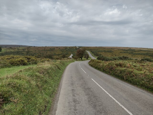
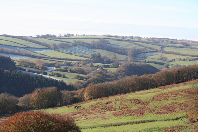
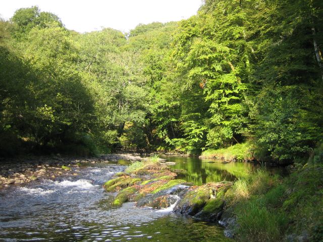
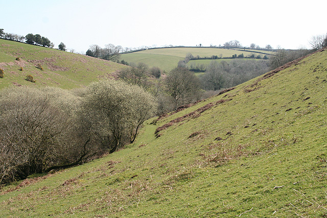
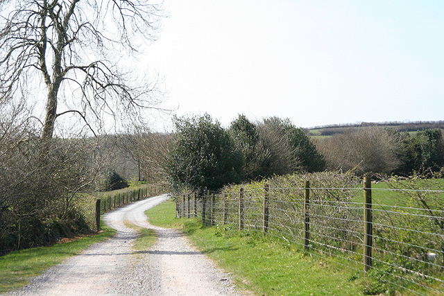
Ashwick Wood is a picturesque woodland located in Somerset, England. Spanning approximately 60 hectares, it is a popular destination for nature enthusiasts and those seeking tranquility amidst the beauty of the countryside. The wood is situated near the village of Ashwick, providing easy access for visitors.

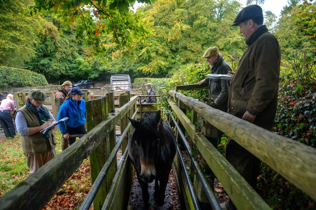
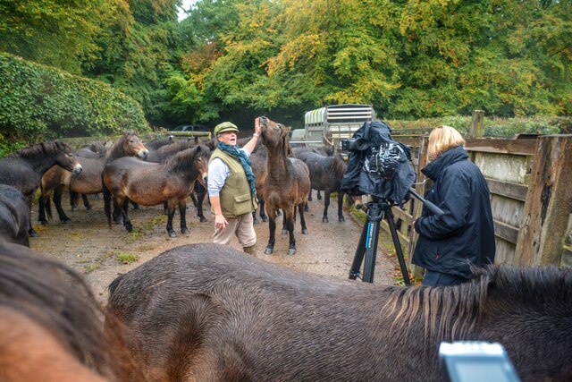
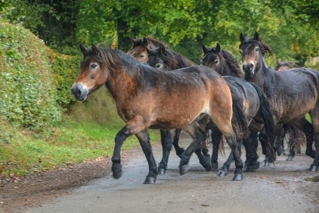
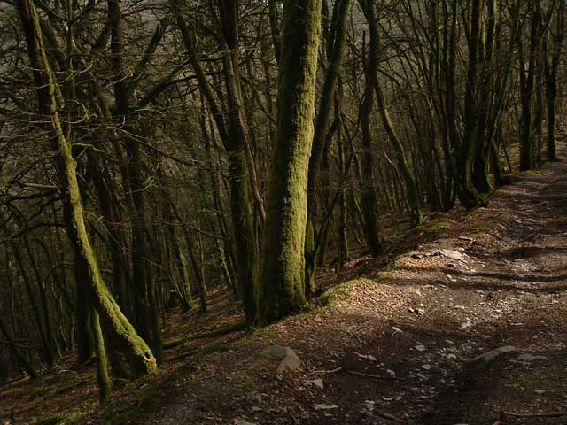
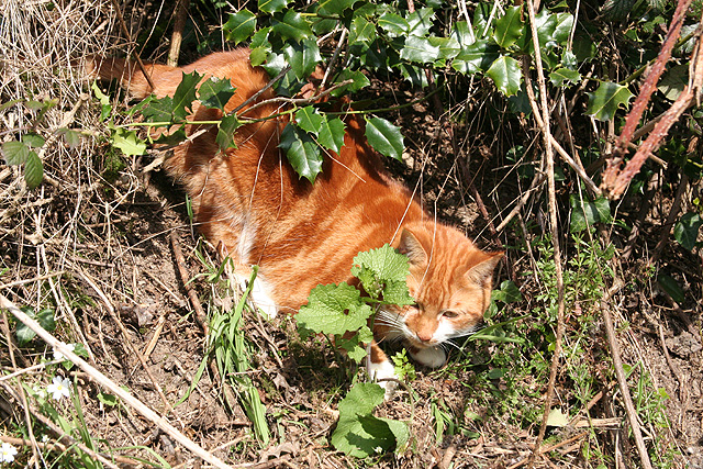
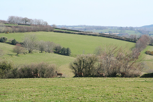
Covered in a dense canopy of various tree species, including oak, beech, and ash, Ashwick Wood offers a diverse and rich ecosystem. The woodland floor is adorned with a carpet of bluebells during the spring season, creating a stunning sight for visitors to behold. Additionally, the wood is home to a wide array of flora and fauna, making it a haven for wildlife. Visitors may have the opportunity to spot birds such as woodpeckers, owls, and various songbirds, as well as mammals like squirrels, badgers, and deer.

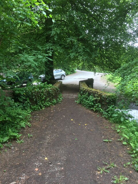
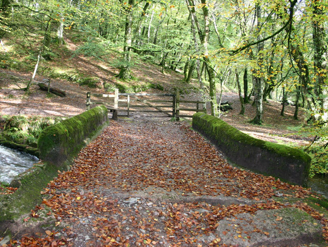
A network of well-maintained trails meanders through Ashwick Wood, allowing visitors to explore its natural beauty at their own pace. These paths provide excellent opportunities for walking, jogging, and cycling, catering to a range of interests. Furthermore, the wood offers ample space for picnics and other outdoor activities, making it an ideal spot for families and groups to spend a leisurely day.

Ashwick Wood is managed by local authorities who prioritize the conservation and protection of its natural resources. This ensures that visitors can continue to enjoy its beauty for years to come. Whether seeking a peaceful retreat or an adventure in nature, Ashwick Wood provides an idyllic setting for all who visit.

If you have any feedback on the listing, please let us know in the comments section below.

Ashwick Wood Images

Images are sourced within 2km of 51.055752/-3.586665 or Grid Reference SS8829. Thanks to Geograph Open Source API. All images are credited.

South Hill on Exmoor  View north towards South Hill from the B3223.
South Hill on Exmoor
View north towards South Hill from the B3223.
Marsh Bridge
Marsh Bridge
Dulverton : Exmoor Ponies Exmoor Ponies being counted.
Dulverton : Exmoor Ponies
Exmoor Ponies being counted.
Dulverton : Exmoor Ponies Ponies from the Anchor herd at rounded up and counted, labelled and put back out onto the moors.
Dulverton : Exmoor Ponies
Ponies from the Anchor herd at rounded up and counted, labelled and put back out onto the moors.
Dulverton : Exmoor Pony A pony has come to say hello.
Dulverton : Exmoor Pony
A pony has come to say hello.
Dulverton : Exmoor Ponies Interest in the Anchor herd is such that the BBC have come to film a report.
Dulverton : Exmoor Ponies
Interest in the Anchor herd is such that the BBC have come to film a report.
Dulverton : Marsh Hill Exmoor ponies heading along Marsh Hill.
Dulverton : Marsh Hill
Exmoor ponies heading along Marsh Hill.
Dulverton : Marsh Hill Exmoor ponies heading along Marsh Hill after being rounded up and ready for an annual count.
Dulverton : Marsh Hill
Exmoor ponies heading along Marsh Hill after being rounded up and ready for an annual count.
Castle Bridge, Dulverton, Somerset Looking north over Castle Bridge.  Just to the right of this, Danes's Brook, which flows under the bridge, joins the river Barle. Presumably the  bridge gets its name from Brewer's Castle, the site of which is out-of-shot up the hill from the top left of this image.
Castle Bridge, Dulverton, Somerset
Looking north over Castle Bridge. Just to the right of this, Danes's Brook, which flows under the bridge, joins the river Barle. Presumably the bridge gets its name from Brewer's Castle, the site of which is out-of-shot up the hill from the top left of this image.
Exe Valley Way: near Great Gate On the Exe Valley Way between Hawkridge and Brewer Castle.
Exe Valley Way: near Great Gate
On the Exe Valley Way between Hawkridge and Brewer Castle.
Dulverton: Draydon Wood Beyond the wood lies the Barle valley and on the hill above is Hinham Farm, its north-facing fields still partly covered in frost. Three riders from the Devon & Somerset hunt can be seen
Dulverton: Draydon Wood
Beyond the wood lies the Barle valley and on the hill above is Hinham Farm, its north-facing fields still partly covered in frost. Three riders from the Devon & Somerset hunt can be seen
River Barle Looking upstream, water level very low after the dry summer.
River Barle
Looking upstream, water level very low after the dry summer.
Dulverton: footbridge over stream On the public footpath between Dulverton and Waddicombe, looking east
Dulverton: footbridge over stream
On the public footpath between Dulverton and Waddicombe, looking east
Dulverton: below Chilcott Looking east in the direction of Lower Chilcott Wood, in a hidden valley, with pussy willow by a stream
Dulverton: below Chilcott
Looking east in the direction of Lower Chilcott Wood, in a hidden valley, with pussy willow by a stream
Dulverton: by Lower Chilcott A cat enjoying Easter sunshine
Dulverton: by Lower Chilcott
A cat enjoying Easter sunshine
Dulverton: Higher Chilcott Farm Home of Pine Lodge Riding Holidays. Looking north east. See <span class="nowrap"><a title="http://www.pinelodge.countryside-inter.net/introductionframe.htm" rel="nofollow ugc noopener" href="http://www.pinelodge.countryside-inter.net/introductionframe.htm">Link</a><img style="margin-left:2px;" alt="External link" title="External link - shift click to open in new window" src="https://s1.geograph.org.uk/img/external.png" width="10" height="10"/></span>
Dulverton: Higher Chilcott Farm
Home of Pine Lodge Riding Holidays. Looking north east. See LinkExternal link
Dulverton: track to Cawkett Looking south west
Dulverton: track to Cawkett
Looking south west
Dulverton: five hinds Near Chilcott Cross, looking east
Dulverton: five hinds
Near Chilcott Cross, looking east
Show me another place!

Ashwick Wood is located at Grid Ref: SS8829 (Lat: 51.055752, Lng: -3.586665)

Administrative County: Somerset

District: Somerset West and Taunton

Police Authority: Avon and Somerset

What 3 Words

///pile.encodes.apes. Near Dulverton, Somerset

Related Wikis

Mounsey Castle

Mounsey Castle is an Iron Age irregular triangular earthwork of 1.75 hectares (4.3 acres) north west of Dulverton, Somerset, England. It has been scheduled...

Brewer's Castle

Brewer's Castle is a defended Iron Age settlement in the West Somerset district of Somerset, England. The hill fort is situated approximately 2 miles...

Ashwick House, Dulverton

not to be confused with the 17th century Ashwick Court in eastern Somerset.Ashwick House is an Edwardian mansion in Ashwick, four miles northwest of Dulverton...

Northmoor, Dulverton

Northmoor is an historic estate in the parish of Dulverton in Somerset, England. The Victorian mansion house known as Northmoor House is set amongst steep...

Oldberry Castle

Oldberry Castle (sometimes called Oldbury Castle) is an Iron Age hill fort north west of Dulverton, Somerset, England. It lies approximately 0.5 miles...

Dulverton

Dulverton is a town and civil parish in west Somerset, England, near the border with Devon. The town had a population of 1,408 at the 2011 Census. The...

Dulverton Rural District

Dulverton was a rural district in Somerset, England, from 1894 to 1974. It was created in 1894 under the Local Government Act 1894. In 1974 it was abolished...

Church of St Giles, Hawkridge

The Anglican Church of St Giles in Hawkridge, Somerset, England was built in the 14th century. It is a Grade II* listed building. == History == The oldest...

Nearby Amenities

Located within 500m of 51.055752,-3.586665
Mounsey Castle
Source: npe
Tourism: attraction
Wikidata: Q6919206
Wikipedia: en:Mounsey Castle
Lat/Long: 51.0543575/-3.5904589
The data included in this document is from www.openstreetmap.org. The data is made available under ODbL.

Have you been to Ashwick Wood?

Leave your review of Ashwick Wood below (or comments, questions and feedback).