Ballpark Copse

Wood, Forest in Somerset Somerset West and Taunton

England

Ballpark Copse

Stone Lane and a postbox by the gate
Stone Lane and a postbox by the gate Credit: David Smith

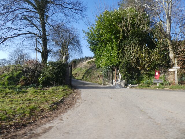
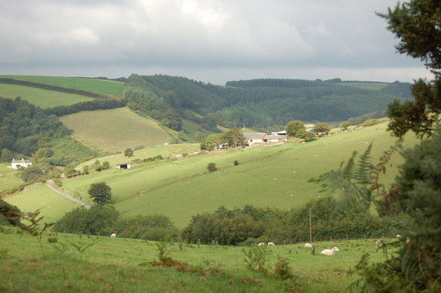
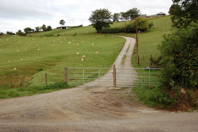
Ballpark Copse is a picturesque woodland located in Somerset, England. Covering an area of approximately 10 acres, it is an enchanting destination for nature enthusiasts and outdoor adventurers alike. The copse is situated in close proximity to the charming village of Ballpark, adding to its allure.

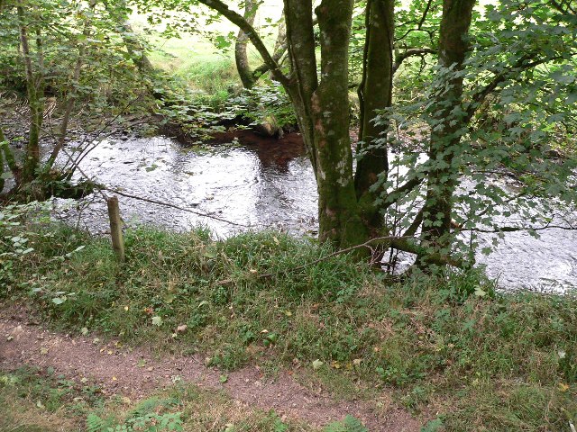
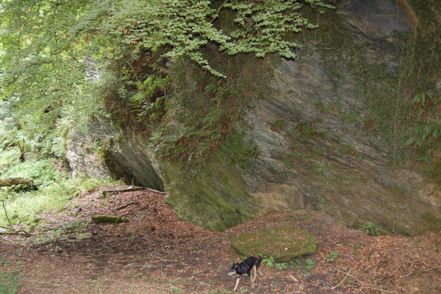
This woodland is characterized by its diverse and thriving ecosystem, encompassing a variety of tree species such as oak, ash, beech, and birch. The dense foliage provides a haven for numerous bird species, making it a popular destination for birdwatchers. The copse is also home to an array of wildlife, including rabbits, squirrels, and deer, which can often be spotted during a stroll through the woods.

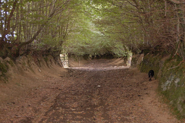
Ballpark Copse offers a network of well-maintained walking trails that meander through the enchanting forest, allowing visitors to fully immerse themselves in the natural beauty of the surroundings. These trails cater to all levels of fitness and provide an opportunity to explore the copse at one's own pace.

The copse is open to the public year-round and attracts visitors from all over the region. It offers a peaceful and tranquil retreat from the hustle and bustle of everyday life, making it an ideal spot for relaxation and rejuvenation. Whether it's a leisurely walk, a picnic amidst nature, or simply a moment of solitude, Ballpark Copse provides a serene and idyllic setting for all to enjoy.

If you have any feedback on the listing, please let us know in the comments section below.

Ballpark Copse Images

Images are sourced within 2km of 51.132752/-3.5996084 or Grid Reference SS8838. Thanks to Geograph Open Source API. All images are credited.

Stone Lane and a postbox by the gate
Road fork at Langdon's Way
Hedge and ditch by B3224 Land around this road has been reclaimed from marshland, so the ditch is probably a reminder of that
Hedge and ditch by B3224
Land around this road has been reclaimed from marshland, so the ditch is probably a reminder of that
Hegebank by B3224
Hegebank by B3224
River Exe at Nethercote Taken on south side of the river.
River Exe at Nethercote
Taken on south side of the river.
The River Exe below Road Castle The young river twists through steep-sided valleys in this part of Exmoor.
The River Exe below Road Castle
The young river twists through steep-sided valleys in this part of Exmoor.
Bridleway to Codsend This part of the route marked as (Holloway Lane) slopes gently down hill all the way to Codsend. It tends to get very boggy in the winter months.
Bridleway to Codsend
This part of the route marked as (Holloway Lane) slopes gently down hill all the way to Codsend. It tends to get very boggy in the winter months.
Round this bend to Codsend This is a small farming community at the end of a single road. The photograph shows the last few metres of bridleway/farm road before the start of the road.
Round this bend to Codsend
This is a small farming community at the end of a single road. The photograph shows the last few metres of bridleway/farm road before the start of the road.
Bridleway sign on Kitnor Heath The sign had been repaired with baler twine and a ride marker after a deer used it as a rubbing post. Note -Dunkery beakon in the background.
Bridleway sign on Kitnor Heath
The sign had been repaired with baler twine and a ride marker after a deer used it as a rubbing post. Note -Dunkery beakon in the background.
Very wide Bridleway off Thorne Lane Approx 200 years ago, this route (Pinn Lane) was used by horse drawn wagons carrying stone from Pinn Quarry at its western end to build many of the local farms and houses.
Very wide Bridleway off Thorne Lane
Approx 200 years ago, this route (Pinn Lane) was used by horse drawn wagons carrying stone from Pinn Quarry at its western end to build many of the local farms and houses.
Disused Quarry This quarry is so overgrown that people passing by on the bridleway near the top corner would only notice trees growing down a steep slope. At a lower level, cattle and sheep are free to wander over overgrown spoil heaps and into the quarry basin.
Disused Quarry
This quarry is so overgrown that people passing by on the bridleway near the top corner would only notice trees growing down a steep slope. At a lower level, cattle and sheep are free to wander over overgrown spoil heaps and into the quarry basin.
Torre Farm surrounded by fields of sheep. Taken from the start of Ison Lane bridleway
Torre Farm surrounded by fields of sheep.
Taken from the start of Ison Lane bridleway
Track up to Torre Farm from Oldrey Lane The track swings to the left then in a large semicircle round the contour of the hill to finish at the farm buildings near the top right.
Track up to Torre Farm from Oldrey Lane
The track swings to the left then in a large semicircle round the contour of the hill to finish at the farm buildings near the top right.
Entrance to Bridleway from B3224 At this point the surface of the bridleway has been worn down to an outcrop of soft sedimentary rock known locally as "shelit".
Entrance to Bridleway from B3224
At this point the surface of the bridleway has been worn down to an outcrop of soft sedimentary rock known locally as "shelit".
Heather and Gorse on Kitnor Heath This view was taken from the grass covered bridleway which was not in the shot.
Heather and Gorse on Kitnor Heath
This view was taken from the grass covered bridleway which was not in the shot.
Electrically operated gates to Bridleway at Stone Cross Extra high level switches have been provided for Horse riders on both sides of these gates. A sensor on the righthand gate post close the gates after the horse passes through. This is also the entrance to Stone Farm.
Electrically operated gates to Bridleway at Stone Cross
Extra high level switches have been provided for Horse riders on both sides of these gates. A sensor on the righthand gate post close the gates after the horse passes through. This is also the entrance to Stone Farm.
Cutthorne valley A view of Cutthorne valley, site of a post medieval field gutter system listed as archaeologically important. The property has been occupied and farmed since Saxon times and was the home of Johannes de Cotehorne in 1327.( Lay Subsidy records)
Cutthorne valley
A view of Cutthorne valley, site of a post medieval field gutter system listed as archaeologically important. The property has been occupied and farmed since Saxon times and was the home of Johannes de Cotehorne in 1327.( Lay Subsidy records)
Ancient cobbled courtyard at Cutthorne This centuries old cobbled yard was part of an original network of tracks which connected all the farms locally. Heading south from this yard away from what is now the B3224 would lead to Thorne Lane (the Old Hare Path) and Pinn Lane. The buildings are a two storey C17th threshing barn and single storey C18th shippon.
Ancient cobbled courtyard at Cutthorne
This centuries old cobbled yard was part of an original network of tracks which connected all the farms locally. Heading south from this yard away from what is now the B3224 would lead to Thorne Lane (the Old Hare Path) and Pinn Lane. The buildings are a two storey C17th threshing barn and single storey C18th shippon.
Show me another place!

Ballpark Copse is located at Grid Ref: SS8838 (Lat: 51.132752, Lng: -3.5996084)

Administrative County: Somerset

District: Somerset West and Taunton

Police Authority: Avon and Somerset

What 3 Words

///cycled.severe.shaves. Near Porlock, Somerset

Nearby Locations

Ballpark Copse

Related Wikis

Road Castle

Road Castle is an Iron Age bank and ditch in the West Somerset district of Somerset, England. The hill fort is situated approximately 2 miles (3.2 km)...

Church of St Mary Magdelene, Exford

The Anglican Church of St Mary Magdelene in Exford, Somerset, England was built in the 15th century. It is a Grade II* listed building. == History == Nothing...

Exford, Somerset

Exford is a rural village at the centre of Exmoor National Park, 7 miles (11 km) north-west of Dulverton, and 10 miles (16 km) south-west of Minehead,...

Dunkery Hill

Dunkery Beacon at the summit of Dunkery Hill is the highest point on Exmoor and in Somerset, England. It is also the highest point in southern England...

Exmoor

Exmoor is loosely defined as an area of hilly open moorland in west Somerset and north Devon in South West England. It is named after the River Exe, the...

Garratts Wood

Garratts Wood is a woodland in Somerset, England, near the village of Winsford. It covers a total area of 1.11 hectares (2.74 acres). It is owned and managed...

South Exmoor SSSI

South Exmoor (grid reference SS880340) is a 3132.7 hectare (7742.3 acre) biological Site of Special Scientific Interest in Devon and Somerset, England...

Timberscombe

Timberscombe is a village and civil parish on the River Avill 2.5 miles (4 km) south-west of Dunster, and 5.5 miles (9 km) south of Minehead within the...

Nearby Amenities

Located within 500m of 51.132752,-3.5996084
Horsecombe Farm
Note Retag: CS #48756035
Place: isolated_dwelling
Lat/Long: 51.1356968/-3.5962621
The data included in this document is from www.openstreetmap.org. The data is made available under ODbL.

Have you been to Ballpark Copse?

Leave your review of Ballpark Copse below (or comments, questions and feedback).