Down Cleeve Plantation

Wood, Forest in Somerset Somerset West and Taunton

England

Down Cleeve Plantation

Stone Lane and a postbox by the gate
Stone Lane and a postbox by the gate Credit: David Smith

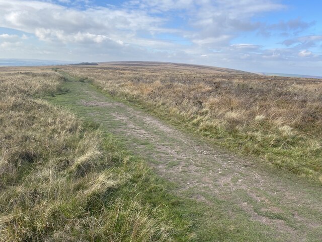
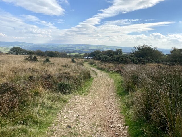
Down Cleeve Plantation is a picturesque woodland located in Somerset, England. Covering an area of approximately 500 acres, it is one of the largest and most diverse plantations in the region. The plantation is situated on the western slopes of the Quantock Hills, offering stunning views of the surrounding countryside.

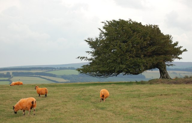
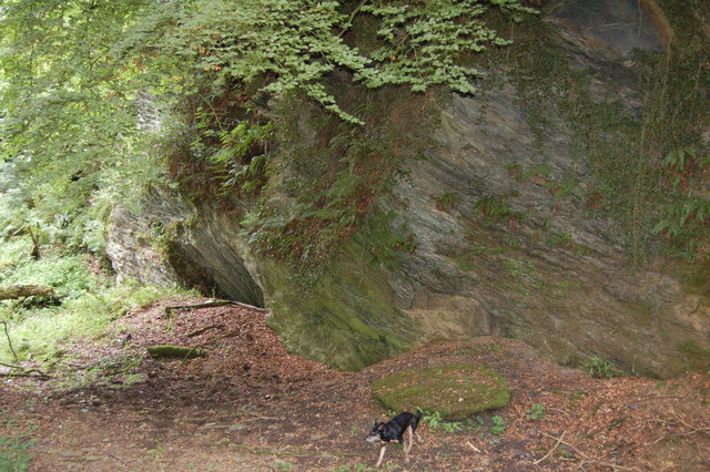
The woodland is predominantly composed of native trees such as oak, beech, and ash, creating a rich and varied habitat for numerous plant and animal species. The diverse range of flora includes bluebells, primroses, and wild garlic, which bloom vibrantly during the spring months.

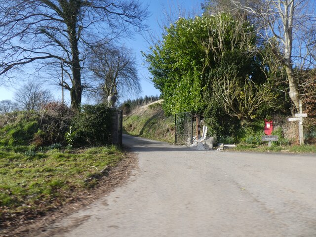
The plantation is crisscrossed with a network of well-maintained footpaths, allowing visitors to explore the woodland and enjoy its natural beauty. These paths lead to several points of interest, including a meandering stream, charming little ponds, and a variety of bird-watching spots.

Down Cleeve Plantation is known for its abundance of wildlife. Visitors may catch a glimpse of deer, foxes, and badgers in their natural habitats, while bird enthusiasts can spot various species such as woodpeckers, buzzards, and owls. The woodland also attracts a diverse range of butterflies and insects, making it a haven for nature enthusiasts and photographers.

The plantation is open to the public throughout the year, and there are no entry fees or restrictions on access. It is a popular destination for walkers, families, and nature lovers seeking to immerse themselves in the tranquility of the countryside. With its scenic trails, diverse ecosystem, and captivating wildlife, Down Cleeve Plantation offers a truly enchanting experience for all who venture into its embrace.

If you have any feedback on the listing, please let us know in the comments section below.

Down Cleeve Plantation Images

Images are sourced within 2km of 51.147886/-3.6048928 or Grid Reference SS8739. Thanks to Geograph Open Source API. All images are credited.

Stone Lane and a postbox by the gate
Road fork at Langdon's Way
Hedge and ditch by B3224 Land around this road has been reclaimed from marshland, so the ditch is probably a reminder of that
Hedge and ditch by B3224
Land around this road has been reclaimed from marshland, so the ditch is probably a reminder of that
Hegebank by B3224
Hegebank by B3224
Moorland track, west of Dunkery Beacon
Bridleway to Dunkery Bridge
Bridleway to Codsend This part of the route marked as (Holloway Lane) slopes gently down hill all the way to Codsend. It tends to get very boggy in the winter months.
Bridleway to Codsend
This part of the route marked as (Holloway Lane) slopes gently down hill all the way to Codsend. It tends to get very boggy in the winter months.
Round this bend to Codsend This is a small farming community at the end of a single road. The photograph shows the last few metres of bridleway/farm road before the start of the road.
Round this bend to Codsend
This is a small farming community at the end of a single road. The photograph shows the last few metres of bridleway/farm road before the start of the road.
Orange Flavoured Lamb on Stone Down The wind swept beech tree is clinging to the remains of a circular enclosure approx 16M diameter.
Orange Flavoured Lamb on Stone Down
The wind swept beech tree is clinging to the remains of a circular enclosure approx 16M diameter.
Bridleway sign on Kitnor Heath The sign had been repaired with baler twine and a ride marker after a deer used it as a rubbing post. Note -Dunkery beakon in the background.
Bridleway sign on Kitnor Heath
The sign had been repaired with baler twine and a ride marker after a deer used it as a rubbing post. Note -Dunkery beakon in the background.
Disused Quarry This quarry is so overgrown that people passing by on the bridleway near the top corner would only notice trees growing down a steep slope. At a lower level, cattle and sheep are free to wander over overgrown spoil heaps and into the quarry basin.
Disused Quarry
This quarry is so overgrown that people passing by on the bridleway near the top corner would only notice trees growing down a steep slope. At a lower level, cattle and sheep are free to wander over overgrown spoil heaps and into the quarry basin.
Entrance to Bridleway from B3224 At this point the surface of the bridleway has been worn down to an outcrop of soft sedimentary rock known locally as "shelit".
Entrance to Bridleway from B3224
At this point the surface of the bridleway has been worn down to an outcrop of soft sedimentary rock known locally as "shelit".
Heather and Gorse on Kitnor Heath This view was taken from the grass covered bridleway which was not in the shot.
Heather and Gorse on Kitnor Heath
This view was taken from the grass covered bridleway which was not in the shot.
Electrically operated gates to Bridleway at Stone Cross Extra high level switches have been provided for Horse riders on both sides of these gates. A sensor on the righthand gate post close the gates after the horse passes through. This is also the entrance to Stone Farm.
Electrically operated gates to Bridleway at Stone Cross
Extra high level switches have been provided for Horse riders on both sides of these gates. A sensor on the righthand gate post close the gates after the horse passes through. This is also the entrance to Stone Farm.
Cutthorne valley A view of Cutthorne valley, site of a post medieval field gutter system listed as archaeologically important. The property has been occupied and farmed since Saxon times and was the home of Johannes de Cotehorne in 1327.( Lay Subsidy records)
Cutthorne valley
A view of Cutthorne valley, site of a post medieval field gutter system listed as archaeologically important. The property has been occupied and farmed since Saxon times and was the home of Johannes de Cotehorne in 1327.( Lay Subsidy records)
Ancient cobbled courtyard at Cutthorne This centuries old cobbled yard was part of an original network of tracks which connected all the farms locally. Heading south from this yard away from what is now the B3224 would lead to Thorne Lane (the Old Hare Path) and Pinn Lane. The buildings are a two storey C17th threshing barn and single storey C18th shippon.
Ancient cobbled courtyard at Cutthorne
This centuries old cobbled yard was part of an original network of tracks which connected all the farms locally. Heading south from this yard away from what is now the B3224 would lead to Thorne Lane (the Old Hare Path) and Pinn Lane. The buildings are a two storey C17th threshing barn and single storey C18th shippon.
Forgotten road being reclaimed by nature Once part of the B4224 a difficult sharp bend (behind the photographer) was smoothed out for motor vehicles. (One can be seen speeding past on the newer section.) See <a href="https://www.geograph.org.uk/photo/267926">SS8739 : Forgotten road being reclaimed by nature</a>.
Forgotten road being reclaimed by nature
Once part of the B4224 a difficult sharp bend (behind the photographer) was smoothed out for motor vehicles. (One can be seen speeding past on the newer section.) See SS8739 : Forgotten road being reclaimed by nature.
Forgotten road being reclaimed by nature A thick carpet of wild plants now cover the east end of a short stretch of road which once led down to a sharp bend in the B3224 near Stone Cross. The entrance and exit are so overgrown that most people are unaware this corner exists.
Forgotten road being reclaimed by nature
A thick carpet of wild plants now cover the east end of a short stretch of road which once led down to a sharp bend in the B3224 near Stone Cross. The entrance and exit are so overgrown that most people are unaware this corner exists.
Show me another place!

Down Cleeve Plantation is located at Grid Ref: SS8739 (Lat: 51.147886, Lng: -3.6048928)

Administrative County: Somerset

District: Somerset West and Taunton

Police Authority: Avon and Somerset

What 3 Words

///amounting.pulse.counts. Near Porlock, Somerset

Related Wikis

Dunkery Hill

Dunkery Beacon at the summit of Dunkery Hill is the highest point on Exmoor and in Somerset, England. It is also the highest point in southern England...

Church of St Mary Magdelene, Exford

The Anglican Church of St Mary Magdelene in Exford, Somerset, England was built in the 15th century. It is a Grade II* listed building. == History == Nothing...

Exford, Somerset

Exford is a rural village at the centre of Exmoor National Park, 7 miles (11 km) north-west of Dulverton, and 10 miles (16 km) south-west of Minehead,...

Sweetworthy

Sweetworthy is the site of two Iron Age hill forts or enclosures at Luccombe, 4 kilometres (2 mi) south of Porlock, Somerset, England. They are on the...

Have you been to Down Cleeve Plantation?

Leave your review of Down Cleeve Plantation below (or comments, questions and feedback).