Aller Orchard Wood

Wood, Forest in Devon Teignbridge

England

Aller Orchard Wood

Path to Vale Road Hmmm - this does bear a strong similarity to <a href="https://www.geograph.org.uk/photo/6795584">SX8670 : Path to Vale Road</a>. But there are walkers demonstrating its use and emerging through the chicane onto Vale Road by the shed.
Path to Vale Road Credit: Derek Harper

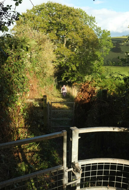
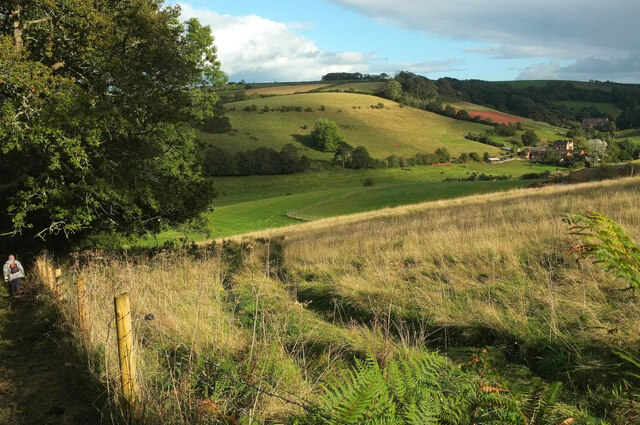
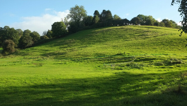
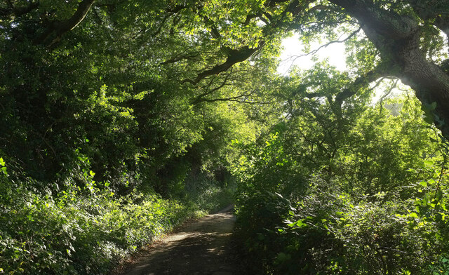
Aller Orchard Wood, located in Devon, is a stunning woodland area known for its natural beauty and diverse ecosystem. Spread across a vast expanse, this wood is a magnificent blend of ancient trees, lush vegetation, and vibrant wildlife. The wood is situated in the heart of the Aller Brook Valley, providing a serene and peaceful environment for visitors.

The woodland is predominantly made up of oak and beech trees, which tower above visitors, casting a beautiful dappled light on the forest floor. The thick canopy of foliage provides shelter for an array of flora and fauna, including ferns, bluebells, and wood anemones. During the spring, the forest floor comes alive with a riot of colors as wildflowers bloom.

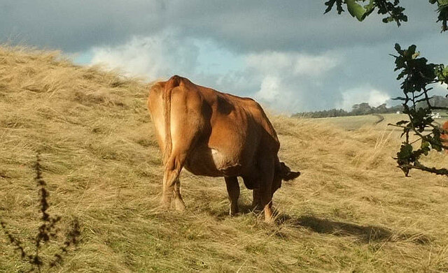
Aller Orchard Wood is a haven for wildlife enthusiasts and nature lovers. The wood is home to a variety of bird species, including the great spotted woodpecker and tawny owl. Visitors may also spot mammals such as foxes, badgers, and deer, as they navigate their way through the undergrowth.

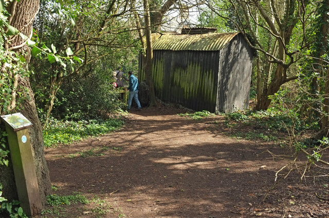
The wood offers several walking trails, allowing visitors to explore its hidden corners and discover its natural wonders. Along the trails, there are informative signs that provide details about the history, ecology, and wildlife of the area, enhancing the overall experience.

Aller Orchard Wood is a cherished natural treasure in Devon, attracting visitors from near and far who seek solace and tranquility in its enchanting surroundings. It is a place where one can reconnect with nature and marvel at the wonders of the natural world.

If you have any feedback on the listing, please let us know in the comments section below.

Aller Orchard Wood Images

Images are sourced within 2km of 50.510804/-3.5834266 or Grid Reference SX8769. Thanks to Geograph Open Source API. All images are credited.

Path to Vale Road Hmmm - this does bear a strong similarity to <a href="https://www.geograph.org.uk/photo/6795584">SX8670 : Path to Vale Road</a>. But there are walkers demonstrating its use and emerging through the chicane onto Vale Road by the shed.
Path to Vale Road
Hmmm - this does bear a strong similarity to SX8670 : Path to Vale Road. But there are walkers demonstrating its use and emerging through the chicane onto Vale Road by the shed.
Alpaca eggs? The sign on the waymark post reads:
"Alpaca Antics: Free Range Eggs, Best In The Valley!! £1.20 ½ dozen - Follow Main Track Down To Our Farm". You can see some of the alpacas in <a href="https://www.geograph.org.uk/photo/6812855">SX8970 : Alpacas, Haccombe</a>.
Alpaca eggs?
The sign on the waymark post reads: "Alpaca Antics: Free Range Eggs, Best In The Valley!! £1.20 ½ dozen - Follow Main Track Down To Our Farm". You can see some of the alpacas in SX8970 : Alpacas, Haccombe.
Carriage drive near Haccombe Chase A little further up <a href="https://www.geograph.org.uk/photo/6933878">SX8970 : Carriage drive, Haccombe</a>.
Carriage drive near Haccombe Chase
A little further up SX8970 : Carriage drive, Haccombe.
Old stone stile near The Round House The weathered steps of a wall stile beside the John Musgrave Heritage Trail.
Old stone stile near The Round House
The weathered steps of a wall stile beside the John Musgrave Heritage Trail.
Fields near The Round House Sheep and protected stuff seen from the John Musgrave Heritage Trail. The former mobile home seen in <a href="https://www.geograph.org.uk/photo/1300118">SX8870 : Former mobile home near The Round House</a> has probably long since gone.
Fields near The Round House
Sheep and protected stuff seen from the John Musgrave Heritage Trail. The former mobile home seen in SX8870 : Former mobile home near The Round House has probably long since gone.
John Musgrave Heritage Trail near Haccombe A pair of gates in quick succession as the Trail follows Haccombe with Combe Footpath 16 down into the valley.
John Musgrave Heritage Trail near Haccombe
A pair of gates in quick succession as the Trail follows Haccombe with Combe Footpath 16 down into the valley.
Haccombe valley Light and dark as clouds and sun alternate. This is from just down Haccombe with Combe Footpath 16 / John Musgrave Heritage Trail from <a href="https://www.geograph.org.uk/photo/6987627">SX8870 : John Musgrave Heritage Trail near Haccombe</a>.
Haccombe valley
Light and dark as clouds and sun alternate. This is from just down Haccombe with Combe Footpath 16 / John Musgrave Heritage Trail from SX8870 : John Musgrave Heritage Trail near Haccombe.
Cow near Haccombe Part of a herd on the valley side beside the John Musgrave Heritage Trail, as shown in <a href="https://www.geograph.org.uk/photo/6987639">SX8970 : Haccombe valley</a>.
Cow near Haccombe
Part of a herd on the valley side beside the John Musgrave Heritage Trail, as shown in SX8970 : Haccombe valley.
Terracettes, Haccombe The valley side seen from the road to the church.
Terracettes, Haccombe
The valley side seen from the road to the church.
Carriage drive near Haccombe Chase Also shown in <a href="https://www.geograph.org.uk/photo/6933884">SX8970 : Carriage drive near Haccombe Chase</a>.
Carriage drive near Haccombe Chase
Newton Abbot : Hewett Close Looking towards the road.
Newton Abbot : Hewett Close
Looking towards the road.
Newton Abbot : Footpath A footpath alongside Shaldon Road.
Newton Abbot : Footpath
A footpath alongside Shaldon Road.
Newton Abbot : Centrax Gas Turbines Looking towards Centrax Gas Turbines on Shaldon Road.
Newton Abbot : Centrax Gas Turbines
Looking towards Centrax Gas Turbines on Shaldon Road.
Newton Abbot : Moorland View Looking along Moorland View from Haytor Drive.
Newton Abbot : Moorland View
Looking along Moorland View from Haytor Drive.
Newton Abbot : Haytor Drive Looking along Haytor Drive.
Newton Abbot : Haytor Drive
Looking along Haytor Drive.
Newton Abbot : Moorland View Looking along Moorland View.
Newton Abbot : Moorland View
Looking along Moorland View.
Newton Abbot : Flete Avenue Flete Avenue off Moorland View.
Newton Abbot : Flete Avenue
Flete Avenue off Moorland View.
Newton Abbot : Moorland View Looking along Moorland View.
Newton Abbot : Moorland View
Looking along Moorland View.
Show me another place!

Aller Orchard Wood is located at Grid Ref: SX8769 (Lat: 50.510804, Lng: -3.5834266)

Administrative County: Devon

District: Teignbridge

Police Authority: Devon and Cornwall

What 3 Words

///cubes.lowest.talked. Near Kingskerswell, Devon

Related Wikis

Aller Park, Devon

Aller Park (also known as Aller) was a village in Devon, England, southeast of the town of Newton Abbot. The name is shared with the Aller Brook, which joins the River Teign at Newton Abbot. Today it is a suburb of the town, within Newton Abbot civil parish.

Aller Vale Pottery

The Aller Vale Pottery was formed in 1865 on the northern edge of the village of Kingskerswell in South Devon, England on the likely site of a medieval pottery. It became well known for the creation of art pottery at the end of the 19th century and gained Royal patronage, but declined thereafter, closing on this site in about 1924. The name continued in use until 1962 related to the production of mass-produced motto ware for the tourist market.

Aller Sand Pit

Aller Sand Pit (grid reference SX880695) is a 0.22 hectare geological Site of Special Scientific Interest in Devon, notified in 1969. It is the type section for the Aller Gravel.

Buckland Athletic F.C.

Buckland Athletic Football Club is a football club based in Newton Abbot, Devon, England. They are currently members of the Western League Premier Division and play at Homers Heath. == History == The club was established in 1977 as a youth team and joined the Torbay Pioneer League.

Abbotskerswell Priory

Abbotskerswell Priory, on the outskirts of the village of Abbotskerswell, near Newton Abbot, Devon, England, was the home of a community of Augustinian nuns from 1861 until 1983. It has now been converted into apartments for retirees. == Abbotsleigh House == Abbotsleigh House was built on high ground on the outskirts of Abbotskerswell during 1847-48.

Milber Down

Milber Down is an Iron Age hill fort on the hill above the suburb of Milber, Newton Abbot in Devon, England. The fort is situated on the north-western slope of Milber Down at about 110 metres above sea level, and is bisected by the minor ridge road that leads to Barton, Torquay. One Iron Age artefact discovered there was a figurine of a stag.

Milber

Milber is a suburban area of Newton Abbot and former civil parish, now in the parish of Newton Abbot, in the Teignbridge district of Devon, England. Much of the area comprises a housing estate at grid reference SX8770. It lies to the east of the town centre, on the opposite side of the A380 road.

Coffinswell

Coffinswell is a small village in South Devon, England, just off the A380, the busy Newton Abbot to Torquay road. It lies within Teignbridge District Council. Coffinswell has a church dedicated to Saint Bartholomew with a Norman font.

Nearby Amenities

Located within 500m of 50.510804,-3.5834266
Turning Circle
Lat/Long: 50.506683/-3.5807153
Milber Down
Place: locality
Source: OS OpenData StreetView
Wikidata: Q6850831
Wikipedia: en:Milber Down
Lat/Long: 50.5118141/-3.5774509
Cafe
Romany Jones
Lat/Long: 50.5104065/-3.5830413
Bus Stop
Bus: yes
Public Transport: platform
Shelter: yes
Lat/Long: 50.5081223/-3.5807945
Motorway Junction
Lat/Long: 50.5091505/-3.5887245
Bus Stop
Bus: yes
Public Transport: platform
Shelter: yes
Lat/Long: 50.5084759/-3.5816317
Generator Method: photovoltaic
Generator Output Electricity: yes
Generator Source: solar
Generator Type: solar_photovoltaic_panel
Location: roof
Power: generator
Lat/Long: 50.5070793/-3.5807244
Generator Method: photovoltaic
Generator Output Electricity: yes
Generator Source: solar
Generator Type: solar_photovoltaic_panel
Location: roof
Power: generator
Lat/Long: 50.5070913/-3.5809443
Generator Method: photovoltaic
Generator Output Electricity: yes
Generator Source: solar
Generator Type: solar_photovoltaic_panel
Location: roof
Power: generator
Lat/Long: 50.5072977/-3.5819716
Generator Method: photovoltaic
Generator Output Electricity: yes
Generator Source: solar
Generator Type: solar_photovoltaic_panel
Location: roof
Power: generator
Lat/Long: 50.5073011/-3.5819314
Generator Method: photovoltaic
Generator Output Electricity: yes
Generator Source: solar
Generator Type: solar_photovoltaic_panel
Location: roof
Power: generator
Lat/Long: 50.5085719/-3.5823042
Generator Method: photovoltaic
Generator Output Electricity: yes
Generator Source: solar
Generator Type: solar_photovoltaic_panel
Location: roof
Power: generator
Lat/Long: 50.5085156/-3.5829184
Generator Method: photovoltaic
Generator Output Electricity: yes
Generator Source: solar
Generator Type: solar_photovoltaic_panel
Location: roof
Power: generator
Lat/Long: 50.5084389/-3.5844795
Generator Method: photovoltaic
Generator Output Electricity: yes
Generator Source: solar
Generator Type: solar_photovoltaic_panel
Location: roof
Power: generator
Lat/Long: 50.5083945/-3.5844768
Power: pole
Lat/Long: 50.5108823/-3.5900929
Post Box
Brand: Royal Mail
Brand Wikidata: Q638098
Brand Wikipedia: en:Royal Mail
Collection Times: Mo-Fr 09:00; Sa 07:00; Su off
Operator: Royal Mail
Operator Wikidata: Q638098
Post Box Design: type_b
Post Box Mounting: brick_pillar
Post Box Type: wall
Ref: TQ12 49D
Royal Cypher: EIIR
Royal Cypher Wikidata: Q33102113
Source: survey;streetlevel imagery;aerial imagery
Lat/Long: 50.5089238/-3.5824016
The data included in this document is from www.openstreetmap.org. The data is made available under ODbL.

Have you been to Aller Orchard Wood?

Leave your review of Aller Orchard Wood below (or comments, questions and feedback).