Anstey Field Plantation

Wood, Forest in Devon North Devon

England

Anstey Field Plantation

Oakford: near Esworthy Cross Looking north east
Oakford: near Esworthy Cross Credit: Martin Bodman

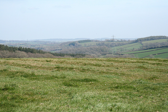
Anstey Field Plantation is an expansive woodland located in Devon, England. Covering an area of approximately 200 acres, it is a prime example of the region's rich natural heritage. The plantation is characterized by its dense forest, consisting mainly of native tree species, including oak, beech, and birch.

The woodland is renowned for its biodiversity, housing a wide variety of flora and fauna. It serves as a vital habitat for numerous bird species, such as woodpeckers, nightingales, and owls, making it a popular destination for birdwatchers. The undergrowth is teeming with vibrant wildflowers, providing a picturesque backdrop for nature enthusiasts.

Anstey Field Plantation also holds historical significance. It has been documented that the woodland was once part of a larger estate owned by the Anstey family, dating back to the 18th century. The remnants of an old manor house and stone walls can still be found within the woodland, adding to its charm and allure.

The plantation is a well-loved recreational spot for locals and visitors alike. Numerous walking trails and paths meander through the forest, offering opportunities for leisurely strolls and exploration. The peaceful ambiance and tranquil environment make it an ideal retreat for those seeking solace in nature.

In conclusion, Anstey Field Plantation is a picturesque woodland in Devon, boasting a diverse ecosystem and a rich historical background. Whether it is for a leisurely walk, birdwatching, or simply enjoying the beauty of the natural world, this enchanting forest offers a serene escape from the hustle and bustle of everyday life.

If you have any feedback on the listing, please let us know in the comments section below.

Anstey Field Plantation Images

Images are sourced within 2km of 50.998785/-3.6133519 or Grid Reference SS8623. Thanks to Geograph Open Source API. All images are credited.

Oakford: near Esworthy Cross Looking north east
Oakford: near Esworthy Cross
Looking north east
Oakford: East Mildon By a public footpath from Ford Farm to Esworthy. The farmhouse was shuttered and deserted in 2003
Oakford: East Mildon
By a public footpath from Ford Farm to Esworthy. The farmhouse was shuttered and deserted in 2003
Oakford: near Higher Swineham Looking north-north-east
Oakford: near Higher Swineham
Looking north-north-east
Oakford: Lower Woodburn The entrance to Lower Woodburn, looking north-north-west. The stream here provides the parish boundary with East Anstey
Oakford: Lower Woodburn
The entrance to Lower Woodburn, looking north-north-west. The stream here provides the parish boundary with East Anstey
Oakford: turning hay at North Esworthy Looking north-north-east
Oakford: turning hay at North Esworthy
Looking north-north-east
Oakford: North Esworthy Looking north west
Oakford: North Esworthy
Looking north west
Knowstone: Bickham Moor Cross On Swineham Hill, looking north
Knowstone: Bickham Moor Cross
On Swineham Hill, looking north
Knowstone: barns at Wiston Seen from the lane between Swineham Moor and Wiston Cross. Looking east-north-east
Knowstone: barns at Wiston
Seen from the lane between Swineham Moor and Wiston Cross. Looking east-north-east
Oakford: near Esworthy Cross Looking east-north-east on the route to Spurway Moor; a tractor hauls a muck spreader onto a track not shown on the Dulverton Ordnance Survey Pathfinder map of 1990
Oakford: near Esworthy Cross
Looking east-north-east on the route to Spurway Moor; a tractor hauls a muck spreader onto a track not shown on the Dulverton Ordnance Survey Pathfinder map of 1990
Oakford: by Swineham Farm Looking north-north-west at the farm entrance with Exmoor on the horizon
Oakford: by Swineham Farm
Looking north-north-west at the farm entrance with Exmoor on the horizon
Brushford: overhead power line A transmission line on Hawtree Moors. Looking south east
Brushford: overhead power line
A transmission line on Hawtree Moors. Looking south east
Brushford: Oldways End A hamlet near the B3227 and on the road to East Anstey. Also on the Somerset – Devon border. Looking east-south-east
Brushford: Oldways End
A hamlet near the B3227 and on the road to East Anstey. Also on the Somerset – Devon border. Looking east-south-east
Dulverton: cottages at Oldways End The Dulverton and Brushford parish boundaries meet here as does the Somerset – Devon border. Looking north west
Dulverton: cottages at Oldways End
The Dulverton and Brushford parish boundaries meet here as does the Somerset – Devon border. Looking north west
Oakford: mowing at Western Farm Seen by the entrance to the farm, on the B3227. A sign announces that this is the home of pedigree Holstein Friesians, the ‘Revelsmill Herd’. Looking south-south-east
Oakford: mowing at Western Farm
Seen by the entrance to the farm, on the B3227. A sign announces that this is the home of pedigree Holstein Friesians, the ‘Revelsmill Herd’. Looking south-south-east
East Anstey: Woodburn Cross Looking west-north-west on the B3227; the van is about to turn right towards Oldways End and East Anstey
East Anstey: Woodburn Cross
Looking west-north-west on the B3227; the van is about to turn right towards Oldways End and East Anstey
Brushford: by Higher Allshire Farm Looking towards South Moor and the valley of the Den Brook. The pasture in the foreground has recently been rolled
Brushford: by Higher Allshire Farm
Looking towards South Moor and the valley of the Den Brook. The pasture in the foreground has recently been rolled
East Anstey: by Smallacombe Moors Looking west-south-west
East Anstey: by Smallacombe Moors
Looking west-south-west
East Anstey: woodland near Whiteford Cross Seen from a lay-by on the B3227 Bampton – South Molton road. Looking south-south-west
East Anstey: woodland near Whiteford Cross
Seen from a lay-by on the B3227 Bampton – South Molton road. Looking south-south-west
Show me another place!

Anstey Field Plantation is located at Grid Ref: SS8623 (Lat: 50.998785, Lng: -3.6133519)

Administrative County: Devon

District: North Devon

Police Authority: Devon and Cornwall

What 3 Words

///remotest.oiled.retrial. Near Dulverton, Somerset

Related Wikis

East Anstey

East Anstey is a village and civil parish in the North Devon district of Devon, England. The parish is located in an area which has been designated as...

Oldways End

Oldways End is a hamlet in the civil parish of East Anstey in the North Devon district of Devon, England. Its nearest town is Tiverton, which lies approximately...

Roachill

Roachill is a hamlet in the civil parish of Knowstone in the North Devon district of Devon, England. Its nearest town is Tiverton, which lies approximately...

Briggins Moor

Briggins Moor is a 15.3 hectare biological Site of Special Scientific Interest in Somerset, notified in 1994. The site is south of Dulverton and close...

Nearby Amenities

Located within 500m of 50.998785,-3.6133519
Generator Method: photovoltaic
Generator Output Electricity: yes
Generator Source: solar
Generator Type: solar_photovoltaic_panel
Location: roof
Power: generator
Lat/Long: 50.9967039/-3.6141627
Generator Method: photovoltaic
Generator Output Electricity: yes
Generator Source: solar
Generator Type: solar_photovoltaic_panel
Location: roof
Power: generator
Lat/Long: 51.0022422/-3.6093602
Power: pole
Source: bing
Lat/Long: 50.9973308/-3.615149
Power: pole
Source: bing
Lat/Long: 50.99756/-3.6164516
Power: pole
Source: bing
Lat/Long: 50.9973963/-3.6188785
Power: pole
Source: bing
Lat/Long: 50.9974747/-3.6176469
Power: pole
Source: bing
Lat/Long: 50.9971392/-3.6141146
Power: pole
Source: bing
Lat/Long: 50.9969308/-3.6129429
Power: pole
Source: bing
Lat/Long: 50.9968484/-3.612085
Power: pole
Source: bing
Lat/Long: 50.9967621/-3.6111767
Power: pole
Source: bing
Lat/Long: 50.996639/-3.6097685
Power: pole
Source: bing
Lat/Long: 50.9958301/-3.6088996
The data included in this document is from www.openstreetmap.org. The data is made available under ODbL.

Have you been to Anstey Field Plantation?

Leave your review of Anstey Field Plantation below (or comments, questions and feedback).