Allers Grove

Wood, Forest in Devon North Devon

England

Allers Grove

Partridge Arms Farm Formerly an inn, now an excellent B&B on the edge of Exmoor
Partridge Arms Farm Credit: John Phillips

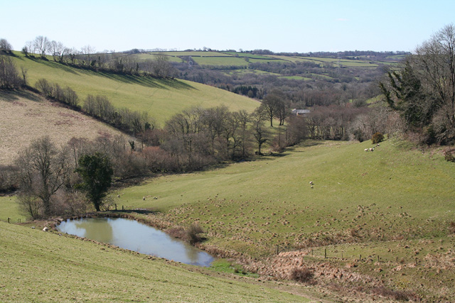
Located in Devon, England, Allers Grove is a picturesque woodland area that offers a serene and enchanting experience for nature lovers. Covering a vast expanse of land, this ancient forest is rich in biodiversity and boasts a diverse range of flora and fauna.

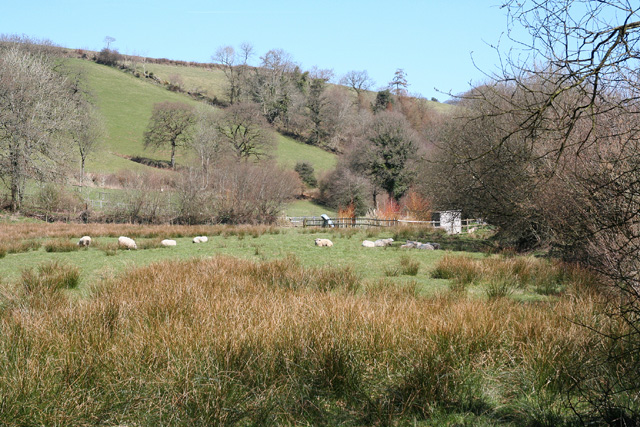
Allers Grove is characterized by its dense canopy of towering trees, predominantly oak and beech, which create a sense of tranquility and provide a natural haven for various wildlife species. The forest floor is adorned with a vibrant carpet of wildflowers, including bluebells and primroses, which bloom in the spring, painting the landscape with a kaleidoscope of colors.

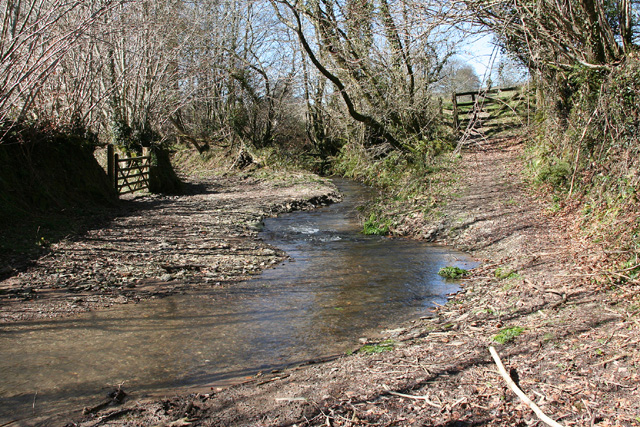
The forest is crisscrossed by a network of well-maintained footpaths and trails, allowing visitors to explore its hidden treasures. These trails wind through the woodland, offering glimpses of babbling brooks, moss-covered rocks, and stunning vistas of the surrounding countryside.

For those seeking a peaceful retreat, Allers Grove provides ample opportunities for outdoor activities such as hiking, birdwatching, and photography. The forest's diverse ecosystem supports a wide array of bird species, including woodpeckers, owls, and thrushes, making it a haven for bird enthusiasts.

In addition to its natural beauty, Allers Grove holds historical significance as well. The forest is believed to have ancient origins, dating back centuries, and has been mentioned in local folklore and historical records.

Allers Grove, with its captivating beauty and tranquil atmosphere, offers a welcome escape from the hustle and bustle of modern life, inviting visitors to immerse themselves in the wonders of nature.

If you have any feedback on the listing, please let us know in the comments section below.
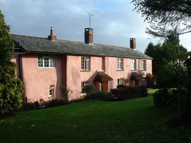
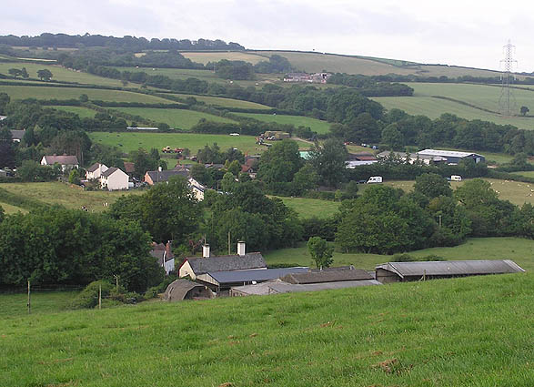
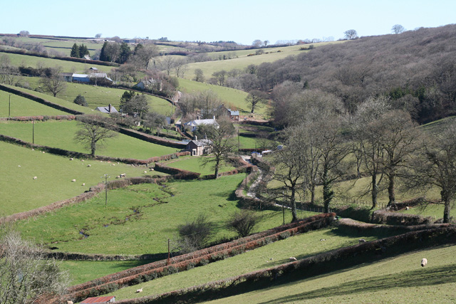
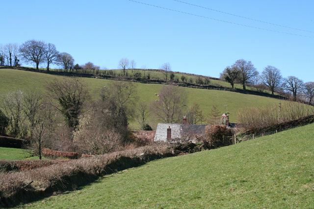
Allers Grove Images

Images are sourced within 2km of 51.017557/-3.6273199 or Grid Reference SS8525. Thanks to Geograph Open Source API. All images are credited.

Partridge Arms Farm Formerly an inn, now an excellent B&B on the edge of Exmoor
Partridge Arms Farm
Formerly an inn, now an excellent B&B on the edge of Exmoor
Yeo Mills looking SW across the valley
East Anstey: Waddicombe Looking north east from the start of a bridleway to Badlake Farm. There is some evidence for a medieval watermill at Waddicombe
East Anstey: Waddicombe
Looking north east from the start of a bridleway to Badlake Farm. There is some evidence for a medieval watermill at Waddicombe
East Anstey: approaching Oak Farm Looking west-south-west on a bridleway from Waddicombe to Dunsley
East Anstey: approaching Oak Farm
Looking west-south-west on a bridleway from Waddicombe to Dunsley
West Anstey: towards Dunsley Mill Looking south west from the bridleway below Badlake Farm
West Anstey: towards Dunsley Mill
Looking south west from the bridleway below Badlake Farm
East Anstey: ford on bridleway Looking west-south-west on bridleway from Waddicombe to Dunsley
East Anstey: ford on bridleway
Looking west-south-west on bridleway from Waddicombe to Dunsley
West Anstey: near Dunsley Looking north towards Dunsley Mill. The Two Moors Way runs by the hedgeline on the skyline on the left, towards West Anstey village
West Anstey: near Dunsley
Looking north towards Dunsley Mill. The Two Moors Way runs by the hedgeline on the skyline on the left, towards West Anstey village
East Anstey - The Froude Arms Now closed and a private residence.
East Anstey - The Froude Arms
Now closed and a private residence.
East Anstey School A cold morning!
East Anstey School
A cold morning!
Houses at East Anstey
East Anstey: Jubilee Inn A 20th century inn by the B3227 Taunton - Bampton - South Molton road, an early 19th century turnpike, now pleasantly quiet after much of its traffic has transferred to the North Devon Link Road. Looking east-north-east
East Anstey: Jubilee Inn
A 20th century inn by the B3227 Taunton - Bampton - South Molton road, an early 19th century turnpike, now pleasantly quiet after much of its traffic has transferred to the North Devon Link Road. Looking east-north-east
Brushford: overhead power line A transmission line on Hawtree Moors. Looking south east
Brushford: overhead power line
A transmission line on Hawtree Moors. Looking south east
Brushford: Oldways End A hamlet near the B3227 and on the road to East Anstey. Also on the Somerset – Devon border. Looking east-south-east
Brushford: Oldways End
A hamlet near the B3227 and on the road to East Anstey. Also on the Somerset – Devon border. Looking east-south-east
Dulverton: cottages at Oldways End The Dulverton and Brushford parish boundaries meet here as does the Somerset – Devon border. Looking north west
Dulverton: cottages at Oldways End
The Dulverton and Brushford parish boundaries meet here as does the Somerset – Devon border. Looking north west
East Anstey: by Yanhey Moor Woodland by the entrance to Higher Radnidge Farm and Radnidge House. Looking south-south-east
East Anstey: by Yanhey Moor
Woodland by the entrance to Higher Radnidge Farm and Radnidge House. Looking south-south-east
East Anstey: Smallacombe Moors Looking south east towards Blackerton
East Anstey: Smallacombe Moors
Looking south east towards Blackerton
West Anstey: saw mill By the Two Moors Way. An old tractor adapted to split logs and also to cut them, using a circular saw. Looking east-north-east on the road leading to Yeo Mill
West Anstey: saw mill
By the Two Moors Way. An old tractor adapted to split logs and also to cut them, using a circular saw. Looking east-north-east on the road leading to Yeo Mill
East Anstey: by Smallacombe Farm On the road to Oldways End, looking east-south-east. The entrance to Smallacombe Farm is on the right by the trees
East Anstey: by Smallacombe Farm
On the road to Oldways End, looking east-south-east. The entrance to Smallacombe Farm is on the right by the trees
Show me another place!

Allers Grove is located at Grid Ref: SS8525 (Lat: 51.017557, Lng: -3.6273199)

Administrative County: Devon

District: North Devon

Police Authority: Devon and Cornwall

What 3 Words

///torso.defeat.tokens. Near Dulverton, Somerset

Related Wikis

Oldways End

Oldways End is a hamlet in the civil parish of East Anstey in the North Devon district of Devon, England. Its nearest town is Tiverton, which lies approximately...

East Anstey

East Anstey is a village and civil parish in the North Devon district of Devon, England. The parish is located in an area which has been designated as...

West Anstey

West Anstey is a village and civil parish on the River Yeo, about 5 miles west of Dulverton, in the North Devon district, in the county of Devon, England...

Roachill

Roachill is a hamlet in the civil parish of Knowstone in the North Devon district of Devon, England. Its nearest town is Tiverton, which lies approximately...

Nearby Amenities

Located within 500m of 51.017557,-3.6273199
Power: tower
Lat/Long: 51.016697/-3.6240085
Power: tower
Lat/Long: 51.0189378/-3.6341151
Power: tower
Lat/Long: 51.0177364/-3.6287506
Addr City: Tiverton
Addr Housename: Lower Radnidge Farm
Addr Postcode: EX16 9JR
Addr Suburb: East Anstey
Lat/Long: 51.0219414/-3.6274372
Power: pole
Lat/Long: 51.0152194/-3.6325398
Power: pole
Lat/Long: 51.0155417/-3.6312363
Power: pole
Lat/Long: 51.0158403/-3.62993
Power: pole
Lat/Long: 51.0161457/-3.6288491
Power: pole
Lat/Long: 51.0160597/-3.627677
Power: pole
Lat/Long: 51.0159095/-3.6266014
Power: pole
Lat/Long: 51.0165368/-3.6337767
Power: pole
Lat/Long: 51.0164984/-3.6318693
Power: pole
Lat/Long: 51.0164562/-3.6298147
Power: pole
Lat/Long: 51.0164343/-3.6276689
Power: pole
Lat/Long: 51.0163955/-3.6256975
Poles: bipole
Power: pole
Lat/Long: 51.0163668/-3.6237019
Poles: bipole
Power: pole
Lat/Long: 51.0169178/-3.6220922
Power: pole
Lat/Long: 51.0174901/-3.6203591
Generator Method: photovoltaic
Generator Output Electricity: yes
Generator Source: solar
Generator Type: solar_photovoltaic_panel
Location: roof
Power: generator
Lat/Long: 51.0219069/-3.6271526
Generator Method: photovoltaic
Generator Output Electricity: yes
Generator Source: solar
Generator Type: solar_photovoltaic_panel
Location: roof
Power: generator
Lat/Long: 51.0219592/-3.6271553
The data included in this document is from www.openstreetmap.org. The data is made available under ODbL.

Have you been to Allers Grove?

Leave your review of Allers Grove below (or comments, questions and feedback).