Grange Copse

Wood, Forest in Devon Teignbridge

England

Grange Copse

"Make love not war", Decoy Country Park Probably made with the clay that abounds here, a little figure perches above a plaque with a heartfelt message as we enter the second month of Russia's invasion of Ukraine.
"Make love not war", Decoy Country Park Credit: Derek Harper

Grange Copse is a picturesque woodland located in the county of Devon, England. Stretching over an area of approximately 50 acres, it is a haven for nature lovers and outdoor enthusiasts. The copse is situated in close proximity to the village of Grange, adding to its accessibility and charm.

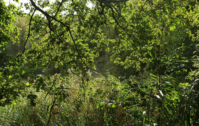
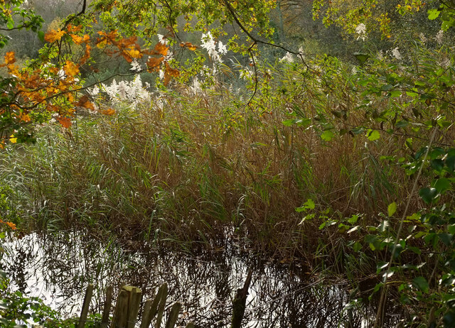
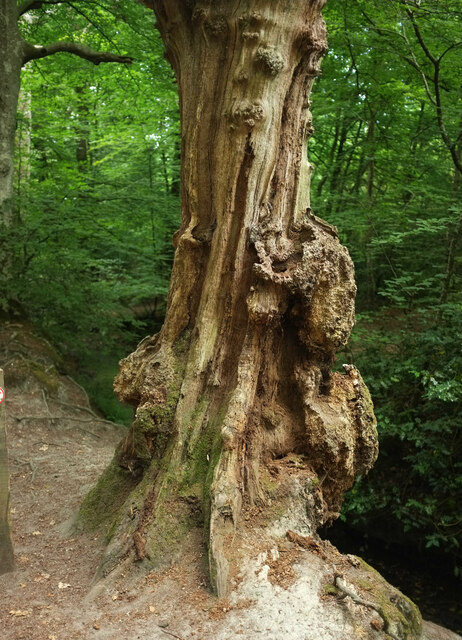
This woodland is primarily composed of deciduous trees, including oak, beech, and ash, which provide a diverse habitat for various flora and fauna species. The dense canopy formed by these trees creates a serene and peaceful environment, offering a respite from the hustle and bustle of daily life.

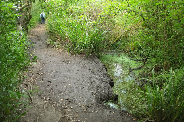
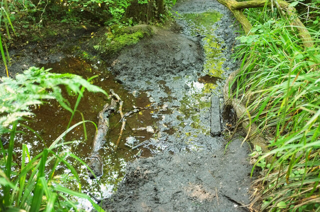
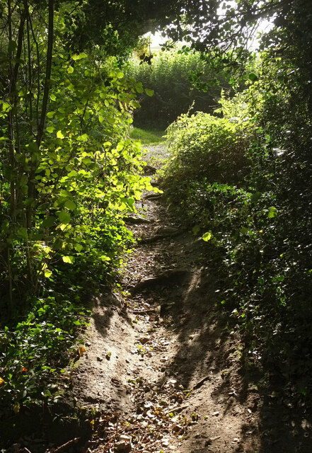
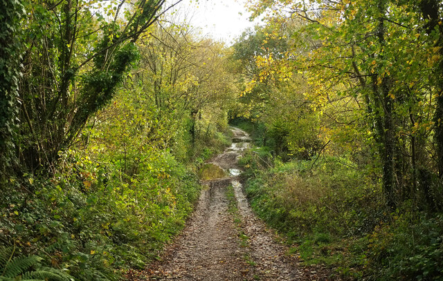
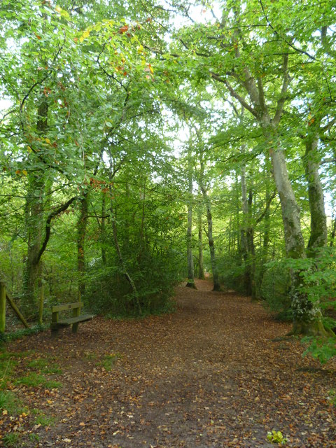
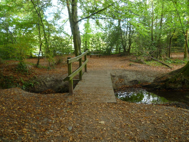
Grange Copse boasts a network of well-maintained footpaths, allowing visitors to explore its beauty at their own pace. The pathways wind through the forest, offering glimpses of wildflowers, ferns, and moss-covered rocks along the way. The copse is also home to a small stream, which adds to the overall enchanting atmosphere.

Wildlife is abundant within Grange Copse, with frequent sightings of birds such as woodpeckers, owls, and thrushes. Squirrels scurrying amongst the trees and rabbits darting through the undergrowth are a common sight as well. The copse provides a safe haven for these creatures, allowing them to thrive in their natural habitat.

Grange Copse is a popular destination for nature walks, picnics, and photography. Its idyllic setting and tranquility make it an ideal spot for those seeking solace and a connection with nature. Whether it's a leisurely stroll or a quiet moment of contemplation, Grange Copse offers a serene escape in the heart of Devon.

If you have any feedback on the listing, please let us know in the comments section below.
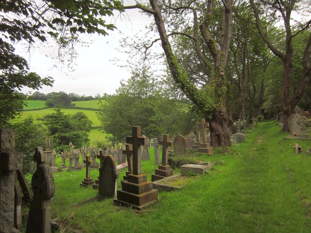
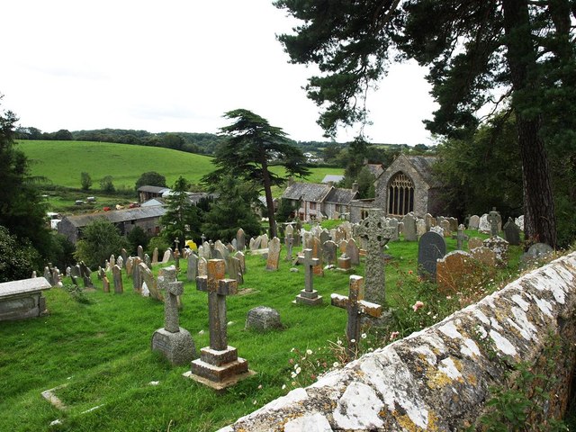
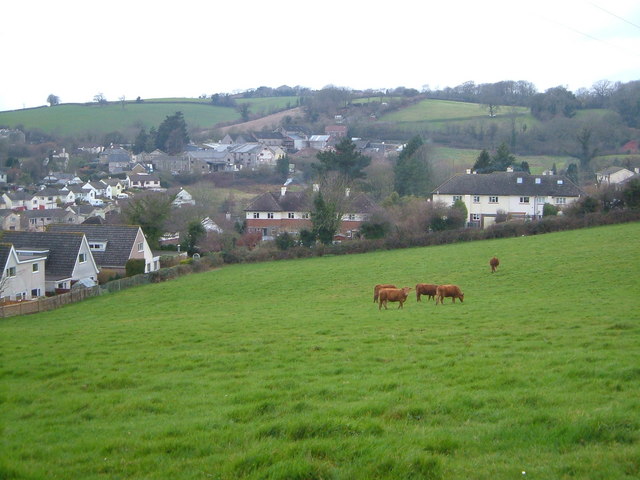
Grange Copse Images

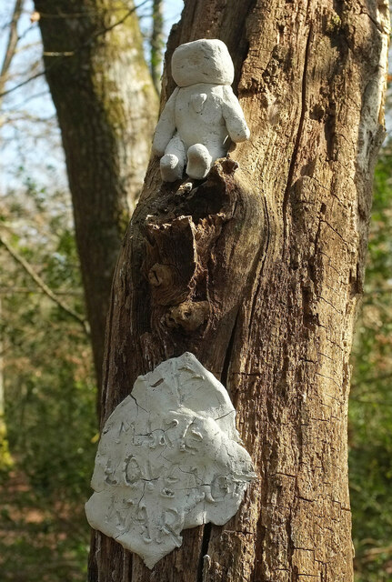
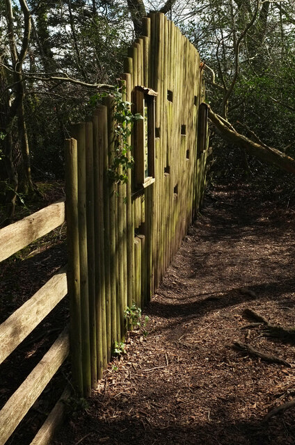
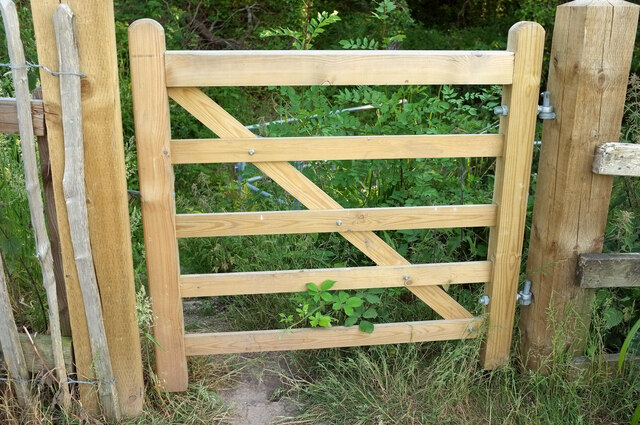
Images are sourced within 2km of 50.504591/-3.6134398 or Grid Reference SX8568. Thanks to Geograph Open Source API. All images are credited.

"Make love not war", Decoy Country Park Probably made with the clay that abounds here, a little figure perches above a plaque with a heartfelt message as we enter the second month of Russia's invasion of Ukraine.
"Make love not war", Decoy Country Park
Probably made with the clay that abounds here, a little figure perches above a plaque with a heartfelt message as we enter the second month of Russia's invasion of Ukraine.
Bird hide, Decoy Lake The timber wall catches the sunlight.
Bird hide, Decoy Lake
The timber wall catches the sunlight.
Red trail, Decoy Country Park <a href="https://www.geograph.org.uk/photo/6776532">SX8670 : Red trail, Decoy Country Park</a> was taken a little further along this path past marshland.
Red trail, Decoy Country Park
SX8670 : Red trail, Decoy Country Park was taken a little further along this path past marshland.
New gate, Decoy A smart new wooden gate giving access to steps and handrail down to a culvert near the Magazine Pond.
New gate, Decoy
A smart new wooden gate giving access to steps and handrail down to a culvert near the Magazine Pond.
Muddy path, Decoy Country Park <a href="https://www.geograph.org.uk/photo/7237449">SX8670 : Red trail, Decoy Country Park</a> was taken a few metres ahead less than a year ago, but we're not going to get there as our footwear reflects that there has been very little rain recently. A shame because this path is key to getting between Magazine Pond and Decoy Lake Lake.
Muddy path, Decoy Country Park
SX8670 : Red trail, Decoy Country Park was taken a few metres ahead less than a year ago, but we're not going to get there as our footwear reflects that there has been very little rain recently. A shame because this path is key to getting between Magazine Pond and Decoy Lake Lake.
By the Magazine Pond Oak leaves and reeds at the northeast corner of the pond.
By the Magazine Pond
Oak leaves and reeds at the northeast corner of the pond.
Footpath junction, Decoy Country Park Having emerged from a field a few metres to the right, Newton Abbot footpath 4 approaches its junction with footpath 3.
Footpath junction, Decoy Country Park
Having emerged from a field a few metres to the right, Newton Abbot footpath 4 approaches its junction with footpath 3.
Magazine Pond The pond is fringed with a white plume-grass.
Magazine Pond
The pond is fringed with a white plume-grass.
Path from Coach Road Newton Abbot footpath 3 heads towards the stretch shown in <a href="https://www.geograph.org.uk/photo/3254090">SX8570 : Newton Abbot : Muddy Track</a>.
Path from Coach Road
Newton Abbot footpath 3 heads towards the stretch shown in SX8570 : Newton Abbot : Muddy Track.
Burls on tree, Decoy Country Park An old trunk beside the watercourse heading lakewards.
Burls on tree, Decoy Country Park
An old trunk beside the watercourse heading lakewards.
Orange Way in Devon and Torbay (114) This confusing map with no directional information is in Decoy Country Park.
Orange Way in Devon and Torbay (114)
This confusing map with no directional information is in Decoy Country Park.
Orange Way in Devon and Torbay (115) Here is seating beside the path.
Orange Way in Devon and Torbay (115)
Here is seating beside the path.
Orange Way in Devon and Torbay (116) The path is getting close to the lake in Decoy Country Park.
Orange Way in Devon and Torbay (116)
The path is getting close to the lake in Decoy Country Park.
Roundabout at East Ogwell The cemetery and chapel can be seen in the background.
Roundabout at East Ogwell
The cemetery and chapel can be seen in the background.
Tower of St Mary's Church Wolborough Across this shallow valley, on the right of the photo, lies the new development of houses of East Ogwell. To the left and hidden in the trees in the distance lies the disused Conitor Limestone Quarry 

Today the lower section of the old quarry is used as an industrial estate, the rest of the old quarry is a little overgrown but the limestone rock faces are still visible.  <a href="https://www.geograph.org.uk/photo/2919929">SX8569 : Conitor Limestone Quarry  - near East Ogwell</a> <a href="https://www.geograph.org.uk/photo/2919927">SX8569 : Conitor Limestone Quarry  - near East Ogwell</a>

On the road alongside the quarry is an old lime kiln.
Tower of St Mary's Church Wolborough
Across this shallow valley, on the right of the photo, lies the new development of houses of East Ogwell. To the left and hidden in the trees in the distance lies the disused Conitor Limestone Quarry Today the lower section of the old quarry is used as an industrial estate, the rest of the old quarry is a little overgrown but the limestone rock faces are still visible. SX8569 : Conitor Limestone Quarry - near East Ogwell SX8569 : Conitor Limestone Quarry - near East Ogwell On the road alongside the quarry is an old lime kiln.
Churchyard, Wolborough From the eastern end, on College Road. "The churchyard which extends to some 4 acres is now full and was closed for burials in 1984" <span class="nowrap"><a title="http://www.ogwol.org.uk/stmary.htm" rel="nofollow ugc noopener" href="http://www.ogwol.org.uk/stmary.htm">Link</a><img style="margin-left:2px;" alt="External link" title="External link - shift click to open in new window" src="https://s1.geograph.org.uk/img/external.png" width="10" height="10"/></span> .
Churchyard, Wolborough
From the eastern end, on College Road. "The churchyard which extends to some 4 acres is now full and was closed for burials in 1984" LinkExternal link .
Churchyard, Wolborough Another view of <a href="https://www.geograph.org.uk/photo/3030573">SX8570 : Churchyard, Wolborough</a> from a few metres into the churchyard, with a glimpse of fields down to the left.
Churchyard, Wolborough
Another view of SX8570 : Churchyard, Wolborough from a few metres into the churchyard, with a glimpse of fields down to the left.
Graveyard of St Mary the Virgin, Wolborough Wolborough Barton Farm can be seen below the churchyard
Graveyard of St Mary the Virgin, Wolborough
Wolborough Barton Farm can be seen below the churchyard
Show me another place!

Grange Copse is located at Grid Ref: SX8568 (Lat: 50.504591, Lng: -3.6134398)

Administrative County: Devon

District: Teignbridge

Police Authority: Devon and Cornwall

What 3 Words

///groups.sheets.bought. Near Abbotskerswell, Devon

Related Wikis

Abbotskerswell

Abbotskerswell is a village and civil parish in the English county of Devon. The village is in the north part of the parish and is located two miles (3...

Abbotskerswell Priory

Abbotskerswell Priory, on the outskirts of the village of Abbotskerswell, near Newton Abbot, Devon, England, was the home of a community of Augustinian...

Buckland Athletic F.C.

Buckland Athletic Football Club is a football club based in Newton Abbot, Devon, England. They are currently members of the Western League Premier Division...

West Ogwell

West Ogwell is a village and former civil parish and manor, now in the parish of Ogwell, in the Teignbridge district, in the county of Devon, England....

Nearby Amenities

Located within 500m of 50.504591,-3.6134398
Abbotskerswell
Is In: Devon, England, UK
Place: village
Source: npe
Lat/Long: 50.5085384/-3.6138959
Barrier: stile
Lat/Long: 50.5026829/-3.6105189
Barrier: stile
Lat/Long: 50.5018781/-3.610343
Barrier: stile
Lat/Long: 50.5010334/-3.6102524
Barrier: stile
Lat/Long: 50.5036689/-3.6110264
Model Stores
Shop: convenience
Lat/Long: 50.5083805/-3.6143427
Bus Stop
Naptan AtcoCode: 1100DEC11456
Naptan NaptanCode: dvndgpmd
Lat/Long: 50.5086223/-3.6144971
Power: tower
Lat/Long: 50.5015464/-3.6099995
Pub
Court Farm Inn
Addr City: Abbotskerswell
Addr Postcode: TQ12 5NY
Addr Street: Wilton Way
Source Postcode: ONS_Postcode_Directory
Wikidata: Q26389623
Lat/Long: 50.5070915/-3.614327
Cafe
Exporium & Coffee House
Lat/Long: 50.5079716/-3.6135816
Post Box
Brand: Royal Mail
Brand Wikidata: Q638098
Brand Wikipedia: en:Royal Mail
Collection Times: Mo-Fr 09:00; Sa 07:00; Su off
Operator: Royal Mail
Operator Wikidata: Q638098
Post Box Mounting: pier
Post Box Type: lamp
Ref: TQ12 126D
Royal Cypher: EIIR
Royal Cypher Wikidata: Q33102113
Source: survey;streetlevel imagery;aerial imagery
Lat/Long: 50.5066905/-3.6142143
Telephone
Lat/Long: 50.5067016/-3.614316
Ladywell
Tourism: attraction
Lat/Long: 50.5051824/-3.6121085
Mini Roundabout
Lat/Long: 50.5080505/-3.6134906
Direction: SW
Generator Method: photovoltaic
Generator Output Electricity: yes
Generator Source: solar
Generator Type: solar_photovoltaic_panel
Location: roof
Power: generator
Lat/Long: 50.5073393/-3.6175375
Direction: SW
Generator Method: photovoltaic
Generator Output Electricity: yes
Generator Source: solar
Generator Type: solar_photovoltaic_panel
Location: roof
Power: generator
Lat/Long: 50.5072677/-3.617384
Direction: SE
Generator Method: photovoltaic
Generator Output Electricity: yes
Generator Source: solar
Generator Type: solar_photovoltaic_panel
Location: roof
Power: generator
Lat/Long: 50.5073607/-3.6164391
Direction: SE
Generator Method: photovoltaic
Generator Output Electricity: yes
Generator Source: solar
Generator Type: solar_photovoltaic_panel
Location: roof
Power: generator
Lat/Long: 50.5070999/-3.6155182
Direction: SSW
Generator Method: photovoltaic
Generator Output Electricity: yes
Generator Source: solar
Generator Type: solar_photovoltaic_panel
Location: roof
Power: generator
Lat/Long: 50.5071579/-3.6117291
Direction: SE
Generator Method: photovoltaic
Generator Output Electricity: yes
Generator Source: solar
Generator Type: solar_photovoltaic_panel
Location: roof
Power: generator
Lat/Long: 50.5054404/-3.6135829
Direction: SE
Generator Method: photovoltaic
Generator Output Electricity: yes
Generator Source: solar
Generator Type: solar_photovoltaic_panel
Location: roof
Power: generator
Lat/Long: 50.5055182/-3.6136452
Direction: SE
Generator Method: photovoltaic
Generator Output Electricity: yes
Generator Source: solar
Generator Type: solar_photovoltaic_panel
Location: roof
Power: generator
Lat/Long: 50.5056265/-3.6136476
Direction: SE
Generator Method: photovoltaic
Generator Output Electricity: yes
Generator Source: solar
Generator Type: solar_photovoltaic_panel
Location: roof
Power: generator
Lat/Long: 50.5055152/-3.6143503
Direction: WSW
Generator Method: photovoltaic
Generator Output Electricity: yes
Generator Source: solar
Generator Type: solar_photovoltaic_panel
Location: roof
Power: generator
Lat/Long: 50.5077679/-3.6136908
Direction: SE
Generator Method: photovoltaic
Generator Output Electricity: yes
Generator Source: solar
Generator Type: solar_photovoltaic_panel
Location: roof
Power: generator
Lat/Long: 50.5080242/-3.6147676
Direction: SE
Generator Method: photovoltaic
Generator Output Electricity: yes
Generator Source: solar
Generator Type: solar_photovoltaic_panel
Location: roof
Power: generator
Lat/Long: 50.5078091/-3.6158372
Direction: SE
Generator Method: photovoltaic
Generator Output Electricity: yes
Generator Source: solar
Generator Type: solar_photovoltaic_panel
Location: roof
Power: generator
Lat/Long: 50.5079113/-3.6156309
Direction: SSE
Generator Method: photovoltaic
Generator Output Electricity: yes
Generator Source: solar
Generator Type: solar_photovoltaic_panel
Location: roof
Power: generator
Lat/Long: 50.5082934/-3.6114828
Direction: SSE
Generator Method: photovoltaic
Generator Output Electricity: yes
Generator Source: solar
Generator Type: solar_photovoltaic_panel
Location: roof
Power: generator
Lat/Long: 50.5063795/-3.6113755
Direction: SSE
Generator Method: photovoltaic
Generator Output Electricity: yes
Generator Source: solar
Generator Type: solar_photovoltaic_panel
Location: roof
Power: generator
Lat/Long: 50.5080341/-3.6121761
Direction: WSW
Generator Method: photovoltaic
Generator Output Electricity: yes
Generator Source: solar
Generator Type: solar_photovoltaic_panel
Location: roof
Power: generator
Lat/Long: 50.5080674/-3.612258
Power: pole
Lat/Long: 50.5009041/-3.6102927
Power: pole
Lat/Long: 50.501352/-3.6096755
Entrance: yes
Lat/Long: 50.5072731/-3.6146806
Post Office
Abbotskerswell Post Office
Addr City: Newton Abbot
Addr Postcode: TQ12 5NP
Addr Street: Slade Lane
Addr Village: Abbotskerswell
Opening Hours: Mo-Su 07:00-20:00
Ref Pol Id: 141075
Source: pol_branch_list_2020‑11‑13
Lat/Long: 50.508413/-3.6143107
Post Box
Brand: Royal Mail
Brand Wikidata: Q638098
Brand Wikipedia: en:Royal Mail
Collection Times: Mo-Fr 16:00; Sa 12:00; Su off
Operator: Royal Mail
Operator Wikidata: Q638098
Post Box Design: type_b
Post Box Type: pillar
Ref: TQ12 125
Royal Cypher: GVIR
Royal Cypher Wikidata: Q33102169
Source: survey;streetlevel imagery;aerial imagery
Lat/Long: 50.5080995/-3.6133687
Defibrillator
Access: yes
Defibrillator Location: outside Abbotskerswell Village Hall
Emergency: defibrillator
Indoor: no
Lat/Long: 50.5070663/-3.6116552
The data included in this document is from www.openstreetmap.org. The data is made available under ODbL.

Have you been to Grange Copse?

Leave your review of Grange Copse below (or comments, questions and feedback).