Churchtown

Settlement in Derbyshire Derbyshire Dales

England

Churchtown

Path down from Stanton Moor
Path down from Stanton Moor Credit: David Lally

Churchtown is a small village located in the county of Derbyshire, England. Situated just 5 miles northeast of the town of Derby, it is nestled within the picturesque countryside of the Derwent Valley. The village gets its name from the presence of a historic church, which has been a focal point of the community for centuries.

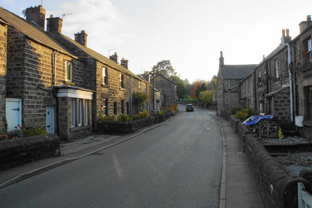
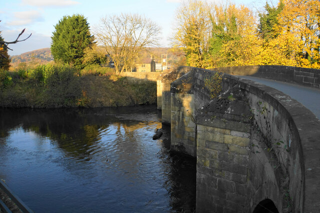
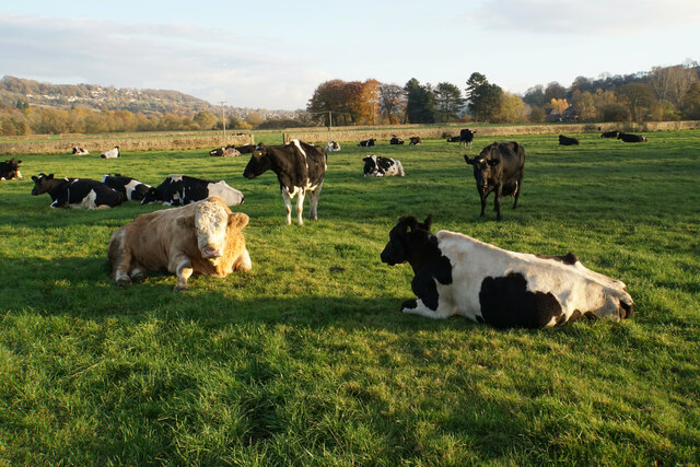
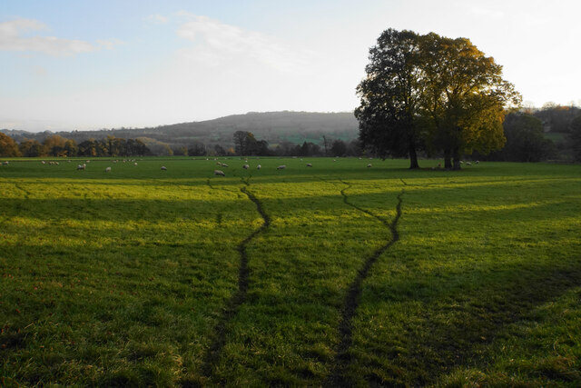
With a population of around 500 residents, Churchtown exudes a quaint and peaceful atmosphere. The village is characterized by its charming cottages and traditional stone-built houses, giving it a distinct rural charm. The stunning surrounding landscapes offer breathtaking views, making it a popular destination for nature enthusiasts and hikers.

The village is well-connected to neighboring towns and cities, with excellent transport links. The A38 road runs nearby, providing easy access to Derby and other major cities like Birmingham and Nottingham. Additionally, the nearby Breadsall railway station offers convenient train services for residents and visitors.

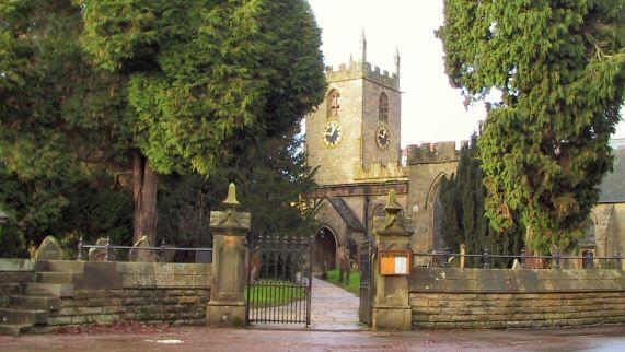
Although small in size, Churchtown has a strong sense of community spirit. The church, St. Peter's Church, stands as a prominent landmark and serves as a gathering place for religious services and community events. The village also boasts a local pub, the Churchtown Inn, where locals and visitors can enjoy a drink or a meal while soaking in the village's tranquil ambiance.

In conclusion, Churchtown in Derbyshire is a delightful village that encapsulates the beauty of the English countryside. Its historic church, charming architecture, and stunning natural surroundings make it a captivating place to visit or reside.

If you have any feedback on the listing, please let us know in the comments section below.
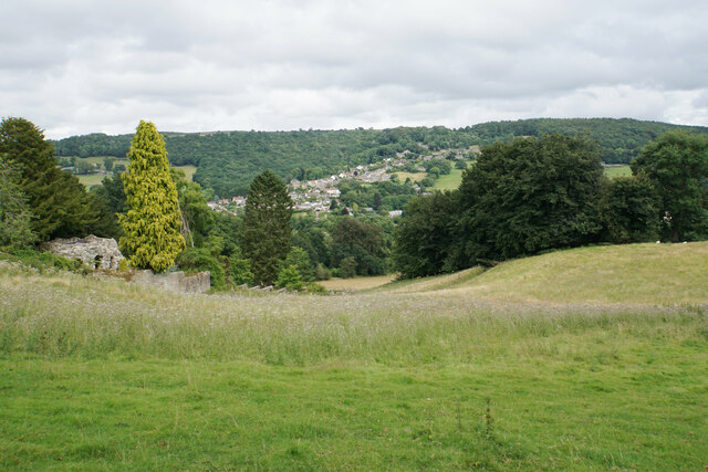
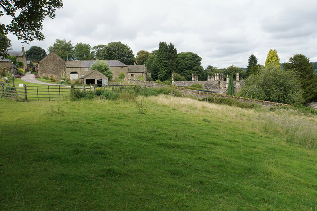
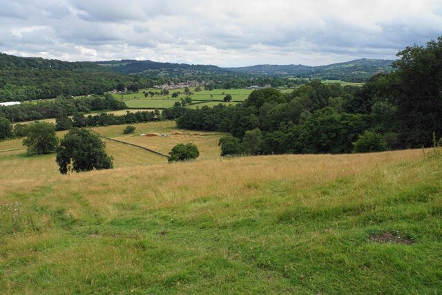
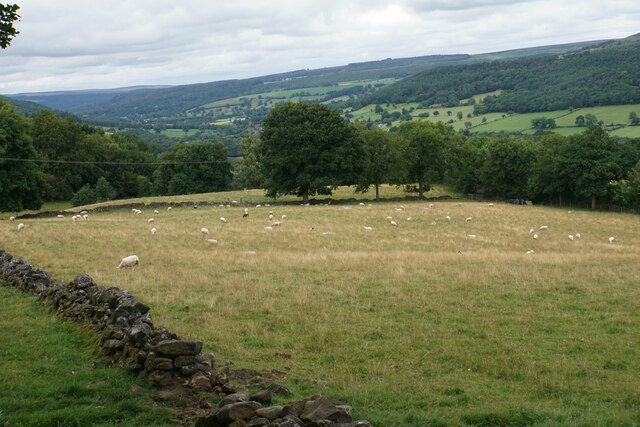
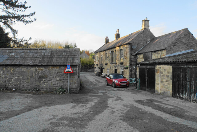
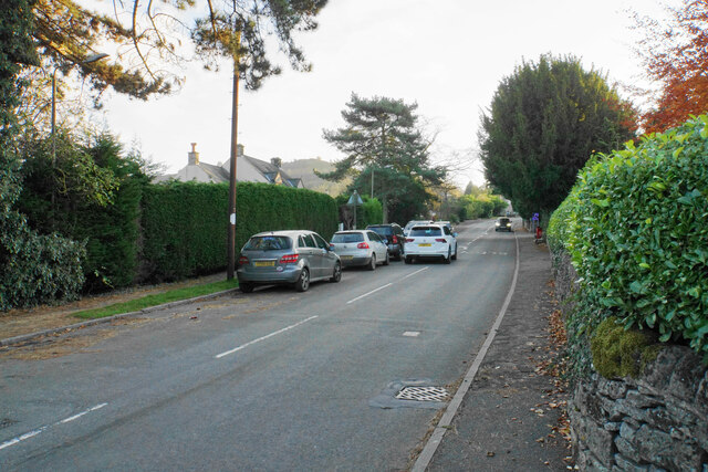
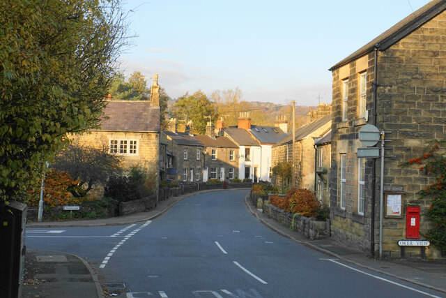
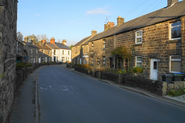
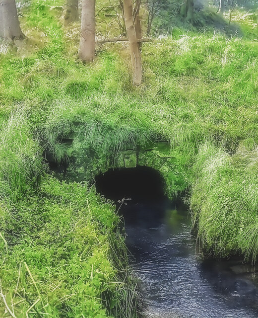
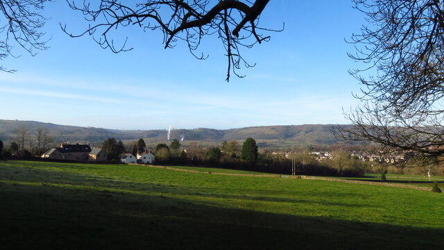
Churchtown Images

Images are sourced within 2km of 53.163452/-1.605095 or Grid Reference SK2663. Thanks to Geograph Open Source API. All images are credited.

Path down from Stanton Moor
Hillside below Stanton Woodhouse The western side of the Derwent valley. The village of Northwood is seen on the other side.
Hillside below Stanton Woodhouse
The western side of the Derwent valley. The village of Northwood is seen on the other side.
Stanton Woodhouse A manor house and farm in the Haddon estate.
Stanton Woodhouse
A manor house and farm in the Haddon estate.
Hillside above the Derwent valley A hillside near Stanton Woodhouse. The next visible community is Darley Dale.
Hillside above the Derwent valley
A hillside near Stanton Woodhouse. The next visible community is Darley Dale.
Sheep above Stanton Woodhouse Looking up the Derwent valley.
Sheep above Stanton Woodhouse
Looking up the Derwent valley.
Road junction in Darley Dale The road left is Chesterfield Road which leaves the A6 here. The building opposite is a cafe. It was formerly a pharmacy but I am sure it was previously a retail bank.
Road junction in Darley Dale
The road left is Chesterfield Road which leaves the A6 here. The building opposite is a cafe. It was formerly a pharmacy but I am sure it was previously a retail bank.
Co-op store in Darley Dale I think this building used to be the RBS bank, being the last retail bank to close in the town.
Co-op store in Darley Dale
I think this building used to be the RBS bank, being the last retail bank to close in the town.
Road junction in Darley Dale Station Road runs off left from the A6. This junction is possibly regarded as the centre of the town, with a millennium stone and the town council minutes.
Road junction in Darley Dale
Station Road runs off left from the A6. This junction is possibly regarded as the centre of the town, with a millennium stone and the town council minutes.
Footpath arriving at Darley Bridge It comes out in a passage next to the Three Stags Heads pub.
Footpath arriving at Darley Bridge
It comes out in a passage next to the Three Stags Heads pub.
Eversleigh Rise The B5057 climbing out of Darley Bridge towards Wensley. It is a bit narrow but this is not the narrowest point in the village.
Eversleigh Rise
The B5057 climbing out of Darley Bridge towards Wensley. It is a bit narrow but this is not the narrowest point in the village.
Main Road. Darley Bridge The B5057 is just getting to the narrowest part through the village
Main Road. Darley Bridge
The B5057 is just getting to the narrowest part through the village
Main Road, Darley Bridge The narrowest part of the B5057 through the village.
Main Road, Darley Bridge
The narrowest part of the B5057 through the village.
Main Road, Darley Bridge The B5057 passing through the village in low afternoon sun.
Main Road, Darley Bridge
The B5057 passing through the village in low afternoon sun.
Darley Bridge The bridge carrying the B5057 over the River Derwent, from which the village derives its name.
Darley Bridge
The bridge carrying the B5057 over the River Derwent, from which the village derives its name.
Cattle by Flatts Farm Grazing on the flood plain of the River Derwent.
Cattle by Flatts Farm
Grazing on the flood plain of the River Derwent.
Sheep tracks near Normanhurst Farm Sheep are grazing on the flood plain of the River Derwent. The sun is sinking behind the hills to the west.
Sheep tracks near Normanhurst Farm
Sheep are grazing on the flood plain of the River Derwent. The sun is sinking behind the hills to the west.
Portal of Hillcarr Sough, Darley Dale Set back from the River Derwent, into which its water flows, is the portal or tail of Hillcarr Sough, one of the most important mine drainage levels within the Derbyshire lead mining area. The total length, including its many branches, is approximately 4.5 miles. Begun in 1766 it took twenty one years to reach the mines and cost about £32,000, which was a huge sum in those days. Because of the great depth beneath Stanton Moor, there were few air shafts sunk during its construction which caused ventilation problems. Ultimately it was hugely successful, allowing mining at depth in the mines around Alport and Youlgreave. Exploration in the late 70s, in chest deep water, revealed beautiful gritstone arching which was carried for some distance from the portal but shortly after this ends, there has been a roof fall over which the water now roars. A rusty link on the portal's keystone was once visible and used to tie boats up during and after construction.
Portal of Hillcarr Sough, Darley Dale
Set back from the River Derwent, into which its water flows, is the portal or tail of Hillcarr Sough, one of the most important mine drainage levels within the Derbyshire lead mining area. The total length, including its many branches, is approximately 4.5 miles. Begun in 1766 it took twenty one years to reach the mines and cost about £32,000, which was a huge sum in those days. Because of the great depth beneath Stanton Moor, there were few air shafts sunk during its construction which caused ventilation problems. Ultimately it was hugely successful, allowing mining at depth in the mines around Alport and Youlgreave. Exploration in the late 70s, in chest deep water, revealed beautiful gritstone arching which was carried for some distance from the portal but shortly after this ends, there has been a roof fall over which the water now roars. A rusty link on the portal's keystone was once visible and used to tie boats up during and after construction.
Path above Holt Farm, Two Dales
Show me another place!

Churchtown is located at Grid Ref: SK2663 (Lat: 53.163452, Lng: -1.605095)

Administrative County: Derbyshire

District: Derbyshire Dales

Police Authority: Derbyshire

What 3 Words

///guarding.grad.barmaid. Near Matlock, Derbyshire

Nearby Locations

Churchtown

Related Wikis

St Helen's Church, Darley Dale

St Helen's Church, Darley Dale is a Grade II* listed parish church in the Church of England in Darley Dale, Derbyshire. == History == The church has elements...

Darley Dale

Darley Dale, formerly Darley, is a town and civil parish in the Derbyshire Dales district of Derbyshire, England, with a population of 5,413. It lies...

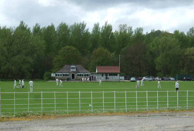
Station Road, Darley Dale

Station Road is a cricket ground in Darley Dale, Derbyshire, England, which has hosted only one top-class match: the 1975 John Player League match between...

Peak Rail

Peak Rail is a preserved railway in Derbyshire, England, which operates a steam and heritage diesel service for tourists and visitors to both the Peak...

Nearby Amenities

Located within 500m of 53.163452,-1.605095
Barrier: stile
Stile: squeezer
Lat/Long: 53.1608605/-1.6023273
Post Box
Brand: Royal Mail
Brand Wikidata: Q638098
Brand Wikipedia: en:Royal Mail
Operator: Royal Mail
Operator Wikidata: Q638098
Ref: DE4 936
Lat/Long: 53.163526/-1.6021436
Barrier: kissing_gate
Lat/Long: 53.1623727/-1.6016153
Bench
Lat/Long: 53.1653886/-1.6048863
Barrier: stile
Material: stone
Stile: stepover
Lat/Long: 53.1659708/-1.6070547
Bench
Lat/Long: 53.1663715/-1.6017694
Bus Stop
Bus: yes
Naptan AtcoCode: 1000DDDC3168
Naptan NaptanCode: dbsgdwaw
Public Transport: platform
Lat/Long: 53.1651272/-1.6013764
Crossing Barrier: double_half
Railway: level_crossing
Lat/Long: 53.1647005/-1.6013004
Barrier: entrance
Source: survey;gps
Lat/Long: 53.1649109/-1.601337
Turning Circle
Lat/Long: 53.1662867/-1.6004695
Turning Circle
Lat/Long: 53.1658306/-1.5994751
Barrier: cycle_barrier
Lat/Long: 53.16473/-1.6012213
Barrier: cycle_barrier
Lat/Long: 53.1637441/-1.5977425
Defibrillator
Access: yes
Defibrillator Location: On a post by the church wall.
Emergency: defibrillator
Indoor: no
Ref GB The Circuit: 29C5090B-F019-40AF-90BB-AEC2008B4F72
Lat/Long: 53.1630356/-1.6021393
Operator: Peak Rail
Railway: signal
Railway Signal Direction: forward
Railway Signal Main: yes
Lat/Long: 53.1650747/-1.6018213
Barrier: entrance
Source: survey;gps
Lat/Long: 53.1635095/-1.6021382
Barrier: stile
Material: wood
Source: survey;gps
Stile: squeezer
Lat/Long: 53.1656826/-1.6059426
Barrier: stile
Source: survey;gps
Stile: squeezer
Lat/Long: 53.1657741/-1.6063139
Operator: Peak Rail
Railway: switch
Lat/Long: 53.1630465/-1.5986712
Operator: Peak Rail
Railway: signal
Railway Signal Direction: backward
Railway Signal Main: yes
Lat/Long: 53.164336/-1.60076
2000 Year Old Tree
Board Title: probable age about 2000 years.
Information: board
Tourism: information
Lat/Long: 53.1631936/-1.6024938
Generator Method: photovoltaic
Generator Output Electricity: yes
Generator Source: solar
Generator Type: solar_photovoltaic_panel
Location: roof
Power: generator
Lat/Long: 53.1650234/-1.5983033
Generator Method: photovoltaic
Generator Output Electricity: yes
Generator Source: solar
Generator Type: solar_photovoltaic_panel
Location: roof
Power: generator
Lat/Long: 53.1659537/-1.5990067
Generator Method: photovoltaic
Generator Output Electricity: yes
Generator Source: solar
Generator Type: solar_photovoltaic_panel
Location: roof
Power: generator
Lat/Long: 53.1656852/-1.5988686
Generator Method: photovoltaic
Generator Output Electricity: yes
Generator Source: solar
Generator Type: solar_photovoltaic_panel
Location: roof
Power: generator
Lat/Long: 53.1668831/-1.6013403
Generator Method: photovoltaic
Generator Output Electricity: yes
Generator Source: solar
Generator Type: solar_photovoltaic_panel
Location: roof
Power: generator
Lat/Long: 53.1669488/-1.6006134
Generator Method: photovoltaic
Generator Output Electricity: yes
Generator Source: solar
Generator Type: solar_photovoltaic_panel
Location: roof
Power: generator
Lat/Long: 53.1639513/-1.5996518
Generator Method: photovoltaic
Generator Output Electricity: yes
Generator Source: solar
Generator Type: solar_photovoltaic_panel
Location: roof
Power: generator
Lat/Long: 53.1638564/-1.5992253
Generator Method: photovoltaic
Generator Output Electricity: yes
Generator Source: solar
Generator Type: solar_photovoltaic_panel
Location: roof
Power: generator
Lat/Long: 53.1639047/-1.5991744
Generator Method: photovoltaic
Generator Output Electricity: yes
Generator Source: solar
Generator Type: solar_photovoltaic_panel
Location: roof
Power: generator
Lat/Long: 53.1639425/-1.5990993
Generator Method: photovoltaic
Generator Output Electricity: yes
Generator Source: solar
Generator Type: solar_photovoltaic_panel
Location: roof
Power: generator
Lat/Long: 53.1639899/-1.5990416
Generator Method: photovoltaic
Generator Output Electricity: yes
Generator Source: solar
Generator Type: solar_photovoltaic_panel
Location: roof
Power: generator
Lat/Long: 53.1640373/-1.5990188
Generator Method: photovoltaic
Generator Output Electricity: yes
Generator Source: solar
Generator Type: solar_photovoltaic_panel
Location: roof
Power: generator
Lat/Long: 53.1640623/-1.5989866
Generator Method: photovoltaic
Generator Output Electricity: yes
Generator Source: solar
Generator Type: solar_photovoltaic_panel
Location: roof
Power: generator
Lat/Long: 53.1641081/-1.598933
Generator Method: photovoltaic
Generator Output Electricity: yes
Generator Source: solar
Generator Type: solar_photovoltaic_panel
Location: roof
Power: generator
Lat/Long: 53.163928/-1.5985306
Generator Method: photovoltaic
Generator Output Electricity: yes
Generator Source: solar
Generator Type: solar_photovoltaic_panel
Location: roof
Power: generator
Lat/Long: 53.1638934/-1.5985722
Generator Method: photovoltaic
Generator Output Electricity: yes
Generator Source: solar
Generator Type: solar_photovoltaic_panel
Location: roof
Power: generator
Lat/Long: 53.1638476/-1.5986259
Generator Method: photovoltaic
Generator Output Electricity: yes
Generator Source: solar
Generator Type: solar_photovoltaic_panel
Location: roof
Power: generator
Lat/Long: 53.1637632/-1.598705
Generator Method: photovoltaic
Generator Output Electricity: yes
Generator Source: solar
Generator Type: solar_photovoltaic_panel
Location: roof
Power: generator
Lat/Long: 53.1636594/-1.5988257
Generator Method: photovoltaic
Generator Output Electricity: yes
Generator Source: solar
Generator Type: solar_photovoltaic_panel
Location: roof
Power: generator
Lat/Long: 53.1636305/-1.5988713
Generator Method: photovoltaic
Generator Output Electricity: yes
Generator Source: solar
Generator Type: solar_photovoltaic_panel
Location: roof
Power: generator
Lat/Long: 53.1636024/-1.5989263
Generator Method: photovoltaic
Generator Output Electricity: yes
Generator Source: solar
Generator Type: solar_photovoltaic_panel
Location: roof
Power: generator
Lat/Long: 53.1635501/-1.5989799
Generator Method: photovoltaic
Generator Output Electricity: yes
Generator Source: solar
Generator Type: solar_photovoltaic_panel
Location: roof
Power: generator
Lat/Long: 53.163735/-1.599342
Generator Method: photovoltaic
Generator Output Electricity: yes
Generator Source: solar
Generator Type: solar_photovoltaic_panel
Location: roof
Power: generator
Lat/Long: 53.1647478/-1.5995608
Parking
Capacity: 10
Parking: street_side
Lat/Long: 53.16277/-1.6019684
The data included in this document is from www.openstreetmap.org. The data is made available under ODbL.

Have you been to Churchtown?

Leave your review of Churchtown below (or comments, questions and feedback).