Churchstanton

Settlement in Devon Somerset West and Taunton

England

Churchstanton

Churchstanton: Stapley Mill A 19th century watermill and millers house now combined in one residence. The course of the leat is still evident in the garden. Looking north east
Churchstanton: Stapley Mill Credit: Martin Bodman

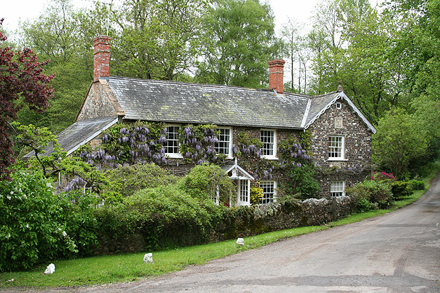
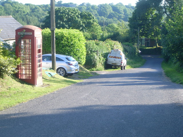
Churchstanton is a small village located in the county of Devon, England. Situated approximately 11 miles north of the market town of Taunton, it falls within the Blackdown Hills Area of Outstanding Natural Beauty. With a population of around 400 residents, Churchstanton offers a tranquil and close-knit community environment.

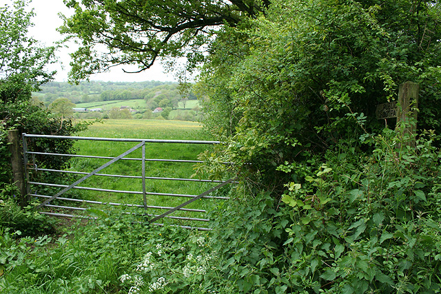
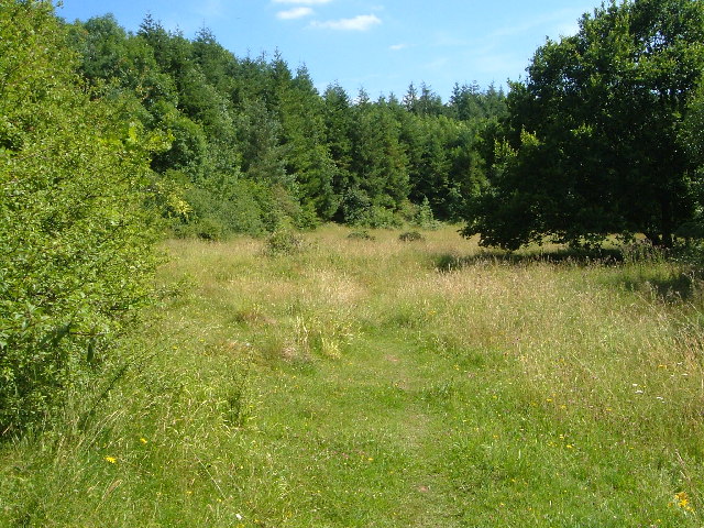
The village is characterized by picturesque landscapes, rolling hills, and meandering streams, making it an ideal location for nature enthusiasts and outdoor activities. The surrounding countryside provides ample opportunities for walking, cycling, and exploring the beautiful scenery. The nearby Blackdown Hills, designated as an Area of Outstanding Natural Beauty, offer breathtaking views and diverse flora and fauna.

At the heart of the village stands the historic Church of St. Peter and St. Paul, which dates back to the 13th century. This picturesque church features stunning architectural details and holds regular services for the local community. Churchstanton also boasts a charming village hall that serves as a hub for various social and cultural events.

Despite its small size, Churchstanton benefits from a strong sense of community spirit. The village organizes regular activities and events, including fairs, festivals, and fundraisers, fostering a sense of togetherness and neighborly support.

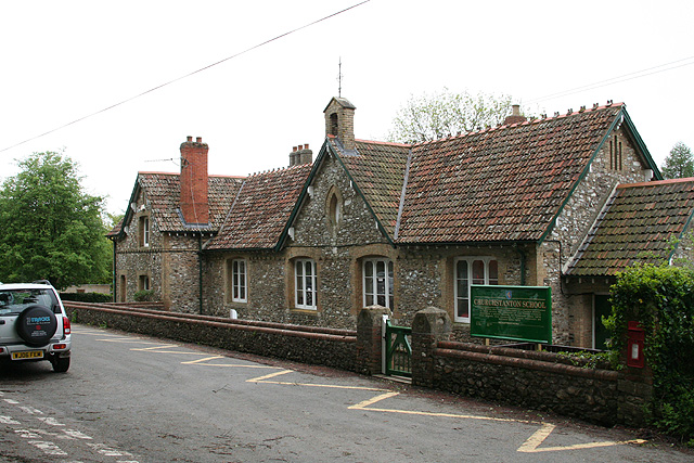
In terms of amenities, Churchstanton is equipped with a primary school, ensuring educational facilities are available for local families. However, for additional services such as shopping, healthcare, and entertainment, residents often rely on nearby towns and villages.

Overall, Churchstanton offers a peaceful and idyllic setting for those seeking a close-knit community and a connection to nature in the stunning Devon countryside.

If you have any feedback on the listing, please let us know in the comments section below.

Churchstanton Images

Images are sourced within 2km of 50.924611/-3.147488 or Grid Reference ST1914. Thanks to Geograph Open Source API. All images are credited.

Churchstanton: Stapley Mill A 19th century watermill and millers house now combined in one residence. The course of the leat is still evident in the garden. Looking north east
Churchstanton: Stapley Mill
A 19th century watermill and millers house now combined in one residence. The course of the leat is still evident in the garden. Looking north east
Churchstanton: Churchstanton School At Willand. Established on this site since 20 October 1879. Looking south west
Churchstanton: Churchstanton School
At Willand. Established on this site since 20 October 1879. Looking south west
Churchstanton:  church of St Peter and St Paul Tower of the parish church seen from the north west
Churchstanton: church of St Peter and St Paul
Tower of the parish church seen from the north west
Churchstanton: lane to Court Farm Looking west-north-west
Churchstanton: lane to Court Farm
Looking west-north-west
Churchstanton: near Courtsmoor Farm Start of a public footpath providing a shortcut across fields. Lear’s Farm in the distance. The public footpath sign is almost lost amongst the foliage
Churchstanton: near Courtsmoor Farm
Start of a public footpath providing a shortcut across fields. Lear’s Farm in the distance. The public footpath sign is almost lost amongst the foliage
Churchstanton: Ringdown Nature Reserve A 59-acre site acquired by the Somerset Wildlife Trust in 1998. It runs down to a tributary of the river Culm. The estate includes wet woodland, marshy grassland, spring line mire and improved grassland. Orchids and butterwort feature together with devils bit scabious and bog asphodel. Woodcock and snipe can be seen here in the winter
Churchstanton: Ringdown Nature Reserve
A 59-acre site acquired by the Somerset Wildlife Trust in 1998. It runs down to a tributary of the river Culm. The estate includes wet woodland, marshy grassland, spring line mire and improved grassland. Orchids and butterwort feature together with devils bit scabious and bog asphodel. Woodcock and snipe can be seen here in the winter
Churchstanton: Downlands Lane Looking north
Churchstanton: Downlands Lane
Looking north
Clayhidon: Hidewood Lane ford The ford through the river Culm marks the parish boundary with Churchstanton and the county boundary between Devon and Somerset. Looking south east
Clayhidon: Hidewood Lane ford
The ford through the river Culm marks the parish boundary with Churchstanton and the county boundary between Devon and Somerset. Looking south east
Churchstanton: former inn Shown as a public house on the Ordnance Survey 1:25,000 map (1987 edition), but clearly the buildings have seen better days. Together with the church and rectory this building once formed the centre of the parish; in fact Stapley, within the parish, is really more of a focus for the place. Looking east-north-east
Churchstanton: former inn
Shown as a public house on the Ordnance Survey 1:25,000 map (1987 edition), but clearly the buildings have seen better days. Together with the church and rectory this building once formed the centre of the parish; in fact Stapley, within the parish, is really more of a focus for the place. Looking east-north-east
Churchstanton: Trickey Warren Lane A public bridleway. Looking east-south-east
Churchstanton: Trickey Warren Lane
A public bridleway. Looking east-south-east
Stapley telephone box This is No 4 of 42 images of BT telephone boxes in Taunton Deane which BT is trying to cull due to their claimed 'lack of use'.  If you would like to see this phone box stay in situ, please email savethispayphone@ukpayphone.com
Stapley telephone box
This is No 4 of 42 images of BT telephone boxes in Taunton Deane which BT is trying to cull due to their claimed 'lack of use'. If you would like to see this phone box stay in situ, please email savethispayphone@ukpayphone.com
Green lane near Churchstanton Green lane on the footpath from Hunter's Lodge to Churchstanton.
Green lane near Churchstanton
Green lane on the footpath from Hunter's Lodge to Churchstanton.
Church of St Peter and St Paul, Churchstanton The east end of the church, seen across the grounds of Churchstanton House from the footpath from Hunter's Lodge.
Church of St Peter and St Paul, Churchstanton
The east end of the church, seen across the grounds of Churchstanton House from the footpath from Hunter's Lodge.
Vencroft Farm, near Churchstanton The entire group of buildings have been recently renovated.  The footpath passes down the drive, ahead, and enters Venn Copse up the gravel path beyond the bridge.
Vencroft Farm, near Churchstanton
The entire group of buildings have been recently renovated. The footpath passes down the drive, ahead, and enters Venn Copse up the gravel path beyond the bridge.
Footpath from Venn Copse The footpath from Burnworthy to Churchstanton descends here through Venn Copse, before passing Vencroft Farm (out of sight, to right of picture) and ascending the drive (ahead).
Footpath from Venn Copse
The footpath from Burnworthy to Churchstanton descends here through Venn Copse, before passing Vencroft Farm (out of sight, to right of picture) and ascending the drive (ahead).
Pigs, Ringdown Common A large and prodigously stony field is home to these pigs. Footpath T 6/13 crosses it but there is no proper access or waymarking.
Pigs, Ringdown Common
A large and prodigously stony field is home to these pigs. Footpath T 6/13 crosses it but there is no proper access or waymarking.
Pond, Ringdown Common A pond well-populated by ducks, on the slopes of the Wiltown Valley, and seen from footpath T 6/13.
Pond, Ringdown Common
A pond well-populated by ducks, on the slopes of the Wiltown Valley, and seen from footpath T 6/13.
Stony field, Ringdown Common From footpath T 6/13 beside Downlands Lane. The field is covered in stones, and a herd of pigs.
Stony field, Ringdown Common
From footpath T 6/13 beside Downlands Lane. The field is covered in stones, and a herd of pigs.
Show me another place!

Churchstanton is located at Grid Ref: ST1914 (Lat: 50.924611, Lng: -3.147488)

Administrative County: Somerset

District: Somerset West and Taunton

Police Authority: Avon and Somerset

What 3 Words

///congas.fact.dislikes. Near Hemyock, Devon

Related Wikis

Churchstanton

Churchstanton is a village and civil parish in Somerset, England, situated within the Blackdown Hills Area of Outstanding Natural Beauty, on the River...

RAF Culmhead

Royal Air Force Culmhead or more simply RAF Culmhead is a former Royal Air Force station, situated at Churchstanton on the Blackdown Hills in Somerset...

Ringdown SSSI, Somerset

Ringdown (grid reference ST178155) is a 4.0 hectare (9.9 acre) biological Site of Special Scientific Interest west of Burnworthy in the Blackdown Hills...

Church of St Leonard, Otterford

The Anglican Church of St Leonard in Otterford, Somerset, England was built in the 14th century. It is a Grade II* listed building. == History == The church...

Otterford

Otterford is a village and civil parish in Somerset, England. It is situated on the Blackdown Hills, 7 miles (11.3 km) south of Taunton. The village has...

Otterhead Lakes

Otterhead Lakes are a pair of reservoirs in the Blackdown Hills Area of Outstanding Natural Beauty south of Otterford in Somerset, England. They are fed...

Quants Reserve

Quants Reserve is a nature reserve north west of Burnworthy in Somerset, England. It consists of a grassland clearing in a forestry plantation. It is well...

Leigh Reservoir

Leigh Reservoir, or Leigh Hill Reservoir, is a small reservoir in Somerset, England. It was built in 1893 to supply water to the town of Taunton, Somerset...

Nearby Amenities

Located within 500m of 50.924611,-3.147488
Churchstanton
Is In: Somerset, England, UK
Place: hamlet
Wikidata: Q2425965
Wikipedia: en:Churchstanton
Lat/Long: 50.924705/-3.1473716
Man Made: flagpole
Lat/Long: 50.924743/-3.1457765
Man Made: flagpole
Lat/Long: 50.9240126/-3.1454475
The data included in this document is from www.openstreetmap.org. The data is made available under ODbL.

Have you been to Churchstanton?

Leave your review of Churchstanton below (or comments, questions and feedback).