Easterndown Copse
Wood, Forest in Devon Teignbridge
England
Easterndown Copse

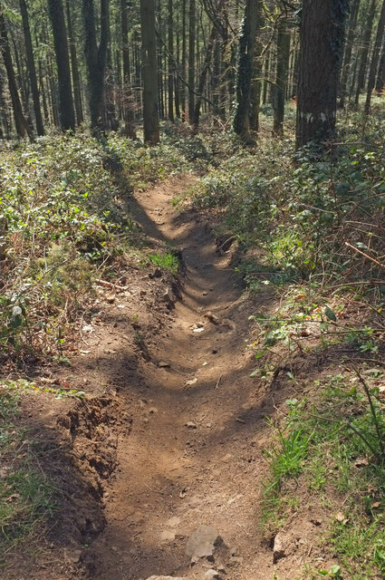
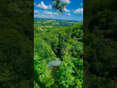
Easterndown Copse is a picturesque woodland located in the county of Devon, England. Stretching across an area of approximately 50 acres, it is a haven for nature enthusiasts and those seeking tranquility in the heart of nature.
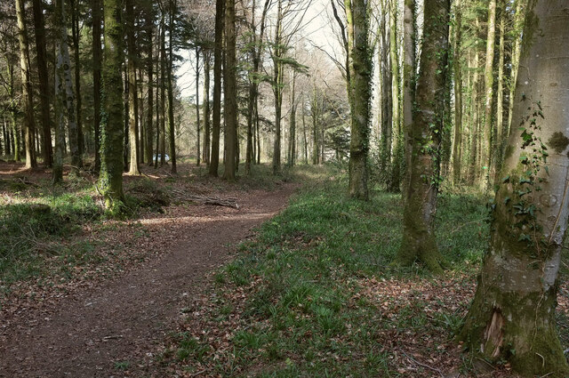
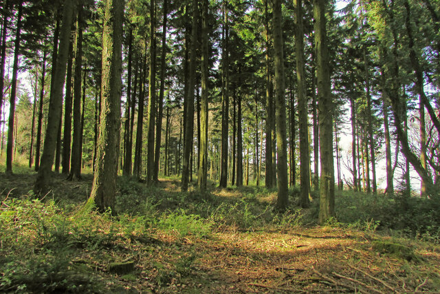
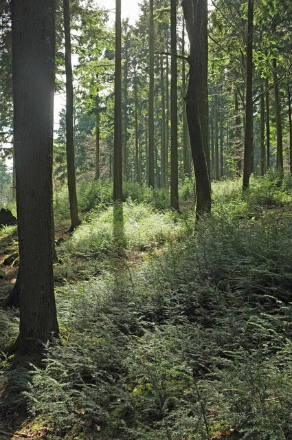
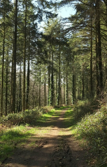
The copse is characterized by its dense and diverse collection of trees, including oak, beech, ash, and birch. These towering trees provide a canopy of shade, creating a serene and peaceful atmosphere within the forest. The forest floor is covered in a lush carpet of wildflowers, ferns, and moss, adding a touch of color to the green surroundings.
A network of well-maintained trails winds its way through Easterndown Copse, offering visitors the opportunity to explore its natural beauty. These paths lead to hidden clearings, where one can relax and enjoy a picnic, or simply sit and absorb the sights and sounds of the woodland.
The copse is also home to a rich variety of wildlife, including deer, foxes, badgers, and a myriad of bird species. Nature lovers can often spot these animals while quietly walking through the woods, making it a popular destination for wildlife photography and birdwatching.
Easterndown Copse is a popular recreational spot for locals and tourists alike. Its natural beauty and tranquility make it an ideal location for walking, jogging, and cycling. The copse is open to the public year-round, with no admission fee, allowing visitors to immerse themselves in the wonders of nature at any time.
If you have any feedback on the listing, please let us know in the comments section below.
Easterndown Copse Images
Images are sourced within 2km of 50.623144/-3.6702565 or Grid Reference SX8181. Thanks to Geograph Open Source API. All images are credited.


Easterndown Copse is located at Grid Ref: SX8181 (Lat: 50.623144, Lng: -3.6702565)
Administrative County: Devon
District: Teignbridge
Police Authority: Devon and Cornwall
What 3 Words
///part.develop.crumple. Near Bovey Tracey, Devon
Nearby Locations
Related Wikis
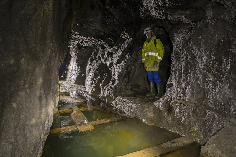
Great Rock Mine
Great Rock Mine is a disused micaceous haematite mine about 3 km north of the town of Bovey Tracey in Devon, England. It was worked from the nineteenth...

Canonteign Falls
Canonteign Falls is a waterfall in the historic tything of Canonteign in the Teign Valley and Dartmoor National Park near Chudleigh, South Devon, England...

Hennock
Hennock is a village and civil parish about 3 miles west north west of Chudleigh, in the Teignbridge district, in the county of Devon, England. In 2011...
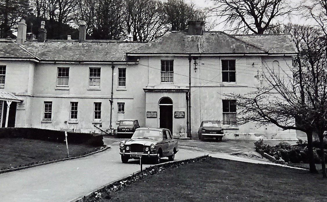
Hawkmoor Hospital
Hawkmoor Hospital, originally known as Hawkmoor County Sanatorium, was a specialist hospital near Bovey Tracey in Devon, England, founded in 1913 as a...
Related Videos

Canonteign Falls – Tallest Waterfall in England!
UK Travel Vlog Episode 4: Filmed 11 September 2020. Join us as we hike to the top of Canonteign Falls – the tallest waterfall in ...

Canonteign Falls Nature Walk in the English Countryside
Canonteign Falls, nestled in the heart of Dartmoor National Park in Devon, is a captivating natural wonder. As England's highest ...
Nearby Amenities
Located within 500m of 50.623144,-3.6702565Have you been to Easterndown Copse?
Leave your review of Easterndown Copse below (or comments, questions and feedback).