Church Westcote

Settlement in Gloucestershire Cotswold

England

Church Westcote

Oxfordshire Way Oxfordshire Way at Gawcombe
Oxfordshire Way Credit: Shaun Ferguson

Church Westcote is a charming village located in the Cotswold district of Gloucestershire, England. Situated in the heart of the picturesque Windrush Valley, it is surrounded by rolling hills, lush green fields, and quintessential English countryside.

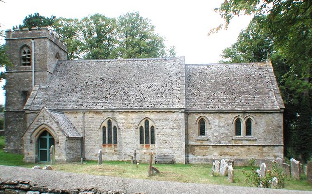
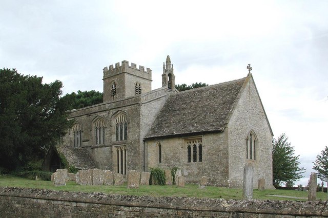
The village is home to a small population of around 100 residents, giving it a close-knit and community-oriented atmosphere. The centerpiece of Church Westcote is the St. Mary's Church, a beautiful 12th-century building that stands as a testament to the village's rich history. With its Norman architecture, stained glass windows, and serene churchyard, St. Mary's is a prominent landmark in the area and serves as a place of worship for locals and visitors alike.

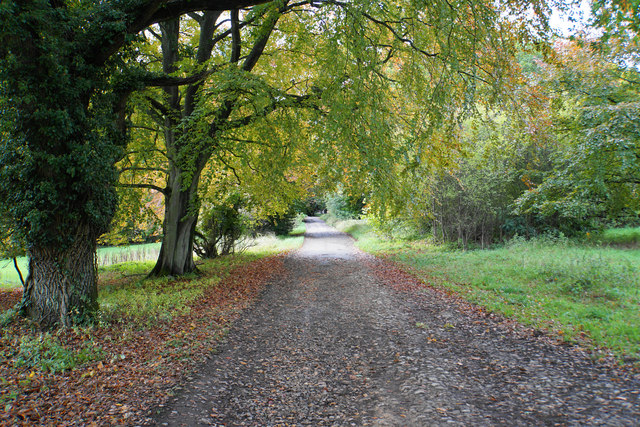
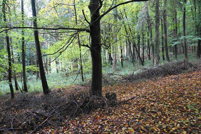
In addition to its historical significance, Church Westcote offers plenty of natural beauty for outdoor enthusiasts. The surrounding landscape provides ample opportunities for scenic walks, hikes, and cycling routes, allowing visitors to immerse themselves in the stunning Cotswold scenery. The village is also conveniently located near other popular Cotswold destinations, such as the market town of Stow-on-the-Wold and the charming village of Bourton-on-the-Water.

While Church Westcote is a peaceful and tranquil village, it also benefits from its proximity to nearby amenities. The village is within easy reach of shops, restaurants, and other facilities in neighboring towns, ensuring that residents have convenient access to everyday necessities.

Overall, Church Westcote offers a delightful blend of history, natural beauty, and community spirit, making it a truly idyllic location in the heart of Gloucestershire's Cotswold region.

If you have any feedback on the listing, please let us know in the comments section below.

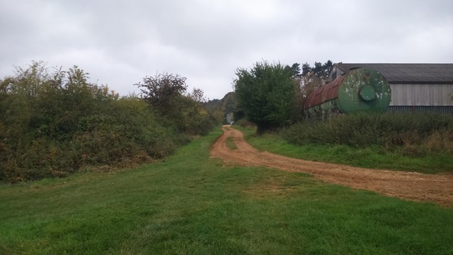
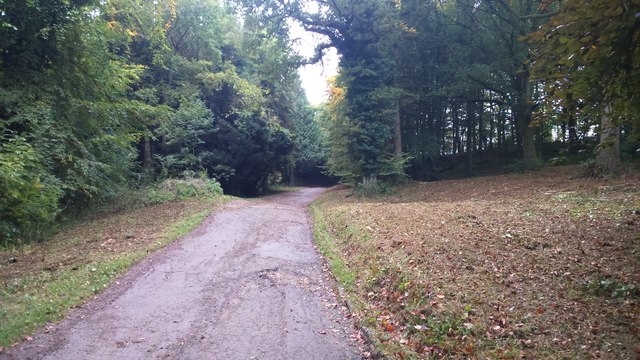
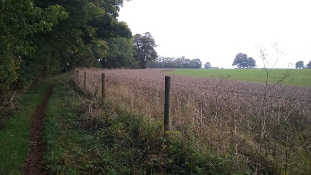
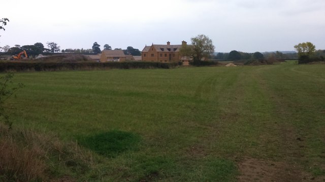
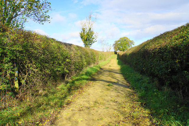
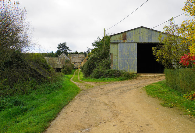
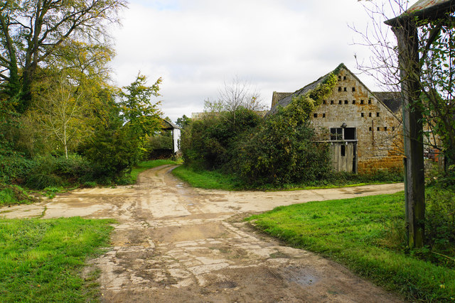
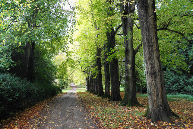
Church Westcote Images

Images are sourced within 2km of 51.8842/-1.678733 or Grid Reference SP2220. Thanks to Geograph Open Source API. All images are credited.

Oxfordshire Way Oxfordshire Way at Gawcombe
Oxfordshire Way
Oxfordshire Way at Gawcombe
Oxfordshire Way Oxfordshire Way heading up the drive from Gawcombe
Oxfordshire Way
Oxfordshire Way heading up the drive from Gawcombe
Oxfordshire Way Oxfordshire Way heading to Wyck Beacon Farm
Oxfordshire Way
Oxfordshire Way heading to Wyck Beacon Farm
Lower Farm From the path from Icomb looking to a new Lower Farm
Lower Farm
From the path from Icomb looking to a new Lower Farm
Path across Westcote Brook Part of the Diamond Way heading towards Church Westcote.
Path across Westcote Brook
Part of the Diamond Way heading towards Church Westcote.
Track up to Pebbly Hill Farm The track is lined by neatly trimmed hedgerows.
Track up to Pebbly Hill Farm
The track is lined by neatly trimmed hedgerows.
The Oxfordshire Way by Westcote Brook You don't see much of the brook which is to the left. The path is as soft and squidgy as it looks.
The Oxfordshire Way by Westcote Brook
You don't see much of the brook which is to the left. The path is as soft and squidgy as it looks.
Path over Westcote Brook The path is not marked on the map and doesn't appear to go anywhere very far.
Path over Westcote Brook
The path is not marked on the map and doesn't appear to go anywhere very far.
A patch of reeds in a field This patch drew attention to itself by the wind blowing through it with a very noisy rustling sound.
A patch of reeds in a field
This patch drew attention to itself by the wind blowing through it with a very noisy rustling sound.
And now there are three Walking the Oxfordshire Way, one path became two parallel tracks, but now we have been joined by a third. These can only be for the benefit of those on horseback.
And now there are three
Walking the Oxfordshire Way, one path became two parallel tracks, but now we have been joined by a third. These can only be for the benefit of those on horseback.
Parallel tracks towards Gawcombe This is the route of the Oxfordshire Way, but there are three tracks to choose from.
Parallel tracks towards Gawcombe
This is the route of the Oxfordshire Way, but there are three tracks to choose from.
Farmland near Church Westcote Flat farmland in the catchment area of Westcote Brook and the River Evenlode.
Farmland near Church Westcote
Flat farmland in the catchment area of Westcote Brook and the River Evenlode.
Track from Gawcombe The route is the Oxfordshire Way. It descends to a plain which is all part of the drainage catchment area of the River Evenlode.
Track from Gawcombe
The route is the Oxfordshire Way. It descends to a plain which is all part of the drainage catchment area of the River Evenlode.
Track through Gawcombe The route of the Oxfordshire Way leads round to the right, avoiding many of the old buildings of the hamlet.
Track through Gawcombe
The route of the Oxfordshire Way leads round to the right, avoiding many of the old buildings of the hamlet.
Track and farm buildings at Gawcombe The top of the barn appears to accommodate a dovecote.
Track and farm buildings at Gawcombe
The top of the barn appears to accommodate a dovecote.
Line of trees near Gawcombe Part of the ornamental driveway to the hamlet.
Line of trees near Gawcombe
Part of the ornamental driveway to the hamlet.
Road to Gawcombe A private road passing through Gawcombe Woods.
Road to Gawcombe
A private road passing through Gawcombe Woods.
Gawcombe Woods Lining the side of a Cotswold ridge.
Gawcombe Woods
Lining the side of a Cotswold ridge.
Show me another place!

Church Westcote is located at Grid Ref: SP2220 (Lat: 51.8842, Lng: -1.678733)

Administrative County: Gloucestershire

District: Cotswold

Police Authority: Gloucestershire

What 3 Words

///body.gets.hazel. Near Bourton on the Water, Gloucestershire

Related Wikis

Westcote, Gloucestershire

Westcote is a civil parish in the Cotswold district, in the county of Gloucestershire, England. The village is about 4 miles (6 km) south-southeast of...

Idbury

Idbury is a village and civil parish in the Cotswold Hills in Oxfordshire, about 4+1⁄2 miles (7 km) southeast of Stow-on-the-Wold in neighbouring Gloucestershire...

Upper Rissington

Upper Rissington is a village and civil parish in the Cotswold district of Gloucestershire, England. It is located about two-and-a-half miles east of Bourton...

Icomb Place

Icomb Place (pronounced "Ickum") is a medieval manor house on the edge of the village of Icomb, near Stow on the Wold in Gloucestershire. The word "place...

Church of St Mary, Icomb

The Anglican Church of St Mary at Icomb in the Cotswold District of Gloucestershire, England was built in the 15th century. It is a grade I listed building...

Bould

Bould is a hamlet in Idbury civil parish, Oxfordshire, about 4.5 miles (7.2 km) southeast of Stow-on-the-Wold in neighbouring Gloucestershire. == External... ==

Fifield, Oxfordshire

Fifield is a village and civil parish about 4 miles (6.4 km) north of Burford in Oxfordshire. The western boundary of the parish forms part of the county...

Icomb

Icomb is a village in the Gloucestershire Cotswolds, near to Stow on the Wold. The population taken at the 2011 census was 202.The village appears as Iacumbe...

Nearby Amenities

Located within 500m of 51.8842,-1.678733
Westcote
Place: village
Lat/Long: 51.8847388/-1.6828687
Nether Westcote
Place: village
Lat/Long: 51.881056/-1.673677
Bus Stop
Old Post Office
Bus: yes
Naptan AtcoCode: 1600GL1171
Naptan Bearing: NW
Naptan CommonName: Old Post Office
Naptan NaptanCode: glogjpad
Naptan Street: Manor Ln
Naptan Verified: no
Public Transport: platform
Source: naptan_import
Lat/Long: 51.8844458/-1.6827201
Bus Stop
Old Post Office
Bus: yes
Naptan AtcoCode: 1600GL1172
Naptan Bearing: SE
Naptan CommonName: Old Post Office
Naptan NaptanCode: glogjpag
Naptan Street: Manor Ln
Naptan Verified: no
Public Transport: platform
Source: naptan_import
Lat/Long: 51.8844705/-1.6825816
Bus Stop
St Francis House
Bus: yes
Naptan AtcoCode: 1600GLA06409
Naptan Bearing: SE
Naptan BusStopType: CUS
Naptan CommonName: St Francis House
Naptan NaptanCode: glogptad
Naptan Street: Field View
Naptan Verified: no
Public Transport: platform
Source: naptan_import
Lat/Long: 51.8836092/-1.683285
Bus Stop
Corner Cottage
Bus: yes
Naptan AtcoCode: 1600GLA06410
Naptan Bearing: NW
Naptan BusStopType: CUS
Naptan CommonName: Corner Cottage
Naptan NaptanCode: glogptag
Naptan Street: Field View
Naptan Verified: no
Public Transport: platform
Source: naptan_import
Lat/Long: 51.8835193/-1.6833002
Bus Stop
War Memorial
Bus: yes
Naptan AtcoCode: 1600GLA06414
Naptan Bearing: SE
Naptan CommonName: War Memorial
Naptan NaptanCode: glogptat
Naptan Street: Field View
Naptan Verified: no
Public Transport: platform
Source: naptan_import
Lat/Long: 51.8826045/-1.6807932
Bus Stop
War Memorial
Bus: yes
Naptan AtcoCode: 1600GLA06415
Naptan Bearing: NW
Naptan BusStopType: CUS
Naptan CommonName: War Memorial
Naptan Indicator: Opp
Naptan NaptanCode: glogptaw
Naptan Street: Field View
Naptan Verified: no
Public Transport: platform
Source: naptan_import
Lat/Long: 51.8825595/-1.6807935
Barrier: kissing_gate
Source: survey
Lat/Long: 51.8846344/-1.6786773
Barrier: stile
Source: survey
Lat/Long: 51.8862418/-1.6837418
Barrier: kissing_gate
Source: survey
Lat/Long: 51.8849867/-1.6779096
Barrier: kissing_gate
Source: survey
Lat/Long: 51.8855717/-1.6757801
Barrier: stile
Source: survey
Lat/Long: 51.8854316/-1.6822737
Barrier: stile
Source: survey
Lat/Long: 51.8857463/-1.6829065
Barrier: kissing_gate
Source: survey
Lat/Long: 51.883927/-1.6802566
Barrier: kissing_gate
Source: survey
Lat/Long: 51.884261/-1.6795682
Barrier: stile
Source: survey
Lat/Long: 51.8858601/-1.6831054
Post Box
Ref: OX7 514
Source: GPS Survey
Lat/Long: 51.8844876/-1.6827175
Post Box
Collection Times: Mo-Fr 16:00; Sa 08:45
Post Box Mounting: brick_pillar
Post Box Type: wall
Ref: OX7 256
Royal Cypher: EIIR
Royal Cypher Wikidata: Q33102113
Source: survey
Survey Date: 2013-04-27
Lat/Long: 51.8803221/-1.6752421
Place Of Worship
Westcote Methodist Church
Denomination: methodist
Religion: christian
Lat/Long: 51.8806511/-1.6746976
Cotswold View
Tourism: guest_house
Lat/Long: 51.8809707/-1.6741223
Direction: NE
Information: map
Inscription: To celebrate the restoration of Tattle by the people of Westcote
Map Type: topo
Tourism: viewpoint
Lat/Long: 51.8819587/-1.6793737
Historic: memorial
Memorial: war_memorial
Lat/Long: 51.8826893/-1.6807401
The data included in this document is from www.openstreetmap.org. The data is made available under ODbL.

Have you been to Church Westcote?

Leave your review of Church Westcote below (or comments, questions and feedback).