Have's Wood

Wood, Forest in Devon Mid Devon

England

Have's Wood

Shop and church, Witheridge
Shop and church, Witheridge Credit: David Martin

Haldon Forest, also known as Haldon Woods or Haldon Forest Park, is a beautiful woodland area located in Devon, England. Covering an area of approximately 3,500 acres, it is situated on the Haldon Hills, just a few miles southwest of the city of Exeter.

Haldon Forest is primarily composed of oak and beech trees, creating a rich and diverse habitat for a variety of flora and fauna. The forest is managed by the Forestry Commission and offers a range of recreational activities for visitors of all ages. There are numerous walking trails and cycling routes throughout the forest, providing ample opportunities for outdoor enthusiasts to explore its natural beauty.

For those seeking more adventure, Haldon Forest boasts a treetop adventure course, known as Go Ape, where visitors can swing through the trees on zip lines and navigate challenging obstacles. Additionally, the forest is home to a vast network of mountain biking trails, suitable for both beginners and experienced riders.

Haldon Forest also has several picnic areas and a café, providing a perfect spot for a leisurely lunch amidst the stunning surroundings. The forest is a popular destination for families, offering a children's play area and various events and activities throughout the year.

With its tranquil atmosphere, breathtaking views, and abundance of recreational opportunities, Haldon Forest is an ideal destination for nature lovers and outdoor enthusiasts alike. Whether it's a peaceful walk through the woods or an adrenaline-fueled adventure, Haldon Forest offers something for everyone to enjoy.

If you have any feedback on the listing, please let us know in the comments section below.

Have's Wood Images

Images are sourced within 2km of 50.909746/-3.7270532 or Grid Reference SS7813. Thanks to Geograph Open Source API. All images are credited.

Shop and church, Witheridge
Cottages in the village centre, Witheridge
Witheridge : New Bridge New Bridge and the B3137 over the Little Dart River.
Witheridge : New Bridge
New Bridge and the B3137 over the Little Dart River.
Witheridge : Grassland Looking down off the B3171.
Witheridge : Grassland
Looking down off the B3171.
Witheridge : Little Dart River The river heads under New Bridge.
Witheridge : Little Dart River
The river heads under New Bridge.
Witheridge : Little Dart River The Litter Dart River at New Bridge.
Witheridge : Little Dart River
The Litter Dart River at New Bridge.
Witheridge: The Square Looking north-north-west with St John the Baptist church undergoing restoration work. A newsagent’s shop stands to the right of the phone box
Witheridge: The Square
Looking north-north-west with St John the Baptist church undergoing restoration work. A newsagent’s shop stands to the right of the phone box
Witheridge: The Mitre Inn This public house stands by the A373 Tiverton – South Molton road. Looking east-north-east
Witheridge: The Mitre Inn
This public house stands by the A373 Tiverton – South Molton road. Looking east-north-east
Thelbridge: towards Woodford Farm Seen from the B3042 Chawleigh-Witheridge road, looking north-north-west
Thelbridge: towards Woodford Farm
Seen from the B3042 Chawleigh-Witheridge road, looking north-north-west
Thelbridge: entrance to Woodford Farm By the B3042 Chawleigh-Witheridge road, looking north-north-west. The Two Moors Way uses this lane
Thelbridge: entrance to Woodford Farm
By the B3042 Chawleigh-Witheridge road, looking north-north-west. The Two Moors Way uses this lane
Lifting swedes by Woodford farm
Church of St John the Baptist, Witheridge
St John The Baptist Church, Witheridge, in 1993
West Worlington church The church is dedicated to St Mary.
West Worlington church
The church is dedicated to St Mary.
Church Cottage, West Worlington This thatched cottage is unusual in that a passageway through it gives access to the church and churchyard.
Church Cottage, West Worlington
This thatched cottage is unusual in that a passageway through it gives access to the church and churchyard.
Cottage and phone box This cottage and phone box are situated on the road between West and East Worlington.
Cottage and phone box
This cottage and phone box are situated on the road between West and East Worlington.
East Worlington church St Mary the Virgin church, East Worlington.
East Worlington church
St Mary the Virgin church, East Worlington.
Lane through Drayford Drayford is a small hamlet in the Little Dart River valley. The bridge over the river can be seen in this picture.
Lane through Drayford
Drayford is a small hamlet in the Little Dart River valley. The bridge over the river can be seen in this picture.
Show me another place!

Have's Wood is located at Grid Ref: SS7813 (Lat: 50.909746, Lng: -3.7270532)

Administrative County: Devon

District: Mid Devon

Police Authority: Devon and Cornwall

What 3 Words

///ribcage.shaver.mile. Near Witheridge, Devon

Related Wikis

Drayford

Drayford is a village in the English county of Devon, approximately 15 miles north west of Exeter. == External links == Media related to Drayford at Wikimedia...
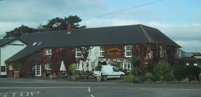
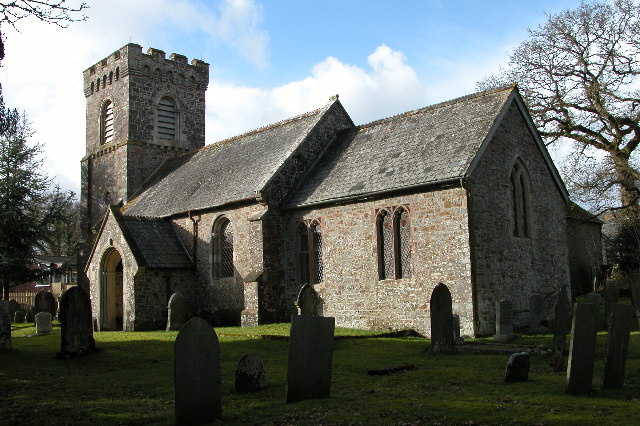
Thelbridge

Thelbridge is a village and civil parish in Devon, England. It is 5 miles NE of Morchard Road railway station and 8½ NNW of Crediton.The local church,...

East Worlington

East Worlington is a civil parish and hamlet in the North Devon administrative area, in the English county of Devon, England.In 2001, the village had 241...

Witheridge

Witheridge is a village and civil parish in the North Devon district of Devon, England. In 2001 the population of the parish was 1162, reducing slightly...

Witheridge F.C.

Witheridge Football Club is a football club based in the Devon village of Witheridge. They are currently members of the Devon & Exeter League Division...

West Worlington

West Worlington is a small village and former civil and ecclesiastical parish, now in the civil parish of East Worlington, in the North Devon district...

Affeton Castle

Affeton Castle is a converted late-medieval gatehouse near East Worlington, Devon, England. It was formerly part of the fortified manor house of Affeton...

Washford Pyne

Washford Pyne is a village and civil parish in Devon, England. It is 7 miles NE of Morchard Road railway station and 8 N by W of Crediton.The local church...

Nearby Amenities

Located within 500m of 50.909746,-3.7270532
Generator Method: photovoltaic
Generator Output Electricity: yes
Generator Source: solar
Generator Type: solar_photovoltaic_panel
Location: roof
Power: generator
Lat/Long: 50.9101628/-3.7288217
Power: pole
Source: bing
Lat/Long: 50.9137218/-3.724663
Power: pole
Source: bing
Lat/Long: 50.9132094/-3.7261999
Power: pole
Source: bing
Lat/Long: 50.9127342/-3.7276188
Power: pole
Source: bing
Lat/Long: 50.9122912/-3.7289625
Power: pole
Source: bing
Lat/Long: 50.9118548/-3.7302822
Power: pole
Source: bing
Lat/Long: 50.9113399/-3.7318084
Poles: bipole
Power: pole
Source: bing
Transformer: distribution
Lat/Long: 50.9108393/-3.7333493
Power: pole
Source: bing
Lat/Long: 50.905762/-3.7238838
Power: pole
Source: bing
Transformer: distribution
Lat/Long: 50.9057594/-3.7255521
Power: pole
Source: bing
Lat/Long: 50.9057823/-3.7272741
Power: pole
Source: bing
Lat/Long: 50.9058093/-3.730085
The data included in this document is from www.openstreetmap.org. The data is made available under ODbL.

Have you been to Have's Wood?

Leave your review of Have's Wood below (or comments, questions and feedback).