Church Enstone

Settlement in Oxfordshire West Oxfordshire

England

Church Enstone

The Crown Inn, Enstone The pub building is originally C17 (see <span class="nowrap"><a title="https://britishlistedbuildings.co.uk/101200432-the-crown-inn-enstone#.YR1iv4hKg2w" rel="nofollow ugc noopener" href="https://britishlistedbuildings.co.uk/101200432-the-crown-inn-enstone#.YR1iv4hKg2w">Link</a><img style="margin-left:2px;" alt="External link" title="External link - shift click to open in new window" src="https://s1.geograph.org.uk/img/external.png" width="10" height="10"/></span> for entry in British Listed Buildings). The building set back to the right is Heythrop Cottage, built in C18 (see <span class="nowrap"><a title="https://britishlistedbuildings.co.uk/101200308-heythrop-cottage-enstone#.YR1jDohKg2w" rel="nofollow ugc noopener" href="https://britishlistedbuildings.co.uk/101200308-heythrop-cottage-enstone#.YR1jDohKg2w">Link</a><img style="margin-left:2px;" alt="External link" title="External link - shift click to open in new window" src="https://s1.geograph.org.uk/img/external.png" width="10" height="10"/></span> for entry in British Listed Buildings).
The Crown Inn, Enstone Credit: Bikeboy

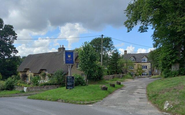
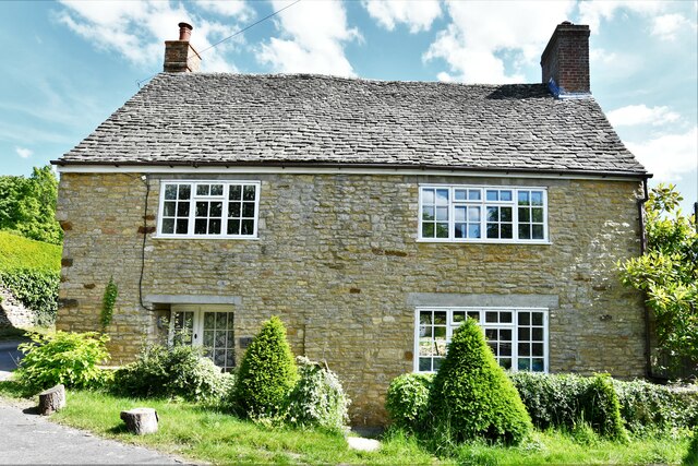
Church Enstone is a charming village located in the county of Oxfordshire, England. Situated approximately 15 miles northwest of Oxford, this picturesque settlement is nestled within the beautiful Cotswolds Area of Outstanding Natural Beauty. The village takes its name from the enchanting St. Kenelm's Church, which stands at its heart.

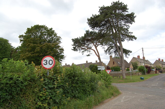
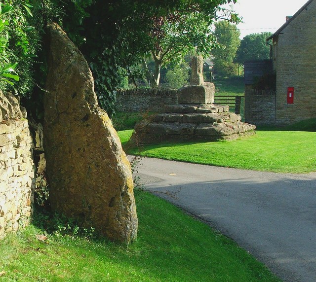
Church Enstone is characterized by its quintessential English countryside setting. The village is surrounded by rolling hills, lush green fields, and idyllic rural landscapes, making it a haven for nature enthusiasts and walkers. The nearby River Evenlode adds to the village's charm, flowing gently through the surrounding countryside.

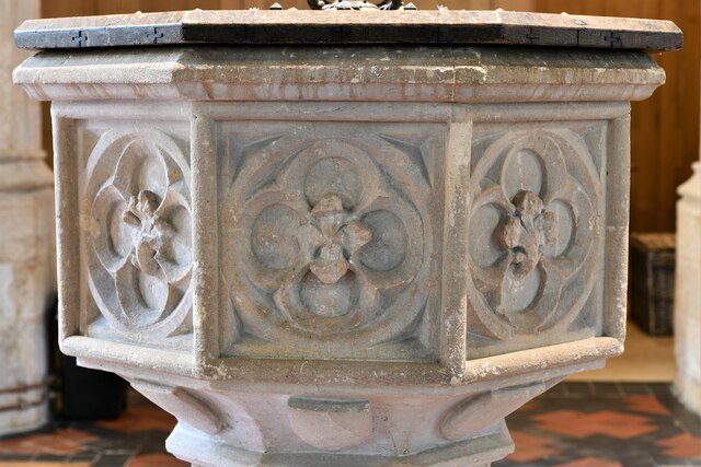
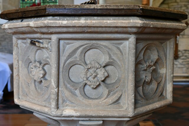
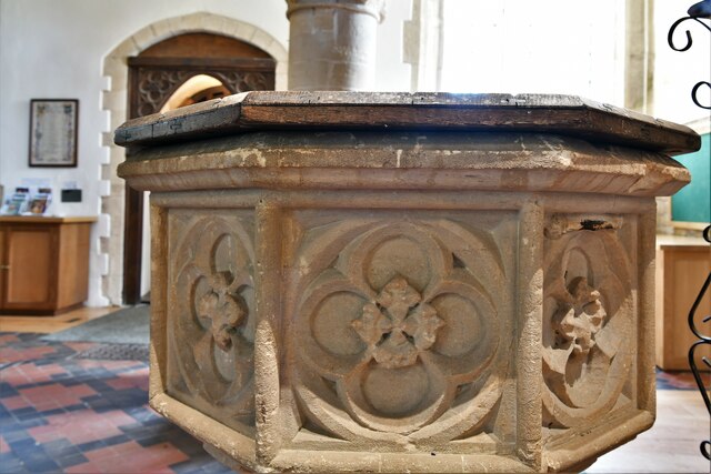
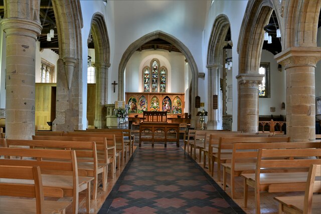
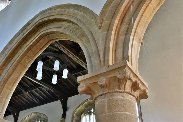
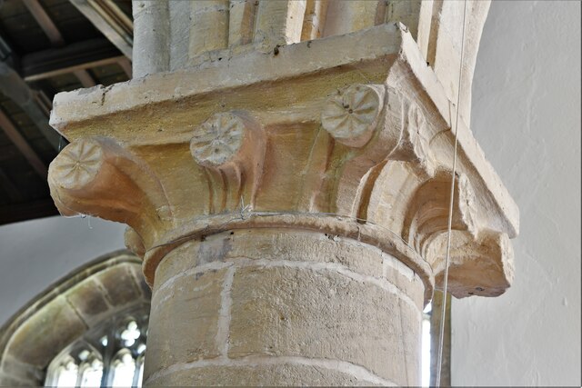
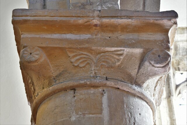
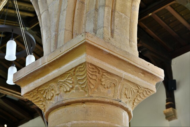
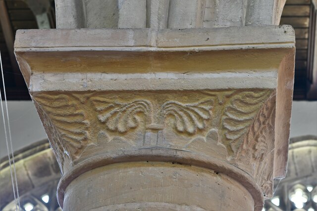
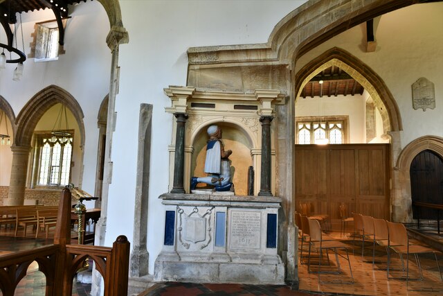
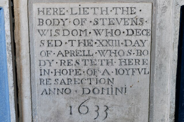
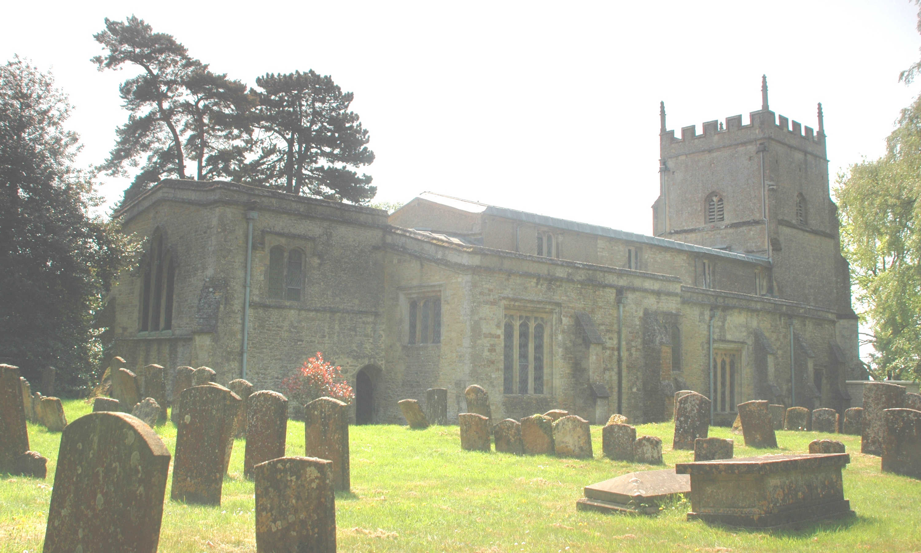
The centerpiece of Church Enstone, St. Kenelm's Church, is a Grade I listed building that dates back to the 12th century. With its stunning architecture and rich history, the church attracts visitors from far and wide. The churchyard is also the final resting place of Sir Winston Churchill's nanny, Elizabeth Anne Everest.

The village itself offers a peaceful and close-knit community atmosphere. It boasts a range of amenities, including a local pub, a primary school, and a village hall that hosts various events throughout the year. The surrounding area offers plenty of opportunities for outdoor activities, such as hiking, cycling, and horse riding.

Overall, Church Enstone presents an idyllic and historic village experience, providing a serene retreat from the hustle and bustle of city life. Its natural beauty, rich heritage, and sense of community make it a truly special place to visit or call home.

If you have any feedback on the listing, please let us know in the comments section below.

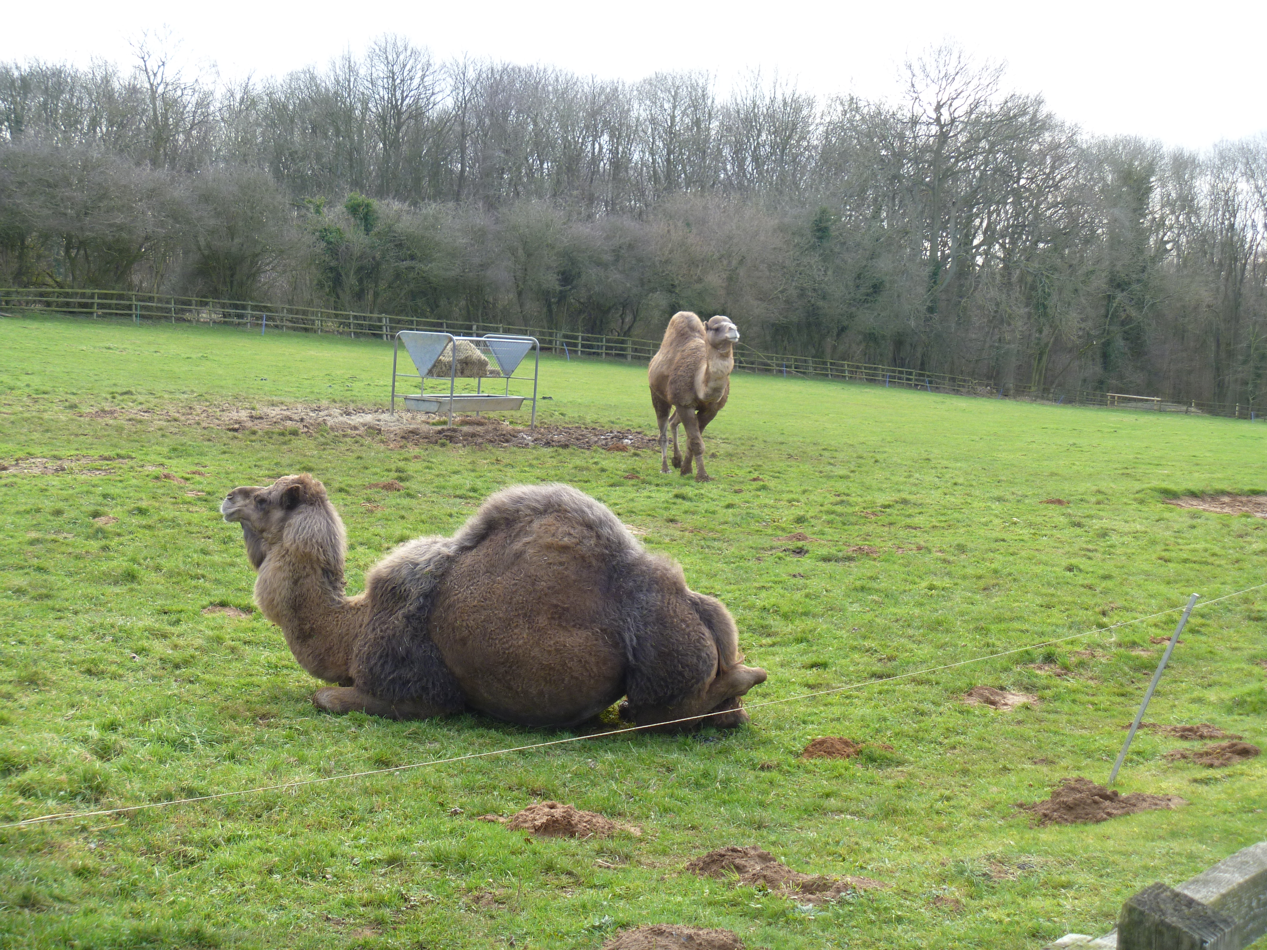
Church Enstone Images

Images are sourced within 2km of 51.917714/-1.453271 or Grid Reference SP3724. Thanks to Geograph Open Source API. All images are credited.

The Crown Inn, Enstone The pub building is originally C17 (see <span class="nowrap"><a title="https://britishlistedbuildings.co.uk/101200432-the-crown-inn-enstone#.YR1iv4hKg2w" rel="nofollow ugc noopener" href="https://britishlistedbuildings.co.uk/101200432-the-crown-inn-enstone#.YR1iv4hKg2w">Link</a><img style="margin-left:2px;" alt="External link" title="External link - shift click to open in new window" src="https://s1.geograph.org.uk/img/external.png" width="10" height="10"/></span> for entry in British Listed Buildings). The building set back to the right is Heythrop Cottage, built in C18 (see <span class="nowrap"><a title="https://britishlistedbuildings.co.uk/101200308-heythrop-cottage-enstone#.YR1jDohKg2w" rel="nofollow ugc noopener" href="https://britishlistedbuildings.co.uk/101200308-heythrop-cottage-enstone#.YR1jDohKg2w">Link</a><img style="margin-left:2px;" alt="External link" title="External link - shift click to open in new window" src="https://s1.geograph.org.uk/img/external.png" width="10" height="10"/></span> for entry in British Listed Buildings).
The Crown Inn, Enstone
The pub building is originally C17 (see LinkExternal link for entry in British Listed Buildings). The building set back to the right is Heythrop Cottage, built in C18 (see LinkExternal link for entry in British Listed Buildings).
Flooding at Cleveley Flooding from the river Glyme
Flooding at Cleveley
Flooding from the river Glyme
Road Junction at Enstone
The road from Cleveley to Enstone
Church Enstone: Forge Cottage
Church Enstone, St. Kenelm's Church: c15th panelled octagonal font
Church Enstone, St. Kenelm's Church: The nave
Church Enstone, St. Kenelm's Church: Nave capital 1
Church Enstone, St. Kenelm's Church: Nave capital 2
Church Enstone, St. Kenelm's Church: Nave capital 3
Church Enstone, St. Kenelm's Church: Nave capital 4
Church Enstone, St. Kenelm's Church: Nave capital 5
Church Enstone, St. Kenelm's Church: Stevens Wisdom memorial (d. 1633) 1
Church Enstone, St. Kenelm's Church: Stevens Wisdom memorial (d. 1633) 2
Church Enstone, St. Kenelm's Church: Stevens Wisdom memorial (d. 1633) 3
Church Enstone, St. Kenelm's Church: Stevens Wisdom memorial (d. 1633) 4
Show me another place!

Church Enstone is located at Grid Ref: SP3724 (Lat: 51.917714, Lng: -1.453271)

Administrative County: Oxfordshire

District: West Oxfordshire

Police Authority: Thames Valley

What 3 Words

///disposal.imprinted.siblings. Near Charlbury, Oxfordshire

Related Wikis

Enstone

Enstone is a village and civil parish in England, about 4 miles (6.4 km) east of Chipping Norton and 15 miles (24 km) north-west of Oxford city. The civil...

Fulwell, Oxfordshire

Fulwell is a hamlet in the civil parish of Enstone in Oxfordshire, England. It lies about 4.5 miles (7 km) southeast of Chipping Norton. Fulwell's toponym...

Taston

Taston is a hamlet in Spelsbury civil parish, about 1.6 miles (2.6 km) north of Charlbury and 4 miles (6.4 km) southeast of Chipping Norton, Oxfordshire...

Lidstone

Lidstone is a hamlet on the River Glyme in Oxfordshire, about 3 miles (5 km) east of Chipping Norton. The hamlet is in Enstone civil parish, about 1+1...

Enstone Airfield

Enstone Aerodrome is a small unlicensed civilian airfield in England close to Enstone in Oxfordshire, which is currently used for microlights, light aircraft...

Heythrop Park

Heythrop Park is a Grade II* listed early 18th-century country house 1 mile (1.6 km) southeast of Heythrop in Oxfordshire. It was designed by the architect...

Heythrop Zoological Gardens

Heythrop Zoological Gardens is a private zoo and animal training centre in Heythrop, near Chipping Norton, Oxfordshire. The zoo has the largest private...

Radford, Oxfordshire

Radford is a hamlet on the River Glyme in Enstone civil parish about 6 miles (10 km) east of Chipping Norton, Oxfordshire. == History == In 1086, the...

Related Videos

Part two of the Easter Holiday Trip in #Rex ! #shorts

And we even found a puddle! #classickeeper #classiccars #classic #landrover #defender #cotswolds #td5 #defender90 #camping ...

Nearby Amenities

Located within 500m of 51.917714,-1.453271
Neat Enstone
Alt Name: Enstone
Note: Neat Enstone and Church Enstone are 2 villages that comprise Enstone parish
Place: village
Wikidata: Q1145119
Wikipedia: en:Enstone
Lat/Long: 51.9159197/-1.4537998
Pub
The Harrow Inn
Lat/Long: 51.918508/-1.4555142
Speed Camera
Lat/Long: 51.9180323/-1.4552682
Post Box
Post Box Type: pillar
Postal Code: OX7
Ref: OX7 259
Royal Cypher: EIIR
Royal Cypher Wikidata: Q33102113
Lat/Long: 51.9158915/-1.4535764
Post Office
Enstone Post Office
Brand: Post Office
Brand Wikidata: Q1783168
Check Date: 2023-09-27
Ref Pol Id: 97646
Lat/Long: 51.9159286/-1.4535378
Barrier: stile
Foot: yes
Lat/Long: 51.9165868/-1.446334
Bus Stop
Enstone Green
Bus: yes
Naptan AtcoCode: 340001873OPP
Naptan Bearing: SE
Naptan CommonName: Enstone Green
Naptan Indicator: Opposite
Naptan Landmark: Oxford Road
Naptan NaptanCode: oxfgjadp
Naptan Street: Oxford Road
Naptan Verified: no
Public Transport: platform
Shelter: yes
Source: naptan_import
Lat/Long: 51.9158455/-1.4538093
Bus Stop
Enstone Green
Bus: yes
Naptan AtcoCode: 340001873OUT
Naptan Bearing: NW
Naptan CommonName: Enstone Green
Naptan Indicator: Outside
Naptan Landmark: Oxford Road
Naptan NaptanCode: oxfgjadm
Naptan Street: Oxford Road
Naptan Verified: no
Public Transport: platform
Source: naptan_import
Lat/Long: 51.9155806/-1.4539232
Chapel Lane
Naptan AtcoCode: 340001874OPP
Naptan Bearing: N
Naptan BusStopType: CUS
Naptan CommonName: Chapel Lane
Naptan Indicator: Opposite
Naptan Landmark: The Harrow
Naptan NaptanCode: oxfgjadj
Naptan ShortCommonName: Chapel Lane
Naptan Street: Oxford Road
Naptan Verified: no
Source: naptan_import
Lat/Long: 51.917398/-1.4548878
Bus Stop
Chapel Lane
Bench: yes
Bus: yes
Naptan AtcoCode: 340001874OUT
Naptan Bearing: S
Naptan CommonName: Chapel Lane
Naptan Indicator: Outside
Naptan Landmark: The Harrow
Naptan NaptanCode: oxfgjadg
Naptan ShortCommonName: Chapel Lane
Naptan Street: Oxford Road
Naptan Verified: no
Public Transport: platform
Shelter: yes
Source: naptan_import
Lat/Long: 51.9177136/-1.4549813
Turning Circle
Lat/Long: 51.9136774/-1.4518962
Power: pole
Lat/Long: 51.9192422/-1.4527408
Power: pole
Lat/Long: 51.9177833/-1.4513378
Power: pole
Lat/Long: 51.9215962/-1.4567748
Power: pole
Lat/Long: 51.9208977/-1.4567208
Power: pole
Lat/Long: 51.9214788/-1.4555314
Power: pole
Lat/Long: 51.9211873/-1.4528103
Power: pole
Lat/Long: 51.9159474/-1.4485224
Power: pole
Lat/Long: 51.9162545/-1.4498498
Power: pole
Lat/Long: 51.9183928/-1.4519401
Power: pole
Lat/Long: 51.9200364/-1.4535346
Building: school
Lat/Long: 51.9150575/-1.4547498
Bench
Lat/Long: 51.9159106/-1.4538376
The data included in this document is from www.openstreetmap.org. The data is made available under ODbL.

Have you been to Church Enstone?

Leave your review of Church Enstone below (or comments, questions and feedback).