Frogwell Wood

Wood, Forest in Devon North Devon

England

Frogwell Wood

Kipscombe Enclosure Taken just beyond the point where the long-distance footpath leaves the track down to Rodney's
Kipscombe Enclosure Credit: Tim Harrison

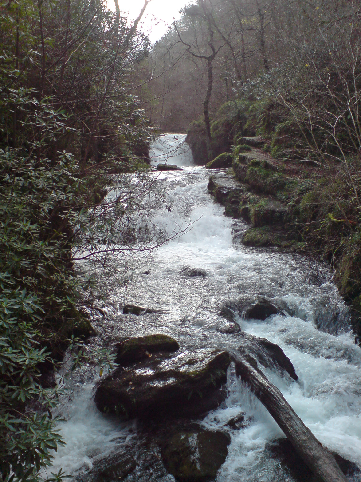
Frogwell Wood is a stunning woodland located in the county of Devon, England. Covering an area of approximately 100 acres, it is known for its natural beauty and diverse ecosystem. The wood is situated near the village of Frogwell, nestled within the picturesque landscape of the Devon countryside.

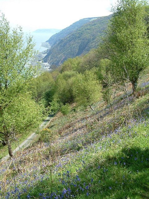
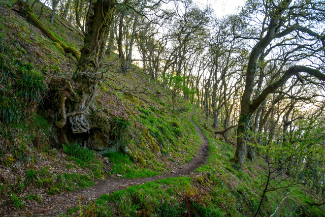
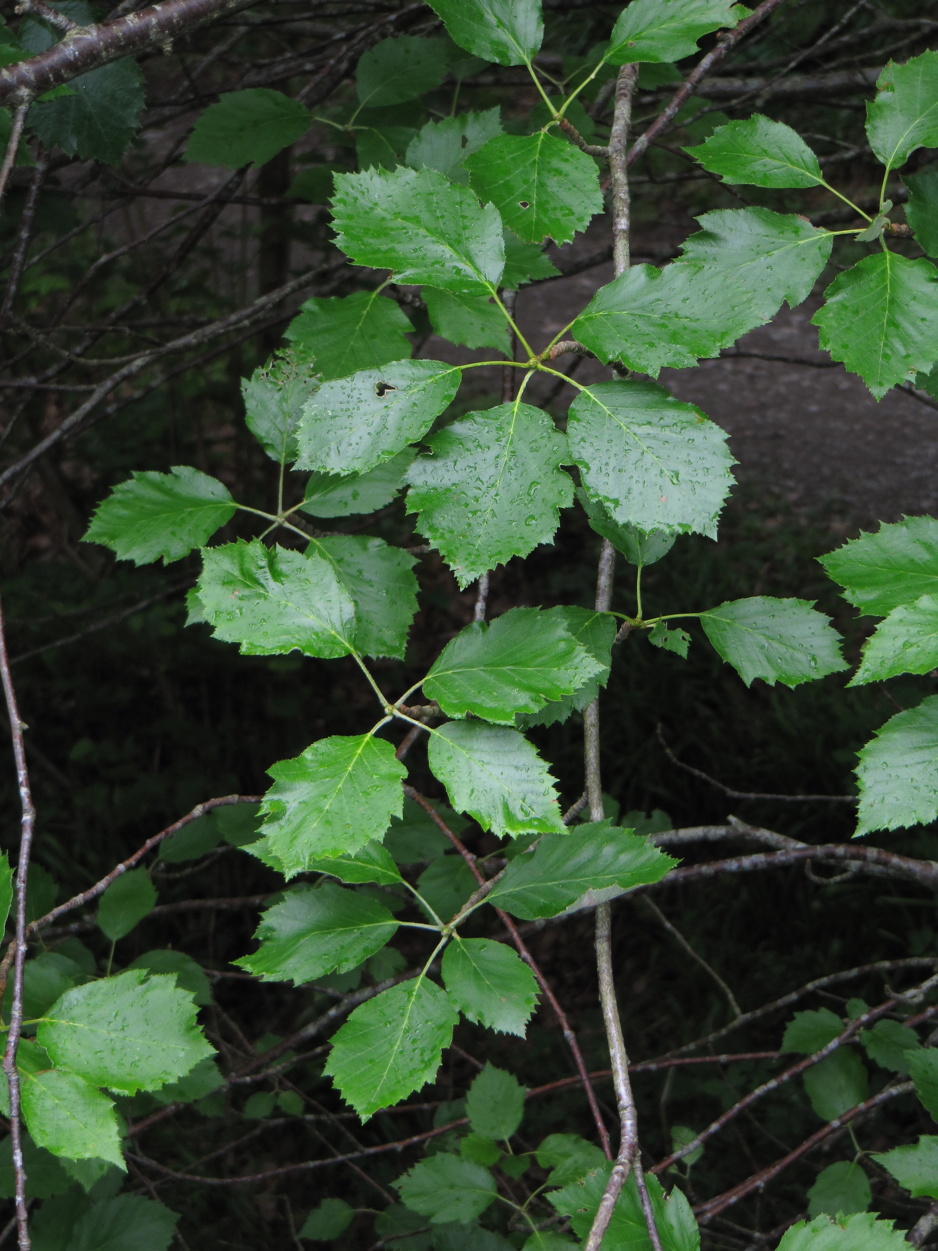
The wood is predominantly composed of mature broadleaved trees, including oak, beech, and ash, which provide a dense canopy and create a cool and shaded environment. These trees also offer a habitat for a wide range of wildlife, including birds, butterflies, and small mammals, making Frogwell Wood a popular destination for nature enthusiasts and birdwatchers.

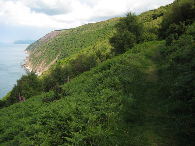
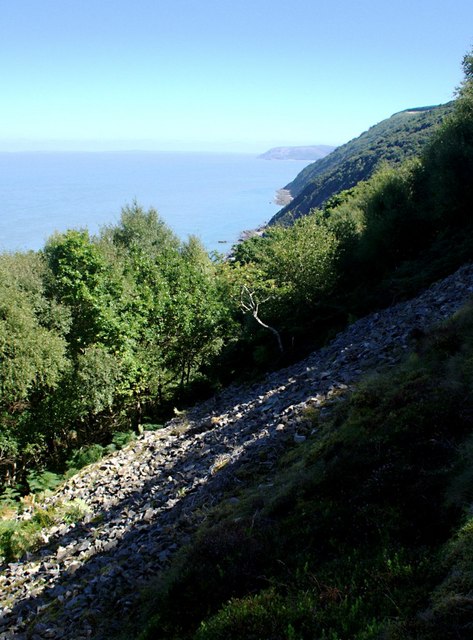
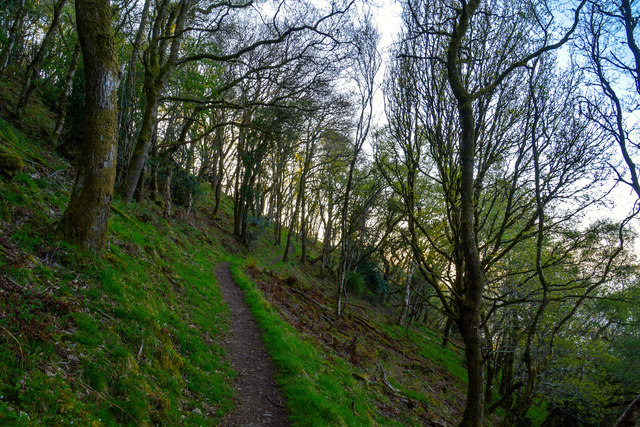
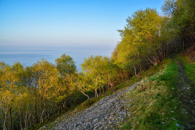
The woodland features well-maintained footpaths and trails that allow visitors to explore its enchanting surroundings. The paths wind through the wood, passing by babbling brooks, tranquil ponds, and open clearings, offering a peaceful and serene atmosphere. Visitors can enjoy leisurely walks, spot various species of plants and fungi, and immerse themselves in the tranquility of the forest.

Frogwell Wood is also renowned for its vibrant display of wildflowers, particularly during the spring and summer months, when the forest floor is adorned with a colorful carpet of bluebells, primroses, and wood anemones. This spectacle attracts photographers and nature lovers, who come to capture the beauty of the wood in full bloom.

Overall, Frogwell Wood is a captivating natural treasure in Devon, providing a haven for wildlife and a place of relaxation and exploration for visitors.

If you have any feedback on the listing, please let us know in the comments section below.

Frogwell Wood Images

Images are sourced within 2km of 51.220272/-3.7681087 or Grid Reference SS7648. Thanks to Geograph Open Source API. All images are credited.

Kipscombe Enclosure Taken just beyond the point where the long-distance footpath leaves the track down to Rodney's
Kipscombe Enclosure
Taken just beyond the point where the long-distance footpath leaves the track down to Rodney's
Coast above Countisbury Cove The South West Coast Path above Countisbury Cove.
Coast above Countisbury Cove
The South West Coast Path above Countisbury Cove.
Scree among the woodland On the coast path above Countisbury Cove the slope steep enough that the woodland cover is overwhelmed by scree in places.
Scree among the woodland
On the coast path above Countisbury Cove the slope steep enough that the woodland cover is overwhelmed by scree in places.
Ruins of old lime kiln, Countisbury Cove
Sands revealed at low tide, Countisbury Cove
Cliffs below Desolate Farm
Outlying rock, Countisbury Cove
Rodney's, Kipscombe Enclosure
The coast path passing through Chubhill Wood The South West Coast Path passing through Chubhill Wood.
The coast path passing through Chubhill Wood
The South West Coast Path passing through Chubhill Wood.
North Devon : Coastal Scenery Looking out across the bay and towards Foreland Point.
North Devon : Coastal Scenery
Looking out across the bay and towards Foreland Point.
North Devon : South West Coast Path Looking along the South West Coast Path.
North Devon : South West Coast Path
Looking along the South West Coast Path.
North Devon : South West Coast Path The South West Coast Path heads through Chubhill Wood.
North Devon : South West Coast Path
The South West Coast Path heads through Chubhill Wood.
North Devon : South West Coast Path Looking along the South West Coast Path in North Devon.
North Devon : South West Coast Path
Looking along the South West Coast Path in North Devon.
North Devon : South West Coast Path Looking along the South West Coast Path as it heads through the woods.
North Devon : South West Coast Path
Looking along the South West Coast Path as it heads through the woods.
North Devon : South West Coast Path The coast path above the cliffs.
North Devon : South West Coast Path
The coast path above the cliffs.
North Devon : South West Coast Path The coast path with the cliff down to the left beyond the trees.
North Devon : South West Coast Path
The coast path with the cliff down to the left beyond the trees.
North Devon : Coastal Scenery Looking across the Exmoor coastline.
North Devon : Coastal Scenery
Looking across the Exmoor coastline.
Cliffs along Countisbury Cove
Show me another place!

Frogwell Wood is located at Grid Ref: SS7648 (Lat: 51.220272, Lng: -3.7681087)

Administrative County: Devon

District: North Devon

Police Authority: Devon and Cornwall

What 3 Words

///fizzled.chestnuts.fussed. Near Lynton, Devon

Related Wikis

Brendon

Brendon is a village and former civil parish, now in the parish of Brendon and Countisbury, in the North Devon district, in the county of Devon, England...

Brendon and Countisbury

Brendon and Countisbury is an English civil parish in the district of North Devon and the county of Devon. The civil parish was created on 1 April 2013...
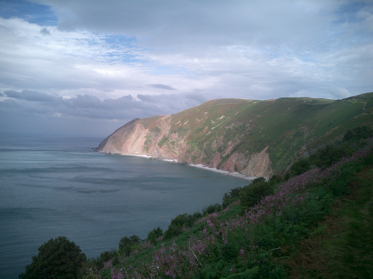
Foreland Point

Foreland Point is a rocky headland in Devon near Lynmouth, and is the most northerly point along the Devon and Exmoor coast. The highest cliff is 89 metres...
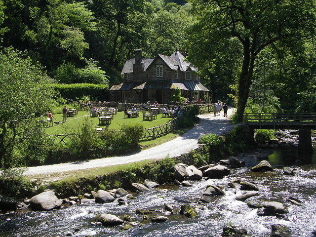
Watersmeet House

Watersmeet House is a National Trust property located some 1.8 miles (2.9 km) east of Lynmouth, in the English county of Devon. A former fishing lodge...

Hoar Oak Water

Hoar Oak Water is a moorland tributary of the East Lyn River in Exmoor, Somerset, England. It rises at Hoaroak Hill in the Chains geological site and flows...

Karpatiosorbus admonitor

Karpatiosorbus admonitor, previously classified as Sorbus admonitor and also called the no parking whitebeam, is a species of whitebeam tree found in Devon...

Countisbury

Countisbury is a village and former civil parish, now in the parish of Brendon and Countisbury, in the North Devon district, in the county of Devon, England...

Myrtlebury

Myrtlebury is an Iron Age enclosure or 'spur' hill fort situated close to Lynmouth in Devon, England. The fort is effectively the north east of a hillside...

Nearby Amenities

Located within 500m of 51.220272,-3.7681087
Barrier: hedge
Lat/Long: 51.2237233/-3.7687037
Brendon
Is In: Devon
Place: village
Wikidata: Q1217620
Lat/Long: 51.2200684/-3.7642682
Pub
Staghunters Inn
Wikidata: Q79837580
Lat/Long: 51.2194799/-3.7664586
Post Box
Collection Times: Mo-Fr 15:45; Sa 11:00
Post Box Type: lamp
Ref: EX35 193
Royal Cypher: EIIR
Royal Cypher Wikidata: Q33102113
Lat/Long: 51.220015/-3.7653459
Bench
Lat/Long: 51.2182303/-3.7716303
Building: yes
Lat/Long: 51.2195354/-3.7690299
Barn Farm
Place: farm
Lat/Long: 51.2196732/-3.7625121
Building: yes
Lat/Long: 51.2200125/-3.763636
Telephone
Booth: K6
Covered: booth
Lat/Long: 51.2186239/-3.76918
Toilets
Lat/Long: 51.2186063/-3.7699641
Bench
Lat/Long: 51.2198973/-3.7630802
Access: private
Barrier: stile
Material: wood
Source: survey;gps
Stile: stepover
Lat/Long: 51.2176916/-3.7717543
Barrier: kissing_gate
Source: survey;gps
Lat/Long: 51.2215092/-3.7613113
The data included in this document is from www.openstreetmap.org. The data is made available under ODbL.

Have you been to Frogwell Wood?

Leave your review of Frogwell Wood below (or comments, questions and feedback).