Church End

Settlement in Oxfordshire West Oxfordshire

England

Church End

South Leigh only The road to South Leigh crosses the slip road off the A40 dual carriageway.
South Leigh only Credit: andrew auger

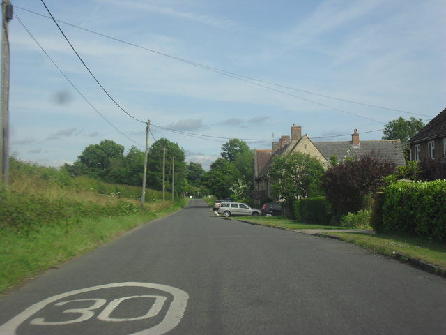
Church End is a small village located in the county of Oxfordshire in England. Situated about 8 miles north of the city of Oxford, Church End is part of the Cherwell district. The village is nestled within a picturesque rural landscape, characterized by rolling hills, lush green fields, and idyllic countryside views.

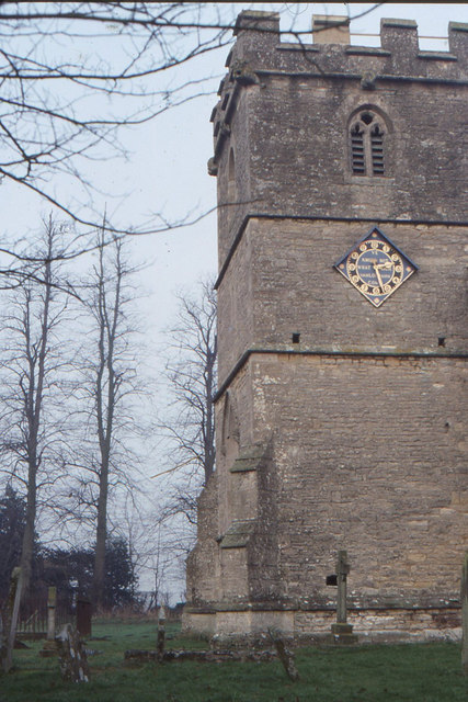
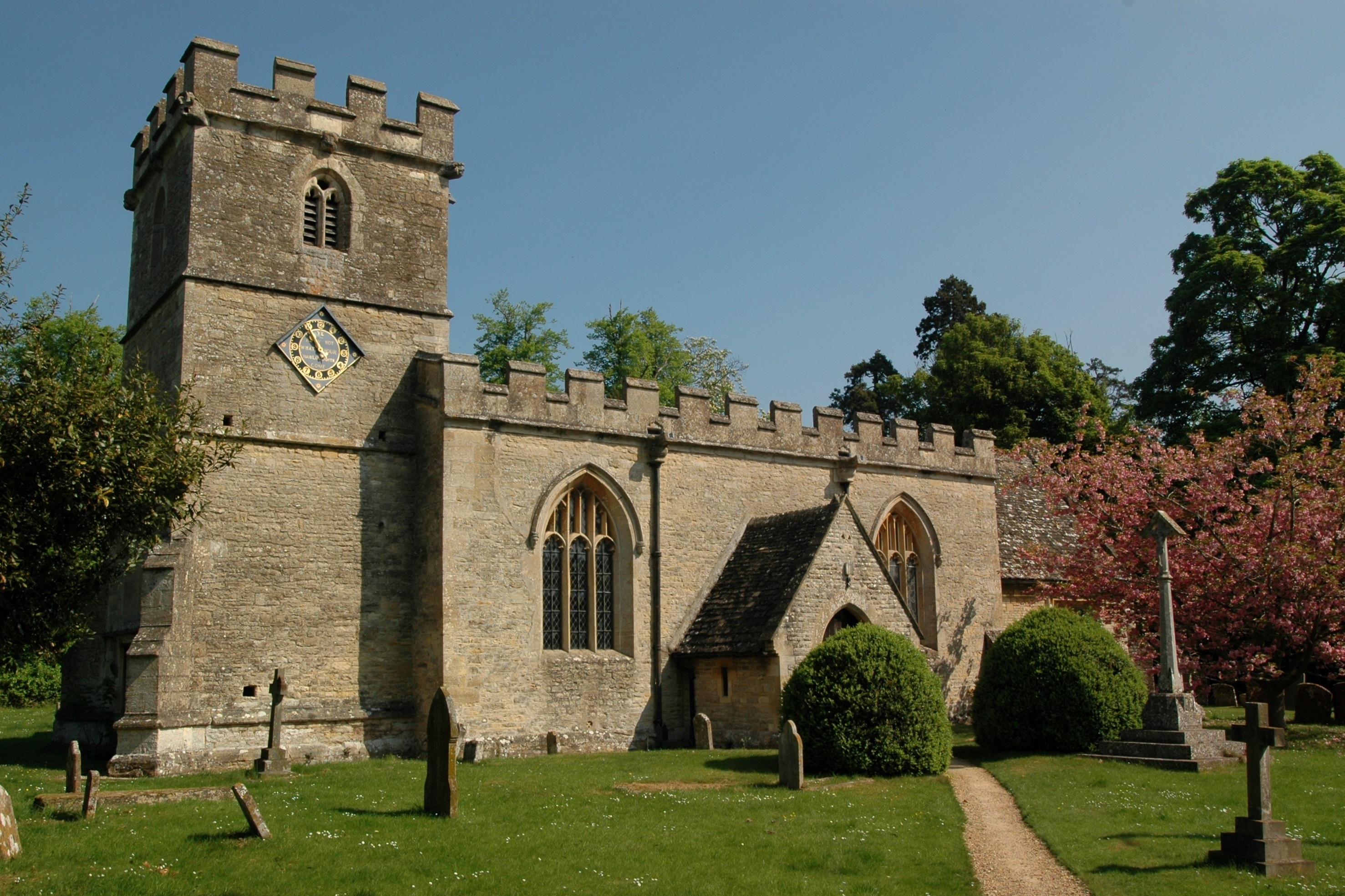
The heart of Church End is dominated by the historic St. Peter's Church, which dates back to the 12th century. This beautiful medieval church stands as a testament to the village's rich history and serves as a focal point for the local community.

The village itself consists of a charming collection of traditional cottages and houses, many of which boast stunning architectural features. The tranquil atmosphere and friendly atmosphere of Church End make it an appealing place to live or visit.

Although small in size, Church End offers a range of amenities for its residents. These include a village hall, a local pub, and a small primary school. For further services and amenities, the nearby town of Kidlington is easily accessible.

The surrounding area provides ample opportunities for outdoor activities and leisure pursuits. The nearby countryside offers scenic walking trails, cycling routes, and peaceful picnic spots. Additionally, Church End benefits from its close proximity to the bustling city of Oxford, renowned for its world-class university, cultural attractions, and vibrant nightlife.

Overall, Church End, Oxfordshire is a charming village that combines a rich historical heritage with a tranquil rural setting, offering residents and visitors a peaceful and picturesque place to call home.

If you have any feedback on the listing, please let us know in the comments section below.

Church End Images

Images are sourced within 2km of 51.769324/-1.4362223 or Grid Reference SP3908. Thanks to Geograph Open Source API. All images are credited.

South Leigh only The road to South Leigh crosses the slip road off the A40 dual carriageway.
South Leigh only
The road to South Leigh crosses the slip road off the A40 dual carriageway.
April Cottage and Field View Roadside cottages on the road to South Leigh, April Cottage is the nearer, and Field View the further.
April Cottage and Field View
Roadside cottages on the road to South Leigh, April Cottage is the nearer, and Field View the further.
Chapel Road, South Leigh
Lane to Stanton Harcourt at Cogges Bridge Cottage
Power lines cross the lane to Stanton Harcourt
Entrance to Gill Mill
Long straight by the sand pits
Tar Farm Cottage
Tar Farm Cottage
Lane to Stanton Harcourt
Lane to Stanton Harcourt A footpath to Tar Farm leaves to the left.
Lane to Stanton Harcourt
A footpath to Tar Farm leaves to the left.
Tar Road south of Springhill Farm After the Stanton Harcourt Road crosses the A40 it adopts the intriguing name: Tar Road. The lane is very narrow and flanked by thick undergrowth without passing places.
Tar Road south of Springhill Farm
After the Stanton Harcourt Road crosses the A40 it adopts the intriguing name: Tar Road. The lane is very narrow and flanked by thick undergrowth without passing places.
Oxford, Witney and Fairford Railway disused route Viewed from Cogges Bridge after a bend in the Tar Road. The railway was closed in 1970. See also: <span class="nowrap"><a title="http://en.wikipedia.org/wiki/Oxford,_Witney_and_Fairford_Railway" rel="nofollow ugc noopener" href="http://en.wikipedia.org/wiki/Oxford,_Witney_and_Fairford_Railway">Link</a><img style="margin-left:2px;" alt="External link" title="External link - shift click to open in new window" src="https://s1.geograph.org.uk/img/external.png" width="10" height="10"/></span>
Oxford, Witney and Fairford Railway disused route
Viewed from Cogges Bridge after a bend in the Tar Road. The railway was closed in 1970. See also: LinkExternal link
Entrance to Tar Lakes and nature reserve Rushy Common & Tar Lakes is a 30ha site with 3 lakes. It is being managed by Smiths Bletchington for the benefit of both local people and wildlife. See also: <span class="nowrap"><a title="http://www.oxfordshire.gov.uk/cms/sites/default/files/folders/documents/environmentandplanning/countryside/naturalenvironment/RushyCommonCarParkSign.pdf" rel="nofollow ugc noopener" href="http://www.oxfordshire.gov.uk/cms/sites/default/files/folders/documents/environmentandplanning/countryside/naturalenvironment/RushyCommonCarParkSign.pdf">Link</a><img style="margin-left:2px;" alt="External link" title="External link - shift click to open in new window" src="https://s1.geograph.org.uk/img/external.png" width="10" height="10"/></span>
Entrance to Tar Lakes and nature reserve
Rushy Common & Tar Lakes is a 30ha site with 3 lakes. It is being managed by Smiths Bletchington for the benefit of both local people and wildlife. See also: LinkExternal link
Wheat fields south of Tar Farm It's a sad reflection on modern law enforcement, that farmers have to padlock every gate in an attempt to prevent trespass; knowing that their legal remedies against it are ineffectual.
Wheat fields south of Tar Farm
It's a sad reflection on modern law enforcement, that farmers have to padlock every gate in an attempt to prevent trespass; knowing that their legal remedies against it are ineffectual.
Cogges Lane north of Beard Mill Farm
St. James the Great, South Leigh
Cogges Lane to Witney Cogges Lane runs from Blackditch to Witney.
Cogges Lane to Witney
Cogges Lane runs from Blackditch to Witney.
Cogges Lane to Witney Cogges Lane runs from Blackditch to Witney.
Cogges Lane to Witney
Cogges Lane runs from Blackditch to Witney.
Show me another place!

Church End is located at Grid Ref: SP3908 (Lat: 51.769324, Lng: -1.4362223)

Administrative County: Oxfordshire

District: West Oxfordshire

Police Authority: Thames Valley

What 3 Words

///branched.tells.little. Near Ducklington, Oxfordshire

Related Wikis

South Leigh railway station

South Leigh railway station was a single-platform station that served the Oxfordshire village of South Leigh on the Oxford, Witney and Fairford Railway...

South Leigh

There is also a Southleigh in Devon.South Leigh is a village and civil parish on Limb Brook, a small tributary of the River Thames, about 2+1⁄2 miles...

Barnard Gate

Barnard Gate is a hamlet about 3 miles (4.8 km) east of Witney in Oxfordshire. It has a public house, the Boot Inn. == References ==

Hardwick, West Oxfordshire

Hardwick is a village and former civil parish, now in the parish of Hardwick-with-Yelford, in the West Oxfordshire district, in the county of Oxfordshire...

Hardwick-with-Yelford

Hardwick-with-Yelford is a civil parish in West Oxfordshire, in the county of Oxfordshire, England. The parish includes the villages of Hardwick and Yelford...

Cokethorpe School

Cokethorpe School is an independent day school in Hardwick, West Oxfordshire. Founded in 1957 by Francis Brown, it is a member of HMC, IAPS, and The Society...

Ducklington Mead

Ducklington Mead is a 4.6-hectare (11-acre) biological Site of Special Scientific Interest east of Ducklington in Oxfordshire.This traditionally managed...

Witney railway station (goods)

Witney goods station served the Oxfordshire town of Witney on the Oxford, Witney and Fairford Railway. It consisted of seven sidings, a goods shed, a wooden...

Nearby Amenities

Located within 500m of 51.769324,-1.4362223
Power: tower
Lat/Long: 51.7653233/-1.435904
The data included in this document is from www.openstreetmap.org. The data is made available under ODbL.

Have you been to Church End?

Leave your review of Church End below (or comments, questions and feedback).