Church End

Settlement in Oxfordshire West Oxfordshire

England

Church End

Great Rollright Church
Great Rollright Church Credit: mym

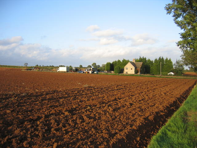
Church End is a small hamlet located in the county of Oxfordshire, England. Situated approximately 2 miles east of the town of Witney, it falls within the civil parish of Ducklington. The hamlet is nestled amidst the scenic countryside, surrounded by rolling hills and picturesque landscapes.

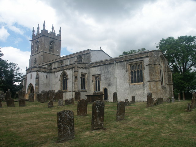
Church End is characterized by its quaint charm and historic significance. The focal point of the hamlet is the St. Bartholomew Church, a Grade II listed building that dates back to the 13th century. The church is known for its stunning architecture, with its impressive tower visible from afar. It serves as a place of worship for the local community and also attracts visitors interested in its rich history.

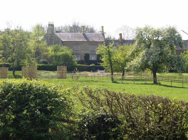
The hamlet itself comprises a small cluster of houses, many of which exude a traditional English cottage-style architecture. These homes are interspersed with lush green gardens and open fields, creating a tranquil and serene atmosphere.

Church End offers residents and visitors a peaceful rural lifestyle, away from the hustle and bustle of larger towns and cities. It provides easy access to the surrounding countryside, which is ideal for leisurely walks, hikes, and cycling. Additionally, its close proximity to Witney ensures that essential amenities, such as shops, schools, and healthcare facilities, are easily accessible.

Overall, Church End is a charming and idyllic hamlet that encapsulates the beauty and tranquility of the Oxfordshire countryside.

If you have any feedback on the listing, please let us know in the comments section below.

Church End Images

Images are sourced within 2km of 51.980041/-1.528167 or Grid Reference SP3231. Thanks to Geograph Open Source API. All images are credited.

Great Rollright Church
Yellow and Green Other than the blue/grey sky and the small bunch of purple flowers in the foreground this scene is a patchwork of yellow fields and green boundaries between them.
Yellow and Green
Other than the blue/grey sky and the small bunch of purple flowers in the foreground this scene is a patchwork of yellow fields and green boundaries between them.
Former Bridge This is a former bridge on the railway between Chipping Norton and Hook Norton.  The brickwork on both sides is almost all covered in climbing plants.
Former Bridge
This is a former bridge on the railway between Chipping Norton and Hook Norton. The brickwork on both sides is almost all covered in climbing plants.
The D'Arcy Dalton Way Heading for Great Rollright, here the D'Arcy Dalton Way <span class="nowrap"><a title="http://www.ramblers.org.uk/info/paths/darcydalton.html" rel="nofollow ugc noopener" href="http://www.ramblers.org.uk/info/paths/darcydalton.html">Link</a><img style="margin-left:2px;" alt="External link" title="External link - shift click to open in new window" src="https://s1.geograph.org.uk/img/external.png" width="10" height="10"/></span> follows the margin between the two fields of wheat, possibly this margin used to be a hedgerow.
The D'Arcy Dalton Way
Heading for Great Rollright, here the D'Arcy Dalton Way LinkExternal link follows the margin between the two fields of wheat, possibly this margin used to be a hedgerow.
Track and footpath, Great Rollright Footpath and track off the road to the west of Great Rollright. This footpath is followed by the D'Arcy Dalton Way.
Track and footpath, Great Rollright
Footpath and track off the road to the west of Great Rollright. This footpath is followed by the D'Arcy Dalton Way.
Former Pub/Hotel, Great Rollright Now boarded up this three storey building appears to have been a pub or hotel. There is a plaque on the front with the name Hunt Edmunds <a href="https://www.geograph.org.uk/photo/7406279">SP3231 : Plaque, The Unicorn, Great Rollright</a> which I think is a brewery in Banbury.
Former Pub/Hotel, Great Rollright
Now boarded up this three storey building appears to have been a pub or hotel. There is a plaque on the front with the name Hunt Edmunds SP3231 : Plaque, The Unicorn, Great Rollright which I think is a brewery in Banbury.
Maize crop near Coombe Farm, Long Compton
Site of  Banbury and Cheltenham Railway bridge The sloping ground just beyond the wall to Limekiln Bungalow is one of the few signs of the bridge which used to carry the Banbury - Cheltenham line over the road to Great Rollright at this point.
Site of Banbury and Cheltenham Railway bridge
The sloping ground just beyond the wall to Limekiln Bungalow is one of the few signs of the bridge which used to carry the Banbury - Cheltenham line over the road to Great Rollright at this point.
Heath Farm Cottages Seen across a freshly ploughed field to the east of Great Rollright.
Heath Farm Cottages
Seen across a freshly ploughed field to the east of Great Rollright.
Farm track
Farm track
Hutton Grange Farm
Hutton Grange Farm
Danes Bottom The confluence of two small watercourses.
Danes Bottom
The confluence of two small watercourses.
To Court Farm The track curves around to Court Farm. The track also forms the district boundary.
To Court Farm
The track curves around to Court Farm. The track also forms the district boundary.
Course of brook
Course of brook
Field between brook and railway Both features marked by hedges.
Field between brook and railway
Both features marked by hedges.
Bridge over disused railway line The A3400 crosses over the former Cheltenham (via Kingham) to Banbury railway line.
Bridge over disused railway line
The A3400 crosses over the former Cheltenham (via Kingham) to Banbury railway line.
Former Banbury to Cheltenham railway line
Show me another place!

Church End is located at Grid Ref: SP3231 (Lat: 51.980041, Lng: -1.528167)

Administrative County: Oxfordshire

District: West Oxfordshire

Police Authority: Thames Valley

What 3 Words

///pools.remission.dimes. Near Hook Norton, Oxfordshire

Related Wikis

Rollright

Rollright is a civil parish in West Oxfordshire, England. It contains the villages of Great Rollright and Little Rollright and some of the prehistoric...

Great Rollright

Great Rollright is a village and former civil parish, now in the parish of Rollright, in the West Oxfordshire district, in Oxfordshire, England, and about...

Rollright Halt railway station

Rollright Halt railway station served the village of Great Rollright in Oxfordshire, England. == History == The station was built by the Great Western...

Ascott, Warwickshire

Ascott is a village in Warwickshire, England. Population details can be found under Whichford. == External links == Media related to Ascott, Warwickshire...

Over Norton Park

Over Norton Park is a farm of 210 acres (85 ha) at Over Norton, lying to the north of Chipping Norton, in the Cotswolds, Oxfordshire, England. It has been...
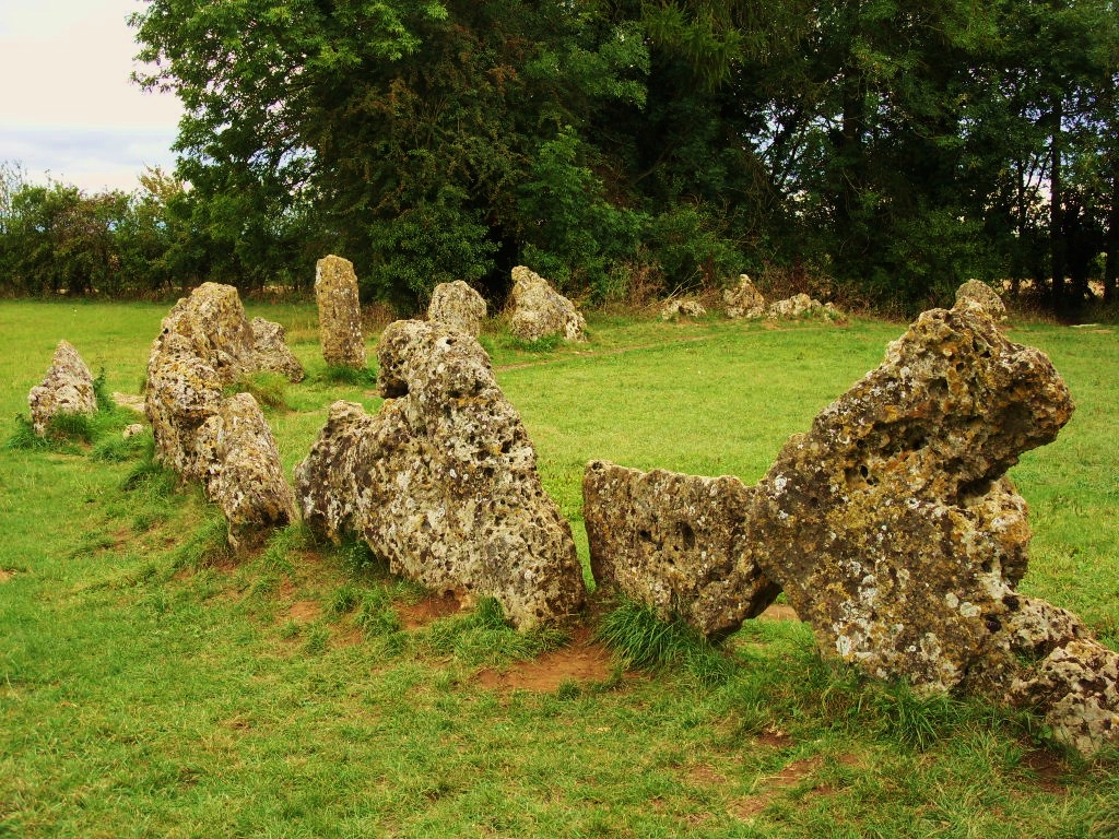
Rollright Stones

The Rollright Stones are a complex of three Neolithic and Bronze Age megalithic monuments near the village of Long Compton, on the borders of Oxfordshire...

Hook Norton Brewery

Hook Norton Brewery is a regional brewery in Hook Norton, Oxfordshire, England, several miles outside the Cotswold Hills. Founded in 1849, the brewing...

Over Norton

Over Norton is a village and civil parish within the West Oxfordshire district, about 1 mile (2 km) north of Chipping Norton, Oxfordshire, England. Over...

Nearby Amenities

Located within 500m of 51.980041,-1.528167
Bus Stop
The Green
Bus: yes
Naptan AtcoCode: 340000360BS
Naptan Bearing: N
Naptan CommonName: The Green
Naptan Indicator: Bus Shelter
Naptan Landmark: Shelter
Naptan NaptanCode: oxfajwjt
Naptan Street: High Street
Public Transport: platform
Shelter: yes
Source: naptan_import;survey
Lat/Long: 51.9787013/-1.5319082
The Green
Naptan AtcoCode: 340000360V
Naptan Bearing: S
Naptan BusStopType: CUS
Naptan CommonName: The Green
Naptan Indicator: Outside
Naptan Landmark: Green
Naptan NaptanCode: oxfajwjp
Naptan Street: High Street
Naptan Verified: no
Source: naptan_import
Lat/Long: 51.9787612/-1.5317496
Great Rollright
Place: village
Source: OS_OpenData_StreetView
Wikidata: Q5599898
Wikipedia: en:Great Rollright
Lat/Long: 51.9777742/-1.5315042
Fixme: incomplete
Lat/Long: 51.9798623/-1.530933
Barrier: kissing_gate
Lat/Long: 51.9800255/-1.5281166
Barrier: kissing_gate
Lat/Long: 51.9789981/-1.5316759
Old Phone: +44 1608 737381
Removed Amenity: telephone
Lat/Long: 51.9786655/-1.5318973
Bench
Lat/Long: 51.9787299/-1.5317203
Post Box
Collection Times: Mo-Fr 09:00; Sa 07:00; Su off
Drive Through: no
Operator: Royal Mail
Post Box Mounting: building
Post Box Type: wall
Ref: OX7 261D
Royal Cypher: GVIR
Royal Cypher Wikidata: Q33102169
Source: survey
Lat/Long: 51.9784539/-1.5304355
Fixme: Where does speed limit end?
Lat/Long: 51.9809049/-1.5239745
Addr Housename: The Smithy
Lat/Long: 51.9784869/-1.5303685
Post Box
Collection Times: Mo-Fr 16:45; Sa 09:00
Post Box Mounting: telegraph_pole
Post Box Type: lamp
Ref: OX7 252
Royal Cypher: GVIR
Royal Cypher Wikidata: Q33102169
Lat/Long: 51.9800649/-1.5276944
Barrier: kissing_gate
Lat/Long: 51.9811494/-1.5246453
Information: route_marker
Tourism: information
Lat/Long: 51.9810579/-1.5247007
Power: pole
Lat/Long: 51.9757857/-1.5259
Power: pole
Lat/Long: 51.9763395/-1.5251297
Power: pole
Lat/Long: 51.9760971/-1.5279709
Power: pole
Lat/Long: 51.9767612/-1.5282767
Power: pole
Lat/Long: 51.9768384/-1.5244157
Power: pole
Lat/Long: 51.9773417/-1.5236879
Power: pole
Lat/Long: 51.9777841/-1.5242858
Defibrillator
Defibrillator Location: left hand side of village hall
Emergency: defibrillator
Indoor: no
Operator: www.defibsafe.co.uk
Ref: AGA967
Source: survey
Lat/Long: 51.9804302/-1.5321313
Power: pole
Lat/Long: 51.9814341/-1.5245405
Power: pole
Lat/Long: 51.9819853/-1.5254355
Power: pole
Lat/Long: 51.9825118/-1.526351
Power: pole
Lat/Long: 51.9833306/-1.5261717
Power: pole
Lat/Long: 51.9818625/-1.5272575
Power: pole
Lat/Long: 51.9821475/-1.526879
Power: pole
Lat/Long: 51.978215/-1.524943
Generator Method: photovoltaic
Generator Output Electricity: yes
Generator Source: solar
Generator Type: solar_photovoltaic_panel
Location: roof
Power: generator
Lat/Long: 51.977256/-1.5269816
Generator Method: photovoltaic
Generator Output Electricity: yes
Generator Source: solar
Generator Type: solar_photovoltaic_panel
Location: roof
Power: generator
Lat/Long: 51.9779326/-1.5323487
Generator Method: photovoltaic
Generator Output Electricity: yes
Generator Source: solar
Generator Type: solar_photovoltaic_panel
Location: roof
Power: generator
Lat/Long: 51.977185/-1.5309325
Give Way
Direction: forward
Lat/Long: 51.9809295/-1.5316841
Give Way
Direction: forward
Lat/Long: 51.9809961/-1.5316773
Post Office
Village Hall Car Park, Hill Rise, Great Rollright, Chipping Norton, OX7 5SW
Addr City: Great Rollright
Addr Housename: Village Hall Car Park
Addr Postcode: OX7 5SW
Addr Street: Hill Rise
Brand: Post Office
Brand Wikidata: Q1783168
Opening Hours: Mo, We 12:15-13:15; Tu,Th 14:15-15:15
Lat/Long: 51.9804641/-1.5320398
The data included in this document is from www.openstreetmap.org. The data is made available under ODbL.

Have you been to Church End?

Leave your review of Church End below (or comments, questions and feedback).