Bury Wood

Wood, Forest in Devon Mid Devon

England

Bury Wood

Driveway to Edgeley House and Cottage
Driveway to Edgeley House and Cottage Credit: Roger Cornfoot

Bury Wood is a charming woodland located in Devon, England. It is a picturesque forest that covers an area of approximately 30 hectares, offering a peaceful and serene environment for visitors to enjoy. The woodland is situated near the small village of Bury, which adds to its quaint and idyllic charm.

Bury Wood is primarily composed of broadleaf trees, including oak, beech, and ash, which create a beautiful canopy that provides shade and shelter for various wildlife species. The forest floor is covered with a rich carpet of wildflowers, ferns, and mosses, adding to the natural beauty of the area.

The wood is crisscrossed by a network of well-maintained footpaths and trails, allowing visitors to explore its hidden corners and discover its hidden gems. It is a popular destination for nature enthusiasts, hikers, and bird watchers, as it is home to a wide variety of bird species, including woodpeckers, owls, and warblers.

Bury Wood also boasts a diverse range of wildlife, including deer, foxes, badgers, and squirrels, making it an ideal place for wildlife spotting and photography. The forest provides a natural habitat for these creatures, and visitors can observe them in their natural environment.

The tranquility and beauty of Bury Wood make it an excellent destination for those seeking a peaceful escape from the hustle and bustle of everyday life. The forest offers a place to relax, unwind, and reconnect with nature, making it a cherished gem in the heart of Devon.

If you have any feedback on the listing, please let us know in the comments section below.
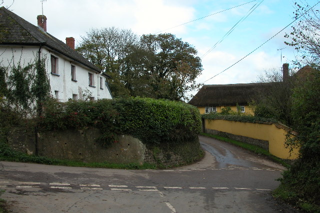
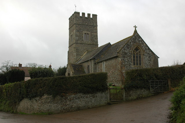
Bury Wood Images

Images are sourced within 2km of 50.851619/-3.7992494 or Grid Reference SS7307. Thanks to Geograph Open Source API. All images are credited.

Driveway to Edgeley House and Cottage
Turning for 'Hilltops'
Path to Kelland Cross
Muddy field entrance
Minor road to Lapford
Minor road to Nymet Rowland
Lane to Nymet Rowland
The road to Bury Barton from A377
Bridge over Tarka Line railway at Bugford Cross The signpost on the A377 is marked as Bugford Cross, and it is near Bugford Mill.  The OS map calls the junction Bury Cross as the road on the other side of the A377 leads to Bury Barton.
Bridge over Tarka Line railway at Bugford Cross
The signpost on the A377 is marked as Bugford Cross, and it is near Bugford Mill. The OS map calls the junction Bury Cross as the road on the other side of the A377 leads to Bury Barton.
Bugford Bridge and the River Yeo
Minor road passing Rudge Cottages The two flowerpot people adorn the gate of one of the cottages.
Minor road passing Rudge Cottages
The two flowerpot people adorn the gate of one of the cottages.
The gateway for the house called Rudge The minor road passes around the rectangular plot occupied by the house and its adjacent farm.
The gateway for the house called Rudge
The minor road passes around the rectangular plot occupied by the house and its adjacent farm.
Nut Copse and the route of a small stream The stream in the valley south of Rudge Rew leads to Rudge and eventually joins the River Yeo near Bugford Bridge
Nut Copse and the route of a small stream
The stream in the valley south of Rudge Rew leads to Rudge and eventually joins the River Yeo near Bugford Bridge
Rudge Rew and farmyard
Minor road passing Rudge Farm In the foreground is the former stand for milk churns
Minor road passing Rudge Farm
In the foreground is the former stand for milk churns
A restricted byway (Back Lane) east of Rudge Rew Back Lane is a track which leads from Rudge Rew to Chillingford.  The other end is in <a href="https://www.geograph.org.uk/photo/2694499">SS7508 : The end of Back Lane (a restricted byway)</a>
A restricted byway (Back Lane) east of Rudge Rew
Back Lane is a track which leads from Rudge Rew to Chillingford. The other end is in SS7508 : The end of Back Lane (a restricted byway)
Back Lane (restricted byway) with Rudge Rew in the distance
Minor road from Morchard Bishop to Rudge The tree on the right is on the restricted byway (Back Lane)
Minor road from Morchard Bishop to Rudge
The tree on the right is on the restricted byway (Back Lane)
Show me another place!

Bury Wood is located at Grid Ref: SS7307 (Lat: 50.851619, Lng: -3.7992494)

Administrative County: Devon

District: Mid Devon

Police Authority: Devon and Cornwall

What 3 Words

///lifetimes.plants.scornful. Near Morchard Bishop, Devon

Nearby Locations

Bury Wood Bugford Wood

Related Wikis

Lapford railway station

Lapford railway station is a rural station on the Tarka Line, serving the village of Lapford in Devon. It is 18 miles 35 chains (29.7 km) from Exeter Central...

Lapford

Lapford is a village and civil parish in Mid Devon in the English county of Devon. It had a population of 993 in 2001, reducing to 867 at the 2011 census...

Eastington, Devon

Eastington is a hamlet in the English county of Devon. Eastington is about one mile east of the village of Lapford. The hamlet comprises a dairy farm and...

Nymet Rowland

Nymet Rowland is a small village, and civil parish of the same name, in central Devon, England, north of Dartmoor. It takes part of its name from "Nymet...

Nearby Amenities

Located within 500m of 50.851619,-3.7992494
Bugford Bridge
Place: locality
Lat/Long: 50.8511392/-3.7957265
Addr Housename: Bury Barton
Lat/Long: 50.8499613/-3.8017169
Lapford Roman Fort
Historic: archaeological_site
Source: http://vici.org/vici/12188
Website: https://www.pastscape.org.uk/hob.aspx?hob_id=34836
Lat/Long: 50.849223/-3.8010008
Bury Barton
Place: locality
Lat/Long: 50.849612/-3.8001857
Power: pole
Source: bing
Lat/Long: 50.8522587/-3.7922439
Power: pole
Source: bing
Transformer: distribution
Lat/Long: 50.8528369/-3.7932082
Power: pole
Source: bing
Lat/Long: 50.8535794/-3.7944567
Power: pole
Source: bing
Lat/Long: 50.8543186/-3.7957227
Power: pole
Source: bing
Lat/Long: 50.8549984/-3.7968613
Power: pole
Source: bing
Lat/Long: 50.8552939/-3.7973763
Power: pole
Source: bing
Lat/Long: 50.8556706/-3.798008
Power: pole
Source: bing
Transformer: distribution
Lat/Long: 50.8502791/-3.802388
Power: pole
Source: bing
Lat/Long: 50.8529013/-3.8059527
Power: pole
Source: bing
Lat/Long: 50.8526574/-3.8056053
Power: pole
Source: bing
Lat/Long: 50.8520267/-3.8046786
Power: pole
Source: bing
Lat/Long: 50.85139/-3.8038418
Power: pole
Source: bing
Lat/Long: 50.8508074/-3.8030827
The data included in this document is from www.openstreetmap.org. The data is made available under ODbL.

Have you been to Bury Wood?

Leave your review of Bury Wood below (or comments, questions and feedback).