Christmas Common

Settlement in Oxfordshire South Oxfordshire

England

Christmas Common

Elegant beech tree, Christmas Common, Oxfordshire
Elegant beech tree, Christmas Common, Oxfordshire Credit: Oswald Bertram

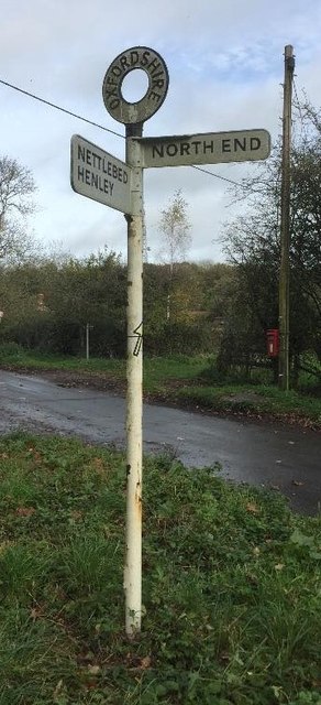
Christmas Common is a small village located in the Chiltern Hills of Oxfordshire, England. Situated approximately five miles north of Henley-on-Thames, it is a charming rural settlement with a population of around 350 residents. The village derives its peculiar name from a local legend suggesting that Oliver Cromwell banned Christmas celebrations there during the 17th century.

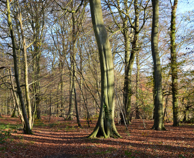
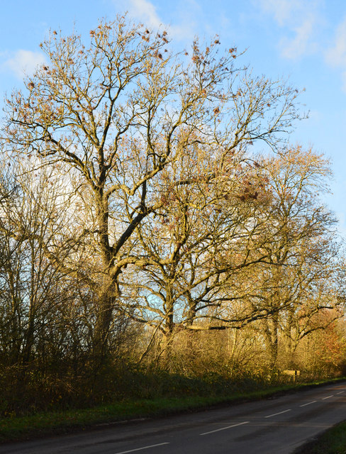
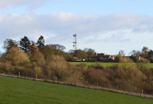
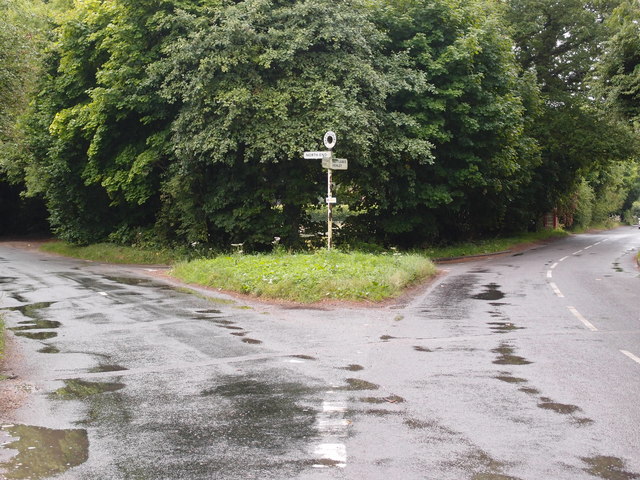
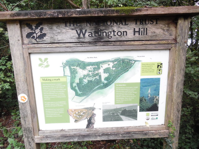
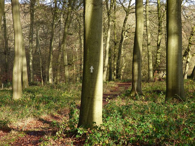
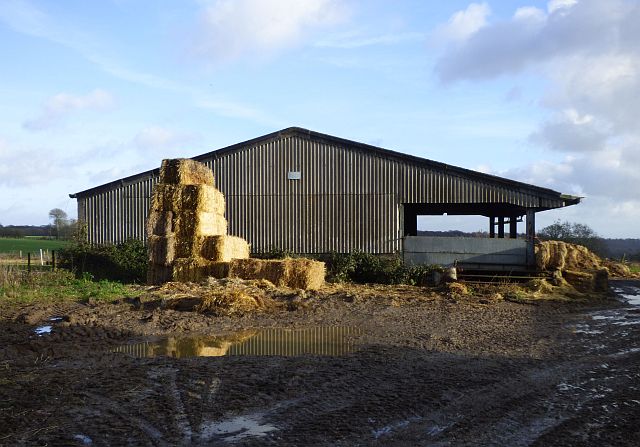
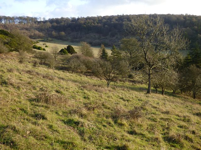
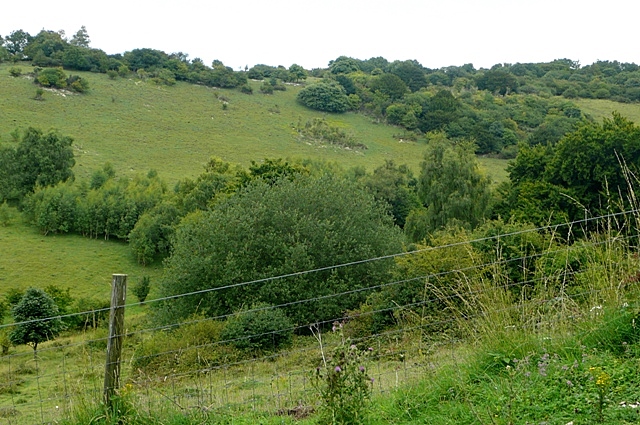
Nestled in an idyllic countryside setting, Christmas Common offers breathtaking views of the surrounding hills and valleys, making it a popular destination for nature enthusiasts and hikers. The area is known for its extensive network of footpaths, including the famous Ridgeway National Trail, which passes through the village. Visitors can explore the picturesque landscape, meandering through lush green meadows and ancient woodlands.

The village itself features a mix of traditional cottages and modern houses, lending it a quaint and timeless atmosphere. The Church of St. Nicholas, a charming medieval church dating back to the 12th century, stands as a prominent landmark in Christmas Common. The church holds regular services and serves as a focal point for the local community.

Despite its small size, the village boasts a vibrant community spirit. Annual events, such as the Christmas Common Summer Fete and the Easter Egg Hunt, bring residents together and attract visitors from nearby towns. The local pub, The Fox and Hounds, offers a warm and welcoming atmosphere, serving delicious food and drinks to locals and tourists alike.

In summary, Christmas Common offers a peaceful retreat from the hustle and bustle of city life, providing visitors with a quintessential English countryside experience. With its stunning natural surroundings and close-knit community, it is truly a hidden gem in Oxfordshire.

If you have any feedback on the listing, please let us know in the comments section below.

Christmas Common Images

Images are sourced within 2km of 51.633733/-0.966868 or Grid Reference SU7193. Thanks to Geograph Open Source API. All images are credited.

Elegant beech tree, Christmas Common, Oxfordshire
November sunshine, Christmas Common, Oxfordshire
Late afternoon light, Greenfield, Oxfordshire
Larch tree, Watlington Hill, Oxfordshire
Sunset, Greenfield, Oxfordshire
Winter's afternoon, Christmas Common, Oxfordshire
Road junction and grass triangle Adjacent to Christmas Common.
Road junction and grass triangle
Adjacent to Christmas Common.
Road junction and grass triangle Near to Christmas Common.
Road junction and grass triangle
Near to Christmas Common.
Information Board at Watlington Hill This information board has been erected by The National Trust in its car park at the east end of Watlington Hill, its postcode being OX49 5HS. It shows a plan of the hill and has the following wording:
  
  On the left of the board
    Making a mark
  Once the local farmers stopped grazing their sheep on Watlington Hill it became overgrown with scrub. It wasn't a pleasant place for walkers and it wasn't a good place for butterflies. Now the National Trust is making a mark on the landscape. It's restoring the hill to a mosaic of chalk grassland and scrub.
  It is a great place to see Chalkhill Blue and Silver-Spotted Skipper butterflies, as well as the majestic Red Kites.
   The National Trust is grateful for funding received for this project from Natural England, Chilterns Conservation Board and Oxfordshire County Council.

   Below the plan
   The White Mark
  Edward Horner, a local squire, thought that the church which he could see from his home would look more impressive if it had a steeple. He had the huge white mark cut into the hillside to achieve this by way of an optical illusion. That's one story, anyway. There may be other explanations....

    On the right of the board
 Please help us to keep the hill unspoilt for everyone to enjoy - take your litter or dog waste home with you.

   The images show from left to right: Silver-Spotted Skipper butterfly, View of Watlington Hill in 1907, and the White Mark with the Parish Church of Saint Leonard in the foreground.
Information Board at Watlington Hill
This information board has been erected by The National Trust in its car park at the east end of Watlington Hill, its postcode being OX49 5HS. It shows a plan of the hill and has the following wording: On the left of the board Making a mark Once the local farmers stopped grazing their sheep on Watlington Hill it became overgrown with scrub. It wasn't a pleasant place for walkers and it wasn't a good place for butterflies. Now the National Trust is making a mark on the landscape. It's restoring the hill to a mosaic of chalk grassland and scrub. It is a great place to see Chalkhill Blue and Silver-Spotted Skipper butterflies, as well as the majestic Red Kites. The National Trust is grateful for funding received for this project from Natural England, Chilterns Conservation Board and Oxfordshire County Council. Below the plan The White Mark Edward Horner, a local squire, thought that the church which he could see from his home would look more impressive if it had a steeple. He had the huge white mark cut into the hillside to achieve this by way of an optical illusion. That's one story, anyway. There may be other explanations.... On the right of the board Please help us to keep the hill unspoilt for everyone to enjoy - take your litter or dog waste home with you. The images show from left to right: Silver-Spotted Skipper butterfly, View of Watlington Hill in 1907, and the White Mark with the Parish Church of Saint Leonard in the foreground.
View from Watlington Hill This view shows the view from Watlington Hill towards Watlington and the surrounding Oxfordshire countryside. Most of Watlington Hill was given to The National Trust in 1941 with additional sections in the intervening years. It now comprises 120 acres (48.5 hectares) of open down and copse with wide views.
View from Watlington Hill
This view shows the view from Watlington Hill towards Watlington and the surrounding Oxfordshire countryside. Most of Watlington Hill was given to The National Trust in 1941 with additional sections in the intervening years. It now comprises 120 acres (48.5 hectares) of open down and copse with wide views.
National Trust Notice at Watlington Hill This notice is located at the south-west edge of Watlington Hill by a bridleway. It has the following wording:

      CONSERVATION IN ACTION

        WALK BACK IN TIME

  In the Winter of 2006, work started opening up this ancient track way.
  This stretch of the feature, which is also known as a sunken way or hollow way is approximately 400m in length, and in its time would have been the modern equivalent of a main 'road'. Virtually the whole project has been achieved by volunteer effort.
  The Sonning Common Green Gym volunteers set themselves the mammoth task of clearing the archaeological features as part of the 'Oxford Inspires 2007' celebrations (which commemorated 1,000 years of the county of Oxfordshire's existence).
 With occasional assistance from other volunteer groups (Friends of Watlington Hill and Oxford Conservation Volunteers); the work has now been completed.

  There were three aims to the project:-

 1. Open up the archaeological feature so that it could once again be used as a walkway.
 
 2. By using the 'sunken' way as an alternative route, visitors will reduce the wear and tear on the existing path (now showing signs of erosion) which lies on the very high quality chalk grassland.

 3. In cutting back many of the large, low branches from the Yew trees, we have regained a large strip of land between the existing path and the 'sunken' way. This area would have been flower rich chalk grassland 30-40 years ago before the dense shade of the Yews killed it off. In time, it should return to this condition, thus benefiting the many butterflies and wild flowers that can be found on this species rich habitat.

 So, please consider using this 'new' old track way as an alternative route and in doing so help to preserve the archaeological feature as well as the grassland habitat for years to come.

 With particular thanks to Sonning Common Gym for all their hard work and to all the volunteers who helped complete the task.
National Trust Notice at Watlington Hill
This notice is located at the south-west edge of Watlington Hill by a bridleway. It has the following wording: CONSERVATION IN ACTION WALK BACK IN TIME In the Winter of 2006, work started opening up this ancient track way. This stretch of the feature, which is also known as a sunken way or hollow way is approximately 400m in length, and in its time would have been the modern equivalent of a main 'road'. Virtually the whole project has been achieved by volunteer effort. The Sonning Common Green Gym volunteers set themselves the mammoth task of clearing the archaeological features as part of the 'Oxford Inspires 2007' celebrations (which commemorated 1,000 years of the county of Oxfordshire's existence). With occasional assistance from other volunteer groups (Friends of Watlington Hill and Oxford Conservation Volunteers); the work has now been completed. There were three aims to the project:- 1. Open up the archaeological feature so that it could once again be used as a walkway. 2. By using the 'sunken' way as an alternative route, visitors will reduce the wear and tear on the existing path (now showing signs of erosion) which lies on the very high quality chalk grassland. 3. In cutting back many of the large, low branches from the Yew trees, we have regained a large strip of land between the existing path and the 'sunken' way. This area would have been flower rich chalk grassland 30-40 years ago before the dense shade of the Yews killed it off. In time, it should return to this condition, thus benefiting the many butterflies and wild flowers that can be found on this species rich habitat. So, please consider using this 'new' old track way as an alternative route and in doing so help to preserve the archaeological feature as well as the grassland habitat for years to come. With particular thanks to Sonning Common Gym for all their hard work and to all the volunteers who helped complete the task.
Woodland, Shirburn The Chiltern Way amidst beeches in the lower part of Blackmoor Wood on the Wormsley Estate.
Woodland, Shirburn
The Chiltern Way amidst beeches in the lower part of Blackmoor Wood on the Wormsley Estate.
Barn at Portobello Farm, Shirburn A muddy farmyard with cattle ensconced for the winter.
Barn at Portobello Farm, Shirburn
A muddy farmyard with cattle ensconced for the winter.
Shirburn Hill, Shirburn The somewhat scrubby grassland has a few larger trees including a stand of conifers to the right of picture and large areas of what appears to be box or privet to the left.
Shirburn Hill, Shirburn
The somewhat scrubby grassland has a few larger trees including a stand of conifers to the right of picture and large areas of what appears to be box or privet to the left.
Old Direction Sign - Signpost by Christmas Common, Watlington parish Annulus finial - 2 arms; Oxford CC halo by the UC road, in parish of Watlington (South Oxfordshire District), Christmas Common, Y-junction of Nettlebed Henley with Hollandridge Lane, on grass triangle.

Surveyed

Milestone Society National ID: OX_SU7193
Old Direction Sign - Signpost by Christmas Common, Watlington parish
Annulus finial - 2 arms; Oxford CC halo by the UC road, in parish of Watlington (South Oxfordshire District), Christmas Common, Y-junction of Nettlebed Henley with Hollandridge Lane, on grass triangle. Surveyed Milestone Society National ID: OX_SU7193
K6 Telephone Box at Christmas Common Situated at Christmas Common OX49 5HL, this red telephone box may soon be taken away from this location as it has had all the payphone equipment removed from inside it.
K6 Telephone Box at Christmas Common
Situated at Christmas Common OX49 5HL, this red telephone box may soon be taken away from this location as it has had all the payphone equipment removed from inside it.
Pasture, Watlington A view towards Britwell Hill from the footpath below Watlington Park.
Pasture, Watlington
A view towards Britwell Hill from the footpath below Watlington Park.
Shirburn Hill from Watlington Hill
Show me another place!

Christmas Common is located at Grid Ref: SU7193 (Lat: 51.633733, Lng: -0.966868)

Administrative County: Oxfordshire

District: South Oxfordshire

Police Authority: Thames Valley

What 3 Words

///chilling.restores.punks. Near Watlington, Oxfordshire

Nearby Locations

Christmas Common

Related Wikis

Christmas Common

Christmas Common is a hamlet in Watlington civil parish, Oxfordshire about 7+1⁄2 miles (12 km) south of Thame in Oxfordshire, close to the boundary with...

Watlington Park

Watlington Park is an English country house with its surrounding grounds of approximately 500 acres (200 ha), located atop an escarpment in the Chiltern...

Watlington and Pyrton Hills

Watlington and Pyrton Hills is a 112.7-hectare (278-acre) biological Site of Special Scientific Interest east of Watlington in Oxfordshire. An area of...

Watlington Chalk Pit

Watlington Chalk Pit is a 1.6-hectare (4.0-acre) Local Nature Reserve east of Watlington in Oxfordshire. It is owned by South Oxfordshire District Council...

Nearby Amenities

Located within 500m of 51.633733,-0.966868
Christmas Common
Place: hamlet
Wikidata: Q5111328
Wikipedia: en:Christmas Common
Lat/Long: 51.6330543/-0.9687969
Addr City: Watlington
Booth: K6
Disused Amenity: telephone
Man Made: telephone_box
Lat/Long: 51.6331999/-0.9689451
Post Box
Collection Times: Mo-Fr 16:45; Sa 08:45
Drive Through: no
Operator: Royal Mail
Post Box Type: lamp
Ref: OX49 507
Royal Cypher: EIIR
Royal Cypher Wikidata: Q33102113
Lat/Long: 51.6338132/-0.9687396
Barrier: kissing_gate
Lat/Long: 51.6356445/-0.9694195
Man Made: mast
Tower Construction: lattice
Tower Type: communication
Lat/Long: 51.6324816/-0.9667903
Communication Microwave: yes
Man Made: mast
Source: survey;
Tower Construction: lattice
Tower Type: communication
Lat/Long: 51.6366793/-0.9681097
Barrier: kissing_gate
Foot: yes
Lat/Long: 51.6332916/-0.9646441
Barrier: kissing_gate
Foot: yes
Lat/Long: 51.6343865/-0.9667935
Direction: 215
Generator Method: photovoltaic
Generator Output Electricity: yes
Generator Solar Modules: 8
Generator Source: solar
Generator Type: solar_photovoltaic_panel
Location: roof
Power: generator
Lat/Long: 51.6349155/-0.9684941
Direction: 125
Generator Method: photovoltaic
Generator Output Electricity: yes
Generator Solar Modules: 12
Generator Source: solar
Generator Type: solar_photovoltaic_panel
Location: roof
Power: generator
Lat/Long: 51.6349658/-0.9686323
The data included in this document is from www.openstreetmap.org. The data is made available under ODbL.

Have you been to Christmas Common?

Leave your review of Christmas Common below (or comments, questions and feedback).