Alderclose Wood

Wood, Forest in Devon North Devon

England

Alderclose Wood

Mariansleigh: River Mole at Alswear Three parishes meet here: beyond the bend the river runs into King’s Nympton and the right bank is in Queen’s Nympton
Mariansleigh: River Mole at Alswear Credit: Martin Bodman

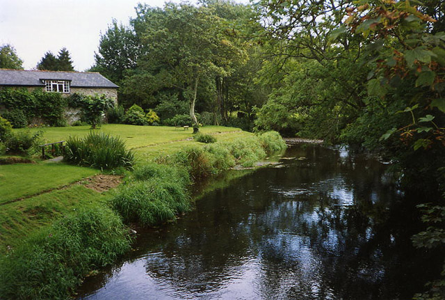
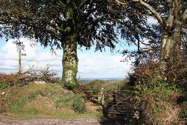
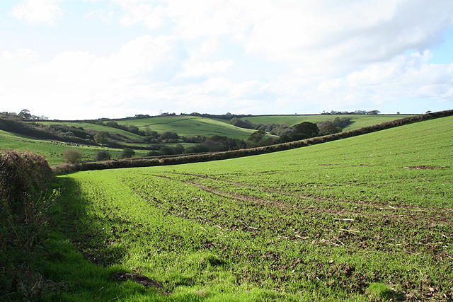
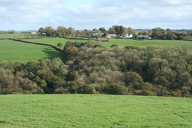
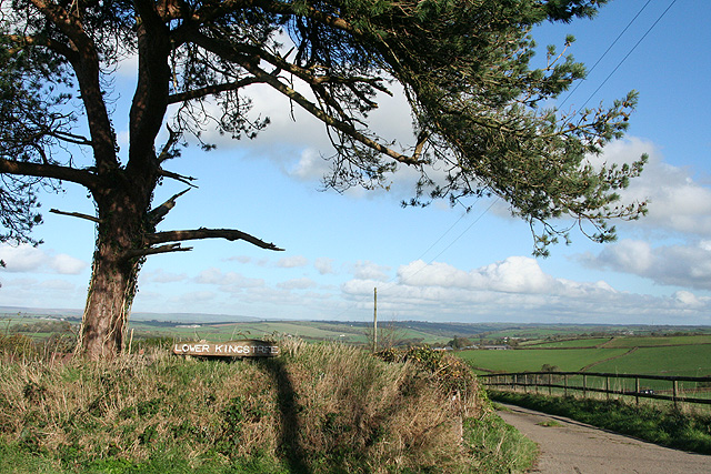
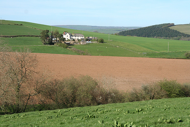
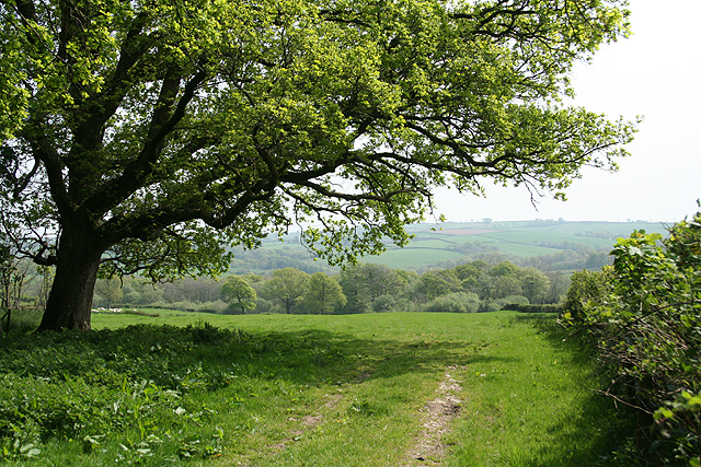
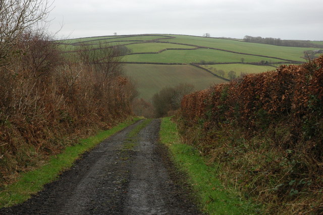
Alderclose Wood is a picturesque woodland located in the county of Devon, England. Stretching over an area of approximately 50 hectares, this enchanting forest is known for its diverse flora and fauna, making it a popular destination for nature enthusiasts and hikers alike.

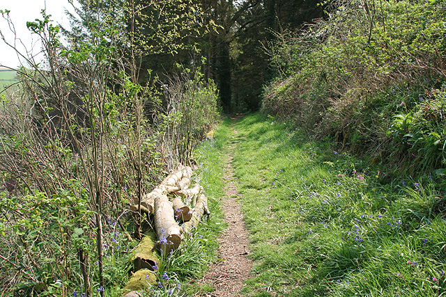
The wood is predominantly composed of alder trees, which lend their name to the area. These deciduous trees provide a dense canopy, creating a serene and shaded environment that is perfect for leisurely walks or quiet contemplation. The forest floor is adorned with a rich carpet of mosses, ferns, and wildflowers, adding to its enchanting beauty.

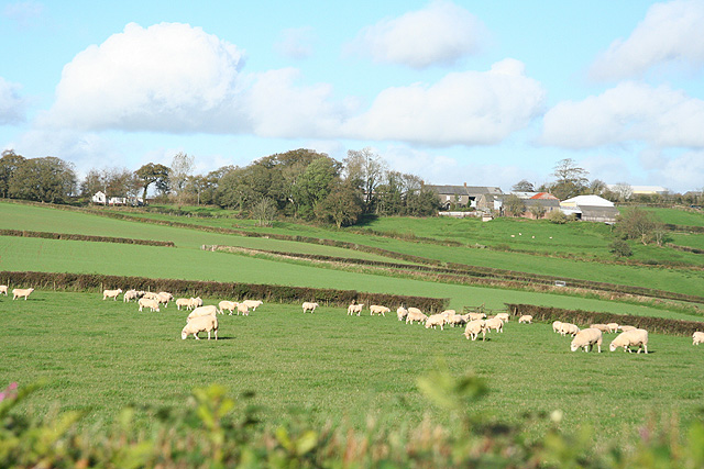
Alderclose Wood is home to a variety of wildlife, including several species of birds, mammals, and insects. Birdwatchers can spot woodpeckers, owls, and various songbirds, while lucky visitors may catch a glimpse of elusive deer or foxes. The wood also boasts a population of butterflies and dragonflies, adding splashes of vibrant colors during the warmer months.

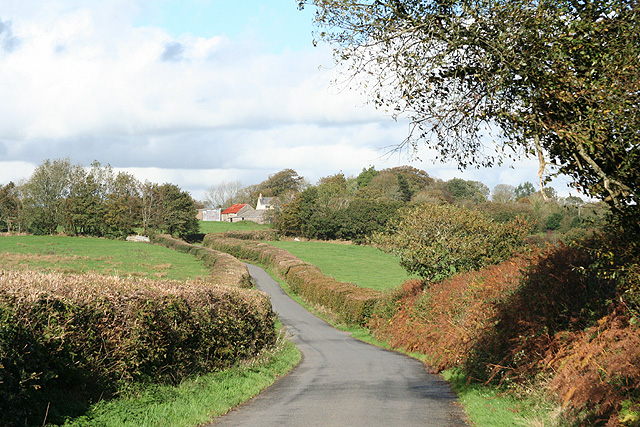
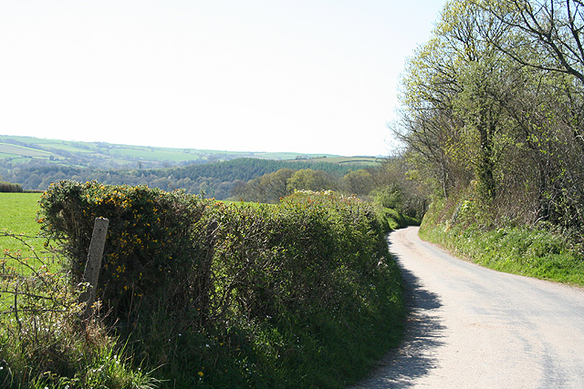
Trails wind through the woodland, allowing visitors to explore its natural wonders at their own pace. These paths are well-maintained and suitable for both casual strolls and more challenging hikes. Along the trails, there are information boards detailing the different species of trees and wildlife found in the area, providing an educational experience for nature lovers.

Alderclose Wood is a peaceful haven that offers a tranquil escape from the hustle and bustle of everyday life. With its serene atmosphere, stunning scenery, and abundant wildlife, this woodland is a must-visit destination for anyone seeking a true connection with nature.

If you have any feedback on the listing, please let us know in the comments section below.

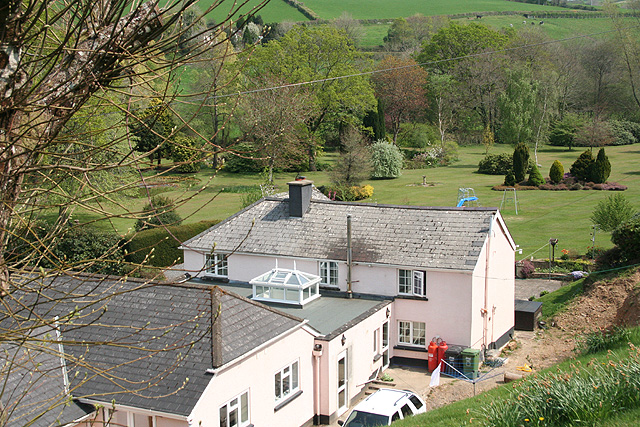
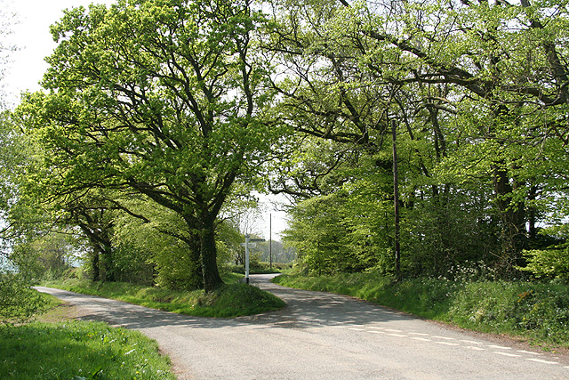
Alderclose Wood Images

Images are sourced within 2km of 50.972861/-3.8187459 or Grid Reference SS7220. Thanks to Geograph Open Source API. All images are credited.

Mariansleigh: River Mole at Alswear Three parishes meet here: beyond the bend the river runs into King’s Nympton and the right bank is in Queen’s Nympton
Mariansleigh: River Mole at Alswear
Three parishes meet here: beyond the bend the river runs into King’s Nympton and the right bank is in Queen’s Nympton
Romansleigh: towards the village Looking north on the lane from Beacon Cross
Romansleigh: towards the village
Looking north on the lane from Beacon Cross
Romansleigh: the village Looking north east with the entrance to the church beyond the phone box and Land Rover. Honeysuckle Cottage is on the left, past the church gate, and Glebe Cottage on the right
Romansleigh: the village
Looking north east with the entrance to the church beyond the phone box and Land Rover. Honeysuckle Cottage is on the left, past the church gate, and Glebe Cottage on the right
Romansleigh: St Rumon’s church The church was rebuilt in 1868 but is dedicated to a Celtic saint. Looking west
Romansleigh: St Rumon’s church
The church was rebuilt in 1868 but is dedicated to a Celtic saint. Looking west
Romansleigh: entrance to West Rowley A public footpath leads to West Rowley and East Rowley and to Rhode Farm. Looking north east
Romansleigh: entrance to West Rowley
A public footpath leads to West Rowley and East Rowley and to Rhode Farm. Looking north east
Romansleigh: near Three Corner Cross Looking west-south-west towards Lower Kingstree Moor
Romansleigh: near Three Corner Cross
Looking west-south-west towards Lower Kingstree Moor
King’s Nympton: towards Highridge Looking north-north-east over farmland
King’s Nympton: towards Highridge
Looking north-north-east over farmland
King’s Nympton: towards Romansleigh Romansleigh is a small village – almost a hamlet – on a hill beyond this square. St Rumon’s church stands amongst trees. Looking east-south-east
King’s Nympton: towards Romansleigh
Romansleigh is a small village – almost a hamlet – on a hill beyond this square. St Rumon’s church stands amongst trees. Looking east-south-east
Romansleigh: by the entrance to Lower Kingstree On the lane between Highridge and Garland Cross, looking east-north-east
Romansleigh: by the entrance to Lower Kingstree
On the lane between Highridge and Garland Cross, looking east-north-east
Early morning caravans Photographed from the top of Romansleigh Holiday park looking down onto caravans dropping lower on this tiered site.
Early morning caravans
Photographed from the top of Romansleigh Holiday park looking down onto caravans dropping lower on this tiered site.
Mariansleigh: lane to Alswear Looking west-north-west
Mariansleigh: lane to Alswear
Looking west-north-west
Queen’s Nympton: towards Little Frenchstone Looking north-north-east. Two small valleys intervene between the camera and the farm which is beyond the square
Queen’s Nympton: towards Little Frenchstone
Looking north-north-east. Two small valleys intervene between the camera and the farm which is beyond the square
King’s Nympton: overlooking New Mill New Mill, now a private house, seen from a public footpath on its boundary. This was the lowest watermill on the Little Silver Stream, a tributary of the Mole. Looking east-south-east
King’s Nympton: overlooking New Mill
New Mill, now a private house, seen from a public footpath on its boundary. This was the lowest watermill on the Little Silver Stream, a tributary of the Mole. Looking east-south-east
King’s Nympton: footpath above New Mill The path runs up the Little Silver valley to Kempstown and Romansleigh. Looking south east
King’s Nympton: footpath above New Mill
The path runs up the Little Silver valley to Kempstown and Romansleigh. Looking south east
King’s Nympton: Highridge Cross A junction rather than a crossroads. Looking west
King’s Nympton: Highridge Cross
A junction rather than a crossroads. Looking west
King’s Nympton: by Highridge Cross Looking south east towards Highridge Wood with an oak tree in new leaf
King’s Nympton: by Highridge Cross
Looking south east towards Highridge Wood with an oak tree in new leaf
King’s Nympton: by Broomham Cross Looking south east
King’s Nympton: by Broomham Cross
Looking south east
Oxham Lane, Romansleigh Oxham Lane is a track from the village of Romansleigh to the valley through which the poetically named Little Silver Stream flows. Across the valley the pattern of fields to the south of Westacott Farm can be seen on the hillside.
Oxham Lane, Romansleigh
Oxham Lane is a track from the village of Romansleigh to the valley through which the poetically named Little Silver Stream flows. Across the valley the pattern of fields to the south of Westacott Farm can be seen on the hillside.
Show me another place!

Alderclose Wood is located at Grid Ref: SS7220 (Lat: 50.972861, Lng: -3.8187459)

Administrative County: Devon

District: North Devon

Police Authority: Devon and Cornwall

What 3 Words

///bought.reverses.stays. Near South Molton, Devon

Related Wikis

Romansleigh

Romansleigh is a village and civil parish in the North Devon district of Devon, England. It is surrounded clockwise from the north by the parishes of Mariansleigh, Meshaw, Chulmleigh, and King's Nympton. In 2001 its population was 98, compared with 155 in 1901.

Alswear

Alswear is a village in Devon, England, approximately 25 miles (40 km) northwest of Exeter.

Queen's Nympton

Queen's Nympton or Queensnympton is a small civil parish in the North Devon district of Devon, England. According to the 2001 census it had a population of 32. There is no actual settlement by the name - the parish was originally an exclave of South Molton, but was split to form a separate civil parish in 1894.From northwards clockwise, the parish borders George Nympton, Bishop's Nympton, Mariansleigh, and King's Nympton.

Mariansleigh

Mariansleigh is a village and civil parish in Devon, England. In 2021 the parish had a population of 170.

George Nympton

George Nympton or Nymet St George is a small village and civil parish in North Devon district, Devon, England. In the 2011 census it was recorded as having a population of 175.From northwards clockwise the neighbouring parishes are South Molton, Bishop's Nympton, Queen's Nympton, and King's Nympton.George Nympton has a parish council.There are 16 listed buildings in the parish, all at Grade II except the church which is Grade II*. They include the village hall, some tombs in the churchyard, and various houses.The parish church of St George is part of the South Molton Mission Community within the Diocese of Exeter.

Meshaw

Meshaw is a village and civil parish in the North Devon district of Devon, England. Its nearest town is South Molton, which lies approximately 5.9 miles (9.5 km) north-west from the village. The village lies just off the B3137 road.

South Molton Community College

South Molton Community College (known to students and teachers as SMCC) is a coeducational foundation secondary school located in South Molton in the English county of Devon.Previously a community school administered solely by Devon County Council, on 2 January 2012 South Molton Community College became a foundation co-operative trust school, partnered with Mole Valley Farmers.South Molton Community College offers GCSEs, BTECs and OCR Nationals as programmes of study for pupils. As of 2021, it also offers students the opportunity to take initial military training.Construction of a new school in North Devon was completed in April 2017.In 2018, a former drama teacher from the school was jailed for voyeurism and possession of indecent images of children after he admitted secretly filming students changing at the school. He was acquitted of other related charges.

King's Nympton

King's Nympton (Latinised to Nymet Regis) is a village, parish and former manor in the North Devon district, in Devon, England, in the heart of the rolling countryside between Exmoor and Dartmoor, some 4½ miles (7 km) S.S.W. of South Molton and 4 miles (6 km) N. of Chulmleigh. The parish exceeds 5,500 acres (2,226 ha) in area and sits mostly on a promontory above the River Mole (anciently the Nymet) which forms nearly half of its parish boundary. In 2021 the parish had a population of 444.

Nearby Amenities

Located within 500m of 50.972861,-3.8187459
Romansleigh
Place: village
Lat/Long: 50.9701217/-3.8144853
Addr City: Romansleigh
Addr Housename: Glebe Farm
Lat/Long: 50.9702026/-3.8156672
Generator Method: photovoltaic
Generator Output Electricity: yes
Generator Source: solar
Generator Type: solar_photovoltaic_panel
Location: roof
Power: generator
Lat/Long: 50.9702524/-3.8131826
Power: pole
Source: bing
Lat/Long: 50.9749317/-3.8131396
Power: pole
Source: bing
Transformer: distribution
Lat/Long: 50.9690489/-3.8152664
Power: pole
Source: bing
Lat/Long: 50.9721534/-3.8123122
Power: pole
Source: bing
Lat/Long: 50.9726838/-3.8128299
Power: pole
Source: bing
Lat/Long: 50.9732833/-3.8134092
Power: pole
Source: bing
Lat/Long: 50.9740704/-3.8132858
The data included in this document is from www.openstreetmap.org. The data is made available under ODbL.

Have you been to Alderclose Wood?

Leave your review of Alderclose Wood below (or comments, questions and feedback).