Bagpark Plantation

Wood, Forest in Devon Teignbridge

England

Bagpark Plantation

Widecombe in the Moor The Shop on the Green - a village hub built with traditional stone.
<span class="nowrap"><a title="www.dartmoor.gov.uk" rel="nofollow ugc noopener" href="http://www.dartmoor.gov.uk">Link</a><img style="margin-left:2px;" alt="External link" title="External link - shift click to open in new window" src="https://s1.geograph.org.uk/img/external.png" width="10" height="10"/></span>
Widecombe in the Moor Credit: Colin Smith

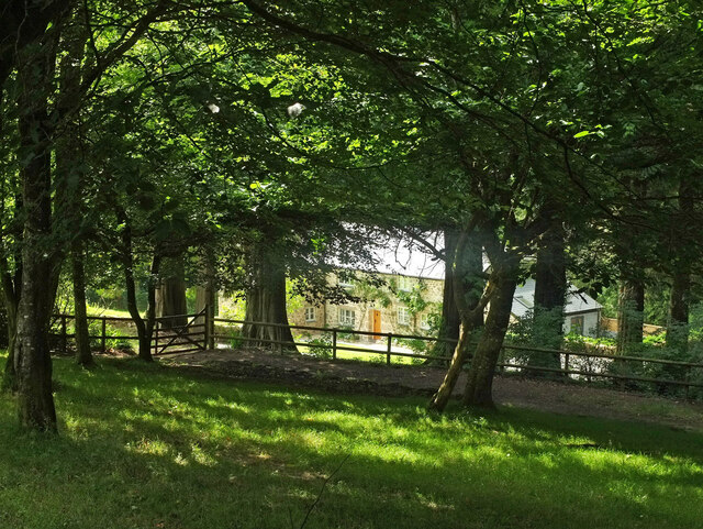
Bagpark Plantation is a sprawling woodland located in the scenic county of Devon, England. Situated in the heart of the county, the plantation covers a vast area of approximately 500 acres. It is renowned for its lush greenery, diverse flora, and tranquil atmosphere, making it an ideal destination for nature lovers and outdoor enthusiasts.

The woodland is primarily composed of a mix of deciduous and evergreen trees, including oak, beech, birch, and pine. These towering trees create a dense canopy that provides shade and shelter to a wide variety of wildlife, including birds, deer, and small mammals. The plantation is home to several rare and protected species, making it a designated Site of Special Scientific Interest.

Visitors to Bagpark Plantation can enjoy a range of activities amidst its stunning natural beauty. There are numerous walking trails that wind through the woodland, offering opportunities for leisurely strolls and peaceful hikes. The plantation also features picnic areas and designated camping spots, allowing visitors to immerse themselves in the tranquility of the forest.

The management of Bagpark Plantation is committed to preserving its natural ecosystem and promoting sustainable forestry practices. Regular maintenance and conservation efforts are undertaken to ensure the health and longevity of the woodland. Educational programs and guided tours are also organized to raise awareness about the importance of biodiversity and the role of forests in mitigating climate change.

Bagpark Plantation is a cherished gem in Devon, attracting visitors from near and far who seek solace in its enchanting woodlands and appreciate the abundance of natural beauty it offers.

If you have any feedback on the listing, please let us know in the comments section below.

Bagpark Plantation Images

Images are sourced within 2km of 50.590249/-3.8102302 or Grid Reference SX7178. Thanks to Geograph Open Source API. All images are credited.

Widecombe in the Moor The Shop on the Green - a village hub built with traditional stone.
<span class="nowrap"><a title="www.dartmoor.gov.uk" rel="nofollow ugc noopener" href="http://www.dartmoor.gov.uk">Link</a><img style="margin-left:2px;" alt="External link" title="External link - shift click to open in new window" src="https://s1.geograph.org.uk/img/external.png" width="10" height="10"/></span>
Widecombe in the Moor
The Shop on the Green - a village hub built with traditional stone. LinkExternal link
Widecombe in the Moor The Church House and Sexton's Cottage - rear view from the village green - built 1537 to accommodate travellers. Church House is now a community centre, owned by the National Trust.
<span class="nowrap"><a title="www.dartmoor.gov.uk" rel="nofollow ugc noopener" href="http://www.dartmoor.gov.uk">Link</a><img style="margin-left:2px;" alt="External link" title="External link - shift click to open in new window" src="https://s1.geograph.org.uk/img/external.png" width="10" height="10"/></span>
Widecombe in the Moor
The Church House and Sexton's Cottage - rear view from the village green - built 1537 to accommodate travellers. Church House is now a community centre, owned by the National Trust. LinkExternal link
Widecombe in the Moor - Church Tower The large granite 14th-century church of St Pancras in Widecombe is renowned as "The Cathedral of the Moor". Its prominent tower reaches 135 feet high.
<span class="nowrap"><a title="www.dartmoor.gov.uk" rel="nofollow ugc noopener" href="http://www.dartmoor.gov.uk">Link</a><img style="margin-left:2px;" alt="External link" title="External link - shift click to open in new window" src="https://s1.geograph.org.uk/img/external.png" width="10" height="10"/></span>
Widecombe in the Moor - Church Tower
The large granite 14th-century church of St Pancras in Widecombe is renowned as "The Cathedral of the Moor". Its prominent tower reaches 135 feet high. LinkExternal link
Widecombe in the Moor - Church The large granite 14th-century church of St Pancras in Widecombe is renowned as "The Cathedral of the Moor". Its prominent tower reaches 135 feet high.
<span class="nowrap"><a title="www.dartmoor.gov.uk" rel="nofollow ugc noopener" href="http://www.dartmoor.gov.uk">Link</a><img style="margin-left:2px;" alt="External link" title="External link - shift click to open in new window" src="https://s1.geograph.org.uk/img/external.png" width="10" height="10"/></span>
Widecombe in the Moor - Church
The large granite 14th-century church of St Pancras in Widecombe is renowned as "The Cathedral of the Moor". Its prominent tower reaches 135 feet high. LinkExternal link
Widecombe in the Moor - Church The large granite 14th-century church of St Pancras in Widecombe is renowned as "The Cathedral of the Moor".
<span class="nowrap"><a title="www.dartmoor.gov.uk" rel="nofollow ugc noopener" href="http://www.dartmoor.gov.uk">Link</a><img style="margin-left:2px;" alt="External link" title="External link - shift click to open in new window" src="https://s1.geograph.org.uk/img/external.png" width="10" height="10"/></span>
Widecombe in the Moor - Church
The large granite 14th-century church of St Pancras in Widecombe is renowned as "The Cathedral of the Moor". LinkExternal link
Widecombe in the Moor - Font The large granite 14th-century church of St Pancras in Widecombe is renowned as "The Cathedral of the Moor".
<span class="nowrap"><a title="www.dartmoor.gov.uk" rel="nofollow ugc noopener" href="http://www.dartmoor.gov.uk">Link</a><img style="margin-left:2px;" alt="External link" title="External link - shift click to open in new window" src="https://s1.geograph.org.uk/img/external.png" width="10" height="10"/></span>
Widecombe in the Moor - Font
The large granite 14th-century church of St Pancras in Widecombe is renowned as "The Cathedral of the Moor". LinkExternal link
Widecombe Gifts Stone building housing a gift shop catering for visitors to Widecombe in the Moor. It is next door to The Old Inn.
<span class="nowrap"><a title="www.dartmoor.gov.uk" rel="nofollow ugc noopener" href="http://www.dartmoor.gov.uk">Link</a><img style="margin-left:2px;" alt="External link" title="External link - shift click to open in new window" src="https://s1.geograph.org.uk/img/external.png" width="10" height="10"/></span>
Widecombe Gifts
Stone building housing a gift shop catering for visitors to Widecombe in the Moor. It is next door to The Old Inn. LinkExternal link
Widecombe in the Moor - Church The large granite 14th-century church of St Pancras in Widecombe is renowned as "The Cathedral of the Moor". Its prominent tower reaches 135 feet high.
Seen here from the southeast, from Pil Tor.
<span class="nowrap"><a title="www.dartmoor.gov.uk" rel="nofollow ugc noopener" href="http://www.dartmoor.gov.uk">Link</a><img style="margin-left:2px;" alt="External link" title="External link - shift click to open in new window" src="https://s1.geograph.org.uk/img/external.png" width="10" height="10"/></span>
Widecombe in the Moor - Church
The large granite 14th-century church of St Pancras in Widecombe is renowned as "The Cathedral of the Moor". Its prominent tower reaches 135 feet high. Seen here from the southeast, from Pil Tor. LinkExternal link
Two Moors Way on Hamel Down Following a track along the ridge.
Two Moors Way on Hamel Down
Following a track along the ridge.
Hameldown Beacon The boundary marker of the Duke of Somerset's estate on the beacon cairn is also shown in <a href="https://www.geograph.org.uk/photo/6433822">SX7078 : Old Boundary Marker</a> and other images at <a title="https://www.geograph.org.uk/gridref/SX7078?centi=SX708789" href="https://www.geograph.org.uk/gridref/SX7078?centi=SX708789">Link</a> .
Hameldown Beacon
The boundary marker of the Duke of Somerset's estate on the beacon cairn is also shown in SX7078 : Old Boundary Marker and other images at Link .
Lane, Natsworthy An alternative route of the Two Moors Way follows this lane to Widecombe in The Moor, nearly four kilometres ahead.
Lane, Natsworthy
An alternative route of the Two Moors Way follows this lane to Widecombe in The Moor, nearly four kilometres ahead.
Lane, Natsworthy A reverse view of <a href="https://www.geograph.org.uk/photo/6948563">SX7280 : Lane, Natsworthy</a> as the lane climbs steadily past Natsworthy Manor.
Lane, Natsworthy
A reverse view of SX7280 : Lane, Natsworthy as the lane climbs steadily past Natsworthy Manor.
Lane, Natsworthy A little further down the lane to Widecombe from <a href="https://www.geograph.org.uk/photo/6948563">SX7280 : Lane, Natsworthy</a>.
Lane, Natsworthy
A little further down the lane to Widecombe from SX7280 : Lane, Natsworthy.
Lower Natsworthy Farm "Farmhouse. Mid to late C19. Granite rubble with brick dressings. Slated roofs...." <span class="nowrap"><a title="https://historicengland.org.uk/listing/the-list/list-entry/1260290" rel="nofollow ugc noopener" href="https://historicengland.org.uk/listing/the-list/list-entry/1260290">Link</a><img style="margin-left:2px;" alt="External link" title="External link - shift click to open in new window" src="https://s1.geograph.org.uk/img/external.png" width="10" height="10"/></span> .
Lower Natsworthy Farm
"Farmhouse. Mid to late C19. Granite rubble with brick dressings. Slated roofs...." LinkExternal link .
Cattle near Pitton From the Two Moors Way south of Isaford.
Cattle near Pitton
From the Two Moors Way south of Isaford.
Lane to Widecombe Near Pitton.
Lane to Widecombe
Near Pitton.
Pittpark Glimpsed from the Two Moors Way.
Pittpark
Glimpsed from the Two Moors Way.
Pittpark and Coach House The house glimpsed in <a href="https://www.geograph.org.uk/photo/6948744">SX7278 : Pittpark</a> has a coach house which is holiday accommodation.
Pittpark and Coach House
The house glimpsed in SX7278 : Pittpark has a coach house which is holiday accommodation.
Show me another place!

Bagpark Plantation is located at Grid Ref: SX7178 (Lat: 50.590249, Lng: -3.8102302)

Administrative County: Devon

District: Teignbridge

Police Authority: Devon and Cornwall

What 3 Words

///ever.deodorant.recording. Near Moretonhampstead, Devon

Related Wikis

The Great Thunderstorm

The Great Thunderstorm of Widecombe-in-the-Moor in Dartmoor, Kingdom of England, took place on Sunday, 21 October 1638, when the church of St Pancras was...

Church of Saint Pancras, Widecombe-in-the-Moor

The Church of Saint Pancras is a Church of England church in Widecombe-in-the-Moor, Devon, England. It is also known as the Cathedral of the Moor. The...

Widecombe in the Moor

Widecombe in the Moor () is a village and large civil parish in Dartmoor National Park in Devon, England. Its church is known as the Cathedral of the Moors...

Jay's Grave

Jay's Grave (or Kitty Jay's Grave) is supposedly the last resting place of a suicide victim who is thought to have died in the late 18th century. It has...

Have you been to Bagpark Plantation?

Leave your review of Bagpark Plantation below (or comments, questions and feedback).