Lower Thynacombe Wood

Wood, Forest in Devon South Hams

England

Lower Thynacombe Wood

Brent Hill House From the lane between Downstow and Gingaford Cross.
Brent Hill House Credit: Derek Harper

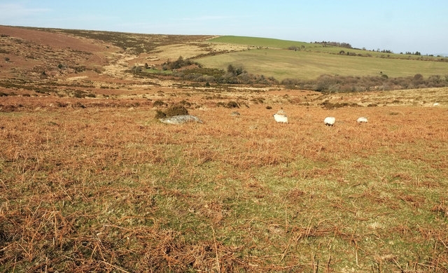
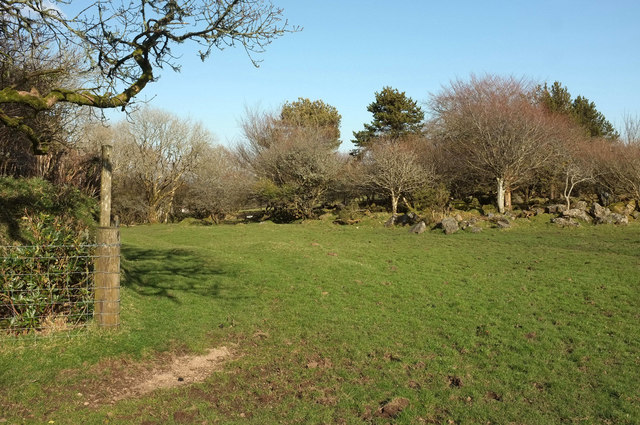
Lower Thynacombe Wood, located in Devon, is a picturesque woodland that boasts a diverse range of flora and fauna. Spanning over several acres, this forested area offers a tranquil escape from the bustling city life, making it a popular destination for nature enthusiasts and hikers alike.

The wood is primarily composed of deciduous trees, such as oak, beech, and ash, which provide a striking display of vibrant colors during the autumn months. The dense canopy of the trees creates a shaded and cool environment, even on hot summer days. As visitors meander through the woodland, they will come across a variety of native wildflowers, including bluebells, wood anemones, and primroses, which add a touch of color to the forest floor.

The wood is also home to a diverse array of wildlife. Birdwatchers will delight in the opportunity to spot species such as the great spotted woodpecker, tawny owl, and treecreeper. Additionally, the wood provides a habitat for small mammals like squirrels, badgers, and foxes. Lucky visitors may even catch a glimpse of a deer or two, gracefully navigating through the undergrowth.

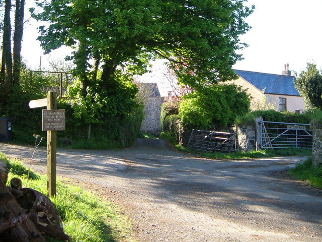
Lower Thynacombe Wood offers several well-marked trails, allowing visitors to explore its natural beauty at their own pace. These paths wind through the woodland, offering glimpses of babbling brooks and small ponds along the way. The peaceful ambiance and stunning scenery make this wood a perfect destination for a relaxing day out in nature.

If you have any feedback on the listing, please let us know in the comments section below.

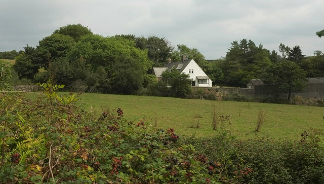
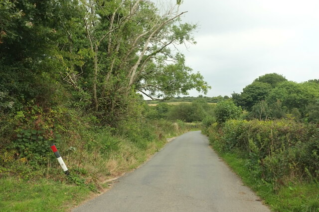
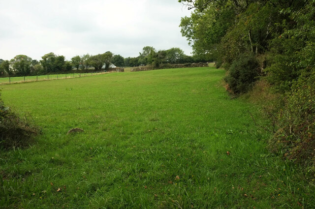
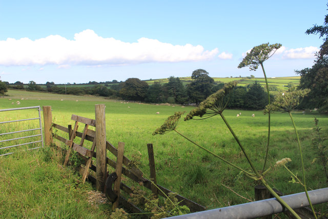
Lower Thynacombe Wood Images

Images are sourced within 2km of 50.451679/-3.8207543 or Grid Reference SX7062. Thanks to Geograph Open Source API. All images are credited.

Brent Hill House From the lane between Downstow and Gingaford Cross.
Brent Hill House
From the lane between Downstow and Gingaford Cross.
Lane from Downstow to Gingaford Cross The stretch from which <a href="https://www.geograph.org.uk/photo/7270873">SX6962 : Brent Hill House</a> was taken.
Lane from Downstow to Gingaford Cross
The stretch from which SX6962 : Brent Hill House was taken.
Field, Downstow Looking left from <a href="https://www.geograph.org.uk/photo/7275064">SX6962 : Lane from Downstow to Gingaford Cross</a>. The farm buildings on the left are at Lower Downstow.
Field, Downstow
Looking left from SX6962 : Lane from Downstow to Gingaford Cross. The farm buildings on the left are at Lower Downstow.
Pasture near Downstow
Old tin working above Dockwell Hole Seen from a path identified by Jeff Collins as the Cumston Track <a href="https://www.geograph.org.uk/photo/4197509">SX6964 : Cumston Track</a>.
Old tin working above Dockwell Hole
Seen from a path identified by Jeff Collins as the Cumston Track SX6964 : Cumston Track.
Moorland above Dockwell Hole Looking across the line of <a href="https://www.geograph.org.uk/photo/6420606">SX6963 : Old tin working above Dockwell Hole</a>; the tin workings follow the sloping straight line past a bush about 110 metres away.
Moorland above Dockwell Hole
Looking across the line of SX6963 : Old tin working above Dockwell Hole; the tin workings follow the sloping straight line past a bush about 110 metres away.
Pool, tin working above Dockwell Hole By the Cumston Track, and looking along the working shown in <a href="https://www.geograph.org.uk/photo/6420606">SX6963 : Old tin working above Dockwell Hole</a>.
Pool, tin working above Dockwell Hole
By the Cumston Track, and looking along the working shown in SX6963 : Old tin working above Dockwell Hole.
Sheep near Dockwell Beyond them, the old tin working shown in <a href="https://www.geograph.org.uk/photo/6420606">SX6963 : Old tin working above Dockwell Hole</a> crosses the image. In the background is the marshy area in the Harbourne valley around Dockwell Hole, and the grass fields on Skerraton Down.
Sheep near Dockwell
Beyond them, the old tin working shown in SX6963 : Old tin working above Dockwell Hole crosses the image. In the background is the marshy area in the Harbourne valley around Dockwell Hole, and the grass fields on Skerraton Down.
Edge of the moor near Dockwell Farm The Cumstock Track enters a stroll on the right, which continues on the other side of the valley ahead where it becomes South Brent bridleway 28, but where some field boundaries have gone missing since the 1887 OS edition.
Edge of the moor near Dockwell Farm
The Cumstock Track enters a stroll on the right, which continues on the other side of the valley ahead where it becomes South Brent bridleway 28, but where some field boundaries have gone missing since the 1887 OS edition.
Dry stone wall, Dockwell A stroll for funnelling livestock on or off the moor begins at this bend in the wall; the corresponding wall to the west-south-west is about 100 metres away, and the walls then become progressively closer together as the stroll drops to cross the valley; see <a href="https://www.geograph.org.uk/photo/6426160">SX6963 : Stroll near Dockwell Farm</a>.
Dry stone wall, Dockwell
A stroll for funnelling livestock on or off the moor begins at this bend in the wall; the corresponding wall to the west-south-west is about 100 metres away, and the walls then become progressively closer together as the stroll drops to cross the valley; see SX6963 : Stroll near Dockwell Farm.
Stroll near Dockwell Farm A funnel of moorland that allows livestock to be herded off the moor, leading here down to a gate where the access land ends, and South Brent bridleway 28 begins.
Stroll near Dockwell Farm
A funnel of moorland that allows livestock to be herded off the moor, leading here down to a gate where the access land ends, and South Brent bridleway 28 begins.
Gate onto the moor near Dockwell Farm South Brent bridleway 28 ends here, and the access land begins on the other side. At first the open moor is constrained within a stroll - see <a href="https://www.geograph.org.uk/photo/6426113">SX6963 : Dry stone wall, Dockwell</a> and <a href="https://www.geograph.org.uk/photo/6426160">SX6963 : Stroll near Dockwell Farm</a>.
Gate onto the moor near Dockwell Farm
South Brent bridleway 28 ends here, and the access land begins on the other side. At first the open moor is constrained within a stroll - see SX6963 : Dry stone wall, Dockwell and SX6963 : Stroll near Dockwell Farm.
Bridleway near Dockwell Farm Looking in the opposite direction from where <a href="https://www.geograph.org.uk/photo/6426233">SX6963 : Gate onto the moor near Dockwell Farm</a> was taken, along South Brent bridleway 28. The stroll continues around to the left between field boundaries. Older curving boundaries can be seen in the field ahead.
Bridleway near Dockwell Farm
Looking in the opposite direction from where SX6963 : Gate onto the moor near Dockwell Farm was taken, along South Brent bridleway 28. The stroll continues around to the left between field boundaries. Older curving boundaries can be seen in the field ahead.
Buildings at Dockwell Farm Seen from a gateway close to <a href="https://www.geograph.org.uk/photo/6426233">SX6963 : Gate onto the moor near Dockwell Farm</a>.
Buildings at Dockwell Farm
Seen from a gateway close to SX6963 : Gate onto the moor near Dockwell Farm.
Bridleway near Dockwell Farm Twenty metres width to this stroll, and presumably South Brent bridleway 28 might occupy all of it. Very handy for COVID-19 social distancing, but we met no-one on the path. Perhaps the earthworks in the foreground indicate the actual route.
Bridleway near Dockwell Farm
Twenty metres width to this stroll, and presumably South Brent bridleway 28 might occupy all of it. Very handy for COVID-19 social distancing, but we met no-one on the path. Perhaps the earthworks in the foreground indicate the actual route.
Bridleway near Dockwell Farm By the oak, the stroll shown in <a href="https://www.geograph.org.uk/photo/6426467">SX6963 : Bridleway near Dockwell Farm</a> widens; on the left behind trees is a livestock pen and an old track to Dockwell Farm.
Bridleway near Dockwell Farm
By the oak, the stroll shown in SX6963 : Bridleway near Dockwell Farm widens; on the left behind trees is a livestock pen and an old track to Dockwell Farm.
Trees near Dockwell Farm A view around the corner shown in <a href="https://www.geograph.org.uk/photo/6426479">SX6963 : Bridleway near Dockwell Farm</a>.
Trees near Dockwell Farm
A view around the corner shown in SX6963 : Bridleway near Dockwell Farm.
Oak near Dockwell Farm Beneath which <a href="https://www.geograph.org.uk/photo/6426479">SX6963 : Bridleway near Dockwell Farm</a> was taken; to the left is the stroll followed by South Brent bridleway 28 to the distant gate onto the moor.
Oak near Dockwell Farm
Beneath which SX6963 : Bridleway near Dockwell Farm was taken; to the left is the stroll followed by South Brent bridleway 28 to the distant gate onto the moor.
Show me another place!

Lower Thynacombe Wood is located at Grid Ref: SX7062 (Lat: 50.451679, Lng: -3.8207543)

Administrative County: Devon

District: South Hams

Police Authority: Devon and Cornwall

What 3 Words

///thickened.scam.huddled. Near South Brent, Devon

Related Wikis

Brent Hill

Brent Hill is the site of an Iron Age hill fort situated close to South Brent in Devon, England. The fort occupies the top of Brent Hill at approx 311...

Lutton, South Brent

Lutton is a small farming hamlet on the outskirts of South Brent, Devon, England. It is a hillside community on the side of Brent Hill. It is only a small...

Dean Prior

Dean Prior is a village and civil parish near the A38 road, in the South Hams district, in the county of Devon, England. It is located near the town of...

Aish, South Brent

Aish is a relatively small hamlet in the English county of Devon. It is near the large village of South Brent. This Aish is not to be confused with the...

South Brent

South Brent is a large village on the southern edge of Dartmoor, England, in the valley of the River Avon. The parish includes the small hamlets of Aish...

Pennywell Farm

Pennywell Farm is a farm tourist attraction just outside the town of Buckfastleigh in South Devon, England. It is a farm 600 feet (180 m) above sea level...

Badworthy

Badworthy is a village in Devon, England.

Luscombe, Rattery

Luscombe is an historic estate situated in the parish of Rattery in Devon. == History == Loscume is an estate mentioned in the Domesday Book of 1086, not...

Have you been to Lower Thynacombe Wood?

Leave your review of Lower Thynacombe Wood below (or comments, questions and feedback).