Soussons Down

Wood, Forest in Devon Teignbridge

England

Soussons Down

Tinworks and Strip Lynchets at Challacombe <span class="nowrap"><a title="https://historicengland.org.uk/listing/the-list/list-entry/1021393?section=official-listing" rel="nofollow ugc noopener" href="https://historicengland.org.uk/listing/the-list/list-entry/1021393?section=official-listing">Link</a><img style="margin-left:2px;" alt="External link" title="External link - shift click to open in new window" src="https://s1.geograph.org.uk/img/external.png" width="10" height="10"/></span>
Tinworks and Strip Lynchets at Challacombe Credit: Sandy Gerrard

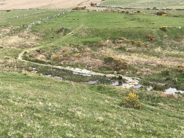
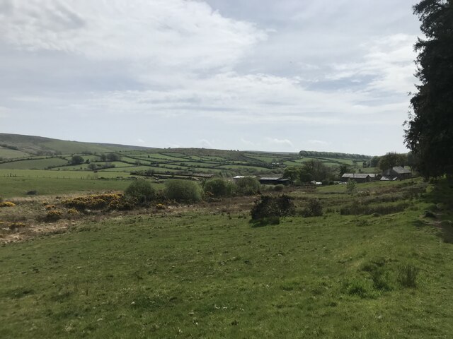
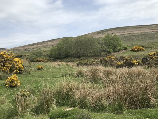
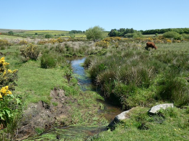
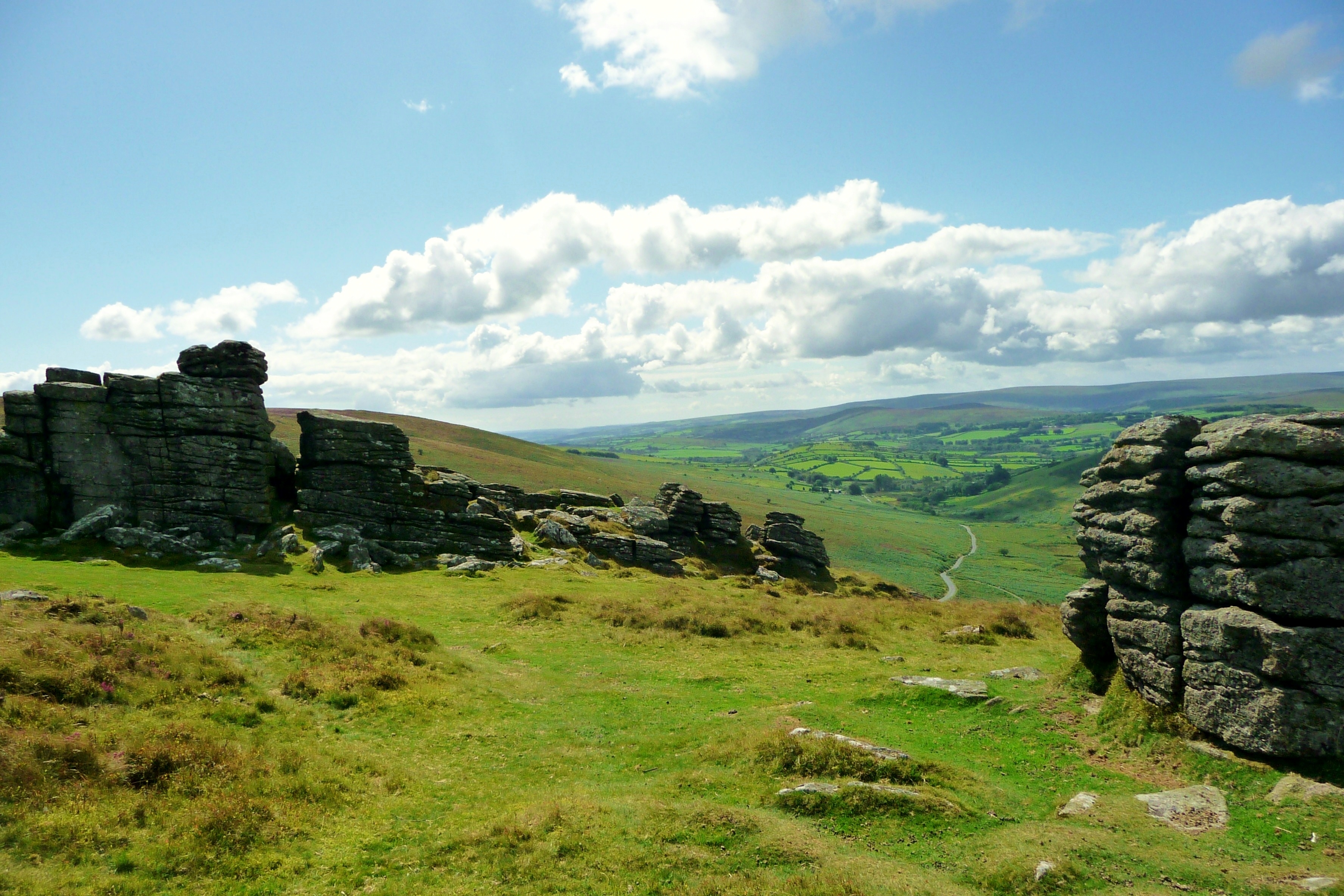
Soussons Down is a picturesque woodland area located in Devon, England. Covering an area of approximately 3,000 acres, it is known for its dense forest and diverse wildlife. The woodland is situated within Dartmoor National Park, adding to its natural beauty and significance.

The majority of Soussons Down is composed of ancient oak and beech trees, creating a stunning canopy that offers shade and shelter for various flora and fauna. The forest floor is covered with a thick carpet of ferns, mosses, and wildflowers, providing a vibrant and colorful landscape.

The area is a haven for wildlife enthusiasts and nature lovers. Visitors are likely to encounter a wide range of species, including deer, foxes, badgers, and various bird species such as woodpeckers and owls. It is also home to the rare pearl-bordered fritillary butterfly, which can be spotted fluttering amongst the wildflowers during the summer months.

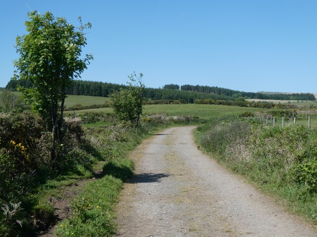
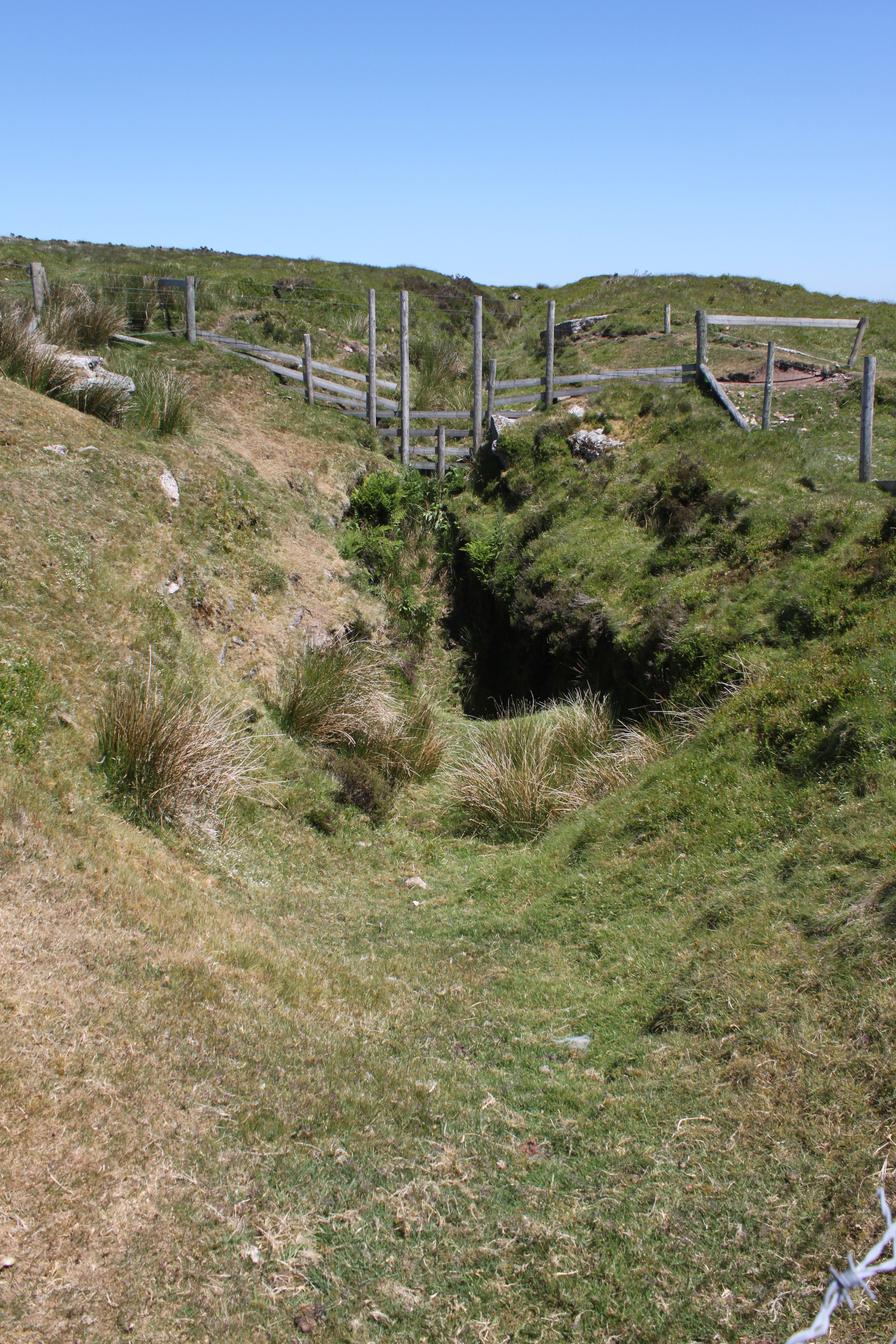
Soussons Down is a popular destination for outdoor activities such as walking, hiking, and cycling. There are numerous trails and pathways that wind through the woodland, offering stunning views and opportunities to explore the area's natural wonders. The trails cater to different levels of difficulty, making it accessible for visitors of all ages and fitness levels.

In addition to its natural beauty, Soussons Down also holds historical significance. The area contains remnants of ancient settlements and stone circles, providing a glimpse into the region's past.

Overall, Soussons Down is a captivating woodland destination that showcases the beauty and diversity of Devon's natural landscape. Whether it's for a leisurely stroll or an immersive nature experience, this enchanting forest offers something for everyone.

If you have any feedback on the listing, please let us know in the comments section below.

Soussons Down Images

Images are sourced within 2km of 50.599343/-3.8704798 or Grid Reference SX6779. Thanks to Geograph Open Source API. All images are credited.

Tinworks and Strip Lynchets at Challacombe <span class="nowrap"><a title="https://historicengland.org.uk/listing/the-list/list-entry/1021393?section=official-listing" rel="nofollow ugc noopener" href="https://historicengland.org.uk/listing/the-list/list-entry/1021393?section=official-listing">Link</a><img style="margin-left:2px;" alt="External link" title="External link - shift click to open in new window" src="https://s1.geograph.org.uk/img/external.png" width="10" height="10"/></span>
Tinworks and Strip Lynchets at Challacombe
Small clapper bridge
Path and stream crossing
Dartmoor near Statts Bridge
Datmoor near the Warren House Inn
Approaching Statts Bridge The B3212 crossing Dartmoor and approaching Statts Bridge.
Approaching Statts Bridge
The B3212 crossing Dartmoor and approaching Statts Bridge.
The B3212 crossing Dartmoor The B3212 crossing Dartmoor near Warren House Inn.
The B3212 crossing Dartmoor
The B3212 crossing Dartmoor near Warren House Inn.
Dartmoor near Warren House Inn
The B3212 near Water Hill The B3212 near Water Hill on Dartmoor.
The B3212 near Water Hill
The B3212 near Water Hill on Dartmoor.
Old Boundary Marker on the edge of Soussons Plantation, Manaton parish Parish Boundary Marker on the north side of the road 30 metres west of the entrance to Soussons Plantation. Manaton parish. Inscribed CB for Cator Bounds. See also <a title="https://www.geograph.org.uk/photo/5536888" href="https://www.geograph.org.uk/photo/5536888">Link</a>.

Milestone Society National ID: DV_CTWD01pb
Old Boundary Marker on the edge of Soussons Plantation, Manaton parish
Parish Boundary Marker on the north side of the road 30 metres west of the entrance to Soussons Plantation. Manaton parish. Inscribed CB for Cator Bounds. See also Link. Milestone Society National ID: DV_CTWD01pb
Soussons Down Kerbed Cairn (Scale 1m) <span class="nowrap"><a title="https://www.megalithic.co.uk/article.php?sid=1266" rel="nofollow ugc noopener" href="https://www.megalithic.co.uk/article.php?sid=1266">Link</a><img style="margin-left:2px;" alt="External link" title="External link - shift click to open in new window" src="https://s1.geograph.org.uk/img/external.png" width="10" height="10"/></span>
Soussons Down Kerbed Cairn
(Scale 1m) LinkExternal link
Soussons Farm
Soussons Farm
Soussons Down forest
Copse and moorland
Copse and moorland
Track to Fair Holm
Track to Fair Holm
Footpath on Cator Common
Track from Pizwell to Postbridge
Stream west of Pizwell
Show me another place!

Soussons Down is located at Grid Ref: SX6779 (Lat: 50.599343, Lng: -3.8704798)

Administrative County: Devon

District: Teignbridge

Police Authority: Devon and Cornwall

What 3 Words

///collides.remarks.estate. Near Chagford, Devon

Related Wikis

Birch Tor and Vitifer mine

Birch Tor and Vitifer mine was a tin mine on Dartmoor, Devon, England. Located in the valley of the Redwater Brook, to the east of the B3212 Moretonhampstead...

Warren House Inn

The Warren House Inn is a remote and isolated public house in the heart of Dartmoor, Devon, England. It is the highest pub in southern England at 1,425...

Hookney Tor

Hookney Tor is a tor, situated on Dartmoor in Devon, England. It lies on the Two Moors Way and remains of Headland Warren farm and Vitifer Mine are also...

Grimspound

Grimspound is a late Bronze Age settlement, situated on Dartmoor in Devon, England. It consists of a set of 24 hut circles surrounded by a low stone wall...

Nearby Amenities

Located within 500m of 50.599343,-3.8704798
Soussons Warren
Place: locality
Source: Bing
Lat/Long: 50.5977007/-3.8664631
Archaeological Site: tumulus
Historic: archaeological_site
Ref GB Nhle: 1021189
Wikidata: Q17677983
Lat/Long: 50.6017476/-3.8708904
The data included in this document is from www.openstreetmap.org. The data is made available under ODbL.

Have you been to Soussons Down?

Leave your review of Soussons Down below (or comments, questions and feedback).