Chislehampton

Settlement in Oxfordshire South Oxfordshire

England

Chislehampton

Grazing near the River Thame
Grazing near the River Thame Credit: JThomas

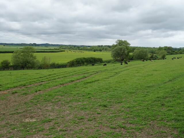
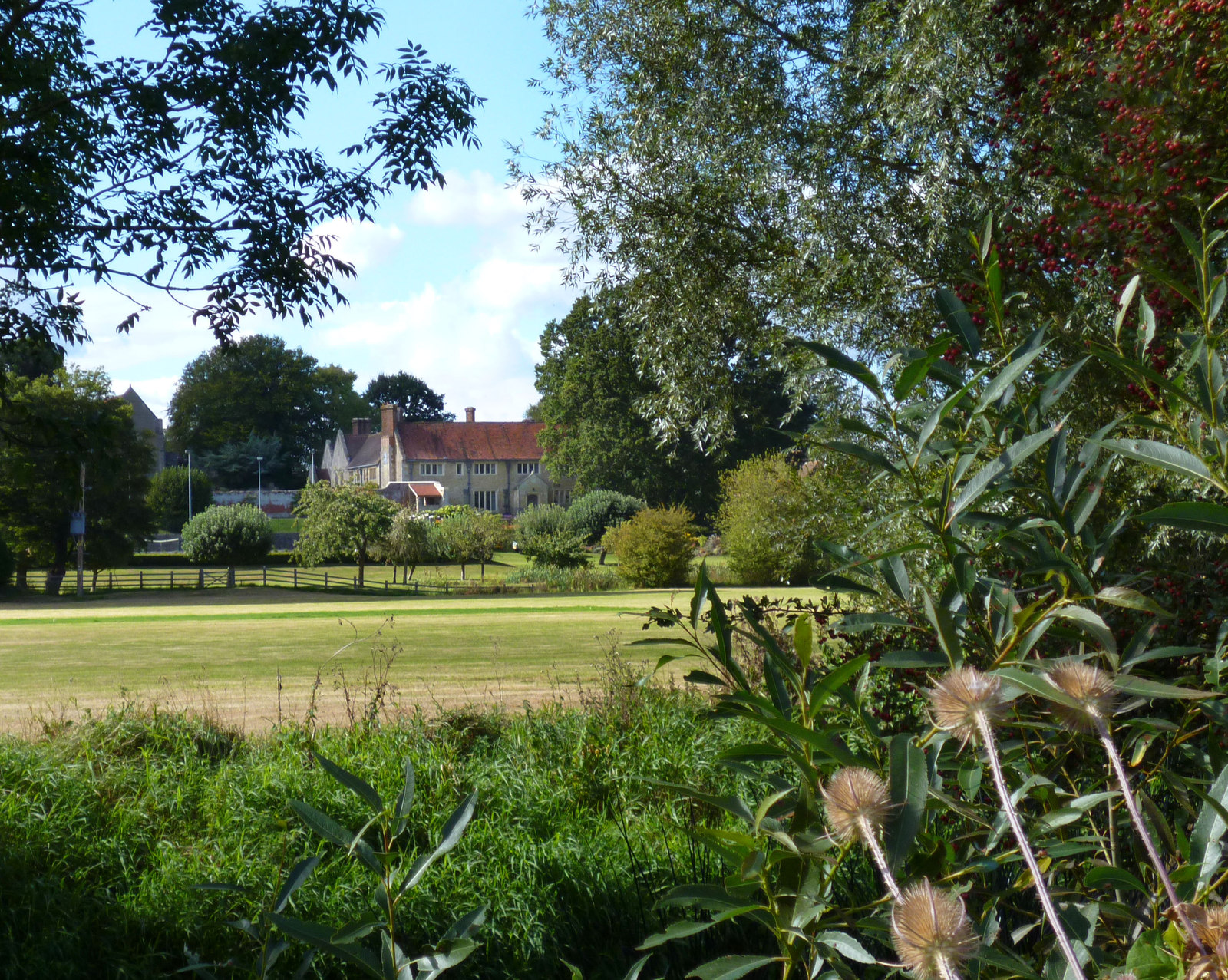
Chislehampton is a small village located in the county of Oxfordshire, England. Situated approximately six miles southeast of the city of Oxford, it falls within the district of South Oxfordshire. The village is nestled in the picturesque countryside, surrounded by rolling hills, farmland, and meandering streams.

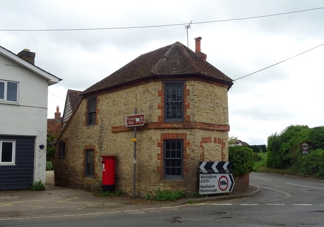
With a population of around 400 residents, Chislehampton maintains a close-knit community feel. The village is primarily residential, characterized by a mix of charming thatched cottages and more modern houses. The local architecture reflects the village's historical roots, with some buildings dating back to the 17th century.

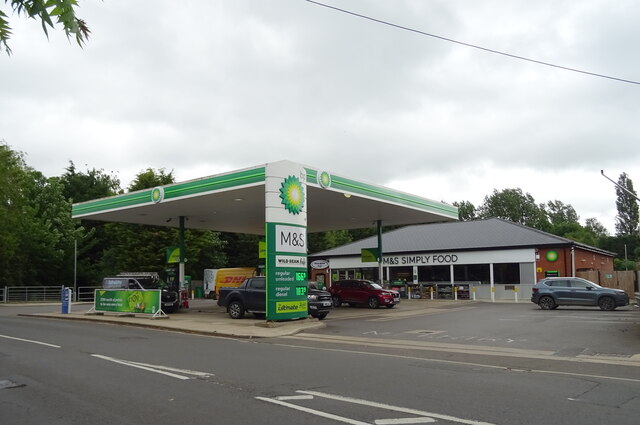
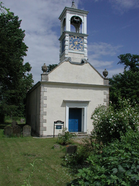
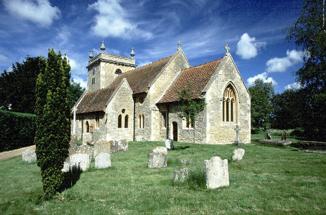
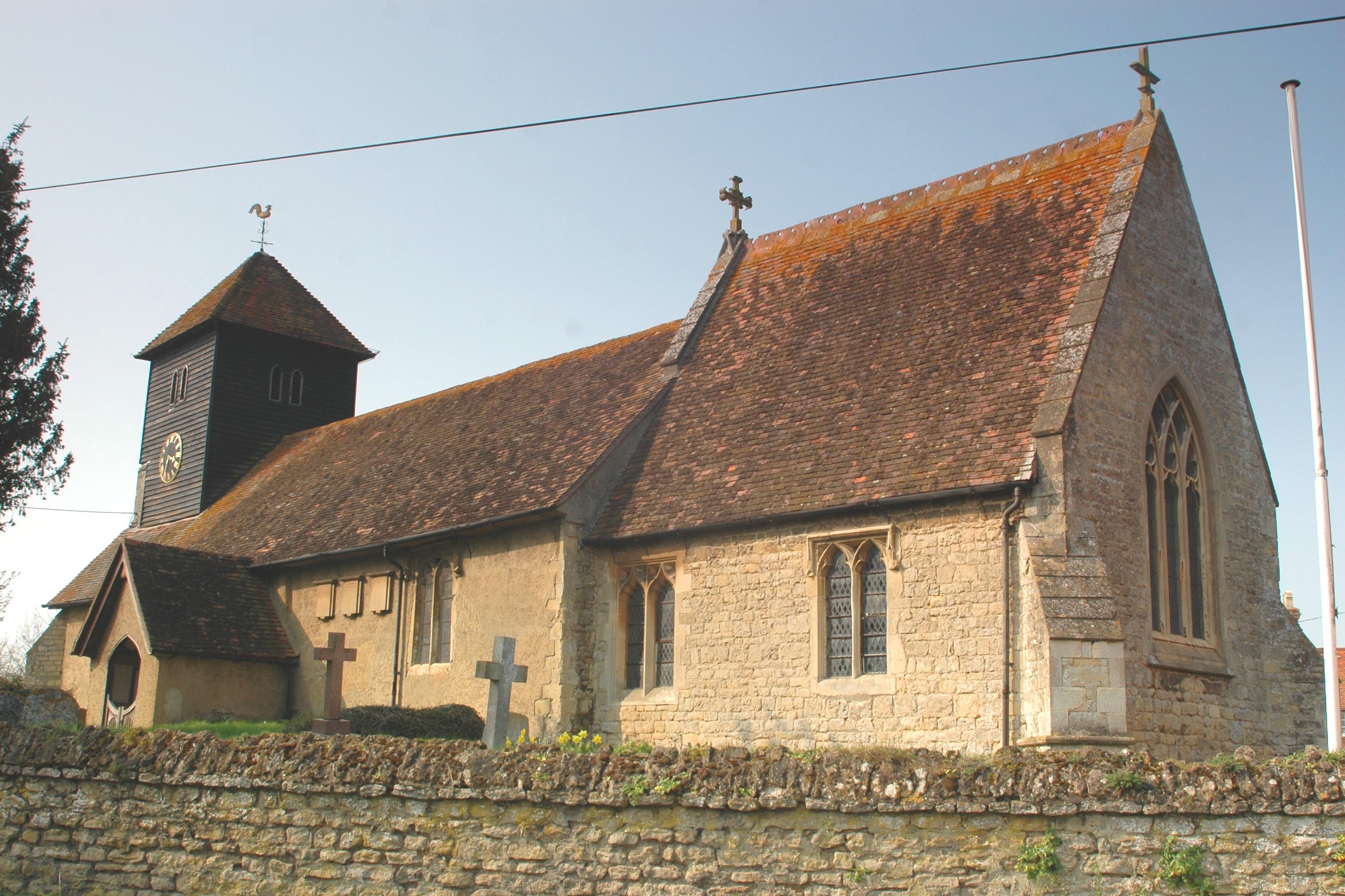
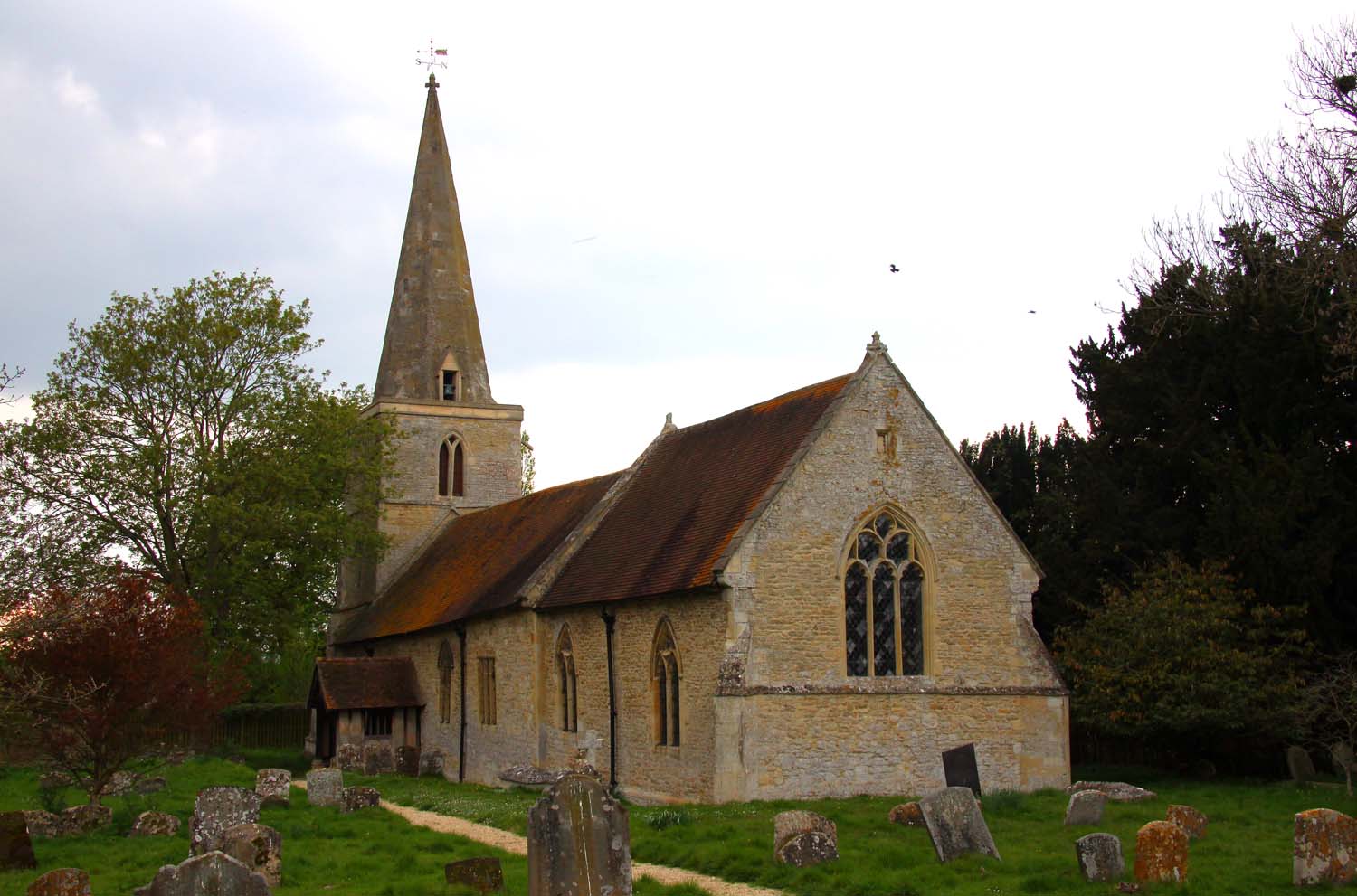
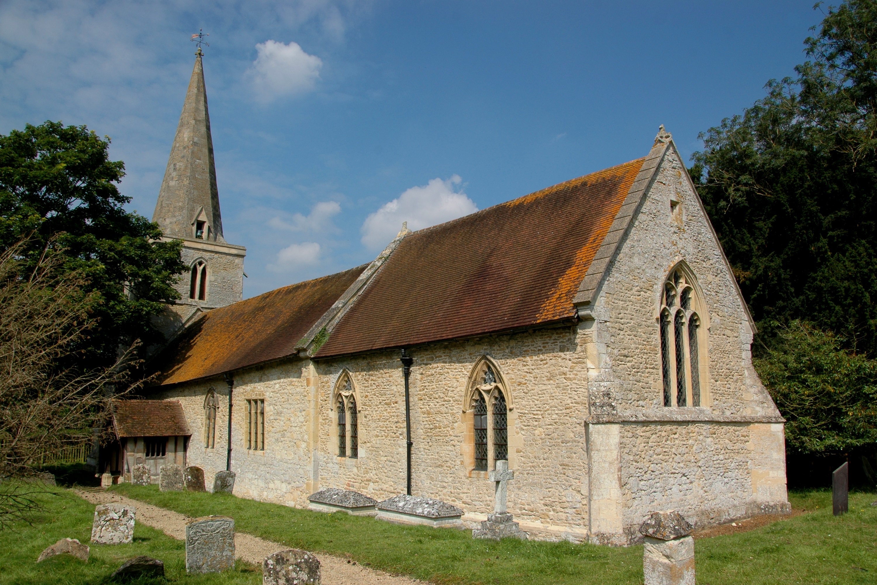
Chislehampton boasts a range of amenities to cater to its residents' needs. These include a primary school, a village hall, a well-preserved parish church, and a local pub. The village also benefits from regular bus services, providing convenient links to nearby towns and the city of Oxford.

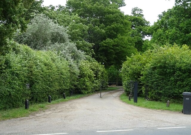
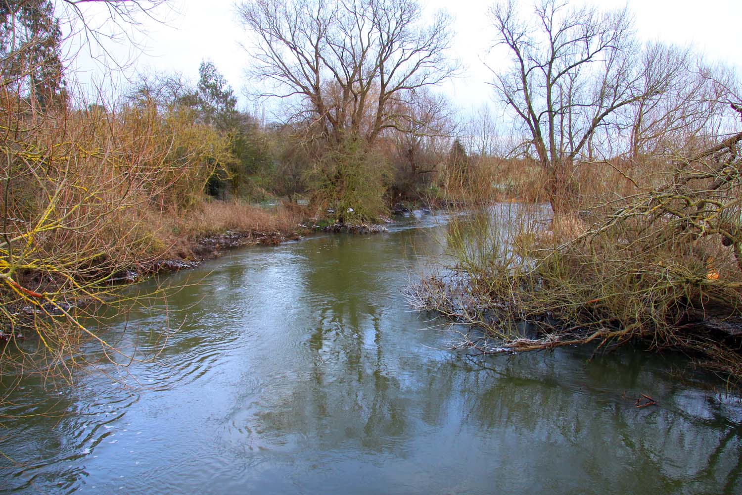
For outdoor enthusiasts, Chislehampton offers plenty of opportunities to enjoy the beautiful countryside. The village is surrounded by footpaths and bridleways, perfect for leisurely walks, cycling, or horse riding. The nearby River Thame also provides a tranquil setting for fishing or picnicking.

While Chislehampton may be a small village, its location provides easy access to a range of amenities and attractions. The historic city of Oxford is a short drive away, offering a wealth of cultural, educational, and recreational opportunities. Additionally, the village benefits from its proximity to the idyllic Oxfordshire countryside, with its charming villages, stately homes, and natural beauty.

If you have any feedback on the listing, please let us know in the comments section below.

Chislehampton Images

Images are sourced within 2km of 51.684947/-1.140591 or Grid Reference SU5998. Thanks to Geograph Open Source API. All images are credited.

Grazing near the River Thame
A329 towards Stadhampton
Cattle near the River Thame
Service station on Thame Road (A329), Stadhampton Petrol 166.9p.
Diesel 183.9p.
Service station on Thame Road (A329), Stadhampton
Petrol 166.9p. Diesel 183.9p.
Thame Road (A329), Stadhampton Petrol 166.9p.
Diesel 183.9p.
Thame Road (A329), Stadhampton
Petrol 166.9p. Diesel 183.9p.
Elizabeth II postbox on Thame Road, Brookhampton Postbox No. OX10 656.
See <a href="https://www.geograph.org.uk/photo/7296764">SU6098 : Cottage on Thame Road, Brookhampton</a> or context.
Elizabeth II postbox on Thame Road, Brookhampton
Postbox No. OX10 656. See SU6098 : Cottage on Thame Road, Brookhampton or context.
Cottage on Thame Road, Brookhampton Showing position of Postbox No. OX44 100.
See <a href="https://www.geograph.org.uk/photo/7296761">SU6098 : Elizabeth II postbox on Thame Road, Brookhampton</a> for postbox.
Cottage on Thame Road, Brookhampton
Showing position of Postbox No. OX44 100. See SU6098 : Elizabeth II postbox on Thame Road, Brookhampton for postbox.
Farmland, Little Milton A crop of wheat to the south of The Jenet.
Farmland, Little Milton
A crop of wheat to the south of The Jenet.
Field entrance off the B480
B480 towards Chiselhampton
The Coach & Horses, Chiselhampton See <a href="https://www.geograph.org.uk/photo/7296299">SU5998 : Sign for the Coach & Horses, Chiselhampton</a> for sign.
The Coach & Horses, Chiselhampton
Sign for the Coach & Horses, Chiselhampton See <a href="https://www.geograph.org.uk/photo/7296298">SU5998 : The Coach & Horses, Chiselhampton</a> for public house.
Sign for the Coach & Horses, Chiselhampton
Gated track off the B480
B480 towards Oxford
B480 towards Oxford
Crop field off the B480
Track (footpath) to Gotham Farm Off the B480.
Track (footpath) to Gotham Farm
Off the B480.
B480 heading north Towards Oxford.
B480 heading north
Towards Oxford.
Elizabeth II postbox on the B480, Chiselhampton Postbox No. OX44 498.
Elizabeth II postbox on the B480, Chiselhampton
Postbox No. OX44 498.
Show me another place!

Chislehampton is located at Grid Ref: SU5998 (Lat: 51.684947, Lng: -1.140591)

Administrative County: Oxfordshire

District: South Oxfordshire

Police Authority: Thames Valley

What 3 Words

///builder.adopt.indulgent. Near Garsington, Oxfordshire

Related Wikis

Chiselhampton

Chiselhampton is a village in the civil parish of Stadhampton, on the River Thame, in the South Oxfordshire district, in the county of Oxfordshire, England...

Brookhampton, Oxfordshire

Brookhampton is a hamlet in the village and civil parish of Stadhampton, 5 miles (8.0 km) north of Wallingford, in South Oxfordshire, England.

Stadhampton

Stadhampton is a village and civil parish about 7 miles (11 km) southeast of Oxford in South Oxfordshire, England. Stadhampton is close to the River Thame...

Ascott, Oxfordshire

Ascott is a hamlet and manor house in the English county of Oxfordshire. Ascott lies close to the River Thame north of Dorchester, around about 7 miles...

Drayton St. Leonard

Drayton St. Leonard is a village and civil parish on the River Thame in Oxfordshire, about 8 miles (13 km) southeast of Oxford. == Manor == The Domesday...

Chippinghurst Manor

Chippinghurst Manor is a Grade II listed country house in Oxfordshire, England.The name of "Chippinghurst" manor means "the hill of Cibba" and appeared...

Beauforest House

Beauforest House is a historic house, near Newington, Oxfordshire, England. It has been listed Grade II on the National Heritage List for England since...

Newington, Oxfordshire

Newington is a village and civil parish in South Oxfordshire, about 4+1⁄2 miles (7 km) north of Wallingford. The 2011 Census recorded the parish's population...

Nearby Amenities

Located within 500m of 51.684947,-1.140591
Chiselhampton
Is In: Oxfordshire, England, UK
Place: village
Wikidata: Q5102071
Wikipedia: en:Chiselhampton
Lat/Long: 51.6861722/-1.1440126
Post Box
Ref: OX44 498
Source: photograph
Lat/Long: 51.6850707/-1.1433213
Barrier: stile
Foot: yes
Lat/Long: 51.6829478/-1.1349245
Bus Stop
Coach and Horses PH
Bus: yes
Bus Routes: 101
Local Ref: opp
Naptan AtcoCode: 340001639OPP
Naptan Bearing: NW
Naptan CommonName: Coach and Horses PH
Naptan Indicator: Opposite
Naptan Landmark: Bus Shelter
Naptan NaptanCode: oxfgdpmt
Naptan Street: B480
Naptan Verified: no
Public Transport: platform
Source: naptan_import;photograph
Lat/Long: 51.6849994/-1.1432426
Bus Stop
Coach and Horses PH
Bus: yes
Local Ref: o/s
Naptan AtcoCode: 340001639OUT
Naptan Bearing: SE
Naptan CommonName: Coach and Horses PH
Naptan Indicator: Outside
Naptan Landmark: Coach and Horses PH
Naptan NaptanCode: oxfgdpta
Naptan Street: B480
Naptan Verified: no
Public Transport: platform
Source: naptan_import;photograph
Lat/Long: 51.6853146/-1.1433803
Barrier: stile
Foot: yes
Lat/Long: 51.6822399/-1.1374983
Barrier: stile
Foot: yes
Lat/Long: 51.6824705/-1.1370935
Rest Area
Source: Bing;openstreetbugs
Lat/Long: 51.683299/-1.1407854
Give Way
Direction: forward
Lat/Long: 51.6852503/-1.1434591
Barrier: stile
Bicycle: no
Foot: yes
Horse: no
Material: wood
Motor Vehicle: no
Stile: stepover
Lat/Long: 51.684331/-1.14302
Barrier: kissing_gate
Bicycle: no
Foot: yes
Horse: no
Motor Vehicle: no
Lat/Long: 51.6829338/-1.13703
Barrier: stile
Bicycle: no
Foot: yes
Horse: no
Material: wood
Motor Vehicle: no
Stile: stepover
Lat/Long: 51.683896/-1.1386772
Bench
Backrest: yes
Material: wood
Lat/Long: 51.6841462/-1.1431012
Bench
Backrest: yes
Material: wood
Lat/Long: 51.6839061/-1.1436593
The data included in this document is from www.openstreetmap.org. The data is made available under ODbL.

Have you been to Chislehampton?

Leave your review of Chislehampton below (or comments, questions and feedback).