Baker's Wood

Wood, Forest in Devon North Devon

England

Baker's Wood

Roadside war memorial near Warkleigh Dedicated to the men of Warkleigh that fell in the great war. Memorial nestles in the road fork.
Roadside war memorial near Warkleigh Credit: Ivan Taylor

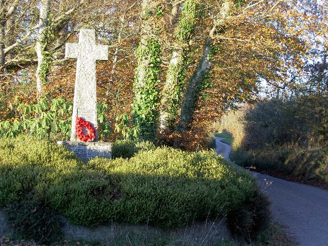
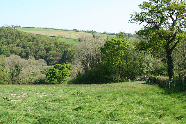
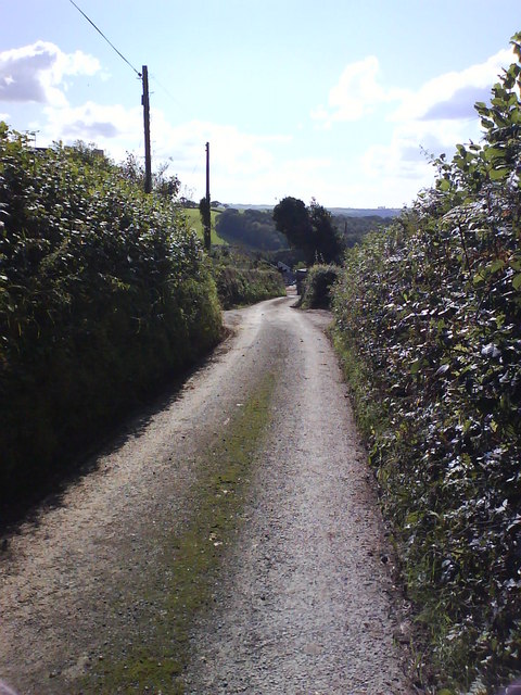
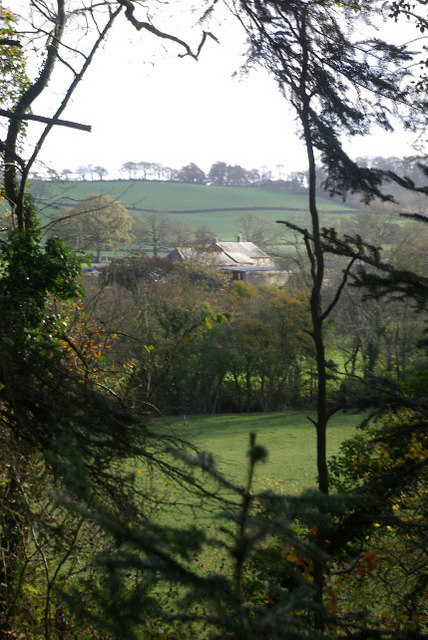
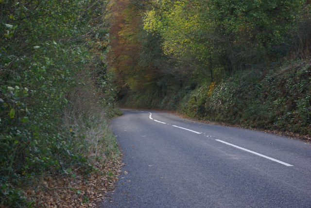
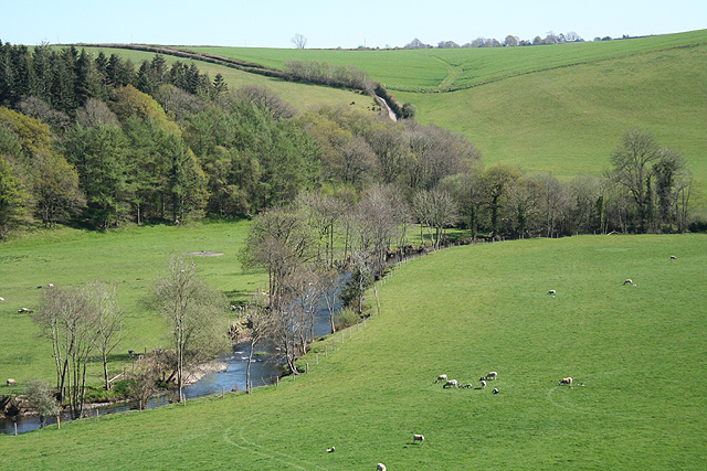
Baker's Wood is a picturesque woodland located in Devon, England. Covering an area of approximately 50 acres, it is a popular destination for nature enthusiasts and those seeking a tranquil escape from the bustling city life. The wood is situated in the heart of the Devon countryside, surrounded by rolling hills and beautiful landscapes.

The woodland is predominantly composed of native trees such as oak, beech, and ash, creating a diverse ecosystem that supports a wide range of wildlife. Visitors can expect to encounter various bird species, including woodpeckers and owls, as well as small mammals like squirrels and rabbits. The forest floor is adorned with a carpet of bluebells during the springtime, creating a breathtaking sight for visitors.

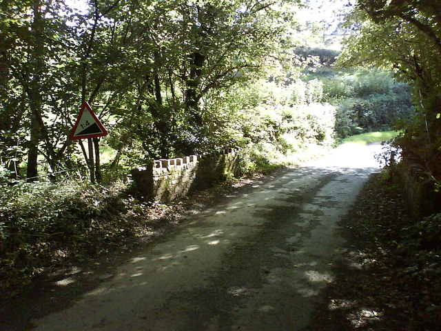
Baker's Wood offers numerous walking trails, allowing visitors to explore and immerse themselves in the natural beauty of the surroundings. These paths wind through the dense woodland, providing opportunities for leisurely strolls and peaceful picnics. The wood is also equipped with well-maintained seating areas, perfect for taking a break and enjoying the serenity of the surroundings.

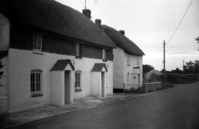
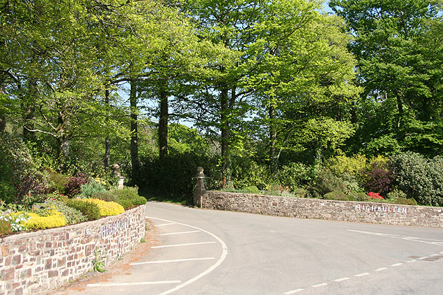
The wood is easily accessible, with a car park located nearby for those traveling by vehicle. It is also within close proximity to several quaint villages and towns, offering visitors the opportunity to combine their woodland visit with exploring the local culture and attractions.

Overall, Baker's Wood is a haven of tranquility, offering visitors a chance to connect with nature and rejuvenate their senses amidst the stunning Devon landscape.

If you have any feedback on the listing, please let us know in the comments section below.

Baker's Wood Images

Images are sourced within 2km of 50.977505/-3.909215 or Grid Reference SS6621. Thanks to Geograph Open Source API. All images are credited.

Roadside war memorial near Warkleigh Dedicated to the men of Warkleigh that fell in the great war. Memorial nestles in the road fork.
Roadside war memorial near Warkleigh
Dedicated to the men of Warkleigh that fell in the great war. Memorial nestles in the road fork.
Village Stores, Chittlehamholt A charming cottage in a charming North Devon village. In the early 1960s, the village store was run by my aunt and uncle.
Village Stores, Chittlehamholt
A charming cottage in a charming North Devon village. In the early 1960s, the village store was run by my aunt and uncle.
St Peter's Church - Satterleigh This church is not now used but is maintained. The wooden tower is 
unusual and is most probably unique in Devon. It does contain bells.
St Peter's Church - Satterleigh
This church is not now used but is maintained. The wooden tower is unusual and is most probably unique in Devon. It does contain bells.
Chittlehamholt: Highbullen entrance Highbullen is a country house hotel, with golf and country clubs. Looking east-south-east
Chittlehamholt: Highbullen entrance
Highbullen is a country house hotel, with golf and country clubs. Looking east-south-east
Satterleigh and Warkleigh: Haynetown Farm Entrance to farm, looking west
Satterleigh and Warkleigh: Haynetown Farm
Entrance to farm, looking west
Satterleigh and Warkleigh: above the Mole valley Looking south-south-east
Satterleigh and Warkleigh: above the Mole valley
Looking south-south-east
Moss Down The Middle! Lane between Sletchcott and Hele
Moss Down The Middle!
Lane between Sletchcott and Hele
Steep Ascent Ahead Small stone bridge with castellations crosses Hele Water
Steep Ascent Ahead
Small stone bridge with castellations crosses Hele Water
Highbullen Victorian house, built in the 1870s, now a hotel. Most of the rooms, however, are in annexes in the grounds, together with extensive leisure facilities including an 18-hole golf course.
Highbullen
Victorian house, built in the 1870s, now a hotel. Most of the rooms, however, are in annexes in the grounds, together with extensive leisure facilities including an 18-hole golf course.
Highbullen Golf Course The Highbullen Estate, now a hotel and country club, sits at the top of the ridge between the Taw and Mole valleys. This golf green, close to the house and part of the hotel's 18-hole course, has a spectacular view eastwards across the Mole Valley.
Highbullen Golf Course
The Highbullen Estate, now a hotel and country club, sits at the top of the ridge between the Taw and Mole valleys. This golf green, close to the house and part of the hotel's 18-hole course, has a spectacular view eastwards across the Mole Valley.
Highbullen Golf Course A carpet of fallen leaves covers Highbullen's golf course, except the greens and fairways which are kept immaculately clear. The Mole Valley lies beyond.
Highbullen Golf Course
A carpet of fallen leaves covers Highbullen's golf course, except the greens and fairways which are kept immaculately clear. The Mole Valley lies beyond.
Chittlehamholt Looking along the lane towards Chittlehampton. The house on the left is The Old Gate House.
Chittlehamholt
Looking along the lane towards Chittlehampton. The house on the left is The Old Gate House.
The Exeter Inn, Chittlehamholt A classic thatched village pub, dating back to the 16th century. In the days when the road through Chittlehamholt was part of the main route between Exeter and Barnstaple, this was a coaching inn.
The Exeter Inn, Chittlehamholt
A classic thatched village pub, dating back to the 16th century. In the days when the road through Chittlehamholt was part of the main route between Exeter and Barnstaple, this was a coaching inn.
The Exeter Inn, Chittlehamholt The inn sign recalls the days when this was a coaching inn on the Exeter - Barnstaple road. Chittlehamholt is a sleepy place nowadays, but the village pub is still at the centre of the community - even providing a public notice board.
The Exeter Inn, Chittlehamholt
The inn sign recalls the days when this was a coaching inn on the Exeter - Barnstaple road. Chittlehamholt is a sleepy place nowadays, but the village pub is still at the centre of the community - even providing a public notice board.
Chittlehamholt Church Dedicated to St John the Baptist, this church is in a rather lonely location some distance from the village.
Chittlehamholt Church
Dedicated to St John the Baptist, this church is in a rather lonely location some distance from the village.
View towards Lenton A gap in the trees on the B3226 gives this glimpse of Lenton Farm across the River Mole.
View towards Lenton
A gap in the trees on the B3226 gives this glimpse of Lenton Farm across the River Mole.
B3226 near Lenton The B3226 South Molton - Fortescue Cross road follows a wooded course through the Mole Valley. The land rises sharply to the right on the Highbullen Estate and drops sharply to the river on the left.
B3226 near Lenton
The B3226 South Molton - Fortescue Cross road follows a wooded course through the Mole Valley. The land rises sharply to the right on the Highbullen Estate and drops sharply to the river on the left.
Cockrams Butt Cross A war memorial in keeping with tradition for siting crosses at remote road junctions.
Cockrams Butt Cross
A war memorial in keeping with tradition for siting crosses at remote road junctions.
Show me another place!

Baker's Wood is located at Grid Ref: SS6621 (Lat: 50.977505, Lng: -3.909215)

Administrative County: Devon

District: North Devon

Police Authority: Devon and Cornwall

What 3 Words

///tweezers.learn.post. Near South Molton, Devon

Related Wikis

Satterleigh and Warkleigh

Satterleigh and Warkleigh is a civil parish in North Devon district, Devon, England. In the 2011 census it was recorded as having a population of 170....

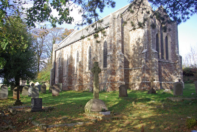
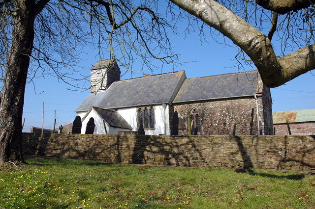
St Peter's Church, Satterleigh

St Peter's Church in Satterleigh, Devon, England was built in the 15th century. It is recorded in the National Heritage List for England as a designated...
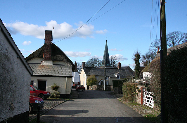
Chittlehamholt

Chittlehamholt is a village and civil parish in North Devon district, Devon, England. In the 2011 census it was recorded as having a population of 169...

River Bray

The River Bray is a small river in North Devon, England. It is a tributary of the River Mole, which in turn is a tributary of the River Taw. It rises in...

King's Nympton

King's Nympton (Latinised to Nymet Regis) is a village, parish and former manor in the North Devon district, in Devon, England, in the heart of the rolling...
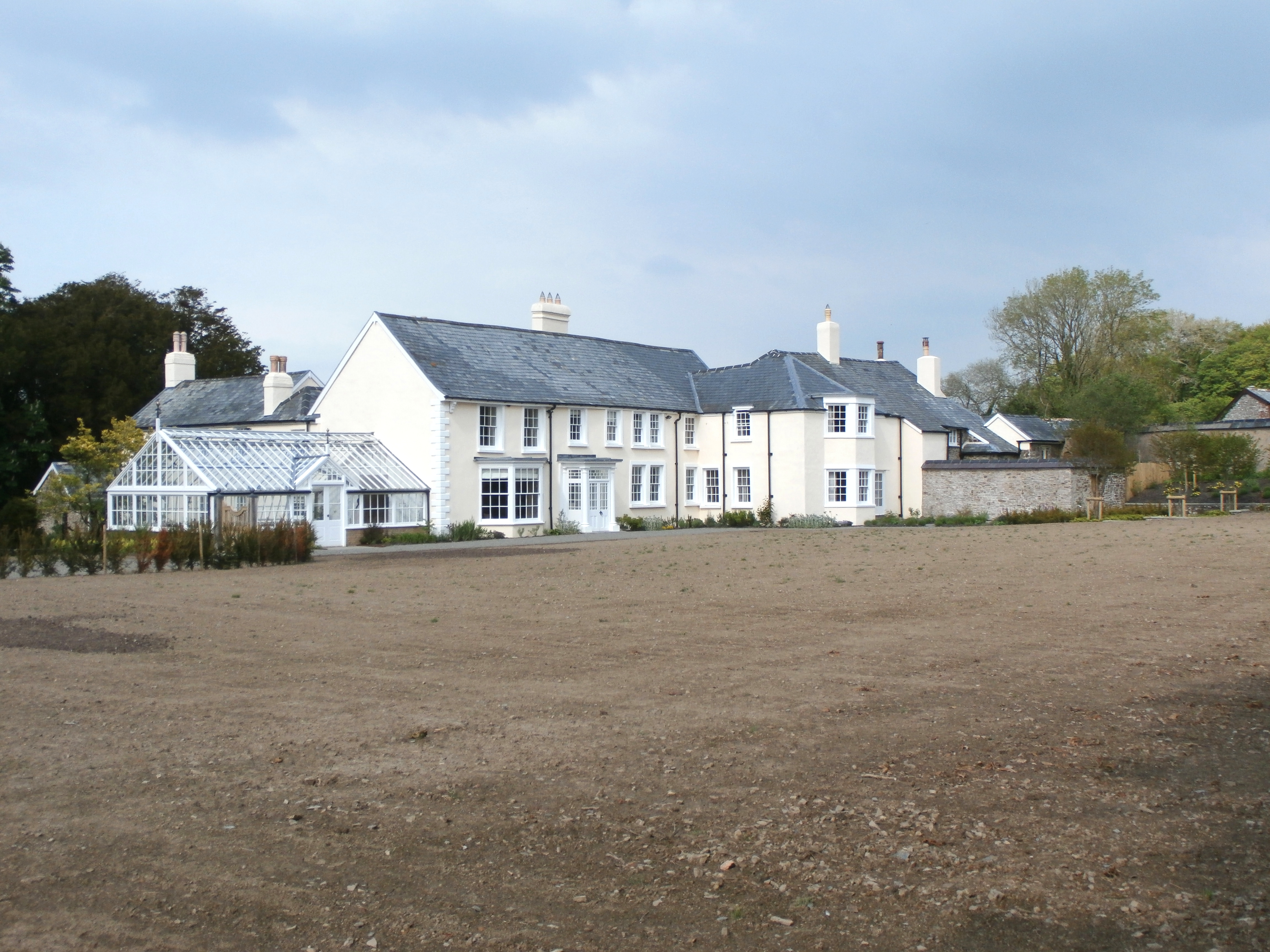
Hudscott

Hudscott is a historic estate within the parish and former manor of Chittlehampton, Devon. From 1700 it became a seat of a junior branch of the influential...

Portsmouth Arms railway station

Portsmouth Arms railway station is a small wayside station in Devon. It is in the parish of Burrington but remote from any village so is named after the...

River Mole, Devon

The River Mole a tributary of the River Taw in Devon which rises on the southwestern border of Exmoor. The river takes its name from the market towns of...

Related Videos

Our Wedding at Highbullen Hotel

This hotel is absolutely amazing, they made our wedding perfect and we couldn't of had a better day. 10.09.2021.

Nearby Amenities

Located within 500m of 50.977505,-3.909215
Newland Cross
Place: locality
Lat/Long: 50.9785432/-3.9030006
Source: gps survey
Lat/Long: 50.9819253/-3.910416
Power: pole
Source: bing
Lat/Long: 50.9773873/-3.9045909
Power: pole
Source: bing
Lat/Long: 50.9775131/-3.903463
Power: pole
Source: bing
Transformer: distribution
Lat/Long: 50.9772437/-3.9056329
Power: pole
Source: bing
Lat/Long: 50.9755802/-3.9067179
Power: pole
Source: bing
Lat/Long: 50.974849/-3.9071766
Power: pole
Source: bing
Lat/Long: 50.9740146/-3.9073724
Power: pole
Source: bing
Lat/Long: 50.9732276/-3.9076084
The data included in this document is from www.openstreetmap.org. The data is made available under ODbL.

Have you been to Baker's Wood?

Leave your review of Baker's Wood below (or comments, questions and feedback).