Ashen Copse

Wood, Forest in Devon North Devon

England

Ashen Copse

Huxtable Farm
Huxtable Farm Credit: Roger Cornfoot

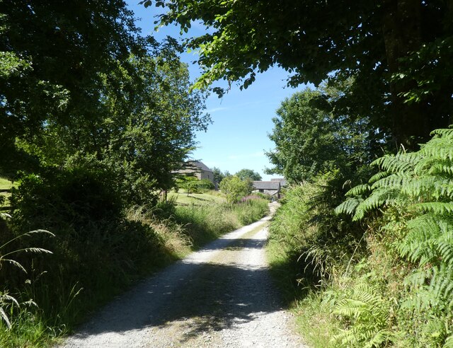
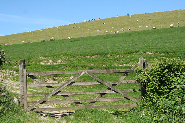
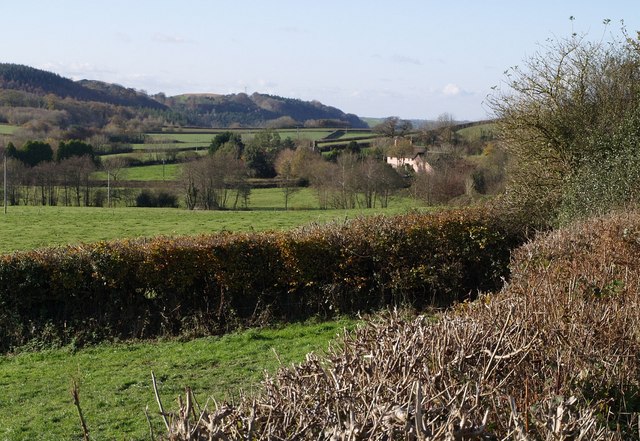
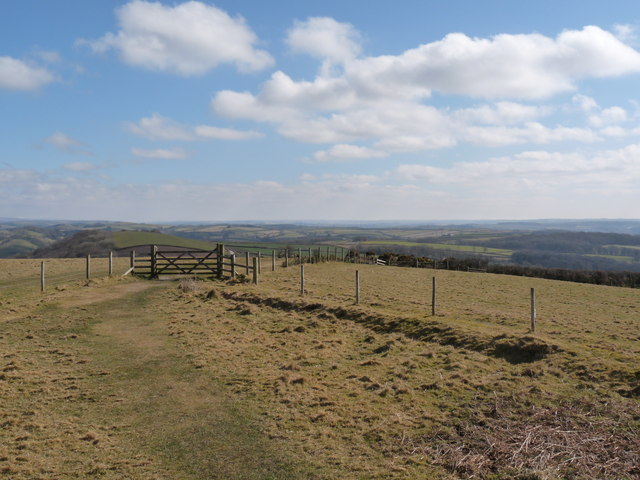
Ashen Copse is a picturesque woodland located in Devon, England. Covering an area of approximately 50 acres, it is a popular destination for nature enthusiasts and outdoor enthusiasts alike. The copse is situated in a rural area, surrounded by rolling hills and scenic countryside.

The woodland is predominantly composed of deciduous trees, including oak, beech, and ash. These trees create a dense canopy that provides shade and shelter for a wide variety of flora and fauna. The forest floor is carpeted with a rich layer of leaf litter, creating a natural habitat for numerous species of insects, fungi, and small mammals.

Ashen Copse is home to a diverse range of wildlife. Visitors may spot deer, foxes, badgers, and rabbits roaming freely in the forest. The birdlife is also abundant, with species such as woodpeckers, owls, and various songbirds calling the copse their home. Nature enthusiasts can enjoy birdwatching and wildlife photography in this tranquil setting.

The copse offers a network of well-maintained trails, allowing visitors to explore the woodland at their own pace. These paths wind through the trees, offering glimpses of sun-dappled clearings and meandering streams. The serene atmosphere and peaceful surroundings make Ashen Copse an ideal location for walking, jogging, or simply enjoying a leisurely stroll amidst nature's beauty.

Overall, Ashen Copse is a captivating woodland destination in Devon, providing a haven for wildlife and a peaceful retreat for visitors seeking a connection with nature.

If you have any feedback on the listing, please let us know in the comments section below.
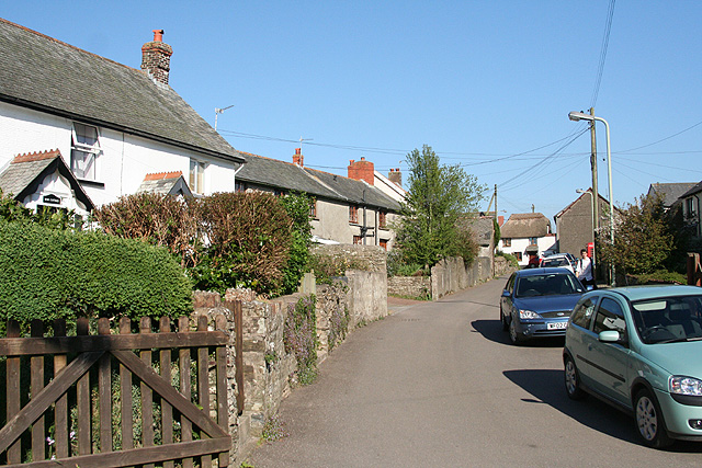
Ashen Copse Images

Images are sourced within 2km of 51.056568/-3.9298467 or Grid Reference SS6430. Thanks to Geograph Open Source API. All images are credited.

Huxtable Farm
Huxtable Farm
Huxtable Lane
Huxtable Lane
A view towards West Buckland and surrounding hills Codden Hill lies just in view to the right of this image with Codden Farm in the valley next to it.
A view towards West Buckland and surrounding hills
Codden Hill lies just in view to the right of this image with Codden Farm in the valley next to it.
West Buckland: Buckingham’s Leary A farm with 250 Friesians in December 2003. In 1890 there was water-power here; one pier of an aqueduct is all that remains of this installation, by the lane beyond the farmhouse. The cottage to the right of the original farm carries an 1858 datestone
West Buckland: Buckingham’s Leary
A farm with 250 Friesians in December 2003. In 1890 there was water-power here; one pier of an aqueduct is all that remains of this installation, by the lane beyond the farmhouse. The cottage to the right of the original farm carries an 1858 datestone
Filleigh: near West Heddon Looking north-north-west towards the farm
Filleigh: near West Heddon
Looking north-north-west towards the farm
Filleigh: grass harvest Looking east near West Heddon farm with grass being transported for silage
Filleigh: grass harvest
Looking east near West Heddon farm with grass being transported for silage
Filleigh: Heddon A Royal Mail van passes. Looking south
Filleigh: Heddon
A Royal Mail van passes. Looking south
Filleigh: below High Down At Heddon. Looking south-south-west
Filleigh: below High Down
At Heddon. Looking south-south-west
West Buckland: by Leary Barton Looking north-north-west opposite the entrance to Leary Barton
West Buckland: by Leary Barton
Looking north-north-west opposite the entrance to Leary Barton
Swimbridge: East Kerscott Seen from the South Molton-Swimbridge road
Swimbridge: East Kerscott
Seen from the South Molton-Swimbridge road
Gould's Leary Scattered along the lane between Filleigh Bridge and Riverton are numerous farmhouses bearing the name "Leary" and preceded by the surname of a person who once lived there. Gould's Leary is just across the lane from May's Leary. Close by to the left, but hidden, is the A371 link road to Barnstaple. The hills on the left, High Down and Great Hill are in adjoining squares.
Gould's Leary
Scattered along the lane between Filleigh Bridge and Riverton are numerous farmhouses bearing the name "Leary" and preceded by the surname of a person who once lived there. Gould's Leary is just across the lane from May's Leary. Close by to the left, but hidden, is the A371 link road to Barnstaple. The hills on the left, High Down and Great Hill are in adjoining squares.
St Peter's Church, West Buckland Taken from the West end.
St Peter's Church, West Buckland
Taken from the West end.
West Buckland: village street Near the church, looking east
West Buckland: village street
Near the church, looking east
West Buckland: St Peter’s church Looking east to the west tower, the only part of the church to escape the 19th century rebuilding. Note the raised churchyard, just possibly an indication of a pre-Christian site
West Buckland: St Peter’s church
Looking east to the west tower, the only part of the church to escape the 19th century rebuilding. Note the raised churchyard, just possibly an indication of a pre-Christian site
Swimbridge: by Riverton Mill Cottage Looking north west along Yeoland Lane: it leads to Yarnacott and Swimbridge village
Swimbridge: by Riverton Mill Cottage
Looking north west along Yeoland Lane: it leads to Yarnacott and Swimbridge village
Swimbridge: near Yeoland House Looking south towards the North Devon Link Road which is hidden beyond the trees that stand at the foot of the field
Swimbridge: near Yeoland House
Looking south towards the North Devon Link Road which is hidden beyond the trees that stand at the foot of the field
Show me another place!

Ashen Copse is located at Grid Ref: SS6430 (Lat: 51.056568, Lng: -3.9298467)

Administrative County: Devon

District: North Devon

Police Authority: Devon and Cornwall

What 3 Words

///latest.ignoring.unicorns. Near South Molton, Devon

Related Wikis

West Buckland, Devon

West Buckland is a small village and former manor, now in the parish of East and West Buckland, in the North Devon district, in the county of Devon, England...

Accott

Accott is an historic estate, now a small settlement, in the parish of Bishop's Tawton in the county of Devon, England == History == The place-name Accott...

East and West Buckland

East and West Buckland is a civil parish in the English county of Devon. Forming part of the district of North Devon its main settlements are West Buckland...

Filleigh

Filleigh is a small village, civil parish and former manor in North Devon, on the southern edge of Exmoor, 3.5 miles (5.6 km) west of South Molton. The...

Swimbridge

Swimbridge (historical spelling: Swymbridge) is a village, parish and former manor in Devon, England. It is situated 4 miles (6.4 km) south-east of Barnstaple...

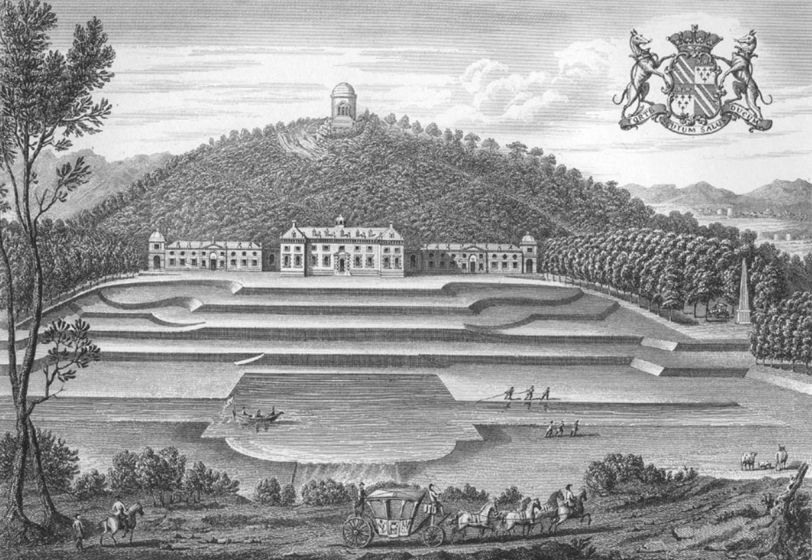
Castle Hill, Filleigh

Castle Hill in the parish of Filleigh in North Devon, is an early Neo-Palladian country house situated 3 miles (5 kilometres) north-west of South Molton...

East Buckland

East Buckland is a small village and former civil parish, now in the parish of East and West Buckland, in the North Devon district of Devon, England, next...

Bremridge Wood

Bremridge Wood formerly part of the Domesday Book estate of Bremridge near South Molton, Devon, England, is the site of an Iron Age enclosure or hill fort...

Nearby Amenities

Located within 500m of 51.056568,-3.9298467
Power: pole
Source: bing
Lat/Long: 51.0527222/-3.927041
Power: pole
Source: bing
Transformer: distribution
Lat/Long: 51.0536596/-3.9264241
Power: pole
Source: bing
Lat/Long: 51.053346/-3.9272824
Power: pole
Source: bing
Lat/Long: 51.0529565/-3.9283446
Power: pole
Source: bing
Lat/Long: 51.0522686/-3.9302248
Power: pole
Source: bing
Lat/Long: 51.0525468/-3.929463
Power: pole
Source: bing
Lat/Long: 51.053228/-3.9298922
Power: pole
Source: bing
Lat/Long: 51.0541452/-3.9303482
Power: pole
Source: bing
Lat/Long: 51.0548533/-3.9307129
Power: pole
Source: bing
Lat/Long: 51.0555361/-3.931067
Power: pole
Source: bing
Lat/Long: 51.0565898/-3.9315981
Power: pole
Source: bing
Lat/Long: 51.0559036/-3.9312494
Power: pole
Source: bing
Lat/Long: 51.0571512/-3.9319414
Power: pole
Source: bing
Lat/Long: 51.0580177/-3.9324698
Power: pole
Source: bing
Lat/Long: 51.0586322/-3.9328399
Power: pole
Source: bing
Lat/Long: 51.0593748/-3.9333013
Power: pole
Source: bing
Lat/Long: 51.0600239/-3.9337438
The data included in this document is from www.openstreetmap.org. The data is made available under ODbL.

Have you been to Ashen Copse?

Leave your review of Ashen Copse below (or comments, questions and feedback).