Court Wood

Wood, Forest in Devon North Devon

England

Court Wood

Umberleigh place of worship The timber work is unusual for this area and seems more appropriate to Canada. The church is called The Church of the Good Shepherd.
Umberleigh place of worship Credit: Fiona Avis

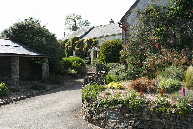
Court Wood is a picturesque forest located in the county of Devon, England. Covering an area of approximately 500 acres, this woodland is a haven for nature enthusiasts, hikers, and outdoor lovers. Situated near the village of Woodbury, Court Wood offers a tranquil escape from the hustle and bustle of city life.

The forest is characterized by its dense and lush vegetation, with a variety of tree species, including oak, beech, and birch, dominating the landscape. These towering trees create a canopy overhead, providing shade and shelter for a diverse range of flora and fauna. Visitors can expect to see an array of wildflowers, ferns, and mosses carpeting the forest floor, adding to its enchanting ambiance.

Court Wood is renowned for its well-maintained network of walking trails, making it an ideal destination for leisurely strolls or more challenging hikes. These paths wind their way through the forest, offering stunning views of the surrounding countryside and glimpses of local wildlife, such as deer, squirrels, and various bird species.

The woodland is also home to several picnic spots and seating areas, inviting visitors to take a break and soak in the natural beauty of their surroundings. Additionally, Court Wood hosts educational activities and guided tours, allowing visitors to learn about the forest's history, conservation efforts, and the importance of sustainable forestry.

Overall, Court Wood in Devon is a captivating destination for those seeking to reconnect with nature and enjoy the tranquility of a truly stunning woodland environment.

If you have any feedback on the listing, please let us know in the comments section below.

Court Wood Images

Images are sourced within 2km of 51.006297/-3.9562535 or Grid Reference SS6224. Thanks to Geograph Open Source API. All images are credited.

Umberleigh place of worship The timber work is unusual for this area and seems more appropriate to Canada. The church is called The Church of the Good Shepherd.
Umberleigh place of worship
The timber work is unusual for this area and seems more appropriate to Canada. The church is called The Church of the Good Shepherd.
Chittlehampton: Ford Mill Two leats, running in neighbouring valleys, provided the water power at the mill which is now a private residence
Chittlehampton: Ford Mill
Two leats, running in neighbouring valleys, provided the water power at the mill which is now a private residence
Chittlehampton
Chittlehampton
Broadmoor crossroads about a mile south of Chittlehampton
Winson Cross An ancient wayside cross. The pedestal was added in the 18th Century and was extensively repaired in the 1960s. These crosses were used to mark sacred spots before churches were built. One of a few left in North Devon.
Winson Cross
An ancient wayside cross. The pedestal was added in the 18th Century and was extensively repaired in the 1960s. These crosses were used to mark sacred spots before churches were built. One of a few left in North Devon.
Swimbridge: Polly Cottage At Stowford. Seen from the lane to Cobbaton, looking south
Swimbridge: Polly Cottage
At Stowford. Seen from the lane to Cobbaton, looking south
Swimbridge: West Stowford Seen from the lane to Cobbaton
Swimbridge: West Stowford
Seen from the lane to Cobbaton
Swimbridge: East Stowford Track and public footpath to Heywood and Chittlehampton. Looking south-south-east
Swimbridge: East Stowford
Track and public footpath to Heywood and Chittlehampton. Looking south-south-east
Blakewell Lane Minor road near Blakewell
Blakewell Lane
Minor road near Blakewell
Stone Cross Medieval stone cross near Eastacott
Stone Cross
Medieval stone cross near Eastacott
Stone cross This signpost is on the opposite side of the road from the medieval stone cross from which it gets its name.
Stone cross
This signpost is on the opposite side of the road from the medieval stone cross from which it gets its name.
Looking down the lane Quiet lane near Broadmoor.
Looking down the lane
Quiet lane near Broadmoor.
Quiet Lane Minor road near Broadmoor Cross
Quiet Lane
Minor road near Broadmoor Cross
Thatched Cottage in the countryside Rural Devon
Thatched Cottage in the countryside
Rural Devon
Biddacott A large 19th C Farmhouse on the outskirts of Chittlehampton
Biddacott
A large 19th C Farmhouse on the outskirts of Chittlehampton
Shimmering in the Sun Biddacott Cross, just poking out of the top of the hedge.
Shimmering in the Sun
Biddacott Cross, just poking out of the top of the hedge.
Stream at Deptford Just visible is Great Deptford Farm.
Stream at Deptford
Just visible is Great Deptford Farm.
Thatched cottages and the Bell Inn, Chittlehampton View south from in front of the church.
Thatched cottages and the Bell Inn, Chittlehampton
View south from in front of the church.
Show me another place!

Court Wood is located at Grid Ref: SS6224 (Lat: 51.006297, Lng: -3.9562535)

Administrative County: Devon

District: North Devon

Police Authority: Devon and Cornwall

What 3 Words

///outings.develops.harnessed. Near South Molton, Devon

Related Wikis

Chittlehampton

Chittlehampton is a village and civil parish in the North Devon district of Devon, England, about 7 miles (11 km) south-west of Barnstaple. At the 2001...

Hawkridge, Chittlehampton

Hawkridge in the parish of Chittlehampton in North Devon, England, is an historic estate, anciently the seat of a junior branch of the Acland family which...

Hudscott

Hudscott is a historic estate within the parish and former manor of Chittlehampton, Devon. From 1700 it became a seat of a junior branch of the influential...

Umberleigh railway station

Umberleigh railway station serves the village of Umberleigh in Devon, England. It is on the Tarka Line to Barnstaple, 33 miles 22 chains (53.6 km) from...

Nearby Amenities

Located within 500m of 51.006297,-3.9562535
Power: pole
Source: bing
Lat/Long: 51.0062457/-3.9589083
Power: pole
Source: bing
Lat/Long: 51.0060474/-3.9605364
Power: pole
Source: bing
Lat/Long: 51.0058009/-3.9619674
Power: pole
Source: bing
Lat/Long: 51.0056085/-3.9631382
Power: pole
Source: bing
Lat/Long: 51.0064668/-3.9577389
Power: pole
Source: bing
Lat/Long: 51.0066288/-3.9562033
Power: pole
Source: bing
Lat/Long: 51.0076633/-3.9551237
Power: pole
Source: bing
Lat/Long: 51.0080186/-3.9547455
Power: pole
Source: bing
Lat/Long: 51.0084819/-3.9542574
Power: pole
Source: bing
Lat/Long: 51.0088877/-3.9530195
Power: pole
Source: bing
Lat/Long: 51.0091645/-3.9521451
Power: pole
Source: bing
Transformer: distribution
Lat/Long: 51.0063343/-3.9615329
Power: pole
Source: bing
Lat/Long: 51.0065258/-3.9571609
The data included in this document is from www.openstreetmap.org. The data is made available under ODbL.

Have you been to Court Wood?

Leave your review of Court Wood below (or comments, questions and feedback).