Collaford Wood

Wood, Forest in Devon South Hams

England

Collaford Wood

Old Boundary Marker on the former A38 in Lee Mill, Sparkwell parish Parish Boundary Marker in Lee Mill against the east end of the north parapet of Leemill Bridge, River Yealm. The inscription of ERMINGTON has been filled with concrete, perhaps in World War 2. One of a pair of markers at each end of the bridge. In Ermington parish until 1966 when it became part of Sparkwell parish.

Milestone Society National ID: DV_PLEX08bpb
Old Boundary Marker on the former A38 in Lee Mill, Sparkwell parish Credit: T Jenkinson

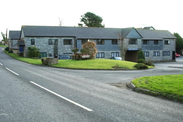
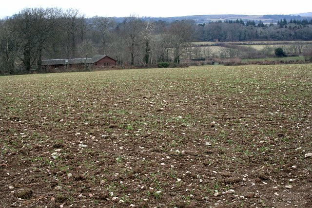
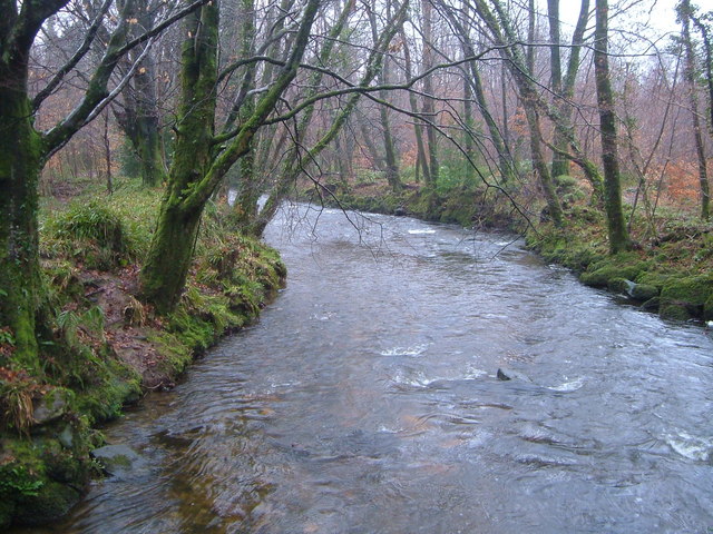
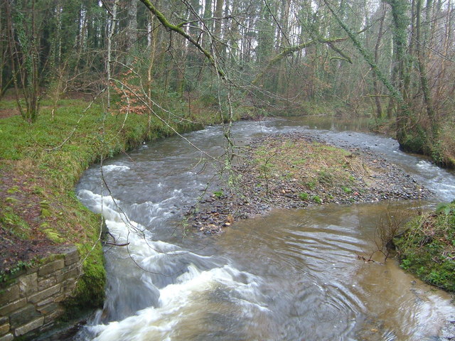
Collaford Wood is a beautiful woodland located in Devon, England. Covering an area of around 50 hectares, it is situated near the village of Harford, within the Dartmoor National Park. The wood is easily accessible, located just off the B3212 road, making it a popular destination for nature enthusiasts and locals alike.

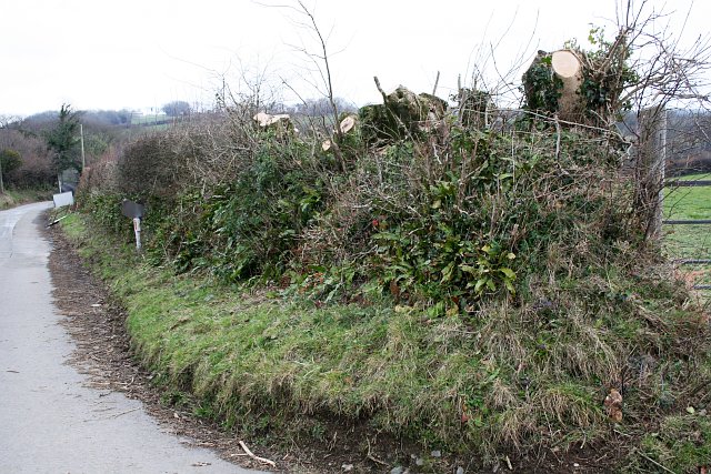
The wood is predominantly composed of mixed broadleaf trees, including oak, beech, and birch, creating a diverse and vibrant ecosystem. The dense canopy provides a haven for a variety of wildlife, including birds, small mammals, and insects. Visitors to Collaford Wood can enjoy peaceful walks along the well-maintained footpaths that wind through the woodland, providing ample opportunities for birdwatching and wildlife spotting.

In addition to its natural beauty, Collaford Wood also has historical significance. The wood was once part of a medieval deer park, and remnants of the park's boundary can still be seen today. There are also traces of ancient field systems, serving as a reminder of the area's agricultural history.

The wood is managed by the Dartmoor National Park Authority, which ensures the conservation of the woodland and its habitats. A small car park is available for visitors, as well as picnic areas for those looking to enjoy a leisurely lunch surrounded by nature.

Overall, Collaford Wood is a picturesque and tranquil location that offers both natural beauty and historical interest. Whether for a peaceful walk, wildlife observation, or a family picnic, this woodland is a perfect destination for nature lovers.

If you have any feedback on the listing, please let us know in the comments section below.

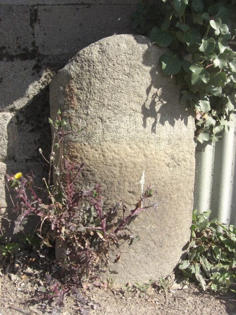
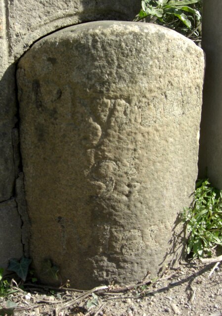
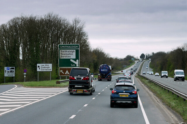
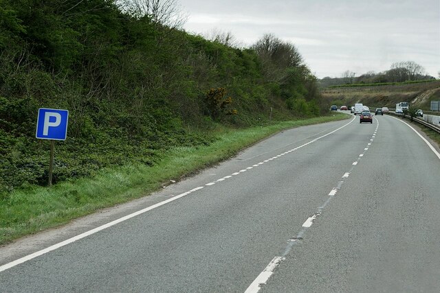
Collaford Wood Images

Images are sourced within 2km of 50.379911/-3.9932193 or Grid Reference SX5855. Thanks to Geograph Open Source API. All images are credited.

Old Boundary Marker on the former A38 in Lee Mill, Sparkwell parish Parish Boundary Marker in Lee Mill against the east end of the north parapet of Leemill Bridge, River Yealm. The inscription of ERMINGTON has been filled with concrete, perhaps in World War 2. One of a pair of markers at each end of the bridge. In Ermington parish until 1966 when it became part of Sparkwell parish.

Milestone Society National ID: DV_PLEX08bpb
Old Boundary Marker on the former A38 in Lee Mill, Sparkwell parish
Parish Boundary Marker in Lee Mill against the east end of the north parapet of Leemill Bridge, River Yealm. The inscription of ERMINGTON has been filled with concrete, perhaps in World War 2. One of a pair of markers at each end of the bridge. In Ermington parish until 1966 when it became part of Sparkwell parish. Milestone Society National ID: DV_PLEX08bpb
Old Boundary Marker on the former A38 in Lee Mill, Sparkwell parish Parish Boundary Marker against the west end of the north parapet of Leemill Bridge, River Yealm. The inscription of PLYMPTON / ST / MARY has been filled with concrete, perhaps in World War 2. One of a pair of markers at each end of the bridge. In Plympton St Mary parish until 1966 when it was renamed Sparkwell parish.

Milestone Society National ID: DV_PLEX08apb
Old Boundary Marker on the former A38 in Lee Mill, Sparkwell parish
Parish Boundary Marker against the west end of the north parapet of Leemill Bridge, River Yealm. The inscription of PLYMPTON / ST / MARY has been filled with concrete, perhaps in World War 2. One of a pair of markers at each end of the bridge. In Plympton St Mary parish until 1966 when it was renamed Sparkwell parish. Milestone Society National ID: DV_PLEX08apb
Devon Expressway, Lee Mill The A38 is a major A-class trunk route. When first designated in 1922, it ran from Derby to Plymouth but it was later extended at both ends so that it now runs for 292 miles from Mansfield in Nottinghamshire to Bodmin in Cornwall.

Prior to the opening of the M5 motorway in the 1960s and 1970s, the A38 formed the main "holiday route" from the Midlands to Somerset, Devon and Cornwall and the south-western section was notorious at holiday times for the congestion. Nowadays, for most of the southern section, the A38 is a fairly quiet road shadowing the M5 extremely closely; often running alongside the motorway as a single carriageway road. The section between Exeter and Plymouth is, however, a busy dual carriageway which serves as the southern extension of the M5 and is known as “the Devon Expressway”.

More information at <span class="nowrap"><a title="http://en.wikipedia.org/wiki/A38_road" rel="nofollow ugc noopener" href="http://en.wikipedia.org/wiki/A38_road">Link</a><img style="margin-left:2px;" alt="External link" title="External link - shift click to open in new window" src="https://s1.geograph.org.uk/img/external.png" width="10" height="10"/></span>  (Wikipedia) and <span class="nowrap"><a title="http://www.sabre-roads.org.uk/wiki/index.php?title=A38" rel="nofollow ugc noopener" href="http://www.sabre-roads.org.uk/wiki/index.php?title=A38">Link</a><img style="margin-left:2px;" alt="External link" title="External link - shift click to open in new window" src="https://s1.geograph.org.uk/img/external.png" width="10" height="10"/></span>  (SABRE).
Devon Expressway, Lee Mill
The A38 is a major A-class trunk route. When first designated in 1922, it ran from Derby to Plymouth but it was later extended at both ends so that it now runs for 292 miles from Mansfield in Nottinghamshire to Bodmin in Cornwall. Prior to the opening of the M5 motorway in the 1960s and 1970s, the A38 formed the main "holiday route" from the Midlands to Somerset, Devon and Cornwall and the south-western section was notorious at holiday times for the congestion. Nowadays, for most of the southern section, the A38 is a fairly quiet road shadowing the M5 extremely closely; often running alongside the motorway as a single carriageway road. The section between Exeter and Plymouth is, however, a busy dual carriageway which serves as the southern extension of the M5 and is known as “the Devon Expressway”. More information at LinkExternal link (Wikipedia) and LinkExternal link (SABRE).
A38 Devon Expressway near Lee Mill The A38 is a major A-class trunk route. When first designated in 1922, it ran from Derby to Plymouth but it was later extended at both ends so that it now runs for 292 miles from Mansfield in Nottinghamshire to Bodmin in Cornwall.

Prior to the opening of the M5 motorway in the 1960s and 1970s, the A38 formed the main "holiday route" from the Midlands to Somerset, Devon and Cornwall and the south-western section was notorious at holiday times for the congestion. Nowadays, for most of the southern section, the A38 is a fairly quiet road shadowing the M5 extremely closely; often running alongside the motorway as a single carriageway road. The section between Exeter and Plymouth is, however, a busy dual carriageway which serves as the southern extension of the M5 and is known as “the Devon Expressway”.

More information at <span class="nowrap"><a title="http://en.wikipedia.org/wiki/A38_road" rel="nofollow ugc noopener" href="http://en.wikipedia.org/wiki/A38_road">Link</a><img style="margin-left:2px;" alt="External link" title="External link - shift click to open in new window" src="https://s1.geograph.org.uk/img/external.png" width="10" height="10"/></span>  (Wikipedia) and <span class="nowrap"><a title="http://www.sabre-roads.org.uk/wiki/index.php?title=A38" rel="nofollow ugc noopener" href="http://www.sabre-roads.org.uk/wiki/index.php?title=A38">Link</a><img style="margin-left:2px;" alt="External link" title="External link - shift click to open in new window" src="https://s1.geograph.org.uk/img/external.png" width="10" height="10"/></span>  (SABRE).
A38 Devon Expressway near Lee Mill
The A38 is a major A-class trunk route. When first designated in 1922, it ran from Derby to Plymouth but it was later extended at both ends so that it now runs for 292 miles from Mansfield in Nottinghamshire to Bodmin in Cornwall. Prior to the opening of the M5 motorway in the 1960s and 1970s, the A38 formed the main "holiday route" from the Midlands to Somerset, Devon and Cornwall and the south-western section was notorious at holiday times for the congestion. Nowadays, for most of the southern section, the A38 is a fairly quiet road shadowing the M5 extremely closely; often running alongside the motorway as a single carriageway road. The section between Exeter and Plymouth is, however, a busy dual carriageway which serves as the southern extension of the M5 and is known as “the Devon Expressway”. More information at LinkExternal link (Wikipedia) and LinkExternal link (SABRE).
Layby on the Devon Expressway at Smithaleigh The A38 is a major A-class trunk route. When first designated in 1922, it ran from Derby to Plymouth but it was later extended at both ends so that it now runs for 292 miles from Mansfield in Nottinghamshire to Bodmin in Cornwall.

Prior to the opening of the M5 motorway in the 1960s and 1970s, the A38 formed the main "holiday route" from the Midlands to Somerset, Devon and Cornwall and the south-western section was notorious at holiday times for the congestion. Nowadays, for most of the southern section, the A38 is a fairly quiet road shadowing the M5 extremely closely; often running alongside the motorway as a single carriageway road. The section between Exeter and Plymouth is, however, a busy dual carriageway which serves as the southern extension of the M5 and is known as “the Devon Expressway”.

More information at <span class="nowrap"><a title="http://en.wikipedia.org/wiki/A38_road" rel="nofollow ugc noopener" href="http://en.wikipedia.org/wiki/A38_road">Link</a><img style="margin-left:2px;" alt="External link" title="External link - shift click to open in new window" src="https://s1.geograph.org.uk/img/external.png" width="10" height="10"/></span>  (Wikipedia) and <span class="nowrap"><a title="http://www.sabre-roads.org.uk/wiki/index.php?title=A38" rel="nofollow ugc noopener" href="http://www.sabre-roads.org.uk/wiki/index.php?title=A38">Link</a><img style="margin-left:2px;" alt="External link" title="External link - shift click to open in new window" src="https://s1.geograph.org.uk/img/external.png" width="10" height="10"/></span>  (SABRE).
Layby on the Devon Expressway at Smithaleigh
The A38 is a major A-class trunk route. When first designated in 1922, it ran from Derby to Plymouth but it was later extended at both ends so that it now runs for 292 miles from Mansfield in Nottinghamshire to Bodmin in Cornwall. Prior to the opening of the M5 motorway in the 1960s and 1970s, the A38 formed the main "holiday route" from the Midlands to Somerset, Devon and Cornwall and the south-western section was notorious at holiday times for the congestion. Nowadays, for most of the southern section, the A38 is a fairly quiet road shadowing the M5 extremely closely; often running alongside the motorway as a single carriageway road. The section between Exeter and Plymouth is, however, a busy dual carriageway which serves as the southern extension of the M5 and is known as “the Devon Expressway”. More information at LinkExternal link (Wikipedia) and LinkExternal link (SABRE).
Devon Expressway (A38) between Voss Park and Deep Lane Junctions The A38 is a major A-class trunk route. When first designated in 1922, it ran from Derby to Plymouth but it was later extended at both ends so that it now runs for 292 miles from Mansfield in Nottinghamshire to Bodmin in Cornwall.

Prior to the opening of the M5 motorway in the 1960s and 1970s, the A38 formed the main "holiday route" from the Midlands to Somerset, Devon and Cornwall and the south-western section was notorious at holiday times for the congestion. Nowadays, for most of the southern section, the A38 is a fairly quiet road shadowing the M5 extremely closely; often running alongside the motorway as a single carriageway road. The section between Exeter and Plymouth is, however, a busy dual carriageway which serves as the southern extension of the M5 and is known as “the Devon Expressway”.

More information at <span class="nowrap"><a title="http://en.wikipedia.org/wiki/A38_road" rel="nofollow ugc noopener" href="http://en.wikipedia.org/wiki/A38_road">Link</a><img style="margin-left:2px;" alt="External link" title="External link - shift click to open in new window" src="https://s1.geograph.org.uk/img/external.png" width="10" height="10"/></span>  (Wikipedia) and <span class="nowrap"><a title="http://www.sabre-roads.org.uk/wiki/index.php?title=A38" rel="nofollow ugc noopener" href="http://www.sabre-roads.org.uk/wiki/index.php?title=A38">Link</a><img style="margin-left:2px;" alt="External link" title="External link - shift click to open in new window" src="https://s1.geograph.org.uk/img/external.png" width="10" height="10"/></span>  (SABRE).
Devon Expressway (A38) between Voss Park and Deep Lane Junctions
The A38 is a major A-class trunk route. When first designated in 1922, it ran from Derby to Plymouth but it was later extended at both ends so that it now runs for 292 miles from Mansfield in Nottinghamshire to Bodmin in Cornwall. Prior to the opening of the M5 motorway in the 1960s and 1970s, the A38 formed the main "holiday route" from the Midlands to Somerset, Devon and Cornwall and the south-western section was notorious at holiday times for the congestion. Nowadays, for most of the southern section, the A38 is a fairly quiet road shadowing the M5 extremely closely; often running alongside the motorway as a single carriageway road. The section between Exeter and Plymouth is, however, a busy dual carriageway which serves as the southern extension of the M5 and is known as “the Devon Expressway”. More information at LinkExternal link (Wikipedia) and LinkExternal link (SABRE).
Devon Expressway, Deep Lane Junction The A38 is a major A-class trunk route. When first designated in 1922, it ran from Derby to Plymouth but it was later extended at both ends so that it now runs for 292 miles from Mansfield in Nottinghamshire to Bodmin in Cornwall.

Prior to the opening of the M5 motorway in the 1960s and 1970s, the A38 formed the main "holiday route" from the Midlands to Somerset, Devon and Cornwall and the south-western section was notorious at holiday times for the congestion. Nowadays, for most of the southern section, the A38 is a fairly quiet road shadowing the M5 extremely closely; often running alongside the motorway as a single carriageway road. The section between Exeter and Plymouth is, however, a busy dual carriageway which serves as the southern extension of the M5 and is known as “the Devon Expressway”.

More information at <span class="nowrap"><a title="http://en.wikipedia.org/wiki/A38_road" rel="nofollow ugc noopener" href="http://en.wikipedia.org/wiki/A38_road">Link</a><img style="margin-left:2px;" alt="External link" title="External link - shift click to open in new window" src="https://s1.geograph.org.uk/img/external.png" width="10" height="10"/></span>  (Wikipedia) and <span class="nowrap"><a title="http://www.sabre-roads.org.uk/wiki/index.php?title=A38" rel="nofollow ugc noopener" href="http://www.sabre-roads.org.uk/wiki/index.php?title=A38">Link</a><img style="margin-left:2px;" alt="External link" title="External link - shift click to open in new window" src="https://s1.geograph.org.uk/img/external.png" width="10" height="10"/></span>  (SABRE).
Devon Expressway, Deep Lane Junction
The A38 is a major A-class trunk route. When first designated in 1922, it ran from Derby to Plymouth but it was later extended at both ends so that it now runs for 292 miles from Mansfield in Nottinghamshire to Bodmin in Cornwall. Prior to the opening of the M5 motorway in the 1960s and 1970s, the A38 formed the main "holiday route" from the Midlands to Somerset, Devon and Cornwall and the south-western section was notorious at holiday times for the congestion. Nowadays, for most of the southern section, the A38 is a fairly quiet road shadowing the M5 extremely closely; often running alongside the motorway as a single carriageway road. The section between Exeter and Plymouth is, however, a busy dual carriageway which serves as the southern extension of the M5 and is known as “the Devon Expressway”. More information at LinkExternal link (Wikipedia) and LinkExternal link (SABRE).
Lyneham Inn, near Plympton Once occupying a busy location on the 'old' main A38(seen), the inn is now bypassed by the "A38 Devon Expressway", which passes approximately a 100 yards over to the south (righthand side).
Lyneham Inn, near Plympton
Once occupying a busy location on the 'old' main A38(seen), the inn is now bypassed by the "A38 Devon Expressway", which passes approximately a 100 yards over to the south (righthand side).
Little Chef, Smithaleigh The Little Chef at Smithaleigh, Devon, just off the A38 Plymouth bound carriageway.
Little Chef, Smithaleigh
The Little Chef at Smithaleigh, Devon, just off the A38 Plymouth bound carriageway.
Challonsleigh Farm Waste Recycling Centre The entrance to Challonsleigh Farm Waste Recycling Centre and Transfer Station at Smithaleigh, Devon. The cars on the left of the picture behind the crash barrier are travelling on the A38 towards Ivybridge.
Challonsleigh Farm Waste Recycling Centre
The entrance to Challonsleigh Farm Waste Recycling Centre and Transfer Station at Smithaleigh, Devon. The cars on the left of the picture behind the crash barrier are travelling on the A38 towards Ivybridge.
The New Country Inn, Smithaleigh The New Country Inn, Smithaleigh, Devon, lies on the route of the old A38. The current A38 now bypasses it to the north.
The New Country Inn, Smithaleigh
The New Country Inn, Smithaleigh, Devon, lies on the route of the old A38. The current A38 now bypasses it to the north.
Taming the Hedge This hedgerow at Langage Cross had been allowed to grow out into small trees.
Taming the Hedge
This hedgerow at Langage Cross had been allowed to grow out into small trees.
Newly Planted Field Looking towards Shipland Cottage.  The Ordnance Survey 1:25,000 map shows this field as woodland!
Newly Planted Field
Looking towards Shipland Cottage. The Ordnance Survey 1:25,000 map shows this field as woodland!
Under the Railway Line The bridge over this minor road carries the mainline railway.  The warning sign says the road is liable to flooding.
Under the Railway Line
The bridge over this minor road carries the mainline railway. The warning sign says the road is liable to flooding.
River Yealm from Popple's Bridge Looking south downstream. The Yealm drops steadily here in its wooded valley between low hills.
River Yealm from Popple's Bridge
Looking south downstream. The Yealm drops steadily here in its wooded valley between low hills.
River Yealm from Lotherton Bridge The Yealm cutting away at both banks as it reaches Lotherton Bridge. Photo taken from the bridge looking upstream (north).
River Yealm from Lotherton Bridge
The Yealm cutting away at both banks as it reaches Lotherton Bridge. Photo taken from the bridge looking upstream (north).
Lyneham House A fine house in a lovely setting
Lyneham House
A fine house in a lovely setting
Grazealders The valley beyond the farmhouse is of Ridgecot Lake, a tributary of the Yealm. The field is shown as woodland on the 1:25000 sheet - but not on other scales.
Grazealders
The valley beyond the farmhouse is of Ridgecot Lake, a tributary of the Yealm. The field is shown as woodland on the 1:25000 sheet - but not on other scales.
Show me another place!

Collaford Wood is located at Grid Ref: SX5855 (Lat: 50.379911, Lng: -3.9932193)

Administrative County: Devon

District: South Hams

Police Authority: Devon and Cornwall

What 3 Words

///deferring.like.widgets. Near Yealmpton, Devon

Nearby Locations

Smithaleigh Collaford Wood

Related Wikis

Langage Power Station

Langage Power Station is a combined-cycle power plant near the city of Plymouth in Devon, England. Centrica, the original owners of the site, announced...

South West Devon (UK Parliament constituency)

South West Devon is a constituency represented in the House of Commons of the UK Parliament since 1997 by Sir Gary Streeter, a Conservative. == Boundaries... ==

Wasteberry Camp

Wasteberry Camp is an Iron Age hill fort situated close to the hamlet of Blackpool, southeast of Plympton, Devon, England. The fort is situated on a hilltop...

Sparkwell

Sparkwell is a small village and civil parish in the South Hams district of Devon. Historically it was part of Haytor Hundred.Its local Anglican church...

Stamford Fort

Stamford Fort is a 19th-century fort, built as a result of the Royal Commission on National Defence of 1859. Part of an extensive scheme known as Palmerston...

Dartmoor Zoological Park

Dartmoor Zoological Park (originally Dartmoor Wildlife Park) is a 30-acre (12 ha) zoo just north of the village of Sparkwell, on the south-west edge of...

Ivybridge Priory

Ivybridge Priory or St. Austin's Priory was a monastic house in Devon, England. From 1932 it was a priory of the Order of Augustinian Recollects. They...

Yondertown

Yondertown is a mining hamlet located in an Area of Great Landscape Value on the edge of Dartmoor National Park in the English county of Devon. The community...

Nearby Amenities

Located within 500m of 50.379911,-3.9932193
Parking
Rest Area
Parking: layby
Toilets: no
Lat/Long: 50.3828178/-3.9889544
Power: pole
Lat/Long: 50.3762913/-3.9950404
Power: pole
Lat/Long: 50.3792727/-3.987101
Power: pole
Lat/Long: 50.3791034/-3.9882329
Power: pole
Lat/Long: 50.3788793/-3.9900622
Power: pole
Lat/Long: 50.3786792/-3.991642
Power: pole
Lat/Long: 50.3784585/-3.9933586
Power: pole
Lat/Long: 50.3782858/-3.9945978
Material: wood
Power: pole
Lat/Long: 50.3823942/-3.9988169
Material: wood
Power: pole
Lat/Long: 50.3825036/-3.9979747
Material: wood
Power: pole
Lat/Long: 50.3827174/-3.9967033
Material: wood
Power: pole
Lat/Long: 50.3829586/-3.9951852
Material: wood
Power: pole
Lat/Long: 50.3831689/-3.9938951
Material: wood
Power: pole
Lat/Long: 50.3833674/-3.9923474
Material: wood
Power: pole
Lat/Long: 50.3834118/-3.9913362
Power: pole
Lat/Long: 50.3810293/-3.9975026
Power: pole
Lat/Long: 50.3802357/-3.9975375
Power: pole
Lat/Long: 50.3793223/-3.9976072
Power: pole
Lat/Long: 50.3780993/-3.9974088
Power: pole
Lat/Long: 50.3779984/-3.9979613
Power: pole
Lat/Long: 50.3776563/-3.9983743
The data included in this document is from www.openstreetmap.org. The data is made available under ODbL.

Have you been to Collaford Wood?

Leave your review of Collaford Wood below (or comments, questions and feedback).