Hill Plantation

Wood, Forest in Devon West Devon

England

Hill Plantation

Old circular AA sign on the former B3217 in Monkokehampton Old AA Sign located on the wall of an old workshop, now a cottage called The Old Forge, on the east side of the former B3217 in Monkokehampton, 8 miles north of Okehampton. Monkokehampton parish.

This is the Circular, village name on black band, no Motor Union symbol or name type, dating from 1923, showing distances Okehampton 7½ Iddesleigh 2¼ London 196. Removed some time between July 2014 and August 2022.

There were five series of AA signs, mostly dating from 1923 and made by Francis & Co / Franco in Deptford, London. The village name and distance to London or Dublin were normally displayed.

See also <span class="nowrap"><a title="https://www.flickr.com/photos/livesurfcams/14394800250" rel="nofollow ugc noopener" href="https://www.flickr.com/photos/livesurfcams/14394800250">Link</a><img style="margin-left:2px;" alt="External link" title="External link - shift click to open in new window" src="https://s1.geograph.org.uk/img/external.png" width="10" height="10"/></span> , <span class="nowrap"><a title="https://www.flickr.com/photos/bumbishop/5656595" rel="nofollow ugc noopener" href="https://www.flickr.com/photos/bumbishop/5656595">Link</a><img style="margin-left:2px;" alt="External link" title="External link - shift click to open in new window" src="https://s1.geograph.org.uk/img/external.png" width="10" height="10"/></span> and <span class="nowrap"><a title="https://www.flickr.com/photos/bridgemarkertim/3966823734" rel="nofollow ugc noopener" href="https://www.flickr.com/photos/bridgemarkertim/3966823734">Link</a><img style="margin-left:2px;" alt="External link" title="External link - shift click to open in new window" src="https://s1.geograph.org.uk/img/external.png" width="10" height="10"/></span>.

Milestone Society National ID: DV-MONKO
Old circular AA sign on the former B3217 in Monkokehampton Credit: A Rosevear

Hill Plantation is a picturesque woodland located in the county of Devon, England. Situated near the town of Newton Abbot, the plantation covers an expansive area of lush greenery and is known for its diverse range of plant and animal species.

The plantation is predominantly made up of tall, majestic trees such as oak, beech, and ash, creating a dense and enchanting forest. These trees provide a haven for a variety of wildlife, including squirrels, foxes, and an array of bird species. The tranquil atmosphere and abundance of natural resources make Hill Plantation a popular destination for nature enthusiasts and birdwatchers.

Trails wind their way through the woodland, allowing visitors to explore the plantation's beauty at their own pace. The trails offer stunning views of the surrounding countryside and provide an opportunity to immerse oneself in the peacefulness of nature. Additionally, the plantation is equipped with benches and picnic areas, offering visitors the chance to relax and enjoy a meal amidst the serene surroundings.

Hill Plantation is also home to a small pond, which further enhances the biodiversity of the area. The pond serves as a habitat for various amphibians, insects, and water-dwelling creatures, adding to the plantation's ecological significance.

Overall, Hill Plantation in Devon is a captivating woodland that showcases the natural beauty of the region. With its diverse flora and fauna, scenic trails, and peaceful ambiance, it offers a perfect escape from the bustle of everyday life, allowing visitors to connect with nature and appreciate the wonders of the great outdoors.

If you have any feedback on the listing, please let us know in the comments section below.

Hill Plantation Images

Images are sourced within 2km of 50.843629/-4.0140575 or Grid Reference SS5806. Thanks to Geograph Open Source API. All images are credited.

Old circular AA sign on the former B3217 in Monkokehampton Old AA Sign located on the wall of an old workshop, now a cottage called The Old Forge, on the east side of the former B3217 in Monkokehampton, 8 miles north of Okehampton. Monkokehampton parish.

This is the Circular, village name on black band, no Motor Union symbol or name type, dating from 1923, showing distances Okehampton 7½ Iddesleigh 2¼ London 196. Removed some time between July 2014 and August 2022.

There were five series of AA signs, mostly dating from 1923 and made by Francis & Co / Franco in Deptford, London. The village name and distance to London or Dublin were normally displayed.

See also <span class="nowrap"><a title="https://www.flickr.com/photos/livesurfcams/14394800250" rel="nofollow ugc noopener" href="https://www.flickr.com/photos/livesurfcams/14394800250">Link</a><img style="margin-left:2px;" alt="External link" title="External link - shift click to open in new window" src="https://s1.geograph.org.uk/img/external.png" width="10" height="10"/></span> , <span class="nowrap"><a title="https://www.flickr.com/photos/bumbishop/5656595" rel="nofollow ugc noopener" href="https://www.flickr.com/photos/bumbishop/5656595">Link</a><img style="margin-left:2px;" alt="External link" title="External link - shift click to open in new window" src="https://s1.geograph.org.uk/img/external.png" width="10" height="10"/></span> and <span class="nowrap"><a title="https://www.flickr.com/photos/bridgemarkertim/3966823734" rel="nofollow ugc noopener" href="https://www.flickr.com/photos/bridgemarkertim/3966823734">Link</a><img style="margin-left:2px;" alt="External link" title="External link - shift click to open in new window" src="https://s1.geograph.org.uk/img/external.png" width="10" height="10"/></span>.

Milestone Society National ID: DV-MONKO
Old circular AA sign on the former B3217 in Monkokehampton
Old AA Sign located on the wall of an old workshop, now a cottage called The Old Forge, on the east side of the former B3217 in Monkokehampton, 8 miles north of Okehampton. Monkokehampton parish. This is the Circular, village name on black band, no Motor Union symbol or name type, dating from 1923, showing distances Okehampton 7½ Iddesleigh 2¼ London 196. Removed some time between July 2014 and August 2022. There were five series of AA signs, mostly dating from 1923 and made by Francis & Co / Franco in Deptford, London. The village name and distance to London or Dublin were normally displayed. See also LinkExternal link , LinkExternal link and LinkExternal link. Milestone Society National ID: DV-MONKO
Monkokehampton Mill The last working water-powered corn mill in Devon, heritage and preserved mills aside. Built in the late 19th century, it stands by a leat from the Okement and was originally powered by two small overshot waterwheels. One survives in working order today.
Monkokehampton Mill
The last working water-powered corn mill in Devon, heritage and preserved mills aside. Built in the late 19th century, it stands by a leat from the Okement and was originally powered by two small overshot waterwheels. One survives in working order today.
St James' Church, Iddesleigh
Broadwoodkelly: south to Dartmoor Farmland and woodland seen from the Monkokehampton-Winkleigh road, near Mount Pleasant. In the distance the Dartmoor range. The rounded height on the left is Cosdon Hill, spot height 550m
Broadwoodkelly: south to Dartmoor
Farmland and woodland seen from the Monkokehampton-Winkleigh road, near Mount Pleasant. In the distance the Dartmoor range. The rounded height on the left is Cosdon Hill, spot height 550m
Iddesleigh: towards Dartmoor Looking south from the track and public right of way between Iddesleigh village and the farm at Eastpark. The most easterly of the Dartmoor range here is Cosdon, the rounded height on the left
Iddesleigh: towards Dartmoor
Looking south from the track and public right of way between Iddesleigh village and the farm at Eastpark. The most easterly of the Dartmoor range here is Cosdon, the rounded height on the left
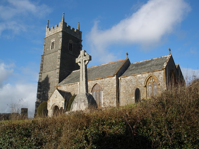
Iddesleigh: St James’ Church The west tower of the 15th century structure stands on a raised churchyard
Iddesleigh: St James’ Church
The west tower of the 15th century structure stands on a raised churchyard
Field beside the Okement A field of oats occupying the Okement flood plain, seen from New Bridge, Monkokehampton. The river is behind the trees on the right.
Field beside the Okement
A field of oats occupying the Okement flood plain, seen from New Bridge, Monkokehampton. The river is behind the trees on the right.
Tarka Trail The long-distance footpath just after turning off the lane south of Iddesleigh alongside a stream near Devon Lodge.
Tarka Trail
The long-distance footpath just after turning off the lane south of Iddesleigh alongside a stream near Devon Lodge.
Iddesleigh Waste Water Treatment Works A small sewage plant beside the B3217 at Pixton Cross. The view behind is down the shallow valley followed briefly by <a href="https://www.geograph.org.uk/photo/465258">SS5607 : Tarka Trail</a>.
Iddesleigh Waste Water Treatment Works
A small sewage plant beside the B3217 at Pixton Cross. The view behind is down the shallow valley followed briefly by SS5607 : Tarka Trail.
Iddesleigh Footpath 10 The footpath just after a footbridge over a little stream, near the start of a very shady stretch climbing to the lane at Pixton.
Iddesleigh Footpath 10
The footpath just after a footbridge over a little stream, near the start of a very shady stretch climbing to the lane at Pixton.
View near Barwick Looking across a shallow valley from a gateway on the lane between Pixton and Barwick. The further part of the view is in SS5908.
View near Barwick
Looking across a shallow valley from a gateway on the lane between Pixton and Barwick. The further part of the view is in SS5908.
Field of barley near Barwick A promising crop in the evening sun, seen from the stile by which Iddesleigh Footpath 3 leaves the lane from Barwick to Loosedon Cross. The small valley ahead on the left can be seen in <a href="https://www.geograph.org.uk/photo/465274">SS5907 : View near Barwick</a>.
Field of barley near Barwick
A promising crop in the evening sun, seen from the stile by which Iddesleigh Footpath 3 leaves the lane from Barwick to Loosedon Cross. The small valley ahead on the left can be seen in SS5907 : View near Barwick.
Lane from New Bridge The parapet of the bridge is in the foreground. The lane climbs away from the Okement floodplain towards Hatherleigh. Evening sun and shadows on the fields.
Lane from New Bridge
The parapet of the bridge is in the foreground. The lane climbs away from the Okement floodplain towards Hatherleigh. Evening sun and shadows on the fields.
From Iddesleigh Bridge Taken from the bridge over the River Okement, looking across a laneside meadow towards Mill Farm (which is in <a href="https://www.geograph.org.uk/gridref/SS5606">SS5606</a>). The lane goes to Weekmore Cross on its way to Iddesleigh.
From Iddesleigh Bridge
Taken from the bridge over the River Okement, looking across a laneside meadow towards Mill Farm (which is in SS5606). The lane goes to Weekmore Cross on its way to Iddesleigh.
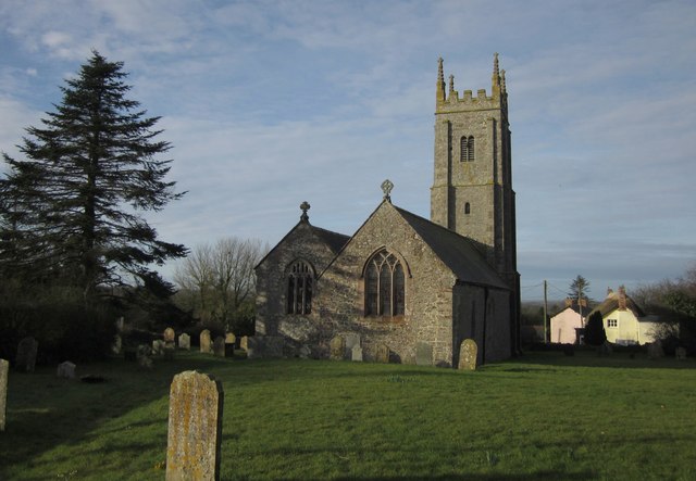
Cross in Iddesleigh churchyard A cross in the southeast corner of the churchyard, with the Old Smithy on the left. Behind is the valley of a tributary of the Torridge; the hill is climbed by the Tarka Trail which also runs along the lane in front of the Smithy.
Cross in Iddesleigh churchyard
A cross in the southeast corner of the churchyard, with the Old Smithy on the left. Behind is the valley of a tributary of the Torridge; the hill is climbed by the Tarka Trail which also runs along the lane in front of the Smithy.
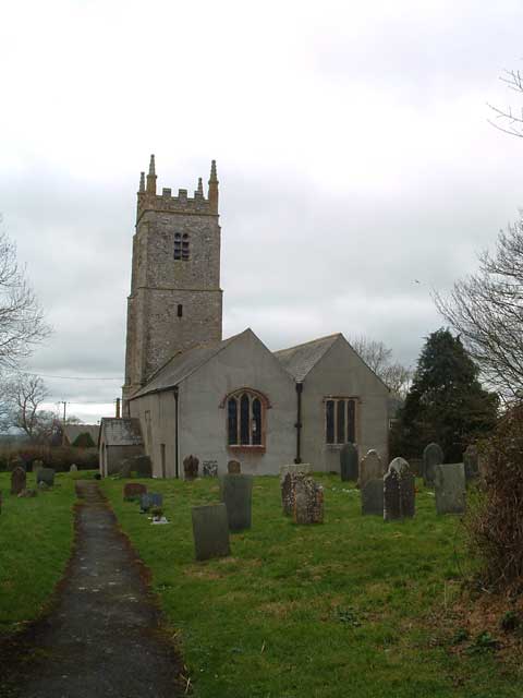
Iddesleigh church The battlemented west tower of <a href="https://www.geograph.org.uk/photo/118980">SS5608 : Iddesleigh: St James’ Church</a>, seen from the corner of the churchyard.
Iddesleigh church
The battlemented west tower of SS5608 : Iddesleigh: St James’ Church, seen from the corner of the churchyard.
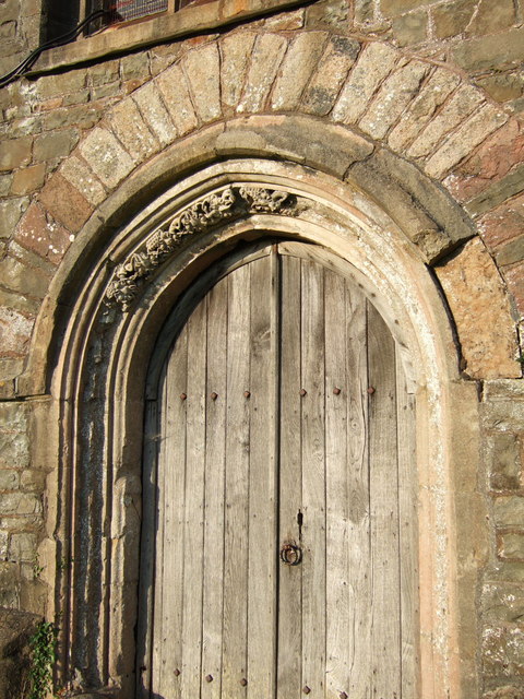
West doorway, Iddesleigh church This doorway at the foot of the tower seen in <a href="https://www.geograph.org.uk/photo/469322">SS5608 : Iddesleigh church</a> has only a small portion of its leaf decoration remaining.
West doorway, Iddesleigh church
This doorway at the foot of the tower seen in SS5608 : Iddesleigh church has only a small portion of its leaf decoration remaining.
Iddesleigh Cross The lane junction seen from the path at the edge of the churchyard. The main road is the B3217 which swings right around the raised churchyard here. The side lane goes to Iddesleigh Bridge.
Iddesleigh Cross
The lane junction seen from the path at the edge of the churchyard. The main road is the B3217 which swings right around the raised churchyard here. The side lane goes to Iddesleigh Bridge.
Show me another place!

Hill Plantation is located at Grid Ref: SS5806 (Lat: 50.843629, Lng: -4.0140575)

Administrative County: Devon

District: West Devon

Police Authority: Devon and Cornwall

What 3 Words

///timed.debit.eyelid. Near Hatherleigh, Devon

Related Wikis

Monkokehampton

Monkokehampton is a village and civil parish in West Devon, England. The village lies on the River Okement, about 3 miles (4.8 km) east-north-east of Hatherleigh...

Iddesleigh

Iddesleigh is a village and civil parish in the county of Devon, England. The settlement has ancient origins and is listed in the Domesday Book. The village...

Church of St James, Iddesleigh

St James' Church, Iddesleigh, is a church in the small village of Iddesleigh, Devon, England. It dates back to the 13th century, although most of the...

River Okement

The River Okement is a tributary of the River Torridge in Devon, England. It rises at two places in Dartmoor, as the West Okement and the East Okement...

Broadwoodkelly

Broadwoodkelly is a village and civil parish in the West Devon district of Devon, England. According to the 2001 census it had a population of 218. The...

Meeth

Meeth is a small village roughly 13.5 km (8.4 mi) north-northwest of Okehampton and 40.7 km (25.3 mi) west-northwest of Exeter. It lies to the west of...

Dowland, Devon

Dowland is a civil parish in Devon, situated near Winkleigh. It is also the name of a hamlet in the parish. == References ==

Meeth Halt railway station

Opened in 1925, Meeth Halt was a small railway station on the North Devon and Cornwall Junction Light Railway, a private line until it became part of the...

Have you been to Hill Plantation?

Leave your review of Hill Plantation below (or comments, questions and feedback).