Beckamoor Plantation

Wood, Forest in Devon West Devon

England

Beckamoor Plantation

Jacobstowe Looking east along the A3072 towards the village centre.
Jacobstowe Credit: Ron Strutt

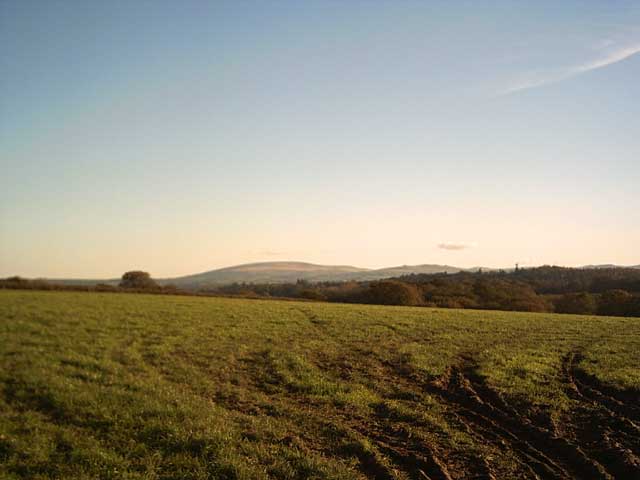
Beckamoor Plantation, located in Devon, England, is a picturesque woodland area renowned for its natural beauty and rich biodiversity. Spanning over hectares of land, this enchanting forest is a haven for nature enthusiasts, hikers, and wildlife lovers alike.

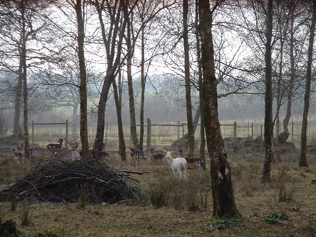
The woodland is characterized by its diverse range of trees, including oak, beech, and ash, which create a breathtaking canopy overhead. The forest floor is carpeted with a myriad of wildflowers, ferns, and mosses, adding to the visual appeal of the plantation. The interplay of light and shadows through the dense foliage creates a magical atmosphere, drawing visitors into a tranquil and serene world.

Beckamoor Plantation is home to a wide variety of wildlife species, making it a popular spot for birdwatchers and wildlife photographers. Visitors may catch glimpses of native birds such as woodpeckers, owls, and various songbirds, while lucky observers might even spot deer or foxes roaming amidst the trees.

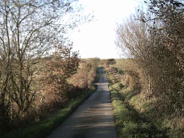
Several well-maintained trails wind through the plantation, allowing visitors to explore the forest at their own pace. These paths provide opportunities for hiking, jogging, or simply enjoying a leisurely stroll while immersing oneself in the wonders of nature. Signposts along the trails provide information about the different tree species and points of interest, enhancing the educational value of the plantation.

Beckamoor Plantation, with its serene ambiance and abundant natural treasures, offers a perfect retreat for those seeking solace in nature's embrace. Whether it's an escape from the bustling city life or a desire to connect with the wilderness, this enchanting woodland provides an unforgettable experience for all who venture into its depths.

If you have any feedback on the listing, please let us know in the comments section below.

Beckamoor Plantation Images

Images are sourced within 2km of 50.804653/-4.0305192 or Grid Reference SS5702. Thanks to Geograph Open Source API. All images are credited.

Jacobstowe Looking east along the A3072 towards the village centre.
Jacobstowe
Looking east along the A3072 towards the village centre.
Deer at Upcott
Deer at Upcott
St James' Church, Jacobstowe
Higher Cadham Farm Taken from the Tarka Trail
Higher Cadham Farm
Taken from the Tarka Trail
Terris Cross Taken on the Tarka Trail.
Terris Cross
Taken on the Tarka Trail.
Tarka Trail near Terris Upcott The road is starting to look like a proper track.
Tarka Trail near Terris Upcott
The road is starting to look like a proper track.
Farmland near  Upcott Taken from the Tarka Trail. Cosdon Hill in the distance.
Farmland near Upcott
Taken from the Tarka Trail. Cosdon Hill in the distance.
Farmland near Deckport Taken from the Tarka Trail. Cosdon Hill and Belstone Tor in the distance.
Farmland near Deckport
Taken from the Tarka Trail. Cosdon Hill and Belstone Tor in the distance.
Tarka Trail near Hatherleigh Moor
A386 on Langabeare Moor Lined with oaks, the main Okehampton-Hatherleigh road climbs slightly along a broad ridge between the Medland and Beckamoor Brook valleys.
A386 on Langabeare Moor
Lined with oaks, the main Okehampton-Hatherleigh road climbs slightly along a broad ridge between the Medland and Beckamoor Brook valleys.
Field near Langabeare Cottages Telltale signs of pipe-laying or similar activity across this field beside the A386.
Field near Langabeare Cottages
Telltale signs of pipe-laying or similar activity across this field beside the A386.
Farm road to Langabeare Barton The track pictured as it leaves the A386 and crosses a tributary of the River Lew immediately below its source (a yard or two to the left in the trees).
Farm road to Langabeare Barton
The track pictured as it leaves the A386 and crosses a tributary of the River Lew immediately below its source (a yard or two to the left in the trees).
Fields near Dunsland Farm Getamap shows the nearer field, a small rectangle beside the B3216, as wooded. The shallow valley occupied by the fields behind carries the Dunsland Brook towards the River Lew. Photo taken at the point where the B road enters the Beckamoor Plantation (to the left).
Fields near Dunsland Farm
Getamap shows the nearer field, a small rectangle beside the B3216, as wooded. The shallow valley occupied by the fields behind carries the Dunsland Brook towards the River Lew. Photo taken at the point where the B road enters the Beckamoor Plantation (to the left).
Field beside B3216 Trees separate the road from the field, beyond which is Cadham Moor. A gently curving line of trees (of which two can be seen) across the centre of the field marks the line of a drain.
Field beside B3216
Trees separate the road from the field, beyond which is Cadham Moor. A gently curving line of trees (of which two can be seen) across the centre of the field marks the line of a drain.
Pasture near Broomford Manor The view is south-west of the B3216 near Jacobstowe.
Pasture near Broomford Manor
The view is south-west of the B3216 near Jacobstowe.
Lane at Cadham
Lane at Cadham
Lane at Cadham
Lane at Cadham
Lane to Woodhall From the point where the lane, running between and lined with oaks on the left, is crossed by Exbourne Footpath 1.
Lane to Woodhall
From the point where the lane, running between and lined with oaks on the left, is crossed by Exbourne Footpath 1.
Show me another place!

Beckamoor Plantation is located at Grid Ref: SS5702 (Lat: 50.804653, Lng: -4.0305192)

Administrative County: Devon

District: West Devon

Police Authority: Devon and Cornwall

What 3 Words

///remembers.nicer.before. Near Hatherleigh, Devon

Related Wikis

West Okement River

The West Okement is a river in north Dartmoor in Devon in south-west England. It rises at West Okement Head near Cranmere Pool and flows in a generally...

Jacobstowe

Jacobstowe is a village and civil parish on the west bank of the River Okement, about 4 miles (6.4 km) north of Okehampton in the West Devon district of...

Hatherleigh

Hatherleigh is a small market town in west Devon, England. It hosts an arts festival in July, and a carnival in November featuring two flaming tar barrel...

Monkokehampton

Monkokehampton is a village and civil parish in West Devon, England. The village lies on the River Okement, about 3 miles (4.8 km) east-north-east of Hatherleigh...

Inwardleigh

Inwardleigh is a village and civil parish about 3 and a half miles north north west of Okehampton railway station, in the West Devon district, in the county...

Exbourne

Exbourne is a village and civil parish in the English county of Devon. The Anglo-Saxon origin of the name is gæces burn - Cuckoo Stream. It occupies a...

River Lew

The River Lew can refer to either of two short rivers that lie close to each other in Devon, England. The more northerly of the two rises just south of...

Folly Gate

Folly Gate is a village in the civil parish of Inwardleigh, in the West Devon district, in the county of Devon, England. It is situated near Okehampton...

Nearby Amenities

Located within 500m of 50.804653,-4.0305192
Power: pole
Lat/Long: 50.8072229/-4.0362364
Power: pole
Lat/Long: 50.8067788/-4.0349329
Power: pole
Lat/Long: 50.80665/-4.0334898
Power: pole
Lat/Long: 50.8065059/-4.0321916
Power: pole
Lat/Long: 50.8063805/-4.0309927
Power: pole
Lat/Long: 50.8062381/-4.0296838
Power: pole
Lat/Long: 50.8058008/-4.0257946
Power: pole
Lat/Long: 50.8056313/-4.0244561
The data included in this document is from www.openstreetmap.org. The data is made available under ODbL.

Have you been to Beckamoor Plantation?

Leave your review of Beckamoor Plantation below (or comments, questions and feedback).