Barnpark Plantation

Wood, Forest in Devon Torridge

England

Barnpark Plantation

Beaford Bridge A quiet bridge over the River Torridge.
Beaford Bridge Credit: Richard Knights

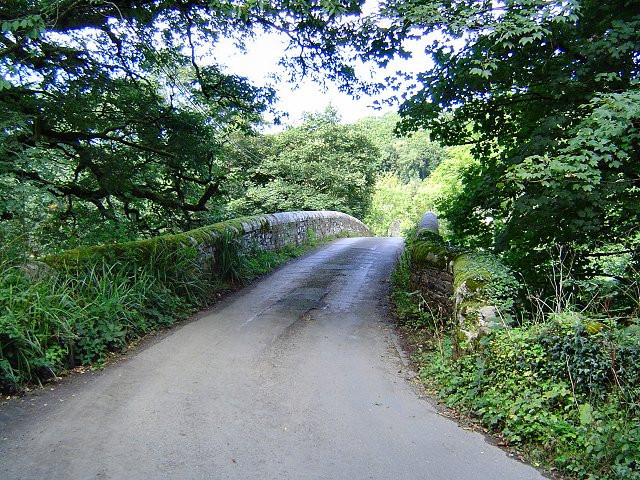
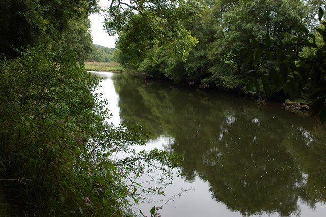
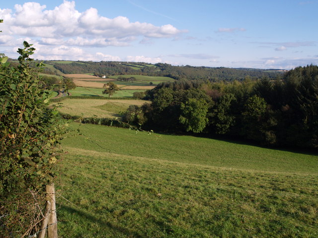
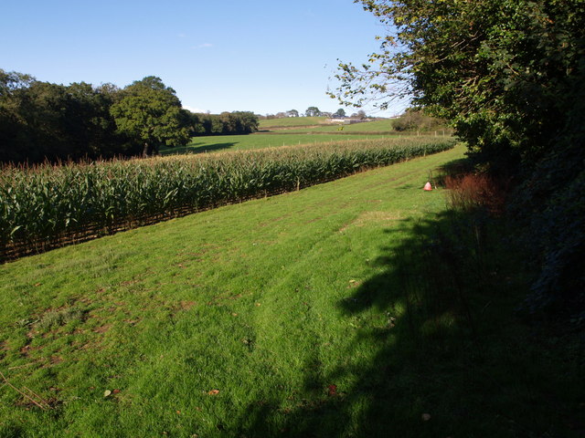
Barnpark Plantation is a picturesque woodland located in the county of Devon, England. Spread over several acres, this plantation is a haven for nature lovers and those seeking tranquility amidst the beauty of the countryside. The plantation is situated near the village of Barnpark, and it offers a stunning array of flora and fauna.

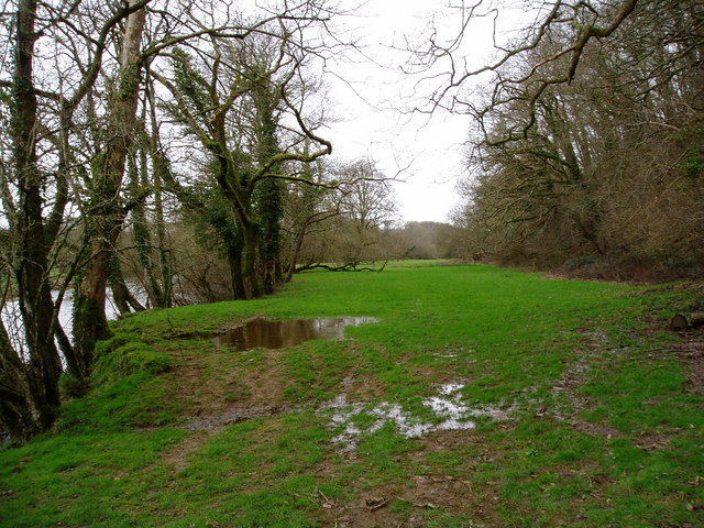
The woodland is predominantly composed of various species of trees, including oak, beech, and pine, creating a diverse and vibrant ecosystem. The trees form a dense canopy, providing shade and shelter for the numerous wildlife species that inhabit the area. Visitors can expect to encounter a wide variety of birds, small mammals, and insects while exploring the plantation.

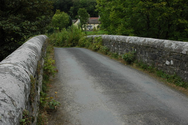
Barnpark Plantation is crisscrossed with well-maintained footpaths, making it an ideal spot for hiking and walking. The paths wind their way through the woodland, offering glimpses of scenic vistas and hidden nooks. There are also designated picnic areas and benches scattered throughout the plantation, providing opportunities for visitors to relax and soak in the natural surroundings.

The plantation is open to the public throughout the year, and admission is free. It is a popular destination for families, nature enthusiasts, and photographers, who are drawn to its natural beauty and the chance to capture stunning images of the woodland.

Overall, Barnpark Plantation is a true gem in the heart of Devon, offering visitors a chance to immerse themselves in the beauty of nature and experience the tranquility of a woodland environment.

If you have any feedback on the listing, please let us know in the comments section below.

Barnpark Plantation Images

Images are sourced within 2km of 50.901735/-4.057483 or Grid Reference SS5513. Thanks to Geograph Open Source API. All images are credited.

Beaford Bridge A quiet bridge over the River Torridge.
Beaford Bridge
A quiet bridge over the River Torridge.
Merton: cottage by Merton Mill Cross As the signpost states, the road on the left leads to Beaford – via Balls Corner and Beaford Mill, on the river Torridge
Merton: cottage by Merton Mill Cross
As the signpost states, the road on the left leads to Beaford – via Balls Corner and Beaford Mill, on the river Torridge
View across the Torridge from Halsdon View across the Torridge from Halsdon (Devon Wildlife Trust reserve) showing a hide on the far bank.
View across the Torridge from Halsdon
View across the Torridge from Halsdon (Devon Wildlife Trust reserve) showing a hide on the far bank.
View of the Torridge from Halsdon View of the Torridge valley from Halsdon (Devon Wildlife Trust reserve).
View of the Torridge from Halsdon
View of the Torridge valley from Halsdon (Devon Wildlife Trust reserve).
Footbridge and ford at Addisford A ford and footbridge give access to the farm track to Addisford. The stream is heading (to the left) for the Torridge. The scene is beside West Lane, from Dolton to Stony Bridge.
Footbridge and ford at Addisford
A ford and footbridge give access to the farm track to Addisford. The stream is heading (to the left) for the Torridge. The scene is beside West Lane, from Dolton to Stony Bridge.
Woodridge Cross A crossing point of winding lanes up a wooded side valley of the Torridge.  In the background is the parapet of Stony Bridge, across the tributary. At first glance, one might wonder whether this postbox gets any usage at all, as no houses are in sight, but there are several within a few hundred metres.
Woodridge Cross
A crossing point of winding lanes up a wooded side valley of the Torridge. In the background is the parapet of Stony Bridge, across the tributary. At first glance, one might wonder whether this postbox gets any usage at all, as no houses are in sight, but there are several within a few hundred metres.
Tutsan Hypericum androsaemum, one of the St John's Worts, growing on the lane near Millham Cottages.
Tutsan
Hypericum androsaemum, one of the St John's Worts, growing on the lane near Millham Cottages.
Lane to Woodridge Cross A minor lane, leading from Langham Cross, along a steep valley created by a tributary of the Torridge.
Lane to Woodridge Cross
A minor lane, leading from Langham Cross, along a steep valley created by a tributary of the Torridge.
Overgrown Rover At the point where the Tarka Trail leaves the lane shown in <a href="https://www.geograph.org.uk/photo/483754">SS5511 : Lane to Woodridge Cross</a>, this Rover 100 has become one with its surroundings.
Overgrown Rover
At the point where the Tarka Trail leaves the lane shown in SS5511 : Lane to Woodridge Cross, this Rover 100 has become one with its surroundings.
Beaford Garage Many garages such as this one in the village of Beaford are closed though this one appears to be still trading.
Beaford Garage
Many garages such as this one in the village of Beaford are closed though this one appears to be still trading.
The River Torridge near Beaford The River Torridge passing Beaford Wood to the south-west of the village of Beaford.
The River Torridge near Beaford
The River Torridge passing Beaford Wood to the south-west of the village of Beaford.
Beaford Bridge and Beaford Mill Beaford Bridge crosses the river Torridge. The picturesque Beaford Mills can be seen in the background.
Beaford Bridge and Beaford Mill
Beaford Bridge crosses the river Torridge. The picturesque Beaford Mills can be seen in the background.
Alpacas at Towell Farm, Beaford
Farmland to the east of Beaford Farmland viewed from the A3124 to the east of the village of Beaford.
Farmland to the east of Beaford
Farmland viewed from the A3124 to the east of the village of Beaford.
Hillies Wood The view from a gateway near Whiteland Head. A rather small stream occupying quite a broad valley emerges from the wood. The lane to Balls Corner Cross  continues, on the left, into SS5413 - photos <a href="https://www.geograph.org.uk/photo/570031">SS5413 : Countryside near Balls</a>, <a href="https://www.geograph.org.uk/photo/569969">SS5413 : Balls</a> and <a href="https://www.geograph.org.uk/photo/569981">SS5413 : Lane to  Whiteland Head</a> were all taken from where the lane goes out of sight.
Hillies Wood
The view from a gateway near Whiteland Head. A rather small stream occupying quite a broad valley emerges from the wood. The lane to Balls Corner Cross continues, on the left, into SS5413 - photos SS5413 : Countryside near Balls, SS5413 : Balls and SS5413 : Lane to Whiteland Head were all taken from where the lane goes out of sight.
Maize field by the Torridge The river, flowing in a deep incised meander, is just some 10 metres through the trees on the left. To the right is the edge of Poundcleave Wood. The farm in the distance is Yeory.
Maize field by the Torridge
The river, flowing in a deep incised meander, is just some 10 metres through the trees on the left. To the right is the edge of Poundcleave Wood. The farm in the distance is Yeory.
Valley across field at Buckland Farm The evening sun emphasises this deep little valley carved by a small stream across a meadow by the lane between Beaford and Dolton. Eastern Wood, beyond, adjoins a larger stream.
Valley across field at Buckland Farm
The evening sun emphasises this deep little valley carved by a small stream across a meadow by the lane between Beaford and Dolton. Eastern Wood, beyond, adjoins a larger stream.
View to Little Cudworthy Looking across a field and a valley to the farm, roughly along the line of Dolton Footpath 2a, which runs along an enclosed track just beyond the hedge on the right, and taken from near the path's junction with Dolton Footpath 3. The treetops to the left are in Cobbler's Plat Copse.
View to Little Cudworthy
Looking across a field and a valley to the farm, roughly along the line of Dolton Footpath 2a, which runs along an enclosed track just beyond the hedge on the right, and taken from near the path's junction with Dolton Footpath 3. The treetops to the left are in Cobbler's Plat Copse.
Show me another place!

Barnpark Plantation is located at Grid Ref: SS5513 (Lat: 50.901735, Lng: -4.057483)

Administrative County: Devon

District: Torridge

Police Authority: Devon and Cornwall

What 3 Words

///houseboat.unloading.masks. Near Great Torrington, Devon

Related Wikis

Brealeys

Brealeys is a village in Devon, England. == References == == External links == Media related to Brealeys at Wikimedia Commons

Beaford

Beaford is a village and civil parish in the Torridge district of Devon, England. The village is about five miles south-east of Great Torrington, on the...

Dolton, Devon

Dolton is a small village and civil parish in the Torridge district of Devon, south-west England, surrounded, clockwise from the north, by Beaford, Ashreigney...

Barometer World

Barometer World was the world's only barometer museum, and was located in the village of Merton, near Great Torrington, Devon, England. Barometer World...

Merton, Devon

Merton is a village, ecclesiastical parish, former manor and civil parish administered by the local government district of Torridge, Devon, England. The...

Huish, Torridge

Huish (anciently Hiwis) is a small village, civil parish and former manor in the Torridge district of Devon, England. The eastern boundary of the parish...

Dowland, Devon

Dowland is a civil parish in Devon, situated near Winkleigh. It is also the name of a hamlet in the parish. == References ==

Stafford, Dolton

Stafford (anciently Stowford) is an historic manor in the parish of Dolton in Devon, England. The present manor house known as Stafford Barton is a grade...

Have you been to Barnpark Plantation?

Leave your review of Barnpark Plantation below (or comments, questions and feedback).