Eastern Hill Wood

Wood, Forest in Devon South Hams

England

Eastern Hill Wood

Coast looking south-east from Blackstone Point
Coast looking south-east from Blackstone Point Credit: David Smith

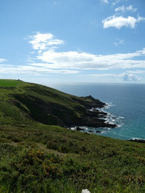
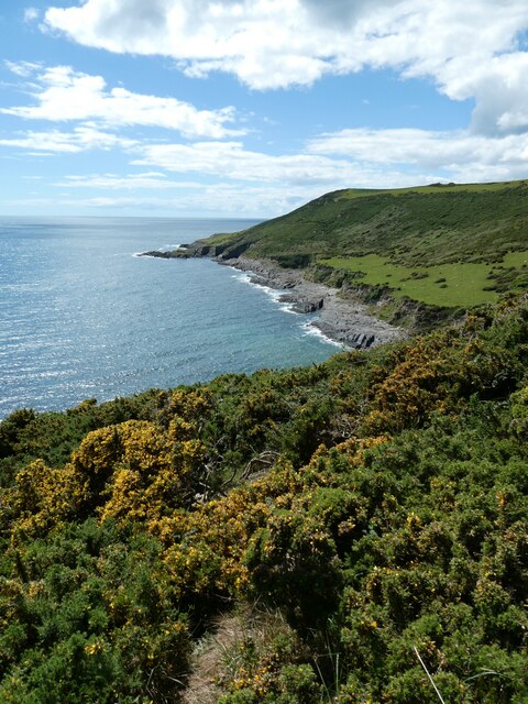
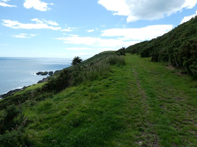
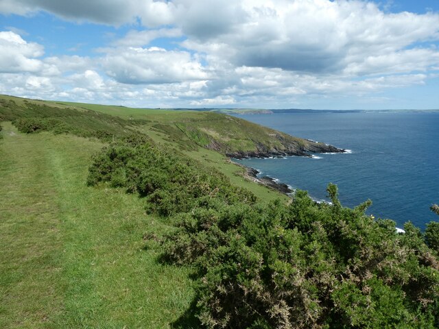
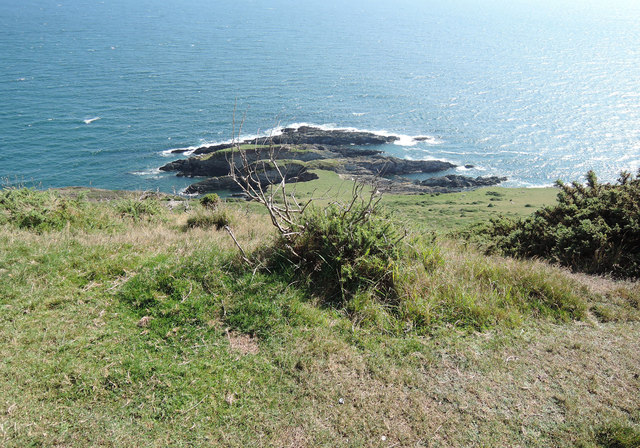
Eastern Hill Wood is a picturesque woodland located in Devon, England. Covering an area of approximately 100 acres, it is a popular destination for nature enthusiasts and hikers alike. The wood is situated on the eastern side of a hill, offering breathtaking views of the surrounding countryside.

The wood is predominantly made up of native broadleaf trees, including oak, beech, and ash, creating a diverse and vibrant ecosystem. The dense canopy provides ample shade during the summer months, making it an ideal spot for a peaceful walk or picnic.

Eastern Hill Wood is home to a variety of wildlife, including deer, badgers, and a wide array of bird species. Birdwatchers often flock to the area to catch a glimpse of rare and migratory birds that pass through during certain times of the year.

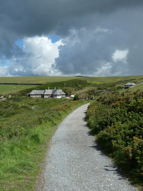
Trails and footpaths wind through the wood, allowing visitors to explore its beauty at their own pace. The paths are well-maintained and suitable for all levels of fitness. Along the way, there are numerous benches and viewpoints where visitors can rest and admire the natural surroundings.

The wood is open to the public year-round, with no admission fees or restrictions. However, visitors are encouraged to respect the natural environment and adhere to any signage or guidelines posted within the wood.

Eastern Hill Wood offers a tranquil escape from the hustle and bustle of everyday life, allowing visitors to immerse themselves in the beauty of nature. Whether it's a leisurely stroll through the trees or a chance to spot some wildlife, this enchanting woodland has something to offer for everyone.

If you have any feedback on the listing, please let us know in the comments section below.

Eastern Hill Wood Images

Images are sourced within 2km of 50.307593/-4.037565 or Grid Reference SX5547. Thanks to Geograph Open Source API. All images are credited.

Coast looking south-east from Blackstone Point
Dark clouds over Warren Cottage and coastal path The South West Coast Path National Trail - 630 miles of superb coastal walking. From Minehead on the edge of the Exmoor National Park to the shores of Poole Harbour in Dorset. It is the longest of all Britain's National Trails.
Website: <span class="nowrap"><a title="http://www.southwestcoastpath.com/" rel="nofollow ugc noopener" href="http://www.southwestcoastpath.com/">Link</a><img style="margin-left:2px;" alt="External link" title="External link - shift click to open in new window" src="https://s1.geograph.org.uk/img/external.png" width="10" height="10"/></span>
Dark clouds over Warren Cottage and coastal path
The South West Coast Path National Trail - 630 miles of superb coastal walking. From Minehead on the edge of the Exmoor National Park to the shores of Poole Harbour in Dorset. It is the longest of all Britain's National Trails. Website: LinkExternal link
Coast at The Warren The South West Coast Path follows a level track on the right of the picture
Coast at The Warren
The South West Coast Path follows a level track on the right of the picture
South West Coast Path in The Warren The South West Coast Path National Trail - 630 miles of superb coastal walking. From Minehead on the edge of the Exmoor National Park to the shores of Poole Harbour in Dorset. It is the longest of all Britain's National Trails.
Website: <span class="nowrap"><a title="http://www.southwestcoastpath.com/" rel="nofollow ugc noopener" href="http://www.southwestcoastpath.com/">Link</a><img style="margin-left:2px;" alt="External link" title="External link - shift click to open in new window" src="https://s1.geograph.org.uk/img/external.png" width="10" height="10"/></span>
South West Coast Path in The Warren
The South West Coast Path National Trail - 630 miles of superb coastal walking. From Minehead on the edge of the Exmoor National Park to the shores of Poole Harbour in Dorset. It is the longest of all Britain's National Trails. Website: LinkExternal link
Yealm Pool and Newton Ferrers
Caravan park and Stoke Beach
The bay of Stoke Beach and cliffs beyond
Church Cove, Stoke
Church Cove, Stoke
View west from Stoke Down The land on the north is Netton Down, and the coves and bays have a range of names, despite being very small
View west from Stoke Down
The land on the north is Netton Down, and the coves and bays have a range of names, despite being very small
The Carriage Drive on Netton Down Part of Lord Revelstoke's private carriage drive <span class="nowrap"><a title="https://www.southdevonaonb.org.uk/wp-content/uploads/2020/06/Noss-Mayo-Revelstoke-Drive-walk-guide.pdf" rel="nofollow ugc noopener" href="https://www.southdevonaonb.org.uk/wp-content/uploads/2020/06/Noss-Mayo-Revelstoke-Drive-walk-guide.pdf">Link</a><img style="margin-left:2px;" alt="External link" title="External link - shift click to open in new window" src="https://s1.geograph.org.uk/img/external.png" width="10" height="10"/></span>
The Carriage Drive on Netton Down
Part of Lord Revelstoke's private carriage drive LinkExternal link
Stoke Point from Netton Down
Netton Down
Netton Down
Netton Island
Netton Island
Towards Rowden Court and Rowden Farm Seen from the National Trust's small Stoke Point car park, by the lane from Netton Farm to Stoke Cross, seen in the foreground
Towards Rowden Court and Rowden Farm
Seen from the National Trust's small Stoke Point car park, by the lane from Netton Farm to Stoke Cross, seen in the foreground
On Revelstoke Drive On Netton Down, looking towards Snellings Down. The late nineteenth-century carriageway created by Lord Revelstoke, now serves as the South West Coast Path for a fair distance between Stoke and the ferry crossing to Wembury
On Revelstoke Drive
On Netton Down, looking towards Snellings Down. The late nineteenth-century carriageway created by Lord Revelstoke, now serves as the South West Coast Path for a fair distance between Stoke and the ferry crossing to Wembury
Stoke Point Seen from the South West Coast Path on Netton Down
Stoke Point
Seen from the South West Coast Path on Netton Down
Stoke Point from Snellings Down Seen from the South West Coast Path. The gorse in the foreground has been subject to swayling. The Devon coastline in the distance is largely lost in the September haze, but on a clear day can be seen running out to Bolt Tail
Stoke Point from Snellings Down
Seen from the South West Coast Path. The gorse in the foreground has been subject to swayling. The Devon coastline in the distance is largely lost in the September haze, but on a clear day can be seen running out to Bolt Tail
Netton Island seen from Snellings Down View from the South West Coast Path
Netton Island seen from Snellings Down
View from the South West Coast Path
Show me another place!

Eastern Hill Wood is located at Grid Ref: SX5547 (Lat: 50.307593, Lng: -4.037565)

Administrative County: Devon

District: South Hams

Police Authority: Devon and Cornwall

What 3 Words

///twinge.verifying.factory. Near Newton Ferrers, Devon

Related Wikis

St Peter's Church, Noss Mayo

St Peter's Church is a Church of England parish church in Noss Mayo, Devon, England. It was constructed in 1880–82 and designed by the London architect...

Holy Cross Church, Newton Ferrers

Holy Cross Church is a Church of England parish church in Newton Ferrers, Devon, England. The existing church has 13th-century origins, with a major restoration...

Newton Ferrers

Newton Ferrers is a village and former manor, civil and ecclesiastical parish, now in the parish of Newton and Noss, in the South Hams district, in the...

Newton and Noss

Newton and Noss is a civil parish in the South Hams district of Devon, England comprising the villages of Newton Ferrers and Noss Mayo and outlying hamlets...

Nearby Amenities

Located within 500m of 50.307593,-4.037565
Source: PGS
Lat/Long: 50.3104097/-4.0403911
Noss Mayo
Place: hamlet
Source: local knowledge
Website: https://www.newtonnoss.co.uk/
Wikidata: Q7061895
Wikipedia: en:Noss Mayo
Lat/Long: 50.30972/-4.0380533
Post Box
Brand: Royal Mail
Brand Wikidata: Q638098
Brand Wikipedia: en:Royal Mail
Collection Times: Mo-Fr 09:00; Sa 07:00; Su off
Drive Through: no
Operator: Royal Mail
Operator Wikidata: Q638098
Post Box Mounting: stone_wall
Post Box Type: wall
Ref: PL8 617D
Royal Cypher: GR
Royal Cypher Wikidata: Q33102273
Source: survey;streetlevel imagery;aerial imagery
Survey Date: 2023-02-26
Lat/Long: 50.3117998/-4.0395353
Generator Method: photovoltaic
Generator Output Electricity: yes
Generator Source: solar
Generator Type: solar_photovoltaic_panel
Location: roof
Power: generator
Lat/Long: 50.3070007/-4.043418
Generator Method: photovoltaic
Generator Output Electricity: yes
Generator Source: solar
Generator Type: solar_photovoltaic_panel
Location: roof
Power: generator
Lat/Long: 50.3070564/-4.0434154
Generator Method: photovoltaic
Generator Output Electricity: yes
Generator Source: solar
Generator Type: solar_photovoltaic_panel
Location: roof
Power: generator
Lat/Long: 50.3083806/-4.0428628
Generator Method: photovoltaic
Generator Output Electricity: yes
Generator Source: solar
Generator Type: solar_photovoltaic_panel
Location: roof
Power: generator
Lat/Long: 50.309291/-4.0416665
Generator Method: photovoltaic
Generator Output Electricity: yes
Generator Source: solar
Generator Type: solar_photovoltaic_panel
Location: roof
Power: generator
Lat/Long: 50.3105835/-4.0407278
Generator Method: photovoltaic
Generator Output Electricity: yes
Generator Source: solar
Generator Type: solar_photovoltaic_panel
Location: roof
Power: generator
Lat/Long: 50.3105226/-4.0407472
Generator Method: photovoltaic
Generator Output Electricity: yes
Generator Source: solar
Generator Type: solar_photovoltaic_panel
Location: roof
Power: generator
Lat/Long: 50.3102494/-4.0396307
Generator Method: photovoltaic
Generator Output Electricity: yes
Generator Source: solar
Generator Type: solar_photovoltaic_panel
Location: roof
Power: generator
Lat/Long: 50.310461/-4.0378632
Generator Method: photovoltaic
Generator Output Electricity: yes
Generator Source: solar
Generator Type: solar_photovoltaic_panel
Location: roof
Power: generator
Lat/Long: 50.3104327/-4.0379651
Leisure: slipway
Lat/Long: 50.3117106/-4.0398703
Leisure: slipway
Lat/Long: 50.3105138/-4.0405362
Bench
Backrest: yes
Lat/Long: 50.3084314/-4.0382391
Bench
Backrest: yes
Lat/Long: 50.3114748/-4.040639
Waste Basket
Lat/Long: 50.3118135/-4.0397895
Bench
Backrest: yes
Lat/Long: 50.3117676/-4.0399202
Post Box
Brand: Royal Mail
Brand Wikidata: Q638098
Brand Wikipedia: en:Royal Mail
Collection Times: Mo-Fr 09:00; Sa 07:00; Su off
Drive Through: no
Operator: Royal Mail
Operator Wikidata: Q638098
Post Box Design: hovis
Post Box Mounting: stone_wall
Post Box Type: lamp
Ref: PL8 774D
Royal Cypher: GR
Royal Cypher Wikidata: Q33102273
Source: survey;streetlevel imagery;aerial imagery
Lat/Long: 50.3111134/-4.0379562
Bus Stop
Noss Mayo Tennis Courts
Bench: no
Bin: no
Bus: yes
Operator: Tally Ho
Public Transport: platform
Shelter: no
Tactile Paving: no
Lat/Long: 50.3092143/-4.0409951
Entrance: yes
Lat/Long: 50.3109022/-4.0408979
Bus Stop
Noss Mayo St Peters Church
Bus: yes
Naptan AtcoCode: 1100DEA10048
Naptan NaptanCode: dvnampjd
Public Transport: platform
Lat/Long: 50.3113519/-4.0379073
Fire Hydrant
Emergency: fire_hydrant
Fire Hydrant Diameter: 75
Fire Hydrant Position: lane
Fire Hydrant Type: underground
Lat/Long: 50.30822/-4.0424504
Fire Hydrant
Emergency: fire_hydrant
Fire Hydrant Diameter: 3
Fire Hydrant Position: lane
Fire Hydrant Type: underground
Survey Date: 2024-01-27
Lat/Long: 50.3116601/-4.0396278
Telephone
Booth: K6
Fixme: needs confirming if it works or not, telephone present
Survey Date: 2023-02-26
Lat/Long: 50.3117934/-4.0395171
Grit Bin
Survey Date: 2023-02-26
Lat/Long: 50.3118988/-4.0392558
Life Ring
Emergency: life_ring
Survey Date: 2023-02-26
Lat/Long: 50.3117785/-4.0400015
Bench
Backrest: yes
Survey Date: 2023-02-26
Lat/Long: 50.311779/-4.0400036
Landing Site
Emergency: landing_site
Lat/Long: 50.3087514/-4.0410697
Defibrillator
Defibrillator Location: Next to steps down to water below The Swan Inn
Emergency: defibrillator
Indoor: no
Survey Date: 2024-01-27
Lat/Long: 50.311795/-4.0397462
Defibrillator
Access: yes
Defibrillator Location: On outside wall of The Tilly Institute opposite the car park on Passage Road
Emergency: defibrillator
Indoor: no
Mapillary: 1132929354512614
Opening Hours: 24/7
Ref: DC0083
Ref GB The Circuit: 10136647-C114-4BB1-99F0-AD6500A25780
Survey Date: 2024-01-27
Lat/Long: 50.3100116/-4.0410131
Bench
Survey Date: 2024-01-27
Lat/Long: 50.3102476/-4.0408703
Bench
Survey Date: 2024-01-27
Lat/Long: 50.3102357/-4.040881
Waste Basket
Survey Date: 2024-01-27
Lat/Long: 50.3102538/-4.04088
Fire Hydrant
Emergency: fire_hydrant
Fire Hydrant Type: underground
Survey Date: 2024-01-27
Lat/Long: 50.3108921/-4.0409883
The data included in this document is from www.openstreetmap.org. The data is made available under ODbL.

Have you been to Eastern Hill Wood?

Leave your review of Eastern Hill Wood below (or comments, questions and feedback).