Bew Cleave Wood

Wood, Forest in Devon West Devon

England

Bew Cleave Wood

Tarka Trail shared path near Meeth
Tarka Trail shared path near Meeth Credit: David Smith

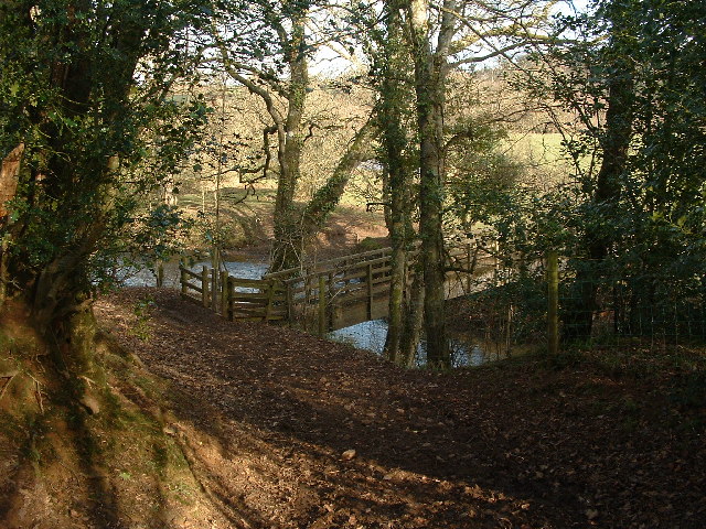
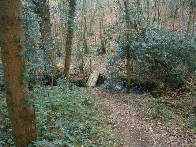
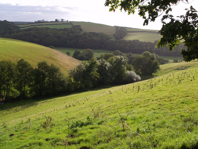
Bew Cleave Wood, located in Devon, England, is a stunning woodland area encompassing approximately 13 hectares. This ancient woodland is nestled within the Dartmoor National Park, offering visitors a picturesque and tranquil setting to explore and immerse themselves in nature.

The wood is predominantly composed of oak trees, along with other native species such as beech, birch, and rowan, creating a diverse and vibrant ecosystem. The dense canopy provides shade and shelter for a variety of wildlife, including birds, mammals, and insects.

Walking through Bew Cleave Wood, one can witness the natural beauty of the area, with wildflowers carpeting the forest floor during spring and summer. The wood is also home to a small stream that meanders through its heart, adding to its charm and providing a source of water for the inhabitants.

The wood offers several footpaths and trails, allowing visitors to explore its many hidden corners and discover its secrets. One popular route is the Bew Cleave Wood Circular Walk, which takes approximately 1.5 hours to complete and offers breathtaking views of the surrounding countryside.

Bew Cleave Wood is not only a haven for nature enthusiasts but also a place of historical significance. It is believed that the wood has been continuously wooded for over 400 years, and remnants of ancient boundary banks can still be found within its boundaries.

Overall, Bew Cleave Wood is a cherished natural gem in Devon, offering a peaceful retreat for those seeking solace in the great outdoors and a glimpse into the area's rich ecological and historical heritage.

If you have any feedback on the listing, please let us know in the comments section below.

Bew Cleave Wood Images

Images are sourced within 2km of 50.843531/-4.0659437 or Grid Reference SS5406. Thanks to Geograph Open Source API. All images are credited.

Tarka Trail shared path near Meeth
Ford and footbridge on Tarka Trail The ford is for cyclists
Ford and footbridge on Tarka Trail
The ford is for cyclists
Tarka Trail: Foot bridge over the Okement There's only one word in this square on the Explorer map. That's the 'Ford' over the River Okement that's just downstream of this foot bridge.
Tarka Trail: Foot bridge over the Okement
There's only one word in this square on the Explorer map. That's the 'Ford' over the River Okement that's just downstream of this foot bridge.
Nethercote House Photo taken from the Tarka Trail between Hatherleigh and Iddesleigh
Nethercote House
Photo taken from the Tarka Trail between Hatherleigh and Iddesleigh
Tarka Trail: Footbridge near Groves Fishleigh There are lots of little footbridges on the Tarka Trail between Hatherleigh and Dolton.
Tarka Trail: Footbridge near Groves Fishleigh
There are lots of little footbridges on the Tarka Trail between Hatherleigh and Dolton.
Iddesleigh: The Torridge Seen just below its confluence with the Okement, near Bridge Town. If there was a bridge here, and the indications are that there was, there is no evidence on the ground today. Looking roughly north west
Iddesleigh: The Torridge
Seen just below its confluence with the Okement, near Bridge Town. If there was a bridge here, and the indications are that there was, there is no evidence on the ground today. Looking roughly north west
Iddesleigh: on the bank of the Torridge Looking west, with snowdrops on the bank; below the river’s confluence with its tributary the Okement
Iddesleigh: on the bank of the Torridge
Looking west, with snowdrops on the bank; below the river’s confluence with its tributary the Okement
River Torridge at Hele Bridge, Devon
River Torridge. View E.N.East from Hele Bridge
Risdon's Fishleigh The farm seen from Hatherleigh Footpath 12. The central building, to the left of the farmhouse, is a long thatched barn. This is Springwatch country.
Risdon's Fishleigh
The farm seen from Hatherleigh Footpath 12. The central building, to the left of the farmhouse, is a long thatched barn. This is Springwatch country.
Field on Tarka Trail A view from the edge of woodland across a field; the trail, here following Hatherleigh Footpath 13, runs along the edge on its way from Groves Fishleigh to Hatherleigh.
Field on Tarka Trail
A view from the edge of woodland across a field; the trail, here following Hatherleigh Footpath 13, runs along the edge on its way from Groves Fishleigh to Hatherleigh.
View from Friar's Hele Cross A view NNE from the ridge north of the Torridge. Fields slope towards an unnamed wood.
View from Friar's Hele Cross
A view NNE from the ridge north of the Torridge. Fields slope towards an unnamed wood.
St Michael's church, Meeth Plenty of Norman work is evident. "This is a very simple church but it has some good quality detail and the C19 restoration has added to rather than detracted from the building" <span class="nowrap"><a title="http://www.britishlistedbuildings.co.uk/en-93295-church-of-st-michael-meeth" rel="nofollow ugc noopener" href="http://www.britishlistedbuildings.co.uk/en-93295-church-of-st-michael-meeth">Link</a><img style="margin-left:2px;" alt="External link" title="External link - shift click to open in new window" src="https://s1.geograph.org.uk/img/external.png" width="10" height="10"/></span> . Seen from the edge of the churchyard, which is set up above the main road.
St Michael's church, Meeth
Plenty of Norman work is evident. "This is a very simple church but it has some good quality detail and the C19 restoration has added to rather than detracted from the building" LinkExternal link . Seen from the edge of the churchyard, which is set up above the main road.
Side valley and Torridge valley A deep little side valley, with trees following the stream, runs down to meet the Torridge. Seen from a track east of Meeth.
Side valley and Torridge valley
A deep little side valley, with trees following the stream, runs down to meet the Torridge. Seen from a track east of Meeth.
Field beside Round Pole Plantation The plantation is to the right across the field. The mound on the extreme left is part of Meeth Clay Tip. Seen in torrential rain from Meeth Footpath 2, here followed by the cycle track version of the Tarka Trail.
Field beside Round Pole Plantation
The plantation is to the right across the field. The mound on the extreme left is part of Meeth Clay Tip. Seen in torrential rain from Meeth Footpath 2, here followed by the cycle track version of the Tarka Trail.
Meeth Halt (disused) The North Devon and Cornwall Junction Light Railway (<span class="nowrap"><a title="http://en.wikipedia.org/wiki/North_Devon_and_Cornwall_Junction_Light_Railway" rel="nofollow ugc noopener" href="http://en.wikipedia.org/wiki/North_Devon_and_Cornwall_Junction_Light_Railway">Link</a><img style="margin-left:2px;" alt="External link" title="External link - shift click to open in new window" src="https://s1.geograph.org.uk/img/external.png" width="10" height="10"/></span> ) closed in 1965. This must always have been a tiny station. It now serves as a starting point for a cyclepath along the former line as a branch of the Tarka Trail.
Meeth Halt (disused)
The North Devon and Cornwall Junction Light Railway (LinkExternal link ) closed in 1965. This must always have been a tiny station. It now serves as a starting point for a cyclepath along the former line as a branch of the Tarka Trail.
Path to church, Meeth "A cobbled path, made in 1818 from Torridge river pebbles by the French prisoners from Dartmoor prison at the time of the Napoleonic wars, leads past old lime trees to the early Norman porch" (<span class="nowrap"><a title="http://www.hatherleigh.net/meeth.asp" rel="nofollow ugc noopener" href="http://www.hatherleigh.net/meeth.asp">Link</a><img style="margin-left:2px;" alt="External link" title="External link - shift click to open in new window" src="https://s1.geograph.org.uk/img/external.png" width="10" height="10"/></span> ). A similar path exists at <a href="https://www.geograph.org.uk/photo/567493">SS5311 : St James the Less church, Huish</a>, presumably of the same origin.
Path to church, Meeth
"A cobbled path, made in 1818 from Torridge river pebbles by the French prisoners from Dartmoor prison at the time of the Napoleonic wars, leads past old lime trees to the early Norman porch" (LinkExternal link ). A similar path exists at SS5311 : St James the Less church, Huish, presumably of the same origin.
Path from church, Meeth Clearly not of the some vintage as <a href="https://www.geograph.org.uk/photo/569349">SS5408 : Path to church, Meeth</a>, at least not in its present tarmaced state, this path leads across the northern churchyard.
Path from church, Meeth
Clearly not of the some vintage as SS5408 : Path to church, Meeth, at least not in its present tarmaced state, this path leads across the northern churchyard.
Show me another place!

Bew Cleave Wood is located at Grid Ref: SS5406 (Lat: 50.843531, Lng: -4.0659437)

Administrative County: Devon

District: West Devon

Police Authority: Devon and Cornwall

What 3 Words

///directors.performed.pony. Near Hatherleigh, Devon

Nearby Locations

Bew Cleave Wood

Related Wikis

Meeth

Meeth is a small village roughly 13.5 km (8.4 mi) north-northwest of Okehampton and 40.7 km (25.3 mi) west-northwest of Exeter. It lies to the west of...

Meeth Halt railway station

Opened in 1925, Meeth Halt was a small railway station on the North Devon and Cornwall Junction Light Railway, a private line until it became part of the...

River Lew

The River Lew can refer to either of two short rivers that lie close to each other in Devon, England. The more northerly of the two rises just south of...

River Okement

The River Okement is a tributary of the River Torridge in Devon, England. It rises at two places in Dartmoor, as the West Okement and the East Okement...

Iddesleigh

Iddesleigh is a village and civil parish in the county of Devon, England. The settlement has ancient origins and is listed in the Domesday Book. The village...

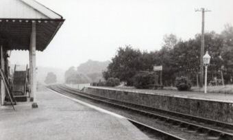
Hatherleigh railway station

Hatherleigh Railway Station was a station on the North Devon and Cornwall Junction Light Railway between Torrington and Halwill Junction, serving the town...

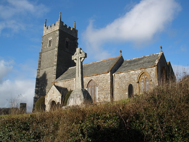
Church of St James, Iddesleigh

St James' Church, Iddesleigh, is a church in the small village of Iddesleigh, Devon, England. It dates back to the 13th century, although most of the...

Hatherleigh

Hatherleigh is a small market town in west Devon, England. It hosts an arts festival in July, and a carnival in November featuring two flaming tar barrel...

Have you been to Bew Cleave Wood?

Leave your review of Bew Cleave Wood below (or comments, questions and feedback).