South Down Wood

Wood, Forest in Devon Torridge

England

South Down Wood

Yarnscombe: by Rooks Cross Looking south
Yarnscombe: by Rooks Cross Credit: Martin Bodman

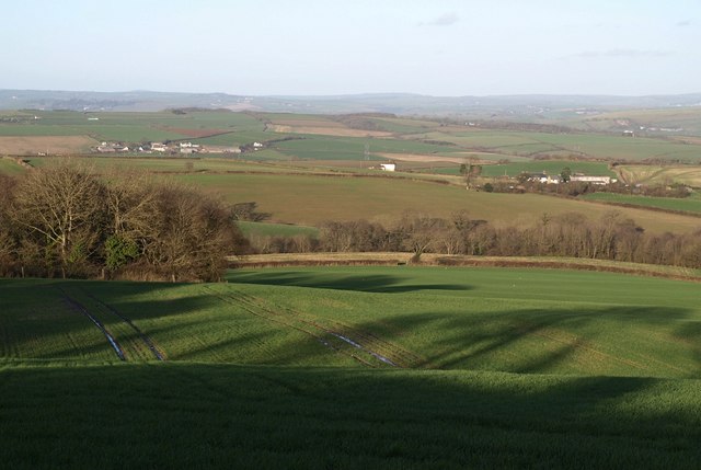
South Down Wood is a picturesque woodland located in Devon, England. Covering an area of approximately 100 acres, it is a popular destination for nature lovers and outdoor enthusiasts. The wood is situated on the slopes of the South Hams, overlooking the stunning coastline of the English Channel.

The woodland is predominantly made up of native tree species, including oak, beech, and ash. These mature trees provide a dense canopy, creating a tranquil and shaded environment within the wood. The forest floor is adorned with a rich variety of flora, including bluebells, wild garlic, and ferns, adding to the natural beauty of the area.

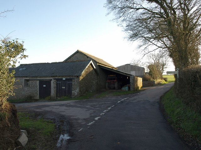
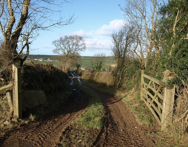
South Down Wood offers a network of well-maintained footpaths, allowing visitors to explore its diverse habitats and enjoy the peaceful ambiance. The wood is home to a wide range of wildlife, including deer, badgers, and a plethora of bird species, making it an ideal spot for birdwatching and wildlife photography.

Visitors to South Down Wood can also take advantage of the designated picnic areas and benches scattered throughout the woodland. These provide perfect spots for relaxation and enjoying a packed lunch while immersing oneself in the tranquil surroundings.

Furthermore, the wood is part of a larger nature reserve, offering opportunities for educational activities and guided walks. It is managed by a local conservation trust, ensuring the preservation of this natural treasure for future generations to appreciate and enjoy.

Overall, South Down Wood is a true gem in the heart of Devon, offering a peaceful retreat for those seeking solace in nature and an opportunity to connect with the stunning landscapes and diverse wildlife that the region has to offer.

If you have any feedback on the listing, please let us know in the comments section below.

South Down Wood Images

Images are sourced within 2km of 50.999259/-4.0793545 or Grid Reference SS5424. Thanks to Geograph Open Source API. All images are credited.

Yarnscombe: by Rooks Cross Looking south
Yarnscombe: by Rooks Cross
Looking south
Yarnscombe: Rooks Cross Looking north
Yarnscombe: Rooks Cross
Looking north
Yarnscombe: towards Delley View from the lane between Rooks Cross and Easton Moor Cross. Looking south
Yarnscombe: towards Delley
View from the lane between Rooks Cross and Easton Moor Cross. Looking south
Yarnscombe: ash tree Near Boode farm, on the lane from Easton Moor. Looking north east
Yarnscombe: ash tree
Near Boode farm, on the lane from Easton Moor. Looking north east
Yarnscombe: by  Easton Moor Cross Looking north, slightly west of Boode, a farm out of shot to the right
Yarnscombe: by Easton Moor Cross
Looking north, slightly west of Boode, a farm out of shot to the right
Yarnscombe: on Easton Moor Looking east-north-east in the direction of Easton Moor Cross. The sky has begun to cloud up
Yarnscombe: on Easton Moor
Looking east-north-east in the direction of Easton Moor Cross. The sky has begun to cloud up
View over Pristacott West From the same spot as <a href="https://www.geograph.org.uk/photo/600256">SS5326 : Valley near Pristacott</a>, this view looks across the same valley immediately west of the hamlet of Pristacott. The crooked field boundary is a legacy of the removal of others. Beyond are further parallel west-east valleys, all draining into Langham Lake.
View over Pristacott West
From the same spot as SS5326 : Valley near Pristacott, this view looks across the same valley immediately west of the hamlet of Pristacott. The crooked field boundary is a legacy of the removal of others. Beyond are further parallel west-east valleys, all draining into Langham Lake.
Hiscott from above Pristacott Taken from the same gateway as <a href="https://www.geograph.org.uk/photo/600261">SS5426 : View over Pristacott West</a>, this photo overlaps with that one on the right. Hiscott is the hamlet on the ridge across the valley; at its west end, Whitelake Farm is the prominent building to the left of the pylon. The nearby barns on the left are at Pristacott.
Hiscott from above Pristacott
Taken from the same gateway as SS5426 : View over Pristacott West, this photo overlaps with that one on the right. Hiscott is the hamlet on the ridge across the valley; at its west end, Whitelake Farm is the prominent building to the left of the pylon. The nearby barns on the left are at Pristacott.
View over Pristacott Compare <a href="https://www.geograph.org.uk/photo/600261">SS5426 : View over Pristacott West</a>. This view shows the same twisting field boundary, this time over the roofs of buildings at the hamlet of Pristacott. The field to the right of it also appears in <a href="https://www.geograph.org.uk/photo/599143">SS5426 : Valley near Pristacott</a>.
View over Pristacott
Compare SS5426 : View over Pristacott West. This view shows the same twisting field boundary, this time over the roofs of buildings at the hamlet of Pristacott. The field to the right of it also appears in SS5426 : Valley near Pristacott.
Hiscott from Pristacott Compare <a href="https://www.geograph.org.uk/photo/600312">SS5426 : Hiscott from above Pristacott</a>. This picture is taken from beneath the barns on the left of that photo, and shows the hamlet of Hiscott along its ridge. The paving in the foreground is the driveway to part of Pristacott Farm.
Hiscott from Pristacott
Compare SS5426 : Hiscott from above Pristacott. This picture is taken from beneath the barns on the left of that photo, and shows the hamlet of Hiscott along its ridge. The paving in the foreground is the driveway to part of Pristacott Farm.
Lane to Hiscott That's not Hiscott in the distance, but Pristacott. The lane has just performed the sharpest of its many wiggles, at its highest point, and now descends towards a tributary valley of Langham Lake.
Lane to Hiscott
That's not Hiscott in the distance, but Pristacott. The lane has just performed the sharpest of its many wiggles, at its highest point, and now descends towards a tributary valley of Langham Lake.
Field and lane from Woodland Cross The shallow valley with the trees drains left towards the Langham Lake tributary valley shown in <a href="https://www.geograph.org.uk/photo/599143">SS5426 : Valley near Pristacott</a>. The lane is from <a href="https://www.geograph.org.uk/photo/668614">SS5325 : Woodland Cross</a> to Hiscott, and is shown further along its course in <a href="https://www.geograph.org.uk/photo/666809">SS5425 : Lane to Hiscott</a>.
Field and lane from Woodland Cross
The shallow valley with the trees drains left towards the Langham Lake tributary valley shown in SS5426 : Valley near Pristacott. The lane is from SS5325 : Woodland Cross to Hiscott, and is shown further along its course in SS5425 : Lane to Hiscott.
Myrtle Cottage Farm The B3232 swings past a layby, a cottage and a farm as it heads from Alverdiscott towards Torrington.
Myrtle Cottage Farm
The B3232 swings past a layby, a cottage and a farm as it heads from Alverdiscott towards Torrington.
East Woodlands from Luppincott A view almost from one corner of the square to the opposite corner. The square contains three valleys forming an amphitheatre, which meet this side of East Woodlands (on the right). The prominent white house in the centre is just across a gridline into SS5325. Beyond, the countryside rolls away to the Taw valley and the western foothills of Exmoor. Taken from a gateway just to the north of the farm at Luppincott.
East Woodlands from Luppincott
A view almost from one corner of the square to the opposite corner. The square contains three valleys forming an amphitheatre, which meet this side of East Woodlands (on the right). The prominent white house in the centre is just across a gridline into SS5325. Beyond, the countryside rolls away to the Taw valley and the western foothills of Exmoor. Taken from a gateway just to the north of the farm at Luppincott.
Luppincott Farm buildings at the lane junction. The signposted lane to the left is a lengthy cul-de-sac to two farms (Lashingcott and Nethercott).
Luppincott
Farm buildings at the lane junction. The signposted lane to the left is a lengthy cul-de-sac to two farms (Lashingcott and Nethercott).
Lane to Hiscott The lane shown in <a href="https://www.geograph.org.uk/photo/666809">SS5425 : Lane to Hiscott</a>, this time with buildings at Hiscott in its sights (the hamlet is in SS5426). Taken from another sharp bend.
Lane to Hiscott
The lane shown in SS5425 : Lane to Hiscott, this time with buildings at Hiscott in its sights (the hamlet is in SS5426). Taken from another sharp bend.
Field access track near Hiscott The track leads to the lane shown in <a href="https://www.geograph.org.uk/photo/668591">SS5425 : Lane to Hiscott</a>, where the car is parked. The hamlet in the centre is Hiscott; to the left is Pristacott. Both are in SS5426.
Field access track near Hiscott
The track leads to the lane shown in SS5425 : Lane to Hiscott, where the car is parked. The hamlet in the centre is Hiscott; to the left is Pristacott. Both are in SS5426.
Woodland Cross A leaning signpost at the slightly offset lane crossroads. <a href="https://www.geograph.org.uk/photo/666831">SS5325 : Field and lane from Woodland Cross</a> was taken from a gateway a metre or two to the left.
Woodland Cross
A leaning signpost at the slightly offset lane crossroads. SS5325 : Field and lane from Woodland Cross was taken from a gateway a metre or two to the left.
Show me another place!

South Down Wood is located at Grid Ref: SS5424 (Lat: 50.999259, Lng: -4.0793545)

Administrative County: Devon

District: Torridge

Police Authority: Devon and Cornwall

What 3 Words

///steamed.compliant.tailors. Near Great Torrington, Devon

Related Wikis

Yarnscombe

Yarnscombe is a small village and parish in the Torridge area of Devon, England. It is situated approximately 5 miles (8 km) from Great Torrington and...

Alverdiscott

Alverdiscott (pronounced Alscott, or ) is a village, civil parish, former manor and former ecclesiastical parish in the Torridge district of Devon, England...

Belle Vue Airfield

Belle Vue Airfield (often classed as airport or heliport) is a single runway airfield about 2.5 miles (4.0 km) north east of Great Torrington in North...

Huntshaw Cross transmitting station

Huntshaw Cross transmitting station is a telecommunications facility serving North Devon including the towns of Barnstaple and South Molton. It broadcasts...

Newton Tracey

Newton Tracey is a village and former civil parish, now in the parish of Horwood, Lovacott and Newton Tracey, in the North Devon district of Devon, England...

Horwood, Lovacott and Newton Tracey

Horwood, Lovacott and Newton Tracey is a civil parish in North Devon district, Devon, England. In the 2011 census it was recorded as having a population...

Huntshaw

Huntshaw is a village and civil parish located 2.5 north north east of Great Torrington, in the Torridge district, in the county of Devon, England. In...

Webbery, Alverdiscott

Webbery (anciently Wibbery) is an historic manor in the parish of Alverdiscott in North Devon, England. == History == === Nicholas the Bowman === The manor...

Nearby Amenities

Located within 500m of 50.999259,-4.0793545
Direction: E
Generator Method: photovoltaic
Generator Output Electricity: yes
Generator Solar Modules: 16
Generator Source: solar
Generator Type: solar_photovoltaic_panel
Location: roof
Power: generator
Lat/Long: 50.9969354/-4.0839006
The data included in this document is from www.openstreetmap.org. The data is made available under ODbL.

Have you been to South Down Wood?

Leave your review of South Down Wood below (or comments, questions and feedback).