Chiddingfold

Settlement in Surrey Waverley

England

Chiddingfold

Toll House, Chiddingfold What looks to be an ex-toll house. The brick fabric looks late for a toll house so may well have served the Petworth Turnpike Trust in its dying years. It would have replaced a Toll House SSE on the North side of the ford/bridge at Northbridge.

Milestone Society National ID: SY.CHI
Toll House, Chiddingfold Credit: Lionel Joseph

Chiddingfold is a picturesque village located in the county of Surrey, England. Situated in the southwestern part of the county, it lies approximately 8 miles south of the town of Godalming and 15 miles southwest of Guildford. Nestled in the heart of the countryside, Chiddingfold is surrounded by rolling hills, lush green fields, and dense woodland, making it an idyllic rural retreat.

The village itself is known for its charming character and historic architecture. It boasts a collection of traditional timber-framed buildings, some dating back to the 16th century, that line its quaint streets. The Crown Inn, a popular pub with a thatched roof and original features, is a prominent landmark in the village.

Chiddingfold is home to a close-knit community, with a population of around 2,000 residents. Amenities in the village include a primary school, village hall, post office, and a selection of independent shops and local businesses. The village also has several sports facilities, including a cricket club and a football club.

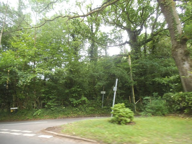
Surrounded by beautiful countryside, Chiddingfold offers numerous opportunities for outdoor activities. The village is a popular starting point for scenic walks and cycling routes, with footpaths and bridleways leading to nearby areas of natural beauty, such as the Surrey Hills Area of Outstanding Natural Beauty and the South Downs National Park.

Chiddingfold's convenient location, with good road links to nearby towns and cities, makes it an attractive place to live for those seeking a peaceful rural lifestyle, while still being within commuting distance of larger urban areas.

If you have any feedback on the listing, please let us know in the comments section below.

Chiddingfold Images

Images are sourced within 2km of 51.113242/-0.627826 or Grid Reference SU9635. Thanks to Geograph Open Source API. All images are credited.

Toll House, Chiddingfold What looks to be an ex-toll house. The brick fabric looks late for a toll house so may well have served the Petworth Turnpike Trust in its dying years. It would have replaced a Toll House SSE on the North side of the ford/bridge at Northbridge.

Milestone Society National ID: SY.CHI
Toll House, Chiddingfold
What looks to be an ex-toll house. The brick fabric looks late for a toll house so may well have served the Petworth Turnpike Trust in its dying years. It would have replaced a Toll House SSE on the North side of the ford/bridge at Northbridge. Milestone Society National ID: SY.CHI
Prestwick Lane at the junction of Combe Lane
Combe Lane, Combe Common
Ridgley Road at the junction of Coxcomb Lane
Prestwick Lane, Combe Common
Cottage on Combe Lane, Chiddingfold
Shops on The Green, Chiddingfold
Shops on The Green, Chiddingfold A very small Boots, one of the few large chains who kept their village shops as well.
Shops on The Green, Chiddingfold
A very small Boots, one of the few large chains who kept their village shops as well.
House on The Green, Chiddingfold
Phillips of Wormley
Phillips of Wormley
The Winterton Arms, Chiddingfold
Houses on Petworth Road, Chiddingfold
Petworth Road, Chiddingfold
Old house on Petworth Road, Chiddingfold
Pook Hill at the junction of Prestwick Lane
House on Prestwick Lane, Combe Common
Show me another place!

Chiddingfold is located at Grid Ref: SU9635 (Lat: 51.113242, Lng: -0.627826)

Administrative County: Surrey

District: Waverley

Police Authority: Surrey

What 3 Words

///stuff.misty.gratuity. Near Chiddingfold, Surrey

Related Wikis

St Teresa of Avila Church, Chiddingfold

St Teresa of Avila Church is a Roman Catholic Parish church in Chiddingfold, Surrey. It is situated on the corner of Petworth Road and Woodside Road in...

Chiddingfold

Chiddingfold is a village and civil parish in the Weald in the Waverley district of Surrey, England. It lies on the A283 road between Milford and Petworth...

Pickhurst

Pickhurst is a grade II* listed house set in 130 acres (53 ha) of land near Chiddingfold, Surrey, England. == History == It was designed by the Scottish...

Tigbourne Court

Tigbourne Court is an Arts and Crafts style country house in Wormley, Surrey, England, 1 mile (1.6 km) south of Witley. It was designed by architect Edwin...

Oakhurst Cottage

Oakhurst Cottage is a tiny 16th or 17th-century cottage in Hambledon, Surrey, in the United Kingdom. It is a Grade II listed building.The cottage was given...

Witley railway station

Witley railway station is a station on the Portsmouth Direct Line in Surrey, England. It is 38 miles 36 chains (61.9 km) down the line from London Waterloo...

Netherside Stream Outcrops

Netherside Stream Outcrops is a 2.9-hectare (7.2-acre) geological Site of Special Scientific Interest north-east of Haslemere in Surrey. It is a Geological...

St Dominic's School

St. Dominic's School in Hambledon, Surrey, England is a co-educational day school, one of the oldest special schools in the United Kingdom. It specialises...

Nearby Amenities

Located within 500m of 51.113242,-0.627826
Chiddingfold
Place: village
Wikidata: Q1776354
Wikipedia: en:Chiddingfold
Lat/Long: 51.1105426/-0.6281992
Bus Stop
Crown Inn
Naptan AtcoCode: 40004411153A
Naptan Bearing: SW
Naptan CommonName: Crown Inn
Naptan Indicator: Just Before
Naptan Landmark: Crown Inn
Naptan NaptanCode: surdtpwg
Naptan Street: Petworth Road
Naptan Verified: no
Shelter: no
Source: naptan_import
Lat/Long: 51.1102731/-0.6290642
Bus Stop
Crown Inn
Naptan AtcoCode: 40004411153B
Naptan Bearing: NE
Naptan CommonName: Crown Inn
Naptan Indicator: Just after
Naptan Landmark: Crown Inn
Naptan NaptanCode: surdtpwj
Naptan Street: Petworth Road
Naptan Verified: no
Shelter: no
Source: naptan_import
Lat/Long: 51.1101237/-0.6293543
Bus Stop
Petworth Road Catholic Church
Naptan AtcoCode: 40004411154A
Naptan Bearing: S
Naptan CommonName: Petworth Road Catholic Church
Naptan Indicator: Just Before
Naptan Landmark: Petworth Road Catholic Church
Naptan NaptanCode: surgpatd
Naptan Street: Petworth Road
Naptan Verified: no
Shelter: no
Source: naptan_import
Lat/Long: 51.1146304/-0.6271636
Bus Stop
Petworth Road Catholic Church
Bus: yes
Naptan AtcoCode: 40004411154B
Naptan Bearing: N
Naptan CommonName: Petworth Road Catholic Church
Naptan Indicator: Just after
Naptan Landmark: Petworth Road Catholic Church
Naptan NaptanCode: surdtpwm
Naptan Street: Petworth Road
Naptan Verified: no
Public Transport: platform
Shelter: yes
Source: naptan_import
Lat/Long: 51.1148468/-0.6272144
Bus Stop
Queens Mead
Naptan AtcoCode: 40004411480A
Naptan Bearing: E
Naptan CommonName: Queens Mead
Naptan Indicator: Just Before
Naptan Landmark: Queens Mead
Naptan NaptanCode: surgjpgj
Naptan Street: Woodside Road
Naptan Verified: no
Source: naptan_import
Lat/Long: 51.1142038/-0.6306623
Bus Stop
Queens Mead
Naptan AtcoCode: 40004411994A
Naptan Bearing: W
Naptan CommonName: Queens Mead
Naptan Indicator: W-bound
Naptan Landmark: Queens Mead
Naptan NaptanCode: surgmtpj
Naptan Street: Woodside Road
Naptan Verified: no
Source: naptan_import
Lat/Long: 51.1141233/-0.6307076
Avola Farm
Place: farm
Source: os_street_view
Lat/Long: 51.1119841/-0.6322116
Place Of Worship
Providence Chapel
Religion: christian
Source: os_street_view
Lat/Long: 51.1128939/-0.6276247
Place Of Worship
Chiddingfold Baptist Church
Addr Postcode: GU8 4RW
Addr Street: Woodside Road
Denomination: baptist
Fhrs Id: 352840
Religion: christian
Source: os_street_view
Source Addr Postcode: FHRS Open Data
Source Name: FHRS Open Data
Lat/Long: 51.1147636/-0.6338242
Bench
Backrest: yes
Lat/Long: 51.1105335/-0.6295793
Cafe
Elliott's Coffee Shop
Addr City: Chiddingfold
Addr Postcode: GU8 4TU
Addr Street: The Green
Cuisine: coffee_shop
Fhrs Id: 1377353
Opening Hours: Mo-Sa 09:00-16:00; Su 10:00-14:00
Source Addr Postcode: FHRS Open Data
Lat/Long: 51.1100554/-0.6282789
Traffic Calming: choker
Lat/Long: 51.109785/-0.6252146
Boots
Addr City: Chiddingfold
Addr Postcode: GU8 4TU
Addr Street: The Green
Brand: Boots
Brand Wikidata: Q6123139
Drive Through: no
Opening Hours: Mo-Fr 09:00-18:00; Sa 09:00-17:00
Operator: Boots
Shop: chemist
Website: https://www.boots.com/stores/5699-chiddingfold-green-gu8-4tu
Lat/Long: 51.1100221/-0.6284185
The Dovecote at Greenaway
Addr City: Chiddingfold
Addr Postcode: GU8 4TS
Addr Street: Pickhurst Road
Tourism: guest_house
Lat/Long: 51.1101357/-0.6255257
Give Way
Direction: backward
Lat/Long: 51.1114502/-0.6278232
Pub
The Villagers
Addr City: Chiddingfold
Addr Postcode: GU8 4QD
Addr Street: Woodside Road
Smoking: outside
Lat/Long: 51.1147462/-0.6319157
Post Box
Collection Times: Mo-Fr 16:00; Sa 09:45
Post Box Type: wall
Ref: GU8 110
Royal Cypher: GVIR
Royal Cypher Wikidata: Q33102169
Lat/Long: 51.1098485/-0.6289357
Post Box
Collection Times: Mo-Fr 16:45; Sa 10:00
Operator: Royal Mail
Post Box Type: pillar
Ref: GU8 101
Royal Cypher: EIIR
Royal Cypher Wikidata: Q33102113
Lat/Long: 51.110626/-0.6258995
Historic: milestone
Lat/Long: 51.1111764/-0.6282128
Check Date: 2022-03-20
Traffic Calming: hump
Lat/Long: 51.1115563/-0.6308183
Check Date: 2022-03-20
Traffic Calming: hump
Lat/Long: 51.1124243/-0.6310198
Give Way
Direction: forward
Lat/Long: 51.1099703/-0.6293065
Give Way
Direction: forward
Lat/Long: 51.1100028/-0.6294223
Turning Loop
Lat/Long: 51.1119228/-0.6213502
Bench
Backrest: yes
Lat/Long: 51.110885/-0.6274906
Bench
Backrest: yes
Lat/Long: 51.1107332/-0.6272068
Bench
Backrest: yes
Lat/Long: 51.1105874/-0.6294655
Roberts Stores
Addr City: Chiddingfold
Addr Postcode: GU8 4UF
Addr Street: Petworth Road
Brand: Londis
Brand Wikidata: Q21008564
Opening Hours: Mo-Sa 06:00-19:00; Su 07:30-14:00
Operator: Londis
Shop: convenience
Lat/Long: 51.1120598/-0.6277156
Waste Basket
Colour: green
Covered: no
Source: survey
Lat/Long: 51.1148504/-0.6273212
Bench
Backrest: yes
Colour: brown
Material: wood
Source: survey
Lat/Long: 51.1132588/-0.6327617
Post Box
Collection Plate: CP7D
Collection Times: Mo-Fr 09:00; Sa 07:00
Last Checked: 2020-09-17
Operator: Royal Mail
Post Box Type: lamp
Ref: GU8 54D
Royal Cypher: EIIR
Royal Cypher Wikidata: Q33102113
Source: survey
Lat/Long: 51.1144566/-0.6316245
Post Box
Collection Plate: CP7D
Collection Times: Mo-Fr 09:00; Sa 07:00
Last Checked: 2020-09-17
Operator: Royal Mail
Post Box Type: lamp
Ref: GU8 102D
Royal Cypher: EIIR
Royal Cypher Wikidata: Q33102113
Source: survey
Lat/Long: 51.113861/-0.6338452
RG Young and Son Butchers
Shop: butcher
Lat/Long: 51.1093696/-0.6291871
Figura
Lat/Long: 51.1098229/-0.6289324
Give Way
Direction: backward
Lat/Long: 51.1105159/-0.6275028
Give Way
Direction: backward
Lat/Long: 51.1113116/-0.62794
Give Way
Direction: forward
Lat/Long: 51.1112998/-0.6277429
Give Way
Direction: forward
Lat/Long: 51.1112577/-0.6277549
S&E Hair
Shop: hairdresser
Lat/Long: 51.1121316/-0.6277013
The data included in this document is from www.openstreetmap.org. The data is made available under ODbL.

Have you been to Chiddingfold?

Leave your review of Chiddingfold below (or comments, questions and feedback).