Anchorsholme

Settlement in Lancashire

England

Anchorsholme

Promenade along the clifftop, Bispham, near Blackpool A promenade along the clifftop at Bispham, north of Blackpool.  A path leads off to the left, down to the beach below.

The promenade forms part of the route of National Cycle Network route 62.
Promenade along the clifftop, Bispham, near Blackpool Credit: Malc McDonald

Anchorsholme is a small suburban area located in the borough of Blackpool, Lancashire, in the northwest of England. Situated along the Fylde Coast, it is approximately 5 miles north of Blackpool town center. The area is primarily residential, with a mix of housing types including detached and semi-detached houses, bungalows, and apartment complexes.

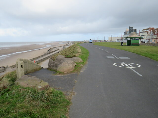
One of the notable features of Anchorsholme is its proximity to the coast, making it an attractive location for those seeking a coastal lifestyle. The area boasts stunning views of the Irish Sea and has a number of sandy beaches, including the popular Anchorsholme Beach, which is known for its clean waters and family-friendly environment.

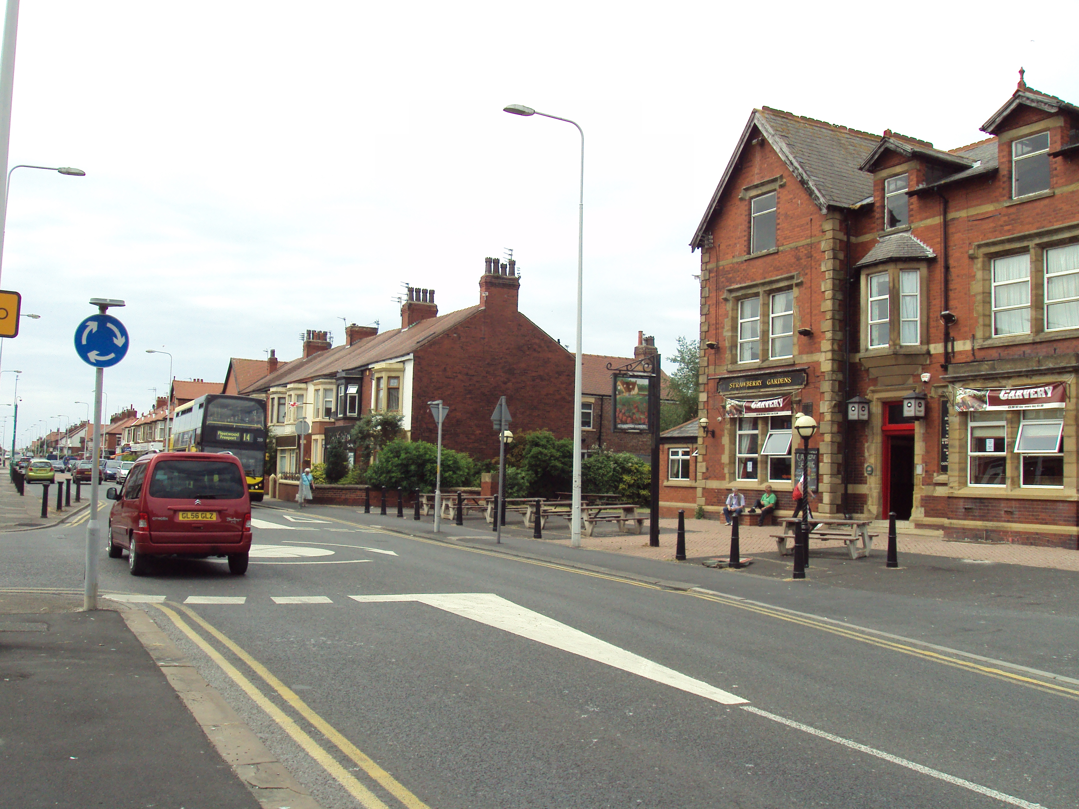
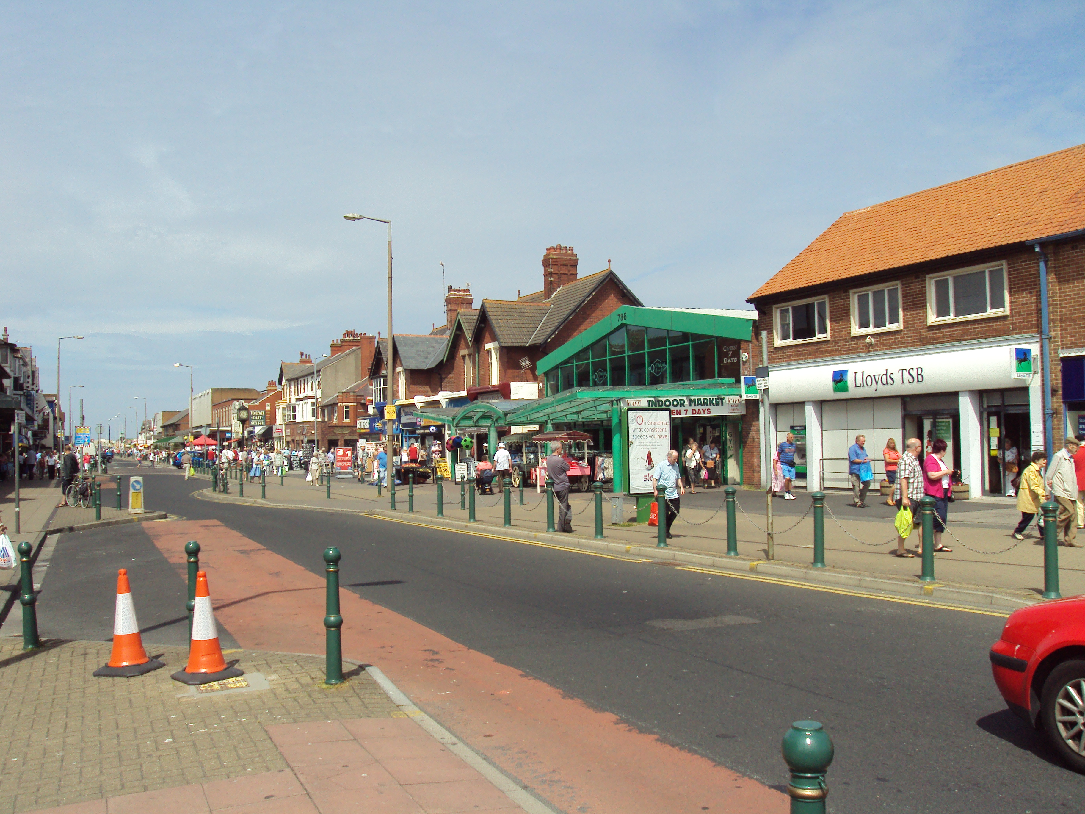
Anchorsholme is also home to a range of amenities and facilities. The area has a small shopping center with a variety of local shops, including grocery stores, cafes, and restaurants, providing residents with convenient access to everyday essentials. There are also several schools in the vicinity, making it a popular choice for families with children.

For outdoor enthusiasts, Anchorsholme offers plenty of opportunities for leisure activities. There are several parks and green spaces in the area, including Anchorsholme Park, which features a children's playground, sports fields, and picnic areas. Moreover, the nearby Wyre Estuary Country Park offers nature trails, birdwatching, and stunning views of the estuary.

Overall, Anchorsholme is a picturesque coastal community that offers residents a peaceful suburban lifestyle combined with the convenience of nearby amenities and stunning natural beauty.

If you have any feedback on the listing, please let us know in the comments section below.

Anchorsholme Images

Images are sourced within 2km of 53.870158/-3.038705 or Grid Reference SD3142. Thanks to Geograph Open Source API. All images are credited.

Promenade along the clifftop, Bispham, near Blackpool A promenade along the clifftop at Bispham, north of Blackpool.  A path leads off to the left, down to the beach below.

The promenade forms part of the route of National Cycle Network route 62.
Promenade along the clifftop, Bispham, near Blackpool
A promenade along the clifftop at Bispham, north of Blackpool. A path leads off to the left, down to the beach below. The promenade forms part of the route of National Cycle Network route 62.
Tram crossing, Norbreck, near Blackpool A crossing for pedestrians and cyclists across the tramway on Blackpool's seafront.  The Norbreck Castle Hotel stands in the background.
Tram crossing, Norbreck, near Blackpool
A crossing for pedestrians and cyclists across the tramway on Blackpool's seafront. The Norbreck Castle Hotel stands in the background.
Norbreck Castle Hotel, near Blackpool Norbreck Castle Hotel is a large hotel on Blackpool's seafront, about three miles north of Blackpool town centre.  The hotel has 480 guest rooms.

More information about the hotel can be found on Wikipedia: <span class="nowrap"><a title="https://en.wikipedia.org/wiki/Norbreck_Castle_Hotel" rel="nofollow ugc noopener" href="https://en.wikipedia.org/wiki/Norbreck_Castle_Hotel">Link</a><img style="margin-left:2px;" alt="External link" title="External link - shift click to open in new window" src="https://s1.geograph.org.uk/img/external.png" width="10" height="10"/></span>
Norbreck Castle Hotel, near Blackpool
Norbreck Castle Hotel is a large hotel on Blackpool's seafront, about three miles north of Blackpool town centre. The hotel has 480 guest rooms. More information about the hotel can be found on Wikipedia: LinkExternal link
Norbreck Castle Hotel, near Blackpool The Norbreck Castle Hotel is a large hotel on Blackpool's seafront, around three miles north of the town centre.  It has 480 guest rooms.  More information about the hotel can be found on Wikipedia: <span class="nowrap"><a title="https://en.wikipedia.org/wiki/Norbreck_Castle_Hotel" rel="nofollow ugc noopener" href="https://en.wikipedia.org/wiki/Norbreck_Castle_Hotel">Link</a><img style="margin-left:2px;" alt="External link" title="External link - shift click to open in new window" src="https://s1.geograph.org.uk/img/external.png" width="10" height="10"/></span>

The road in the foreground forms part of the A584.
Norbreck Castle Hotel, near Blackpool
The Norbreck Castle Hotel is a large hotel on Blackpool's seafront, around three miles north of the town centre. It has 480 guest rooms. More information about the hotel can be found on Wikipedia: LinkExternal link The road in the foreground forms part of the A584.
Queen's Promenade, Norbreck, near Blackpool Queen's Promenade forms part of the route of the A584 as it makes its way along Blackpool's seafront.
Queen's Promenade, Norbreck, near Blackpool
Queen's Promenade forms part of the route of the A584 as it makes its way along Blackpool's seafront.
Queen's Promenade, Norbreck, near Blackpool Queen's Promenade forms part of the route of the A584 as it passes along Blackpool's seafront.
Queen's Promenade, Norbreck, near Blackpool
Queen's Promenade forms part of the route of the A584 as it passes along Blackpool's seafront.
Seafront at Little Bispham, near Blackpool A view looking out to sea from the promenade at Little Bispham, north of Blackpool.
Seafront at Little Bispham, near Blackpool
A view looking out to sea from the promenade at Little Bispham, north of Blackpool.
Tram leaving Little Bispham A tram leaving the stop at Little Bispham, to head to the end of the line at Fleetwood.
Tram leaving Little Bispham
A tram leaving the stop at Little Bispham, to head to the end of the line at Fleetwood.
Flagpole on the seafront, Little Bispham, near Blackpool A flagpole on the seafront at Little Bispham, a few miles north of Blackpool.
Flagpole on the seafront, Little Bispham, near Blackpool
A flagpole on the seafront at Little Bispham, a few miles north of Blackpool.
Seafront at Little Bispham, near Blackpool A view south along the seafront promenade at Little Bispham, to the north of Blackpool.  In the background, to the left of the image, is the Norbreck Castle Hotel.

The promenade forms part of the route of National Cycle Network route 62.
Seafront at Little Bispham, near Blackpool
A view south along the seafront promenade at Little Bispham, to the north of Blackpool. In the background, to the left of the image, is the Norbreck Castle Hotel. The promenade forms part of the route of National Cycle Network route 62.
Anchorsholme Slipway, Little Bispham, near Blackpool Anchorshome slipway, on the seafront promenade at Little Bispham north of Blackpool.

The promenade is on the route of National Cycle Network route 62.
Anchorsholme Slipway, Little Bispham, near Blackpool
Anchorshome slipway, on the seafront promenade at Little Bispham north of Blackpool. The promenade is on the route of National Cycle Network route 62.
Seafront promenade near Cleveleys A row of metal posts prevent the seafront promenade from being used by motor vehicles (although they wouldn't stop mopeds, motor scooters or motorcycles).

The promenade is open to cyclists as well as pedestrians, and is on the route of National Cycle Network route 62.
Seafront promenade near Cleveleys
A row of metal posts prevent the seafront promenade from being used by motor vehicles (although they wouldn't stop mopeds, motor scooters or motorcycles). The promenade is open to cyclists as well as pedestrians, and is on the route of National Cycle Network route 62.
Houses with sloping roofs, near Cleveleys A development of houses with sloping roofs, near the coastal town of Cleveleys.
Houses with sloping roofs, near Cleveleys
A development of houses with sloping roofs, near the coastal town of Cleveleys.
Houses with sloping roofs, near Cleveleys A development of houses with sloping roofs, near the coastal town of Cleveleys.
Houses with sloping roofs, near Cleveleys
A development of houses with sloping roofs, near the coastal town of Cleveleys.
Houses with sloping roofs, near Cleveleys Houses with sloping roofs, near the coastal town of Cleveleys.
Houses with sloping roofs, near Cleveleys
Houses with sloping roofs, near the coastal town of Cleveleys.
Promenade and Princes Way, near Cleveleys A ramp leading off the promenade and onto Princes Way near Cleveleys.  The promenade and the wall form part of the coastal flood defence here.

The promenade forms part of the route of National Cycle Network route 62.
Promenade and Princes Way, near Cleveleys
A ramp leading off the promenade and onto Princes Way near Cleveleys. The promenade and the wall form part of the coastal flood defence here. The promenade forms part of the route of National Cycle Network route 62.
Gateway to Cleveleys The promenade which stretches along the entire length of Blackpool's seafront, passing into the town of Cleveleys.

Here, the promenade crosses a boundary, leaving the unitary authority of Blackpool and entering Wyre District, and thus entering the county of Lancashire.

The promenade forms part of the route of National Cycle Network route 62.
Gateway to Cleveleys
The promenade which stretches along the entire length of Blackpool's seafront, passing into the town of Cleveleys. Here, the promenade crosses a boundary, leaving the unitary authority of Blackpool and entering Wyre District, and thus entering the county of Lancashire. The promenade forms part of the route of National Cycle Network route 62.
Promenade at Cleveleys The seafront promenade at Cleveleys, in Lancashire.  The promenade forms part of Cleveleys' flood defences, and is on the route of National Cycle Network route 62.
Promenade at Cleveleys
The seafront promenade at Cleveleys, in Lancashire. The promenade forms part of Cleveleys' flood defences, and is on the route of National Cycle Network route 62.
Show me another place!

Anchorsholme is located at Grid Ref: SD3142 (Lat: 53.870158, Lng: -3.038705)

Unitary Authority: Blackpool

Police Authority: Lancashire

What 3 Words

///chins.forest.awards. Near Cleveleys, Lancashire

Nearby Locations

Anchorsholme

Related Wikis

A587 road

The A587 is a road in England that runs from Blackpool to Fleetwood in Lancashire. The road runs a total distance of approximately 9.5 miles (15.3 km)...

Anchorsholme

Anchorsholme is an area of Blackpool, in the Borough of Blackpool in Lancashire, England. It is close to the town of Cleveleys and village of Thornton...

Children's Corner (amusement park)

Children's Corner, also known as Kiddie's Corner, was a small amusement park located in Cleveleys, Lancashire, England. It stood at the western end of...

Cleveleys

Cleveleys is a town on the Fylde Coast of Lancashire, England, about 4 miles (6 km) north of Blackpool and 2 miles (3 km) south of Fleetwood. It is part...

Thornton-Cleveleys

Thornton-Cleveleys is a conurbation consisting of the village of Thornton and the town of Cleveleys. The two settlements formed a joint urban district...
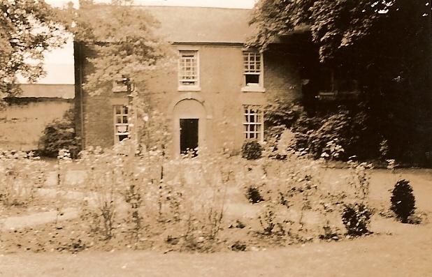
Marsh Farmhouse

Marsh Farmhouse is an historic building in Thornton-Cleveleys, Lancashire, England. Built in 1803, it is a Grade II listed building. It is located to the...

Sub Zero Ice Rink

Sub Zero Ice Rink was an ice rink, in Cleveleys, Lancashire, England. The rink was 36 metres (118 ft) x 22 metres (72 ft). It was home to the Fylde Flyers...

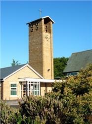
Christ Church, Thornton

Christ Church is in Meadows Avenue, Thornton, Lancashire, England. It is an active Anglican parish church in the deanery of Poulton, the archdeaconry...

Nearby Amenities

Located within 500m of 53.870158,-3.038705
Little Bispham
Place: suburb
Source: npe
Lat/Long: 53.8677325/-3.0448146
Anchorsholme
Place: suburb
Source: survey
Wikidata: Q4752761
Lat/Long: 53.8696556/-3.0321975
Traffic Signals
Lat/Long: 53.8721073/-3.0432363
Network: Blackpool Tramway
Operator: Blackpool Transport
Lat/Long: 53.8684961/-3.0456843
Network: Blackpool Tramway
Operator: Blackpool Transport
Lat/Long: 53.8692071/-3.0443115
Network: Blackpool Tramway
Operator: Blackpool Transport
Lat/Long: 53.8696527/-3.0434829
Network: Blackpool Tramway
Operator: Blackpool Transport
Lat/Long: 53.8699296/-3.0431422
Network: Blackpool Tramway
Operator: Blackpool Transport
Lat/Long: 53.8702324/-3.0428905
Network: Blackpool Tramway
Operator: Blackpool Transport
Lat/Long: 53.8709818/-3.0426642
Traffic Signals
Lat/Long: 53.8721573/-3.0425107
Network: Blackpool Tramway
Operator: Blackpool Transport
Lat/Long: 53.8716644/-3.0427537
Network: Blackpool Tramway
Operator: Blackpool Transport
Lat/Long: 53.8723577/-3.0428472
Network: Blackpool Tramway
Operator: Blackpool Transport
Lat/Long: 53.8736029/-3.0429984
Turning Circle
Lat/Long: 53.8723146/-3.0342721
Turning Circle
Lat/Long: 53.8719857/-3.0366607
Turning Circle
Lat/Long: 53.8714724/-3.0365534
Turning Circle
Lat/Long: 53.867503/-3.0356289
Turning Circle
Lat/Long: 53.8698384/-3.0348102
Crossing: traffic_signals
Network: Blackpool Tramway
Operator: Blackpool Transport
Railway: crossing
Lat/Long: 53.8721388/-3.0428276
Turning Circle
Lat/Long: 53.8668109/-3.0356938
Library
Anchorsholme Library
Addr City: Thornton-Cleveleys
Addr Postcode: FY5 3RS
Addr Street: Luton Road
Addr Suburb: Anchorsholme
Fhrs Id: 1010118
Toilets Wheelchair: no
Wheelchair: yes
Wikidata: Q54913954
Lat/Long: 53.8699562/-3.0324092
Network: Blackpool Tramway
Operator: Blackpool Transport
Lat/Long: 53.8711949/-3.0426881
Place Of Worship
St Teresa's
Addr City: Thornton-Cleveleys
Addr Postcode: FY5 3JT
Addr Street: St Teresa's Avenue
Addr Suburb: Little Bispham
Denomination: catholic
Religion: christian
Lat/Long: 53.8736177/-3.0379678
Turning Circle
Lat/Long: 53.873268/-3.0366684
Turning Circle
Lat/Long: 53.8738232/-3.0364693
Turning Circle
Lat/Long: 53.8733983/-3.0371048
Post Box
Check Date: 2022-10-02
Collection Times: Mo-Fr 09:00; Sa 07:00; Su off
Operator: Royal Mail
Post Box Type: pillar
Ref: FY5 306D
Royal Cypher: EIIR
Royal Cypher Wikidata: Q33102113
Lat/Long: 53.8745375/-3.0382674
Post Box
Brand: Royal Mail
Brand Wikidata: Q638098
Collection Times: Mo-Fr 09:00; Sa 07:00; Su off
Drive Through: no
Operator: Royal Mail
Operator Wikidata: Q638098
Post Box Type: pillar
Ref: FY5 73D
Royal Cypher: GR
Royal Cypher Wikidata: Q33102273
Lat/Long: 53.8722843/-3.0404607
Anchorsholme Lane
Network: Blackpool Tramway
Operator: Blackpool Transport
Public Transport: stop_position
Railway: tram_stop
Tram: yes
Wheelchair: yes
Lat/Long: 53.8714156/-3.042768
Anchorsholme Lane
Network: Blackpool Tramway
Operator: Blackpool Transport
Public Transport: stop_position
Railway: tram_stop
Tram: yes
Wheelchair: yes
Lat/Long: 53.8714137/-3.0427197
Crossing: uncontrolled
Network: Blackpool Tramway
Operator: Blackpool Transport
Railway: crossing
Lat/Long: 53.8738464/-3.0430253
Crossing: traffic_signals
Network: Blackpool Tramway
Operator: Blackpool Transport
Railway: crossing
Lat/Long: 53.870666/-3.0427475
Network: Blackpool Tramway
Operator: Blackpool Transport
Lat/Long: 53.8685251/-3.0457061
Network: Blackpool Tramway
Operator: Blackpool Transport
Lat/Long: 53.8687405/-3.0452794
Network: Blackpool Tramway
Operator: Blackpool Transport
Lat/Long: 53.8691403/-3.0445049
Network: Blackpool Tramway
Operator: Blackpool Transport
Lat/Long: 53.8695556/-3.043707
Network: Blackpool Tramway
Operator: Blackpool Transport
Lat/Long: 53.8698083/-3.043267
Network: Blackpool Tramway
Operator: Blackpool Transport
Lat/Long: 53.8698248/-3.0432975
Network: Blackpool Tramway
Operator: Blackpool Transport
Lat/Long: 53.870047/-3.0430707
Network: Blackpool Tramway
Operator: Blackpool Transport
Lat/Long: 53.8700794/-3.0429962
Network: Blackpool Tramway
Operator: Blackpool Transport
Lat/Long: 53.8703728/-3.0428589
Network: Blackpool Tramway
Operator: Blackpool Transport
Lat/Long: 53.8707047/-3.042687
Network: Blackpool Tramway
Operator: Blackpool Transport
Lat/Long: 53.8708273/-3.0427163
Network: Blackpool Tramway
Operator: Blackpool Transport
Lat/Long: 53.8709996/-3.0427046
Network: Blackpool Tramway
Operator: Blackpool Transport
Lat/Long: 53.8721348/-3.0428783
Network: Blackpool Tramway
Operator: Blackpool Transport
Lat/Long: 53.8731855/-3.0430206
Crossing: traffic_signals
Network: Blackpool Tramway
Operator: Blackpool Transport
Railway: crossing
Lat/Long: 53.8721352/-3.0428809
Mini Roundabout
Lat/Long: 53.8703417/-3.0337809
Post Box
Brand: Royal Mail
Brand Wikidata: Q638098
Collection Times: Mo-Fr 16:00; Sa 12:00; Su off
Drive Through: no
Operator: Royal Mail
Operator Wikidata: Q638098
Post Box Type: pillar
Ref: FY5 218
Royal Cypher: EIIR
Royal Cypher Wikidata: Q33102113
Lat/Long: 53.8668222/-3.0389405
Post Box
Brand: Royal Mail
Brand Wikidata: Q638098
Collection Times: Mo-Fr 09:00; Sa 07:00; Su off
Drive Through: no
Operator: Royal Mail
Operator Wikidata: Q638098
Post Box Type: pillar
Ref: FY5 241D
Royal Cypher: GVIR
Royal Cypher Wikidata: Q33102169
Lat/Long: 53.8706854/-3.0355076
Pharmacy
Cleveleys Pharmacy
Addr City: Thornton-Cleveleys
Addr Housenumber: 42
Addr Postcode: FY5 3JG
Addr Street: Kelso Avenue
Dispensing: yes
Healthcare: pharmacy
Wheelchair: limited
Lat/Long: 53.8729249/-3.042368
Fast Food
Bella Gusto
Addr City: Thornton-Cleveleys
Addr Housenumber: 228
Addr Postcode: FY5 1NL
Addr Street: Fleetwood Road
Cuisine: italian
Fhrs Id: 140320
Takeaway: yes
Lat/Long: 53.8664704/-3.0395907
Fast Food
Dragons Palace
Addr City: Thornton-Cleveleys
Addr Housenumber: 234
Addr Postcode: FY5 1NL
Addr Street: Fleetwood Road
Cuisine: chinese
Fhrs Id: 142017
Takeaway: only
Lat/Long: 53.8666344/-3.0395889
Car Rental
Enterprise
Addr City: Thornton-Cleveleys
Addr Housenumber: 236-8
Addr Postcode: FY5 1NL
Addr Street: Fleetwood Road
Brand: Enterprise
Brand Wikidata: Q17085454
Official Name: Enterprise Rent-A-Car
Lat/Long: 53.8668345/-3.0394382
Euphoria Hair
Addr City: Thornton-Cleveleys
Addr Housenumber: 230a
Addr Postcode: FY5 1NL
Addr Street: Fleetwood Road
Shop: hairdresser
Lat/Long: 53.8665249/-3.03959
AJ Premier Convenience Store
Addr City: Thornton-Cleveleys
Addr Housenumber: 224
Addr Postcode: FY5 1NL
Addr Street: Fleetwood Road
Brand: Premier Stores
Brand Wikidata: Q7240340
Brand Wikipedia: en:Premier (store)
Fhrs Id: 1706793
Shop: convenience
Website: https://www.premier-stores.co.uk/our-stores/aj-convenience-store-1
Lat/Long: 53.86635/-3.0395938
Smiths Equipment Hire
Addr City: Thornton-Cleveleys
Addr Housenumber: 245
Addr Postcode: FY5 1NJ
Addr Street: Fleetwood Road
Shop: hardware
Lat/Long: 53.8666278/-3.0387313
Sages Hardware
Addr City: Thornton-Cleveleys
Addr Housenumber: 251
Addr Postcode: FY5 1NJ
Addr Street: Fleetwood Road
Shop: garden_centre
Lat/Long: 53.8668509/-3.0386975
Sweeney Todd
Addr City: Thornton-Cleveleys
Addr Housenumber: 230b
Addr Postcode: FY5 1NL
Addr Street: Fleetwood Road
Shop: hairdresser
Lat/Long: 53.8665794/-3.0395877
Nursing Home
Nightingales Care Home
Addr City: Thornton-Cleveleys
Addr Housenumber: 355a
Addr Postcode: FY5 1PB
Addr Street: Norbreck Road
Addr Suburb: Little Bispham
Fhrs Id: 141864
Lat/Long: 53.8681252/-3.041019
Kindergarten
Norbreck Happy Days Nursery
Addr City: Thornton-Cleveleys
Addr Postcode: FY5 1NY
Addr Street: Russell Avenue
Fhrs Id: 140532
Lat/Long: 53.865941/-3.0413181
Fast Food
243 Sandwich Bar
Addr City: Thornton-Cleveleys
Addr Housenumber: 243
Addr Postcode: FY5 1RA
Addr Street: Fleetwood Road
Cuisine: sandwich
Fhrs Id: 548741
Lat/Long: 53.8657165/-3.0386949
Fast Food
Pearl City
Addr City: Thornton-Cleveleys
Addr Housenumber: 26-28
Addr Postcode: FY5 3QL
Addr Street: Anchorsholme Lane East
Addr Suburb: Little Bispham
Cuisine: chinese
Fhrs Id: 143570
Takeaway: yes
Lat/Long: 53.8721264/-3.0412703
Addr City: Thornton-Cleveleys
Addr Housenumber: 38-40
Addr Postcode: FY5 3QL
Addr Street: Anchorsholme Lane East
Addr Suburb: Little Bispham
Lat/Long: 53.8721912/-3.040471
Fast Food
New Anchor
Addr City: Thornton-Cleveleys
Addr Housenumber: 42
Addr Postcode: FY5 3QL
Addr Street: Anchorsholme Lane East
Addr Suburb: Little Bispham
Cuisine: fish_and_chips
Fhrs Id: 143572
Takeaway: yes
Lat/Long: 53.8722197/-3.0402725
Addr City: Thornton-Cleveleys
Addr Housenumber: 29
Addr Postcode: FY5 3QH
Addr Street: Anchorsholme Lane East
Addr Suburb: Little Bispham
Lat/Long: 53.8725818/-3.0398139
Restaurant
Gennars
Addr City: Thornton-Cleveleys
Addr Housenumber: 15
Addr Postcode: FY5 3QH
Addr Street: Anchorsholme Lane East
Addr Suburb: Little Bispham
Cuisine: italian
Fhrs Id: 898342
Takeaway: only
Lat/Long: 53.8723747/-3.0417102
Restaurant
Meherin
Addr City: Thornton-Cleveleys
Addr Housenumber: 7
Addr Postcode: FY5 3QH
Addr Street: Anchorsholme Lane East
Addr Suburb: Little Bispham
Cuisine: indian
Fhrs Id: 140253
Lat/Long: 53.8723557/-3.041898
Briardene Hotel
Addr City: Thornton-Cleveleys
Addr Housenumber: 56
Addr Postcode: FY5 3JG
Addr Street: Kelso Avenue
Addr Suburb: Little Bispham
Fhrs Id: 715048
Tourism: hotel
Lat/Long: 53.8737118/-3.0426977
Perfection Hair & Beauty
Addr City: Thornton-Cleveleys
Addr Housenumber: 30-32
Addr Postcode: FY5 3QL
Addr Street: Anchorsholme Lane East
Addr Suburb: Little Bispham
Shop: hairdresser
Lat/Long: 53.8721311/-3.0410725
Lawtons
Addr City: Thornton-Cleveleys
Addr Housenumber: 34
Addr Postcode: FY5 3QL
Addr Street: Anchorsholme Lane East
Addr Suburb: Little Bispham
Clothes: underwear
Shop: clothes
Lat/Long: 53.872158/-3.0408365
Fast Tan
Addr City: Thornton-Cleveleys
Addr Housenumber: 36
Addr Postcode: FY5 3QL
Addr Street: Anchorsholme Lane East
Addr Suburb: Little Bispham
Leisure: tanning_salon
Lat/Long: 53.8721659/-3.0407265
Willows
Addr City: Thornton-Cleveleys
Addr Housenumber: 44-46
Addr Postcode: FY5 3QL
Addr Street: Anchorsholme Lane East
Addr Suburb: Little Bispham
Shop: florist
Lat/Long: 53.8722307/-3.0401659
Co-op Funeral Services
Addr City: Thornton-Cleveleys
Addr Housenumber: 42
Addr Postcode: FY5 3JG
Addr Street: Kelso Avenue
Addr Suburb: Little Bispham
Shop: funeral_directors
Lat/Long: 53.8727289/-3.0423707
Andrew Curran
Addr City: Thornton-Cleveleys
Addr Housenumber: 1
Addr Postcode: FY5 3QH
Addr Street: Anchorsholme Lane East
Addr Suburb: Little Bispham
Shop: car_parts
Lat/Long: 53.8723873/-3.0423546
Kelso House
Addr City: Blackpool
Addr Housenumber: 58
Addr Street: Kelso Avenue
Tourism: apartment
Lat/Long: 53.873922/-3.0427291
Defibrillator
Emergency: defibrillator
Lat/Long: 53.8738421/-3.038165
Fast Food
Bella Fried Chicken
Addr City: Thornton-Cleveleys
Addr Housenumber: 226
Addr Postcode: FY5 1NL
Addr Street: Fleetwood Road
Addr Suburb: Little Bispham
Cuisine: chicken
Lat/Long: 53.8664161/-3.0395922
Atm
Lat/Long: 53.8719658/-3.0431204
Sams Convience Store
Addr City: Thornton-Cleveleys
Addr Housenumber: 22
Addr Postcode: FY5 3EH
Addr Street: Lyddesdale Avenue
Addr Suburb: Little Bispham
Brand: Premier Stores
Brand Wikidata: Q7240340
Brand Wikipedia: en:Premier (store)
Shop: convenience
Website: https://www.premier-stores.co.uk/our-stores/sams-convenience-store-0
Lat/Long: 53.8711142/-3.0394994
Sylvia Conway Dance Academy
Addr City: Thornton-Cleveleys
Addr Housenumber: 17
Addr Postcode: FY5 3QH
Addr Street: Anchorsholme Lane
Addr Suburb: Little Bispham
Dance Teaching: yes
Leisure: dance
Lat/Long: 53.872392/-3.0415553
Strachan Travel
Addr City: Thornton-Cleveleys
Addr Housenumber: 5
Addr Postcode: FY5 3QH
Addr Street: Anchorsholme Lane
Addr Suburb: Little Bispham
Shop: travel_agency
Lat/Long: 53.8723531/-3.0419844
Blackpool Electric Bikes
Addr City: Thornton-Cleveleys
Addr Housenumber: 3
Addr Postcode: FY5 3QH
Addr Street: Anchorsholme Lane
Addr Suburb: Little Bispham
Shop: bicycle
Lat/Long: 53.8723493/-3.0420716
Cuts 'n' Curls
Addr City: Thornton-Cleveleys
Addr Housenumber: 18a
Addr Postcode: FY5 3EQ
Addr Street: Lyddesdale Avenue
Addr Suburb: Little Bispham
Shop: hairdresser
Lat/Long: 53.871478/-3.0393612
You
Addr City: Thornton-Cleveleys
Addr Housenumber: 20
Addr Postcode: FY5 3EQ
Addr Street: Lyddesdale Avenue
Addr Suburb: Little Bispham
Shop: beauty
Lat/Long: 53.8714147/-3.0393827
Traffic Signals
Crossing Ref: pelican
Traffic Signals: signal
Lat/Long: 53.8723655/-3.0430418
Parcel Locker
Brand: Amazon Hub Locker
Brand Wikidata: Q16974764
Opening Hours: 24/7
Operator: Amazon
Operator Wikidata: Q3884
Operator Wikipedia: en:Amazon (company)
Parcel Locker Type: cabinet
Parcel Mail In: returns_only
Parcel Pickup: yes
Lat/Long: 53.8706406/-3.0334355
Atm
Atm Fee: free
Lat/Long: 53.8705957/-3.0334514
Parking
Access: customers
Lat/Long: 53.8707735/-3.0332813
Parking
Access: customers
Lat/Long: 53.8675658/-3.0342106
Traffic Signals
Traffic Signals: signal
Lat/Long: 53.8722752/-3.0426911
Traffic Signals
Traffic Signals: signal
Lat/Long: 53.8719674/-3.0429864
Traffic Signals
Traffic Signals: signal
Lat/Long: 53.8704323/-3.0423168
Parking
Access: private
Lat/Long: 53.8727513/-3.0416947
Barrier: bollard
Lat/Long: 53.8741113/-3.038387
Traffic Signals
Traffic Signals: signal
Lat/Long: 53.8719414/-3.0426321
Traffic Signals
Traffic Signals: signal
Lat/Long: 53.8707303/-3.0425561
Traffic Signals
Traffic Signals: signal
Lat/Long: 53.8704127/-3.0426003
Traffic Signals
Traffic Signals: signal
Lat/Long: 53.8703827/-3.0423425
Traffic Signals
Traffic Signals: signal
Lat/Long: 53.8661899/-3.0391333
The Town Store
Addr City: Thornton-Cleveleys
Addr Housenumber: 2
Addr Postcode: FY5 3QL
Addr Street: Anchorsholme Lane East
Addr Suburb: Little Bispham
Fhrs Id: 1701986
Shop: convenience
Lat/Long: 53.8720402/-3.0422741
Crossing
Crossing: zebra
Tactile Paving: no
Lat/Long: 53.8701456/-3.0338363
Crossing
Crossing: zebra
Lat/Long: 53.8732107/-3.0331816
Parcel Locker
Opening Hours: 24/7
Operator: InPost UK Ltd
Parcel Locker Type: cabinet
Parcel Mail In: returns_only
Parcel Pickup: yes
Lat/Long: 53.8711941/-3.0395038
Parcel Locker
Brand: Inpost UK Ltd
Opening Hours: 24/7
Operator: Inpost UK Ltd
Parcel Locker Type: cabinet
Parcel Mail In: returns_only
Parcel Pickup: yes
Lat/Long: 53.8723667/-3.0434892
Bicycle Parking
Bicycle Parking: stands
Capacity: 8
Covered: no
Lat/Long: 53.872271/-3.0405697
Defibrillator
Access: yes
Defibrillator Location: Golden Eagle
Emergency: defibrillator
Lat/Long: 53.8663977/-3.0346103
Fast Food
Asia Fusion Street Food
Addr City: Thornton-Cleveleys
Addr Housenumber: 8
Addr Postcode: FY5 3QL
Addr Street: Anchorsholme Lane East
Cuisine: asian
Fhrs Id: 1631359
Lat/Long: 53.8721065/-3.0419454
The Brew At Anchorsholme
Addr City: Thornton-Cleveleys
Addr Postcode: FY5 1LY
Addr Street: Anchorsholme Lane West
Fhrs Id: 1671168
Shop: coffee
Lat/Long: 53.8701432/-3.045761
The data included in this document is from www.openstreetmap.org. The data is made available under ODbL.

Have you been to Anchorsholme?

Leave your review of Anchorsholme below (or comments, questions and feedback).