Ashbury Plantations

Wood, Forest in Devon West Devon

England

Ashbury Plantations

Old Turnpike Terminus Marker on the A3079 in Okehampton Hamlets parish Turnpike Terminus Marker at Thorndon Cross on the north side of the A3079 Holsworthy Road by the gate of Maddaford Retreat. On the boundary of Okehampton Hamlets and Sourton parishes, until 1894 Okehampton and Sourton. It was snapped off at ground level by a reversing lorry in the 1980s and was moved to the gardens of Railway Cottages but is now reset on the path.

Milestone Society National ID: DV_OKHW04t
Old Turnpike Terminus Marker on the A3079 in Okehampton Hamlets parish Credit: A Rosevear

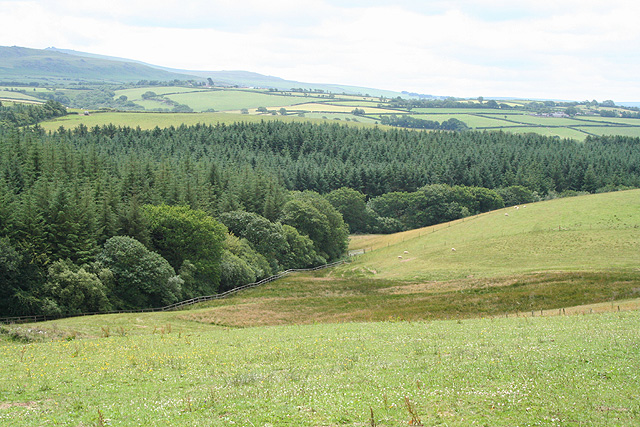
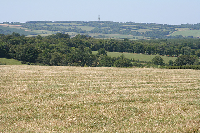
Ashbury Plantations is a picturesque wooded area located in Devon, England. Nestled within the heart of Devon's countryside, this sprawling forest covers a vast expanse of land, providing a haven for nature enthusiasts and outdoor adventurers alike.

The plantation is renowned for its dense and lush woodlands, dominated by a variety of tree species including oak, beech, and birch. The canopies of these majestic trees create a serene and tranquil atmosphere, allowing visitors to escape the hustle and bustle of daily life.

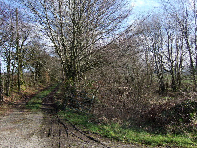
Within the plantation, there is a network of well-maintained trails that wind through the forest, providing ample opportunities for hiking, walking, and exploring. The trails vary in difficulty, catering to both novice and experienced hikers. As visitors venture deeper into the forest, they may encounter an array of wildlife, such as deer, foxes, and a multitude of bird species.

In addition to its natural beauty, Ashbury Plantations is also home to a diverse range of flora and fauna. Wildflowers, ferns, and mosses carpet the forest floor, while ancient, towering trees stand as a testament to the area's rich history.

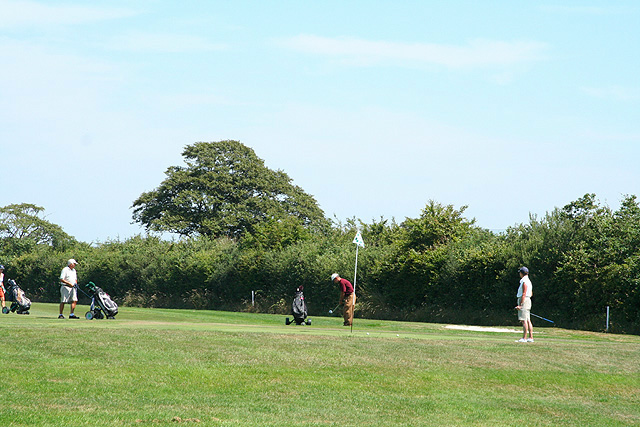
For those seeking a peaceful retreat, Ashbury Plantations offers a number of picnic spots and benches, allowing visitors to relax and enjoy the tranquil surroundings. The plantation also provides educational opportunities, with guided tours and nature walks available to learn about the local ecosystem and conservation efforts.

Overall, Ashbury Plantations in Devon offers a serene and beautiful escape into nature, where visitors can immerse themselves in the stunning woodlands, observe wildlife, and enjoy the tranquility of the forest.

If you have any feedback on the listing, please let us know in the comments section below.

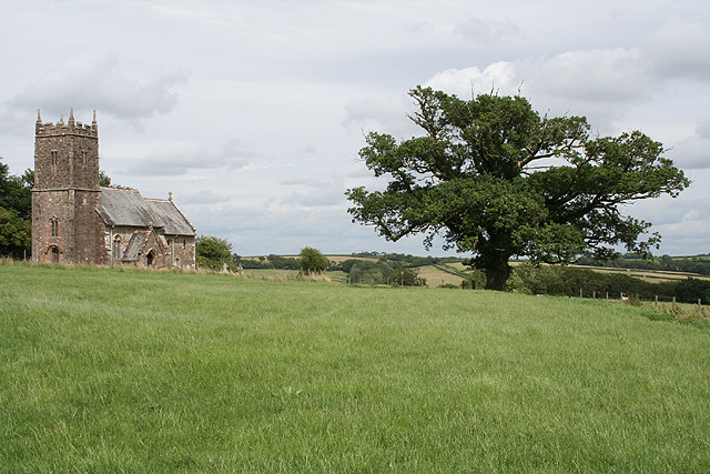
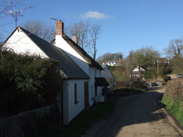
Ashbury Plantations Images

Images are sourced within 2km of 50.742119/-4.0820708 or Grid Reference SX5395. Thanks to Geograph Open Source API. All images are credited.

Old Turnpike Terminus Marker on the A3079 in Okehampton Hamlets parish Turnpike Terminus Marker at Thorndon Cross on the north side of the A3079 Holsworthy Road by the gate of Maddaford Retreat. On the boundary of Okehampton Hamlets and Sourton parishes, until 1894 Okehampton and Sourton. It was snapped off at ground level by a reversing lorry in the 1980s and was moved to the gardens of Railway Cottages but is now reset on the path.

Milestone Society National ID: DV_OKHW04t
Old Turnpike Terminus Marker on the A3079 in Okehampton Hamlets parish
Turnpike Terminus Marker at Thorndon Cross on the north side of the A3079 Holsworthy Road by the gate of Maddaford Retreat. On the boundary of Okehampton Hamlets and Sourton parishes, until 1894 Okehampton and Sourton. It was snapped off at ground level by a reversing lorry in the 1980s and was moved to the gardens of Railway Cottages but is now reset on the path. Milestone Society National ID: DV_OKHW04t
Maddaford Moor Halt, North Devon The London & South Western Railway opened their Exeter to Bude branch in 1879 and 47 years later the Southern Railway provided this remote Maddaford Moor Halt. It closed in 1966 and is located where the line passed under the A3079, at a hamlet now known as Thorndon Cross, four miles west of Okehampton.
Maddaford Moor Halt, North Devon
The London & South Western Railway opened their Exeter to Bude branch in 1879 and 47 years later the Southern Railway provided this remote Maddaford Moor Halt. It closed in 1966 and is located where the line passed under the A3079, at a hamlet now known as Thorndon Cross, four miles west of Okehampton.
Sourton: near Thorndon Cross Looking south-south-east with the Dartmoor hills on the skyline
Sourton: near Thorndon Cross
Looking south-south-east with the Dartmoor hills on the skyline
Okehampton Hamlets: Cruft Gate Farm Looking north east. The farm has in the same family for at least 42 years
Okehampton Hamlets: Cruft Gate Farm
Looking north east. The farm has in the same family for at least 42 years
Okehampton Hamlets: barn by Lower Cruft Farm Looking north-north-west. Stone, wood, corrugated iron and brick are all used in this structure
Okehampton Hamlets: barn by Lower Cruft Farm
Looking north-north-west. Stone, wood, corrugated iron and brick are all used in this structure
Northlew: public bridleway to Scobchester Looking west
Northlew: public bridleway to Scobchester
Looking west
Ashbury: Scobchester Looking east
Ashbury: Scobchester
Looking east
Ashbury: ford on bridleway Looking north east on the edge of Wadland Down Plantations. The river Lew is formed from this and neighbouring streams
Ashbury: ford on bridleway
Looking north east on the edge of Wadland Down Plantations. The river Lew is formed from this and neighbouring streams
Ashbury: Wadland Down Plantations Looking west on a public bridleway
Ashbury: Wadland Down Plantations
Looking west on a public bridleway
Okehampton Hamlets: towards Venn Down Looking west
Okehampton Hamlets: towards Venn Down
Looking west
Okehampton Hamlets: towards Hilltown The communications mast is near the high point of the hill on the left, above Hilltown Farm; Dartmoor stands on the skyline to the right. Looking east
Okehampton Hamlets: towards Hilltown
The communications mast is near the high point of the hill on the left, above Hilltown Farm; Dartmoor stands on the skyline to the right. Looking east
Okehampton Hamlets: Southcott Looking north. On a back road between Southcott Cross and Kigbeare
Okehampton Hamlets: Southcott
Looking north. On a back road between Southcott Cross and Kigbeare
Okehampton Hamlets: golf course On the 13th hole of one of four 18-hole golf courses at the Ashbury Golf Hotel; looking east-north-east. See also <span class="nowrap"><a title="http://www.manorashbury.co.uk/ashbury_index.asp" rel="nofollow ugc noopener" href="http://www.manorashbury.co.uk/ashbury_index.asp">Link</a><img style="margin-left:2px;" alt="External link" title="External link - shift click to open in new window" src="https://s1.geograph.org.uk/img/external.png" width="10" height="10"/></span>
Okehampton Hamlets: golf course
On the 13th hole of one of four 18-hole golf courses at the Ashbury Golf Hotel; looking east-north-east. See also LinkExternal link
Ashbury: on Scobchester Down Looking east-north-east towards Lower Cruft Farm
Ashbury: on Scobchester Down
Looking east-north-east towards Lower Cruft Farm
Beaworthy Bridleway 53 and dismantled railway The bridleway on the left runs beside the line of the dismantled Halwill Junction - Okehampton railway, to the right. Parallel to both runs the A3079, alongside the trees on the right. The bridleway is accessed at two points from the main road: here at the farm drive to Pinnacle Farm; and by a bridge under the railway at the far end of this stretch of bridleway.
Beaworthy Bridleway 53 and dismantled railway
The bridleway on the left runs beside the line of the dismantled Halwill Junction - Okehampton railway, to the right. Parallel to both runs the A3079, alongside the trees on the right. The bridleway is accessed at two points from the main road: here at the farm drive to Pinnacle Farm; and by a bridge under the railway at the far end of this stretch of bridleway.
Ashbury Golf Club Entrance to the main hotel and leisure complex.
Ashbury Golf Club
Entrance to the main hotel and leisure complex.
Ashbury Golf Club These buildings were originally a farmhouse, converted as part of the golf hotel and leisure complex.
Ashbury Golf Club
These buildings were originally a farmhouse, converted as part of the golf hotel and leisure complex.
Kigbeare Golf Club With distant views of Dartmoor to the south.
Kigbeare Golf Club
With distant views of Dartmoor to the south.
Show me another place!

Ashbury Plantations is located at Grid Ref: SX5395 (Lat: 50.742119, Lng: -4.0820708)

Administrative County: Devon

District: West Devon

Police Authority: Devon and Cornwall

What 3 Words

///disprove.occupy.duos. Near Okehampton, Devon

Nearby Locations

Ashbury Plantations

Related Wikis

Maddaford Moor Halt railway station

Maddaford Moor Halt was a railway station on the Bude Branch that closed in 1966. The halt was located where the line passed under the A3079, at a hamlet...

Ashbury, Devon

Ashbury is a village and former civil parish, now in the parish of Northlew, in the West Devon district, in the county of Devon, England. It is 5 miles...

A386 road

The A386 is a primary route in Devon, England. It runs from Plymouth on the south coast to Appledore on the north coast. The road starts in the centre...

Northlew

Northlew is a village and civil parish in the West Devon district of the county of Devon, England. To the west of the village, but within the parish, are...

Boasley Cross

Boasley Cross is a village in Devon, England. == External links == Media related to Boasley Cross at Wikimedia Commons

Meldon Viaduct railway station

Meldon Viaduct railway station was a railway station at Meldon in Devon. It was renamed in 2015 from Meldon Quarry railway station. == History == The station...

Inwardleigh

Inwardleigh is a village and civil parish about 3 and a half miles north north west of Okehampton railway station, in the West Devon district, in the county...

Meldon Viaduct

Meldon Viaduct is a disused railway viaduct crossing the West Okement River at Meldon, 2.5 miles (4.0 km) south-west of Okehampton, on the edge of Dartmoor...

Nearby Amenities

Located within 500m of 50.742119,-4.0820708
Turning Circle
Lat/Long: 50.7410418/-4.0771291
10
Golf: pin
Lat/Long: 50.7386377/-4.0776829
15
Golf: pin
Lat/Long: 50.7421153/-4.0757036
16
Golf: pin
Lat/Long: 50.7414262/-4.0774739
The data included in this document is from www.openstreetmap.org. The data is made available under ODbL.

Have you been to Ashbury Plantations?

Leave your review of Ashbury Plantations below (or comments, questions and feedback).