Ashbury Plantations

Wood, Forest in Devon West Devon

England

Ashbury Plantations

Northlew: lane from Hatherleigh Looking south-south-west approaching Lower Eastcott
Northlew: lane from Hatherleigh Credit: Martin Bodman

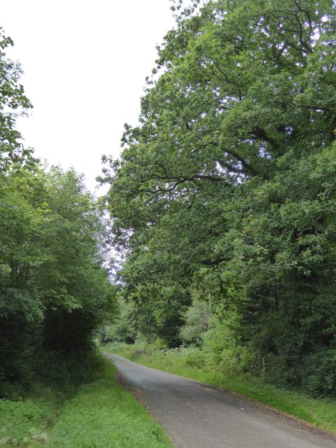
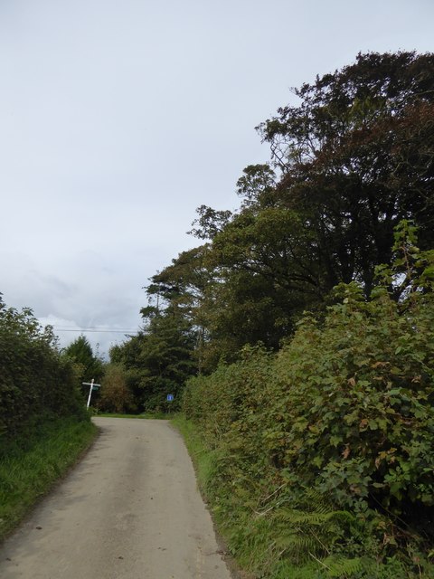
Ashbury Plantations is a picturesque forest located in Devon, England. Situated in the heart of the county, this woodland area covers a vast expanse, offering visitors a serene and idyllic retreat from the bustling city life. Spanning over acres of land, Ashbury Plantations is known for its dense canopy of trees, creating a stunning display of vibrant greenery throughout the year.

The forest is primarily composed of various tree species, including oak, beech, and pine, which contribute to its rich biodiversity. The diverse flora and fauna make Ashbury Plantations a haven for nature enthusiasts and wildlife lovers alike. Birdwatchers can spot a wide range of avian species, such as woodpeckers, owls, and thrushes, while small mammals like squirrels and rabbits can be seen darting through the undergrowth.

Several walking trails crisscross the forest, allowing visitors to explore its beauty at their own pace. These paths offer breathtaking views of the surrounding landscape, with glimpses of rolling hills and meandering streams. The tranquil atmosphere and the soothing sounds of nature make it an ideal location for those seeking solace or a peaceful outdoor experience.

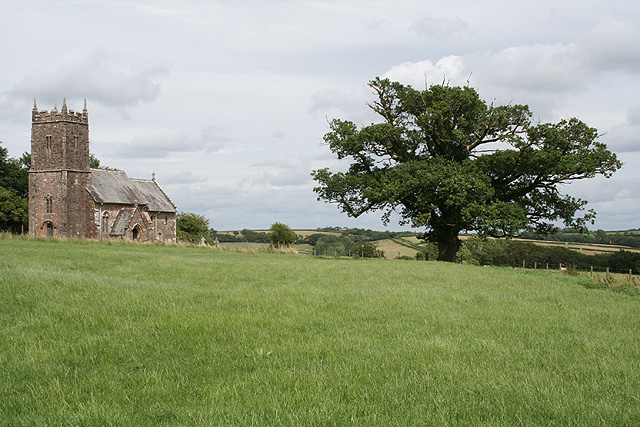
Ashbury Plantations is also known for its historical significance. It has been a part of Devon's heritage for centuries, with evidence of human settlement dating back to ancient times. Remnants of old structures and archaeological sites can be found within the forest, adding to its charm and intrigue.

Overall, Ashbury Plantations in Devon is a captivating destination for nature lovers, history buffs, and those looking to escape the hustle and bustle of everyday life. With its lush vegetation, abundant wildlife, and scenic beauty, it promises an unforgettable experience for all who visit.

If you have any feedback on the listing, please let us know in the comments section below.

Ashbury Plantations Images

Images are sourced within 2km of 50.772407/-4.0852597 or Grid Reference SX5399. Thanks to Geograph Open Source API. All images are credited.

Northlew: lane from Hatherleigh Looking south-south-west approaching Lower Eastcott
Northlew: lane from Hatherleigh
Looking south-south-west approaching Lower Eastcott
Westacott The entrance to a large group of farm buildings named "Higher Westacott" on the 1:25000 sheet. A small triangle of land with trees is crossed by a couple of tracks.
Westacott
The entrance to a large group of farm buildings named "Higher Westacott" on the 1:25000 sheet. A small triangle of land with trees is crossed by a couple of tracks.
Lane to Norleigh Barton A family process at gentle pace on horseback along the lane from Westacott to Norleigh Barton, a couple of hundred metres beyond the bungalow in the background.
Lane to Norleigh Barton
A family process at gentle pace on horseback along the lane from Westacott to Norleigh Barton, a couple of hundred metres beyond the bungalow in the background.
Narracott Farm The farm seen across fields from close to the lane between Westacott and Gribbleford Bridge. On the left the fields slope towards the Hookmoor Brook.
Narracott Farm
The farm seen across fields from close to the lane between Westacott and Gribbleford Bridge. On the left the fields slope towards the Hookmoor Brook.
Track to Hookmoor Brook Although the track is signposted as a public footpath,Inwardleigh Footpath 7 technically does not begin until the track reaches the brook, although it is shown as publicly accessible on the 1:25000 sheet. The lane on the right is from Westacott to Gribbleford Bridge.
Track to Hookmoor Brook
Although the track is signposted as a public footpath,Inwardleigh Footpath 7 technically does not begin until the track reaches the brook, although it is shown as publicly accessible on the 1:25000 sheet. The lane on the right is from Westacott to Gribbleford Bridge.
Field near Lambert Cross From the lane from Durdon Cross to Gribbleford Bridge. Three oaks stand along the far hedgerow. The land is dropping towards the Hookmoor Brook valley.
Field near Lambert Cross
From the lane from Durdon Cross to Gribbleford Bridge. Three oaks stand along the far hedgerow. The land is dropping towards the Hookmoor Brook valley.
Lane to Lambert Cross From the gateway shown in <a href="https://www.geograph.org.uk/photo/2777407">SS5200 : Field near Lambert Cross</a>, looking down the lane between its banks.
Lane to Lambert Cross
From the gateway shown in SS5200 : Field near Lambert Cross, looking down the lane between its banks.
Norleigh Barton The farmhouse, beyond the barn, is Victorian and described at <span class="nowrap"><a title="http://list.english-heritage.org.uk/resultsingle.aspx?uid=1105245&searchtype=mapsearch" rel="nofollow ugc noopener" href="http://list.english-heritage.org.uk/resultsingle.aspx?uid=1105245&searchtype=mapsearch">Link</a><img style="margin-left:2px;" alt="External link" title="External link - shift click to open in new window" src="https://s1.geograph.org.uk/img/external.png" width="10" height="10"/></span> . Seen from the route with public access which connects Hatherleigh Bridleway 8 with the lane at Norleigh Cross.
Norleigh Barton
The farmhouse, beyond the barn, is Victorian and described at LinkExternal link . Seen from the route with public access which connects Hatherleigh Bridleway 8 with the lane at Norleigh Cross.
Woodland at Lambert Cross
Lambert Cross Looking north to the road junction
Lambert Cross
Looking north to the road junction
Road west from Lambert Cross
View south to Lambert Cross To the north of the road junction, there are woods on each side of the road.  This is from a point just north of the boundary of the woodland on the west side
View south to Lambert Cross
To the north of the road junction, there are woods on each side of the road. This is from a point just north of the boundary of the woodland on the west side
Forest track into Hookmoor Wood
Hookmoor Wood
Hookmoor Wood
Access track near Norleigh Barton The track leads between fields; there is a gate to the field on the left at this entrance.  Formerly the track led to an area of marshland, now reclaimed
Access track near Norleigh Barton
The track leads between fields; there is a gate to the field on the left at this entrance. Formerly the track led to an area of marshland, now reclaimed
Woodland near Westacott
Norleigh Cross A minor junction; the arm on the right is a cul-de-sac
Norleigh Cross
A minor junction; the arm on the right is a cul-de-sac
Norleigh Barton farmhouse Listed grade II; built in the mid 19th century
Norleigh Barton farmhouse
Listed grade II; built in the mid 19th century
Show me another place!

Ashbury Plantations is located at Grid Ref: SX5399 (Lat: 50.772407, Lng: -4.0852597)

Administrative County: Devon

District: West Devon

Police Authority: Devon and Cornwall

What 3 Words

///barstool.costs.height. Near Hatherleigh, Devon

Related Wikis

Northlew

Northlew is a village and civil parish in the West Devon district of the county of Devon, England. To the west of the village, but within the parish, are...
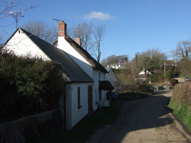
Ashbury, Devon

Ashbury is a village and former civil parish, now in the parish of Northlew, in the West Devon district, in the county of Devon, England. It is 5 miles...

Inwardleigh

Inwardleigh is a village and civil parish about 3 and a half miles north north west of Okehampton railway station, in the West Devon district, in the county...

Folly Gate

Folly Gate is a village in the civil parish of Inwardleigh, in the West Devon district, in the county of Devon, England. It is situated near Okehampton...

Have you been to Ashbury Plantations?

Leave your review of Ashbury Plantations below (or comments, questions and feedback).