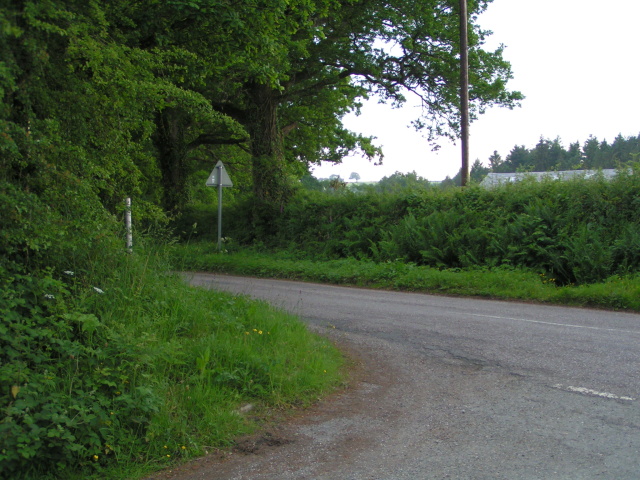
Alderbed Plantation

Wood, Forest in Devon Torridge

England

Alderbed Plantation

Tarka Trail notices, Petrockstowe station A small car park to the right makes this a spot for starting walks or cycle rides along the trail, which here follows the line of the North Devon and Cornwall Junction Light Railway. Going through the gate on the left and turning right will take you past the site of the former station and on through woodland towards Meeth. The wood in the background is Heathmoor Plantation.
Tarka Trail notices, Petrockstowe station Credit: Derek Harper

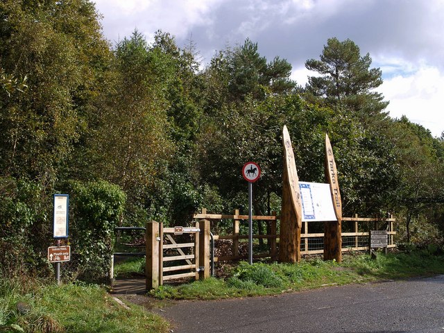
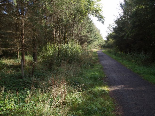
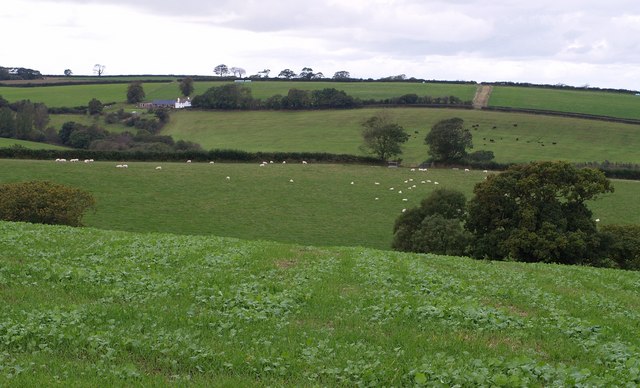
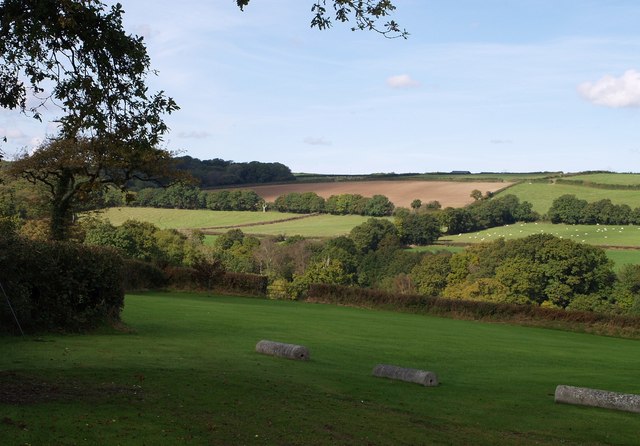
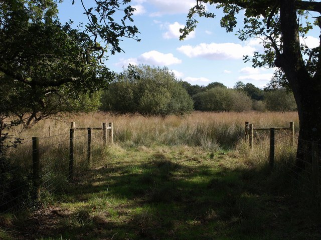
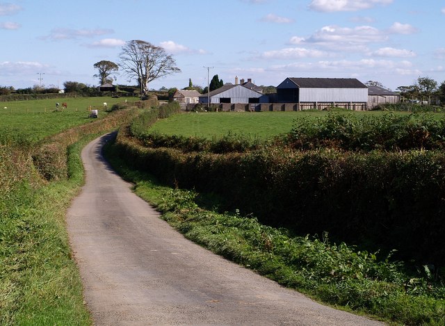
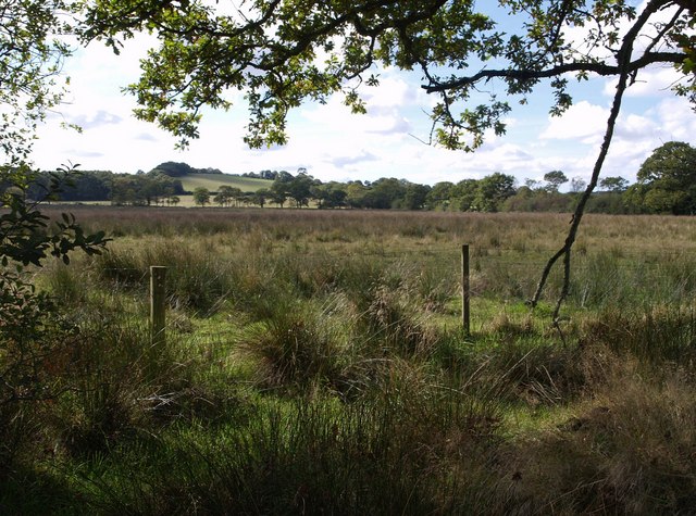
Alderbed Plantation is a picturesque woodland located in Devon, a county in the southwest of England. Spanning over a vast expanse, the plantation is renowned for its lush greenery, dense forests, and diverse ecosystem.

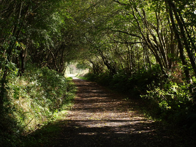
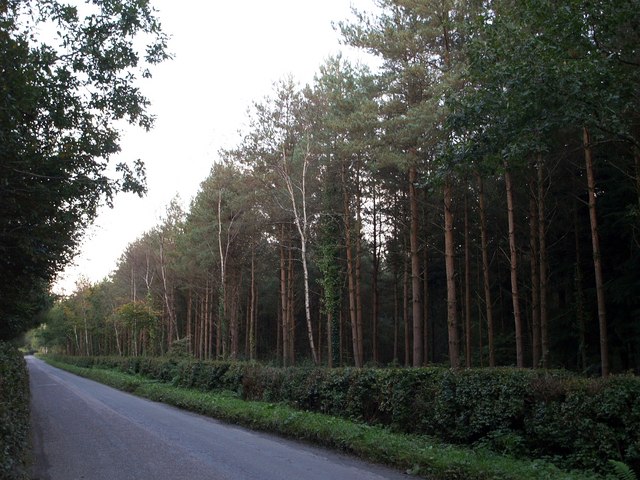
The main attraction of Alderbed Plantation is its rich assortment of tree species. As the name suggests, alder trees dominate the landscape, with their slender trunks and vibrant green leaves. These trees are interspersed with other native species such as oak, beech, and birch, creating a visually stunning tapestry of colors throughout the year. The forest floor is covered in a thick layer of moss and ferns, adding to the enchanting ambiance of the plantation.

The plantation serves as a habitat for a wide range of wildlife. Bird enthusiasts can spot various species, including woodpeckers, owls, and songbirds, while small mammals like squirrels and rabbits are commonly seen scurrying through the undergrowth. In addition, the plantation is home to several species of deer, adding a touch of elegance to the natural surroundings.

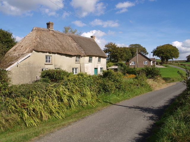
Visitors to Alderbed Plantation can explore the area through a network of well-maintained trails. These pathways wind through the forest, offering glimpses of breathtaking vistas and secluded clearings. The plantation also features picnic areas and designated camping spots for those who wish to immerse themselves in the tranquility of nature.

Overall, Alderbed Plantation is a haven for nature lovers, providing an opportunity to experience the beauty and serenity of Devon's woodlands.

If you have any feedback on the listing, please let us know in the comments section below.

Alderbed Plantation Images

Images are sourced within 2km of 50.862769/-4.1076787 or Grid Reference SS5109. Thanks to Geograph Open Source API. All images are credited.

Tarka Trail notices, Petrockstowe station A small car park to the right makes this a spot for starting walks or cycle rides along the trail, which here follows the line of the North Devon and Cornwall Junction Light Railway. Going through the gate on the left and turning right will take you past the site of the former station and on through woodland towards Meeth. The wood in the background is Heathmoor Plantation.
Tarka Trail notices, Petrockstowe station
A small car park to the right makes this a spot for starting walks or cycle rides along the trail, which here follows the line of the North Devon and Cornwall Junction Light Railway. Going through the gate on the left and turning right will take you past the site of the former station and on through woodland towards Meeth. The wood in the background is Heathmoor Plantation.
Berry Farm Seen from the lane from Petrockstowe to Winswell, close to a bridge over a stream.
Berry Farm
Seen from the lane from Petrockstowe to Winswell, close to a bridge over a stream.
Recycled sign, Petrockstowe station I tried turning this upside down to read the former wording, but it seems to have been re-used several times!
Recycled sign, Petrockstowe station
I tried turning this upside down to read the former wording, but it seems to have been re-used several times!
Tarka Trail The trail, combining footpath and cycleway (NCN route 3), follows the former track of the North Devon and Cornwall Junction Light Railway across Bury Moors.
Tarka Trail
The trail, combining footpath and cycleway (NCN route 3), follows the former track of the North Devon and Cornwall Junction Light Railway across Bury Moors.
Lane past Berry Farm The lane from Petrockstowe to Winswell passes the spot where <a href="https://www.geograph.org.uk/photo/567857">SS5010 : Berry Farm</a> was taken.
Lane past Berry Farm
The lane from Petrockstowe to Winswell passes the spot where SS5010 : Berry Farm was taken.
Burymoor Plantation A rather gloomy road that links Petrockstowe station on the Tarka Trail with the A386 near Merton. Burymoor Plantation is on the right; on the left is Baker's Plantation.
Burymoor Plantation
A rather gloomy road that links Petrockstowe station on the Tarka Trail with the A386 near Merton. Burymoor Plantation is on the right; on the left is Baker's Plantation.
Road passing Petrockstowe station site
Cott Lane, Petrockstow Looking east towards the main road.  Mist filled the valley that morning, hence no background!
Cott Lane, Petrockstow
Looking east towards the main road. Mist filled the valley that morning, hence no background!
Petrockstowe Church The church is dedicated to Saint Petroc.
Petrockstowe Church
The church is dedicated to Saint Petroc.
Tarka Trail junction The trail follows the line of the North Devon and Cornwall Junction Light Railway for a long distance across North Devon; on the left it reaches the last hundred metres before veering off towards the Torridge. On the right is a cyclepath which takes a different route around the clay pits to reach <a href="https://www.geograph.org.uk/photo/567424">SS5407 : Meeth Halt (disused)</a>.
Tarka Trail junction
The trail follows the line of the North Devon and Cornwall Junction Light Railway for a long distance across North Devon; on the left it reaches the last hundred metres before veering off towards the Torridge. On the right is a cyclepath which takes a different route around the clay pits to reach SS5407 : Meeth Halt (disused).
Tarka Trail in Foxes' Covert The trail follows the line of the North Devon and Cornwall Junction Light Railway through woodland as it approaches the Little Mere River.
Tarka Trail in Foxes' Covert
The trail follows the line of the North Devon and Cornwall Junction Light Railway through woodland as it approaches the Little Mere River.
Fields near Petrockstowe A view from the lane (part of NCN route 3) from Petrockstowe to Hembury Gate. The valleys drain to the right towards the Little Mere River. The farm, Deer Park, is in SS5010.
Fields near Petrockstowe
A view from the lane (part of NCN route 3) from Petrockstowe to Hembury Gate. The valleys drain to the right towards the Little Mere River. The farm, Deer Park, is in SS5010.
Magpie Contrasting conditions of thatch, and contrasting ages of buildings. This little group is on the lane from Sheepwash to Patchel Cross.
Magpie
Contrasting conditions of thatch, and contrasting ages of buildings. This little group is on the lane from Sheepwash to Patchel Cross.
Across Patchill Plantation Looking across the top of the wood, and the valley on whose slopes it lies, from Petrockstow Footpath 3 near the farm at Patchill. The valley drains east (right) towards Petrockstowe Moor (the parish seems to have no final E, unlike the village and the moor). On the left is Hartleigh Wood, largely in SS5008.
Across Patchill Plantation
Looking across the top of the wood, and the valley on whose slopes it lies, from Petrockstow Footpath 3 near the farm at Patchill. The valley drains east (right) towards Petrockstowe Moor (the parish seems to have no final E, unlike the village and the moor). On the left is Hartleigh Wood, largely in SS5008.
Aish Lodge Other local placenames are spelt "Ash", but this little lodge, at a junction between the lane from Friar's Hele Cross to Petrockstowe and a farm track on the fringe of Ash Moor, is an exception.
Aish Lodge
Other local placenames are spelt "Ash", but this little lodge, at a junction between the lane from Friar's Hele Cross to Petrockstowe and a farm track on the fringe of Ash Moor, is an exception.
Ash Moor Looking into a field with an extraordinarily irregular boundary, a rarity in this flat land where most boundaries are straight. The field is adjacent to the locally notorious unused Ash Moor burial site, where almost a million carcasses from the 2001 FMD outbreak were intended to be buried. The area is now the latest addition to Devon Wildlife Trust's nature reserves.
Ash Moor
Looking into a field with an extraordinarily irregular boundary, a rarity in this flat land where most boundaries are straight. The field is adjacent to the locally notorious unused Ash Moor burial site, where almost a million carcasses from the 2001 FMD outbreak were intended to be buried. The area is now the latest addition to Devon Wildlife Trust's nature reserves.
Westacott The farm, seen from along the lane from Filleighmoor Gate to Patchel Cross.
Westacott
The farm, seen from along the lane from Filleighmoor Gate to Patchel Cross.
Ash Moor Unlike the field described in <a href="https://www.geograph.org.uk/photo/575201">SS5208 : Ash Moor</a>, this field is rectangular, apart from a boundary the two share, and has been restored since work was done here in connection with plans to bury FMD carcasses in 2001.
Ash Moor
Unlike the field described in SS5208 : Ash Moor, this field is rectangular, apart from a boundary the two share, and has been restored since work was done here in connection with plans to bury FMD carcasses in 2001.
Show me another place!

Alderbed Plantation is located at Grid Ref: SS5109 (Lat: 50.862769, Lng: -4.1076787)

Administrative County: Devon

District: Torridge

Police Authority: Devon and Cornwall

What 3 Words

///shortens.chilling.lighter. Near Hatherleigh, Devon
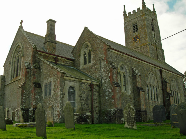
Related Wikis

Petrockstowe

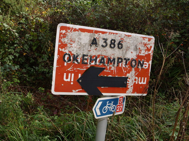
Petrockstowe (or Petrockstow) is a small village and civil parish in the district of Torridge in Northern Devon, England. Its population in 2001 was 379, hardly different from the figure of 385 recorded in 1901. The southern boundary of the parish lies on the River Torridge, and it is surrounded, clockwise from the north, by the parishes of Peters Marland, Merton, Huish, Meeth, Highampton and Buckland Filleigh.The village lies about four miles NNW of the town of Hatherleigh and is some two miles west of the A386 road, accessible only by minor roads.

Petrockstow railway station

Petrockstow railway station was a station serving the village of Petrockstowe in West Devon, which is about one mile away. The station was, throughout its passenger-carrying life from 1925 to 1965, spelt without the final "e" of the village name. The railway was originally built as a narrow-gauge freight line to carry ball clay to Torrington from the Marland and Meeth clay pits.

Heanton Satchville, Petrockstowe

Heanton Satchville was a historic manor in the parish of Petrockstowe, North Devon, England. With origins in the Domesday manor of Hantone, it was first recorded as belonging to the Yeo family in the mid-14th century and was then owned successively by the Rolle, Walpole and Trefusis families. The mansion house was destroyed by fire in 1795.

Huish, Torridge

Huish (anciently Hiwis) is a small village, civil parish and former manor in the Torridge district of Devon, England. The eastern boundary of the parish is formed by the River Torridge and the western by the Rivers Mere and Little Mere, and it is surrounded, clockwise from the north, by the parishes of Merton, Dolton, Meeth and Petrockstowe. In 2001 the population of the parish was 49, down from 76 in 1901.The village lies just off the A386 road, about five and a half miles north of Hatherleigh, and about seven miles south of Great Torrington.

Meeth Halt railway station

Opened in 1925, Meeth Halt was a small railway station on the North Devon and Cornwall Junction Light Railway, a private line until it became part of the Southern Region of British Railways in 1948. The line was built in part over a narrow gauge line that was used from 1881 to take ball clay from claypits at Marland and Meeth to Torrington, which was until 1925 the terminus of a branch from Barnstaple. The line was closed to passenger traffic in 1965 as part of the Beeching proposals, but remained open for freight from the Meeth clay workings north of Meeth Halt through Torrington to Barnstaple until 1982.

Meeth

Meeth is a small village roughly 13.5 km (8.4 mi) north-northwest of Okehampton and 40.7 km (25.3 mi) west-northwest of Exeter. It lies to the west of the River Torridge. In the past, ball clay mines were a major source of employment in the village, lying just to the west, however these closed in 2004.

Merton, Devon

Merton is a village, ecclesiastical parish, former manor and civil parish administered by the local government district of Torridge, Devon, England. The parish, which lies about five miles south east of the town of Great Torrington, is surrounded clockwise from the north by the parishes of Little Torrington, Beaford, Dolton, Huish, Petrockstowe and Peters Marland. In 2001 its population was 331, down from the 507 residents it had in 1901.

Barometer World

Barometer World was the world's only barometer museum, and was located in the village of Merton, near Great Torrington, Devon, England. Barometer World makes, sells and restores barometers of a variety of types. It was established in 1979 by Philip Collins.

Nearby Amenities

Located within 500m of 50.862769,-4.1076787
Pub
The Laurels
Wikidata: Q80477017
Lat/Long: 50.8631731/-4.1139766
Post Box
Brand: Royal Mail
Brand Wikidata: Q638098
Brand Wikipedia: en:Royal Mail
Drive Through: no
Fixme: Post box present in Sept 2011 Google Streetview but not listed in Royal Mail list (Mar 2022). Needs a survey to confirm if box still exists
Operator: Royal Mail
Operator Wikidata: Q638098
Post Box Mounting: wooden_post
Post Box Type: lamp
Ref: EX20 155
Source: streetlevel imagery;aerial imagery
Lat/Long: 50.8628743/-4.1134536
Noexit: yes
Lat/Long: 50.8617944/-4.1139112
Aish Villa B & B
Addr City: Okehampton
Addr Housename: Aish Villa
Addr Postcode: EX20 3HN
Addr Street: Rectory Rise
Addr Suburb: Petrockstow
Tourism: guest_house
Lat/Long: 50.8620178/-4.1136552
Direction: SSW
Generator Method: photovoltaic
Generator Output Electricity: yes
Generator Solar Modules: 16
Generator Source: solar
Generator Type: solar_photovoltaic_panel
Location: roof
Power: generator
Lat/Long: 50.8649273/-4.1127947
Direction: SE
Generator Method: photovoltaic
Generator Output Electricity: yes
Generator Solar Modules: 16
Generator Source: solar
Generator Type: solar_photovoltaic_panel
Location: roof
Power: generator
Lat/Long: 50.8650433/-4.1136879
Direction: ESE
Generator Method: photovoltaic
Generator Output Electricity: yes
Generator Solar Modules: 16
Generator Source: solar
Generator Type: solar_photovoltaic_panel
Location: roof
Power: generator
Lat/Long: 50.8589879/-4.1052429
The data included in this document is from www.openstreetmap.org. The data is made available under ODbL.

Have you been to Alderbed Plantation?

Leave your review of Alderbed Plantation below (or comments, questions and feedback).