Eastern Cleave Wood

Wood, Forest in Devon West Devon

England

Eastern Cleave Wood

River Lyd A calm patch of water on the River Lyd in Lydford Gorge.
River Lyd Credit: Ian Capper

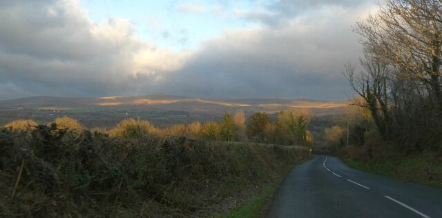
Eastern Cleave Wood is a picturesque forest located in Devon, England. It covers an area of approximately 200 acres and is renowned for its natural beauty and diverse wildlife. The wood is situated on the eastern side of Cleave Valley, hence its name.

The wood is characterized by its dense canopy of trees, predominantly consisting of oak, beech, and birch. These trees create a lush green environment, especially during the spring and summer months when the forest floor is adorned with a variety of wildflowers. The wood is also home to a rich array of fauna, including deer, foxes, badgers, and a wide range of bird species.

Eastern Cleave Wood offers visitors a peaceful retreat away from the hustle and bustle of city life. It features several well-maintained walking trails, allowing visitors to explore the forest at their own pace. These trails wind through the wood, offering breathtaking views of the surrounding countryside and the nearby river that runs through the valley.

The wood is a popular destination for nature enthusiasts, hikers, and photographers. It provides ample opportunities for birdwatching, wildlife spotting, and capturing stunning landscape photographs. There are also designated picnic areas where visitors can relax and enjoy a meal amidst the tranquil surroundings.

Eastern Cleave Wood is easily accessible by car and is located just a short drive away from the nearby town of Devon. It offers a unique and enchanting experience for anyone looking to immerse themselves in nature and escape the stresses of everyday life.

If you have any feedback on the listing, please let us know in the comments section below.

Eastern Cleave Wood Images

Images are sourced within 2km of 50.642184/-4.1112558 or Grid Reference SX5084. Thanks to Geograph Open Source API. All images are credited.

River Lyd A calm patch of water on the River Lyd in Lydford Gorge.
River Lyd
A calm patch of water on the River Lyd in Lydford Gorge.
Former Lydford to Launceston railway The route of the Lydford Junction to Launceston railway through Lydford Gorge.  Built originally as a broad gauge line by the Launceston and South Devon Railway and opened in 1865, it was later absorbed by the Great Western Railway.  Passenger traffic ceased in 1962, with goods traffic ceasing in 1964.  This section is now a footpath, used by visitors to the gorge.
Former Lydford to Launceston railway
The route of the Lydford Junction to Launceston railway through Lydford Gorge. Built originally as a broad gauge line by the Launceston and South Devon Railway and opened in 1865, it was later absorbed by the Great Western Railway. Passenger traffic ceased in 1962, with goods traffic ceasing in 1964. This section is now a footpath, used by visitors to the gorge.
Sunset on western Dartmoor
West Devon : Footpath A footpath above Lydford Gorge.
West Devon : Footpath
A footpath above Lydford Gorge.
Lydford Gorge [22] Part of the long and easy way down from the top path to the river path.  This route has been engineered to enable the National Trust's tramper to convey those with limited mobility own to see the White Lady waterfall.
In the ownership of the National Trust, the gorge offers some excellent walks.  This circular route runs high above the river (top path) from the Devil's Cauldron entrance to the Waterfall entrance returning along the river path - a distance of some 3 miles.
Lydford Gorge [22]
Part of the long and easy way down from the top path to the river path. This route has been engineered to enable the National Trust's tramper to convey those with limited mobility own to see the White Lady waterfall. In the ownership of the National Trust, the gorge offers some excellent walks. This circular route runs high above the river (top path) from the Devil's Cauldron entrance to the Waterfall entrance returning along the river path - a distance of some 3 miles.
Lydford Gorge [23] A glimpse of the river from the long and easy path down.
In the ownership of the National Trust, the gorge offers some excellent walks.  This circular route runs high above the river (top path) from the Devil's Cauldron entrance to the Waterfall entrance returning along the river path - a distance of some 3 miles.
Lydford Gorge [23]
A glimpse of the river from the long and easy path down. In the ownership of the National Trust, the gorge offers some excellent walks. This circular route runs high above the river (top path) from the Devil's Cauldron entrance to the Waterfall entrance returning along the river path - a distance of some 3 miles.
Lydford Gorge [24] The long and easy way continues to descend to the river.
In the ownership of the National Trust, the gorge offers some excellent walks.  This circular route runs high above the river (top path) from the Devil's Cauldron entrance to the Waterfall entrance returning along the river path - a distance of some 3 miles.
Lydford Gorge [24]
The long and easy way continues to descend to the river. In the ownership of the National Trust, the gorge offers some excellent walks. This circular route runs high above the river (top path) from the Devil's Cauldron entrance to the Waterfall entrance returning along the river path - a distance of some 3 miles.
Lydford Gorge [25] The long and easy way turns through 180 degrees to zig zag down to the river.
In the ownership of the National Trust, the gorge offers some excellent walks.  This circular route runs high above the river (top path) from the Devil's Cauldron entrance to the Waterfall entrance returning along the river path - a distance of some 3 miles.
Lydford Gorge [25]
The long and easy way turns through 180 degrees to zig zag down to the river. In the ownership of the National Trust, the gorge offers some excellent walks. This circular route runs high above the river (top path) from the Devil's Cauldron entrance to the Waterfall entrance returning along the river path - a distance of some 3 miles.
Lydford Gorge [26] The final stretch of the long and easy way down to the river from the top path.
In the ownership of the National Trust, the gorge offers some excellent walks.  This circular route runs high above the river (top path) from the Devil's Cauldron entrance to the Waterfall entrance returning along the river path - a distance of some 3 miles.
Lydford Gorge [26]
The final stretch of the long and easy way down to the river from the top path. In the ownership of the National Trust, the gorge offers some excellent walks. This circular route runs high above the river (top path) from the Devil's Cauldron entrance to the Waterfall entrance returning along the river path - a distance of some 3 miles.
Lydford Gorge [27] The River Lyd is met after descending the long and easy way from the top path.
In the ownership of the National Trust, the gorge offers some excellent walks.  This circular route runs high above the river (top path) from the Devil's Cauldron entrance to the Waterfall entrance returning along the river path - a distance of some 3 miles.
Lydford Gorge [27]
The River Lyd is met after descending the long and easy way from the top path. In the ownership of the National Trust, the gorge offers some excellent walks. This circular route runs high above the river (top path) from the Devil's Cauldron entrance to the Waterfall entrance returning along the river path - a distance of some 3 miles.
Lydford Gorge [28] A money tree by the side of the river path.
In the ownership of the National Trust, the gorge offers some excellent walks.  This circular route runs high above the river (top path) from the Devil's Cauldron entrance to the Waterfall entrance returning along the river path - a distance of some 3 miles.
Lydford Gorge [28]
A money tree by the side of the river path. In the ownership of the National Trust, the gorge offers some excellent walks. This circular route runs high above the river (top path) from the Devil's Cauldron entrance to the Waterfall entrance returning along the river path - a distance of some 3 miles.
Lydford Gorge [29] The River Lyd, seen from the river path.
In the ownership of the National Trust, the gorge offers some excellent walks.  This circular route runs high above the river (top path) from the Devil's Cauldron entrance to the Waterfall entrance returning along the river path - a distance of some 3 miles.
Lydford Gorge [29]
The River Lyd, seen from the river path. In the ownership of the National Trust, the gorge offers some excellent walks. This circular route runs high above the river (top path) from the Devil's Cauldron entrance to the Waterfall entrance returning along the river path - a distance of some 3 miles.
Lydford Gorge [30] An information board giving details of the industrial archaeology in the gorge.
In the ownership of the National Trust, the gorge offers some excellent walks.  This circular route runs high above the river (top path) from the Devil's Cauldron entrance to the Waterfall entrance returning along the river path - a distance of some 3 miles.
Lydford Gorge [30]
An information board giving details of the industrial archaeology in the gorge. In the ownership of the National Trust, the gorge offers some excellent walks. This circular route runs high above the river (top path) from the Devil's Cauldron entrance to the Waterfall entrance returning along the river path - a distance of some 3 miles.
West Devon : Lydford Gorge - Footpath A footpath heading down the hill.
West Devon : Lydford Gorge - Footpath
A footpath heading down the hill.
West Devon : Lydford Gorge - Woodland Path A path heading through the woodland.
West Devon : Lydford Gorge - Woodland Path
A path heading through the woodland.
West Devon : Lydford Gorge - River Lyd A river running through the woods.
West Devon : Lydford Gorge - River Lyd
A river running through the woods.
West Devon : Lydford Gorge - Woodland Pennies in the wood.
West Devon : Lydford Gorge - Woodland
Pennies in the wood.
Show me another place!

Eastern Cleave Wood is located at Grid Ref: SX5084 (Lat: 50.642184, Lng: -4.1112558)

Administrative County: Devon

District: West Devon

Police Authority: Devon and Cornwall

What 3 Words

///daffodils.fruit.menswear. Near Tavistock, Devon

Related Wikis

Lydford Castle

Lydford Castle is a medieval castle in the town of Lydford, Devon, England. The first castle in Lydford, sometimes termed the Norman fort, was a small...

Lydford

Lydford, sometimes spelled Lidford, is a village, once an important town, in Devon, seven miles (11 km) north of Tavistock on the western fringe of Dartmoor...

West Devon

West Devon is a local government district with borough status in Devon, England. Its council is based in Tavistock, the borough's largest town. The borough...

Lydford railway station

Lydford railway station was a junction at Lydford between the Great Western Railway (GWR) and London and South Western Railway (LSWR) situated in a remote...

Burnville House, Brentor

Burnville House (or Farm) in Brentor, West Devon, England, is a building of historical significance and is Grade II listed on the English Heritage Register...

Bridestowe railway station

Bridestowe railway station served the 2 miles or so distant village of Bridestowe in West Devon, England, located outside Okehampton on the edge of Dartmoor...

Brat Tor

Brat Tor, also known as Brai Tor and Widgery Tor, is a dramatic granite tor on the western flank of Dartmoor, England. It is best known for Widgery Cross...

Burley Wood

Burley Wood is the site of an Iron Age hill fort north of Lydford in Devon, England. The fort occupies much of a hilltop some 220 metres above sea level...

Nearby Amenities

Located within 500m of 50.642184,-4.1112558
Lydford Gorge (NT)
Natural: valley
Lat/Long: 50.6413631/-4.1110328
Pub
The Castle Inn
Addr City: Okehampton
Addr Place: Lydford
Addr Postcode: EX20 4BH
Fhrs Id: 809000
Outdoor Seating: yes
Smoking: outside
Website: http://castleinnlydford.com/
Wikidata: Q80476959
Lat/Long: 50.6436963/-4.1089861
Bicycle Parking
Bicycle Parking: stands
Capacity: 10
Covered: no
Lat/Long: 50.6405926/-4.1101916
Cafe
Lydford Gorge (NT)
Addr City: Okehampton
Addr Place: Lydford
Addr Postcode: EX20 4BH
Fhrs Id: 809001
Phone: +44 1822 820320
Source Addr Postcode: FHRS Open Data
Website: https://www.nationaltrust.org.uk/lydford-gorge
Lat/Long: 50.6406298/-4.1103178
Addr City: Okehampton
Addr Housename: Bridge House Lodge
Addr Place: Lydford
Lat/Long: 50.6392545/-4.1089847
Toilets
Access: yes
Opening Hours: May to September
Lat/Long: 50.643598/-4.1085618
Recycling
Recycling Type: container
Lat/Long: 50.6434662/-4.1082874
Noexit: yes
Lat/Long: 50.6436643/-4.1106192
Bus Stop
Naptan AtcoCode: 1100DEA12048
Naptan NaptanCode: dvnajmwd
Lat/Long: 50.6413254/-4.1097158
Toilets
Access: customers
Operator: National Trust
Toilets Disposal: flush
Lat/Long: 50.6405486/-4.1103509
Devil's Cauldron
Height: 30
Waterway: waterfall
Lat/Long: 50.6415929/-4.1109253
Cafe
Tea Rooms
Addr City: Okehampton
Addr Place: Lydford
Addr Postcode: EX20 4BH
Fhrs Id: 808842
Source Addr Postcode: FHRS Open Data
Lat/Long: 50.6405912/-4.1107147
Tourism: picnic_site
Lat/Long: 50.6418115/-4.1117149
Natural: spring
Lat/Long: 50.6449991/-4.1093954
Information: board
Tourism: information
Lat/Long: 50.6449692/-4.1093203
Barrier: kissing_gate
Lat/Long: 50.6439042/-4.1094974
Barrier: kissing_gate
Lat/Long: 50.6435393/-4.1101934
Entrance: yes
Lat/Long: 50.6446286/-4.107521
Telephone
Booth: K6
Covered: booth
Listed Status: Grade II
Operator: British Telecommunications PLC
Lat/Long: 50.644624/-4.107262
Post Box
Collection Times: Mo-Fr 12:00; Sa 10:45; Su off
Operator: Royal Mail
Operator Wikidata: Q638098
Post Box Design: 2010_pattern
Post Box Mounting: pier
Post Box Type: lamp
Ref: EX20 112D
Royal Cypher: EIIR
Royal Cypher Wikidata: Q33102113
Source: survey;streetlevel imagery;aerial imagery
Lat/Long: 50.6446394/-4.1072762
Southgate
Place: locality
Lat/Long: 50.6428996/-4.1064368
Addr City: Okehampton
Addr Housename: Luxmoor
Addr Street: Silver Street
Addr Suburb: Lydford
Lat/Long: 50.6448763/-4.1065681
Addr City: Okehampton
Addr Housename: Willsworthy View
Addr Place: Lydford
Addr Postcode: EX20 4BH
Lat/Long: 50.6439259/-4.1081142
Bus Stop
Lat/Long: 50.6447384/-4.1069736
Addr City: Okehampton
Addr Housename: Bayfield House
Addr Place: Lydford
Addr Postcode: EX20 4BH
Lat/Long: 50.6427687/-4.1080533
Bus Stop
Operator: Dartline
Ref: 188
Shelter: no
Lat/Long: 50.6436646/-4.1087394
Addr City: Okehampton
Addr Housename: Penny Cottage
Addr Place: Lydford
Addr Postcode: EX20 4BH
Lat/Long: 50.6436519/-4.1085876
Addr City: Okehampton
Addr Housename: Barnhayes
Addr Street: Silver Street
Addr Suburb: Lydford
Lat/Long: 50.6447439/-4.1065247
Addr City: Okehampton
Addr Housename: Begonia Cottage
Addr Street: Silver Street
Addr Suburb: Lydford
Lat/Long: 50.644955/-4.1058959
Addr City: Okehampton
Addr Housename: St Petrocks
Addr Place: Lydford
Addr Postcode: EX20 4BH
Lat/Long: 50.6430403/-4.1073953
Addr City: Okehampton
Addr Housename: Catle Lea
Addr Place: Lydford
Addr Postcode: EX20 4BH
Lat/Long: 50.6432882/-4.1073862
Generator Method: solar
Generator Source: solar
Generator Type: solar_photovoltaic_panel
Power: generator
Lat/Long: 50.644927/-4.1057659
Addr City: Okehampton
Addr Housename: The Coach House
Addr Place: Lydford
Addr Postcode: EX20 4BH
Lat/Long: 50.6434788/-4.1088352
Addr City: Okehampton
Addr Housename: Clearview
Addr Suburb: Lydford
Lat/Long: 50.6443627/-4.10748
Addr City: Okehampton
Addr Housename: Southgate Cottages
Addr Place: Lydford
Addr Postcode: EX20 4BH
Lat/Long: 50.643247/-4.1065958
Addr City: Okehampton
Addr Housename: Castle House
Addr Place: Lydford
Addr Postcode: EX20 4BH
Lat/Long: 50.6439724/-4.108531
Addr City: Okehampton
Addr Housename: The Old Lydford Post Offuce
Addr Place: Lydford
Addr Postcode: EX20 4BH
Lat/Long: 50.6441247/-4.1078129
Addr City: Okehampton
Addr Housename: Clifton Cottage
Addr Postcode: EX20 4BH
Addr Suburb: Lydford
Lat/Long: 50.6442178/-4.1077145
Defibrillator
Access: yes
Defibrillator Location: outside The Nicholls Hall
Emergency: defibrillator
Indoor: no
Lat/Long: 50.6446701/-4.107465
Addr City: Okehampton
Addr Housename: Bickleigh
Addr Place: Lydford
Addr Postcode: EX20 4BH
Lat/Long: 50.6438288/-4.1083592
Addr City: Okehampton
Addr Housename: Oaten Hills
Addr Place: Lydford
Addr Postcode: EX20 4BH
Lat/Long: 50.6440522/-4.1083378
Addr City: Okehampton
Addr Housename: Mouses Back
Addr Place: Lydford
Addr Postcode: EX20 4BH
Lat/Long: 50.6440335/-4.1079634
Generator Method: solar
Generator Source: solar
Generator Type: solar_photovoltaic_panel
Power: generator
Lat/Long: 50.6449481/-4.1058327
Addr City: Okehampton
Addr Housename: The Old Chapel
Addr Suburb: Lydford
Lat/Long: 50.6447713/-4.107288
Anglo-Saxon Lydford
Information: board
Tourism: information
Lat/Long: 50.6442366/-4.1074307
Addr City: Okehampton
Addr Housenumber: 11
Addr Place: Lydford
Addr Postcode: EX20 4BH
Lat/Long: 50.6437072/-4.1085055
Addr City: Okehampton
Addr Housename: The Old Reading Room
Addr Street: Silver Street
Addr Suburb: Lydford
Lat/Long: 50.6447237/-4.1067852
Addr City: Okehampton
Addr Housename: Barberry
Addr Place: Lydford
Addr Postcode: EX20 4BH
Lat/Long: 50.6439951/-4.1080306
Addr City: Okehampton
Addr Housename: Cornerways
Addr Street: Silver Street
Addr Suburb: Lydford
Lat/Long: 50.6449949/-4.1057983
Addr City: Okehampton
Addr Housename: Lydonia
Addr Suburb: Lydford
Lat/Long: 50.6445328/-4.1071258
Addr City: Okehampton
Addr Housename: The Rectory
Addr Place: Lydford
Addr Postcode: EX20 4BH
Lat/Long: 50.6430797/-4.1091472
Man Made: wastewater_plant
Lat/Long: 50.6436703/-4.1107598
Man Made: flagpole
Lat/Long: 50.6446389/-4.1074369
Advertising: board
Lat/Long: 50.6445442/-4.1074601
Advertising: board
Lat/Long: 50.6445935/-4.1073797
The data included in this document is from www.openstreetmap.org. The data is made available under ODbL.

Have you been to Eastern Cleave Wood?

Leave your review of Eastern Cleave Wood below (or comments, questions and feedback).