North Plantation

Wood, Forest in Devon West Devon

England

North Plantation
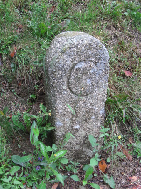
Old Bridge Marker in Buckland Monachorum cemetery County Bridge Marker moved from the roadside to beside a path inside the cemetery gates. Buckland Monachorum parish. The stone marks the extent of roadway adjoining the bridge that the County was obliged to maintain.

Milestone Society National ID: DV_BMCPbr
Old Bridge Marker in Buckland Monachorum cemetery Credit: T Jenkinson

The requested URL returned error: 429 Too Many Requests

If you have any feedback on the listing, please let us know in the comments section below.

North Plantation Images

Images are sourced within 2km of 50.50304/-4.1160282 or Grid Reference SX5069. Thanks to Geograph Open Source API. All images are credited.

Old Bridge Marker in Buckland Monachorum cemetery County Bridge Marker moved from the roadside to beside a path inside the cemetery gates. Buckland Monachorum parish. The stone marks the extent of roadway adjoining the bridge that the County was obliged to maintain.

Milestone Society National ID: DV_BMCPbr
Old Bridge Marker in Buckland Monachorum cemetery
County Bridge Marker moved from the roadside to beside a path inside the cemetery gates. Buckland Monachorum parish. The stone marks the extent of roadway adjoining the bridge that the County was obliged to maintain. Milestone Society National ID: DV_BMCPbr
Old Boundary Marker on Station Road, Horrabridge County Bridge Marker against the north facing wall of the London Inn on Station Road, 80 metres south of the bridge on the River Walkham. Formerly in Buckland Monachorum parish, since 1950 in Horrabridge parish. Inscribed C, the stone marks the extent of roadway adjoining the bridge that the County was obliged to maintain.

Milestone Society National ID: DV_PLPT10br
Old Boundary Marker on Station Road, Horrabridge
County Bridge Marker against the north facing wall of the London Inn on Station Road, 80 metres south of the bridge on the River Walkham. Formerly in Buckland Monachorum parish, since 1950 in Horrabridge parish. Inscribed C, the stone marks the extent of roadway adjoining the bridge that the County was obliged to maintain. Milestone Society National ID: DV_PLPT10br
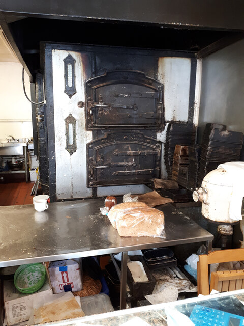
Honey's Bakery Traditional bakery and confectioner. The shop features two cast iron bread ovens which date back over 100 years, in which loaves and cakes are baked every night except Saturdays. <span class="nowrap"><a title="https://sites.google.com/site/thebridgenewsupdates/home/2015/landmarks-of-horrabridge-1---the-bakery---updated-27-11-15" rel="nofollow ugc noopener" href="https://sites.google.com/site/thebridgenewsupdates/home/2015/landmarks-of-horrabridge-1---the-bakery---updated-27-11-15">Link</a><img style="margin-left:2px;" alt="External link" title="External link - shift click to open in new window" src="https://s1.geograph.org.uk/img/external.png" width="10" height="10"/></span> See also <a href="https://www.geograph.org.uk/photo/6956996">SX5169 : Bread ovens inside Honey's Bakery</a>
Honey's Bakery
Traditional bakery and confectioner. The shop features two cast iron bread ovens which date back over 100 years, in which loaves and cakes are baked every night except Saturdays. LinkExternal link See also SX5169 : Bread ovens inside Honey's Bakery
Bread ovens inside Honey's Bakery These traditional cast iron bread ovens dating from the 19th century are still used to bake bread and cakes every night except Saturdays. <span class="nowrap"><a title="https://sites.google.com/site/thebridgenewsupdates/home/2015/landmarks-of-horrabridge-1---the-bakery---updated-27-11-15" rel="nofollow ugc noopener" href="https://sites.google.com/site/thebridgenewsupdates/home/2015/landmarks-of-horrabridge-1---the-bakery---updated-27-11-15">Link</a><img style="margin-left:2px;" alt="External link" title="External link - shift click to open in new window" src="https://s1.geograph.org.uk/img/external.png" width="10" height="10"/></span> See also <a href="https://www.geograph.org.uk/photo/6956994">SX5169 : Honey's Bakery</a>
Bread ovens inside Honey's Bakery
These traditional cast iron bread ovens dating from the 19th century are still used to bake bread and cakes every night except Saturdays. LinkExternal link See also SX5169 : Honey's Bakery
Approaching Gem Bridge from the north
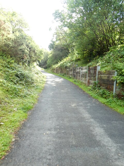
Cutting for Drake's Trail south of Gem Bridge Immediately to the south of Gem Bridge over the river, the former railway passed through a cutting; some work has been done to reinforce the bank
Cutting for Drake's Trail south of Gem Bridge
Immediately to the south of Gem Bridge over the river, the former railway passed through a cutting; some work has been done to reinforce the bank
Bridge over Drake's Trail south of Gem Bridge
Countryside north-west of Horrabridge Seen from Magpie Bridge
Countryside north-west of Horrabridge
Seen from Magpie Bridge
Magpie Bridge looking west The former railway bridge is part of Drakes Trail
Magpie Bridge looking west
The former railway bridge is part of Drakes Trail
Foundation blocks from original Gem Bridge These blocks were part of the foundations of the railway bridge across the valley, now crossed by the cycle route on a new bridge.  They have been placed by the path as a monument and as seating for picnics
Foundation blocks from original Gem Bridge
These blocks were part of the foundations of the railway bridge across the valley, now crossed by the cycle route on a new bridge. They have been placed by the path as a monument and as seating for picnics
Grenofen Bridge The River Walkham at Grenofen Bridge
Grenofen Bridge
The River Walkham at Grenofen Bridge
Site of former Grenofen railway viaduct The Plympton-Tavistock railway viaduct over the Walkham river at Grenofen was unfortunately demolished by explosives as a training exercise some time ago. Vandals! The trackbed stops at the ledge showing at the foot of the picture.  The far side was just right of the middle distance in the picture. The camera is facing towards Tavistock.
Site of former Grenofen railway viaduct
The Plympton-Tavistock railway viaduct over the Walkham river at Grenofen was unfortunately demolished by explosives as a training exercise some time ago. Vandals! The trackbed stops at the ledge showing at the foot of the picture. The far side was just right of the middle distance in the picture. The camera is facing towards Tavistock.
Disused buildings, Westdown copper Mine 
These mine buildings are sited 500m downstream from Grenofen bridge car park,  on level ground 75m from the river Walkham north bank. Photograph taken in July 1978.
Disused buildings, Westdown copper Mine
These mine buildings are sited 500m downstream from Grenofen bridge car park, on level ground 75m from the river Walkham north bank. Photograph taken in July 1978.
Railway bridge, above the river Walkham View looking north west to a bridge carrying a path/track above the former Plympton to Tavistock railway. The site is around 1km west of the car park at Bedford Bridge on the A386.
Railway bridge, above the river Walkham
View looking north west to a bridge carrying a path/track above the former Plympton to Tavistock railway. The site is around 1km west of the car park at Bedford Bridge on the A386.
Buckland Monachorum: weir on the river Walkham The weir served the Lady Bertha Mine at SX471689, a mile or more away. The leat on the left, now a dry ditch, powered water wheels on the mine, used for crushing ores and initially for pumping water. The mine raised nearly 4,400 tons of copper ore and almost 1,700 tons of arsenic in the period 1855–1882. Note the remains of a fish pass here
Buckland Monachorum: weir on the river Walkham
The weir served the Lady Bertha Mine at SX471689, a mile or more away. The leat on the left, now a dry ditch, powered water wheels on the mine, used for crushing ores and initially for pumping water. The mine raised nearly 4,400 tons of copper ore and almost 1,700 tons of arsenic in the period 1855–1882. Note the remains of a fish pass here
New bridge on the new cycle path along the old railway A cycle path is being built along the old Yelverton - Tavistock railway. A major problem is crossing the River Walkham after the demolition of the old viaduct, which had originally been designed by Brunel although it was modified later.

This is a temporary bridge being lifted into position on 3rd April 2007. A high-level one is planned to replace it in a few years. The depth of the problem can be seen from Crispin Purdye's image <a href="https://www.geograph.org.uk/photo/64586">SX4970 : Site of former Grenofen railway viaduct</a>.

Ben Naylor of Devon County Council did the specification. The bridge was built by CTS Bridges of Huddersfield <span class="nowrap"><a title="http://www.ctsbridges.co.uk/" rel="nofollow ugc noopener" href="http://www.ctsbridges.co.uk/">Link</a><img style="margin-left:2px;" alt="External link" title="External link - shift click to open in new window" src="https://s1.geograph.org.uk/img/external.png" width="10" height="10"/></span>.
New bridge on the new cycle path along the old railway
A cycle path is being built along the old Yelverton - Tavistock railway. A major problem is crossing the River Walkham after the demolition of the old viaduct, which had originally been designed by Brunel although it was modified later. This is a temporary bridge being lifted into position on 3rd April 2007. A high-level one is planned to replace it in a few years. The depth of the problem can be seen from Crispin Purdye's image SX4970 : Site of former Grenofen railway viaduct. Ben Naylor of Devon County Council did the specification. The bridge was built by CTS Bridges of Huddersfield LinkExternal link.
Whitchurch: Walkham Valley The Walkam below West Down, looking south east on the public footpath between Grenofen Bridge and Double Waters
Whitchurch: Walkham Valley
The Walkam below West Down, looking south east on the public footpath between Grenofen Bridge and Double Waters
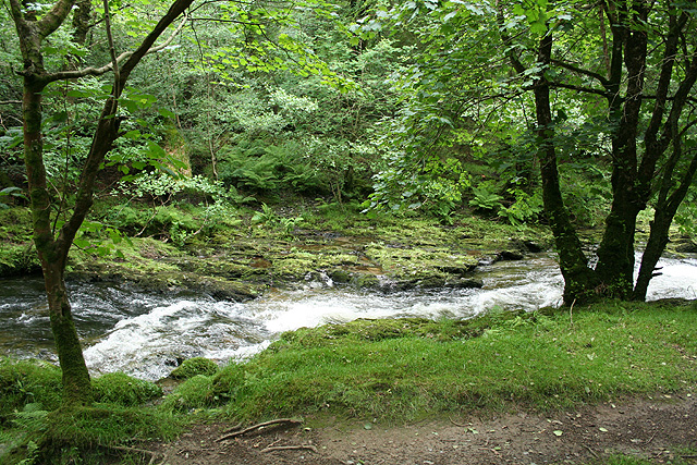
Whitchurch: below West Down The Walkham seen from the public footpath between Grenofen Bridge and Double Waters, looking east-north-east
Whitchurch: below West Down
The Walkham seen from the public footpath between Grenofen Bridge and Double Waters, looking east-north-east
Show me another place!

North Plantation is located at Grid Ref: SX5069 (Lat: 50.50304, Lng: -4.1160282)

Administrative County: Devon

District: West Devon

Police Authority: Devon and Cornwall

What 3 Words

///steepest.potions.mandates. Near Horrabridge, Devon

Related Wikis

The Garden House

The Garden House is an open garden located in Buckland Monachorum, Devon, England. The first house built in 1305 was intended to be a home for the vicars...

St Andrew's Church, Buckland Monachorum

St Andrew's Church, Buckland Monachorum is a Grade I listed parish church in the Church of England Diocese of Exeter in Buckland Monachorum, Devon. �...

Buckland Monachorum

Buckland Monachorum is a village and civil parish in the West Devon district of Devon, England, situated on the River Tavy, about 10 miles north of Plymouth...

Horrabridge

Horrabridge is a village in West Devon, England with a population of 2,115 people in 2006, down from 2,204 in 1991. It is located approximately 12 miles...

Nearby Amenities

Located within 500m of 50.50304,-4.1160282
Parking
Lat/Long: 50.5042721/-4.1155285
Bench
Lat/Long: 50.5024723/-4.1118804
Parking
Capacity: 15
Lat/Long: 50.5052974/-4.1203348
Parking
Lat/Long: 50.5045349/-4.1168052
Power: pole
Lat/Long: 50.5004928/-4.1113865
Power: pole
Lat/Long: 50.5008221/-4.1130334
Power: pole
Lat/Long: 50.5008409/-4.114809
Power: pole
Lat/Long: 50.5008511/-4.1161984
Power: pole
Lat/Long: 50.500863/-4.1178104
Power: pole
Lat/Long: 50.5008716/-4.1196665
Power: pole
Lat/Long: 50.5008835/-4.1210935
Image: https://img.geocaching.com/waymarking/display/32101fcd-7959-4fe1-b290-aa3a9e0c4fb8.JPG
Man Made: milk_churn_stand
Lat/Long: 50.5051329/-4.1208024
The data included in this document is from www.openstreetmap.org. The data is made available under ODbL.

Have you been to North Plantation?

Leave your review of North Plantation below (or comments, questions and feedback).