Birchcleave Wood

Wood, Forest in Devon West Devon

England

Birchcleave Wood

Magpie Bridge looking west The former railway bridge is part of Drakes Trail
Magpie Bridge looking west Credit: David Smith

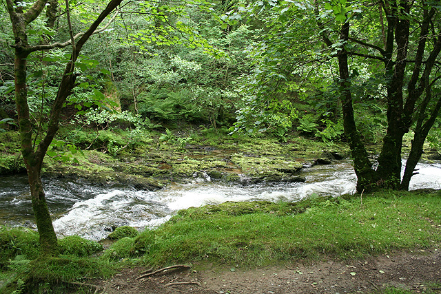
Birchcleave Wood, located in Devon, England, is a charming and picturesque woodland that spans over a vast area. Known for its pristine beauty and serene atmosphere, it is a popular destination for nature lovers and hikers alike.

The wood is predominantly made up of birch trees, which give it its name, but also features an array of other deciduous and coniferous trees. With its dense foliage and well-preserved vegetation, Birchcleave Wood offers a diverse and vibrant habitat for a variety of wildlife.

The forest floor is covered with a blanket of moss and ferns, creating a lush carpet that adds to the enchanting ambiance. The wood is crisscrossed with numerous walking trails, allowing visitors to explore and immerse themselves in the tranquil surroundings.

Birchcleave Wood is also home to a plethora of wildlife. Nature enthusiasts can spot a range of bird species, including woodpeckers and owls, as well as small mammals such as squirrels and rabbits. The wood is also known for its diverse insect population, with butterflies and dragonflies fluttering through the air during the warmer months.

The wood is open to the public year-round, offering opportunities for leisurely walks, birdwatching, and photography. It provides a peaceful retreat from the hustle and bustle of daily life, allowing visitors to reconnect with nature and enjoy the simple pleasures of the great outdoors.

In conclusion, Birchcleave Wood in Devon is a captivating forest that showcases the beauty of nature. Its rich biodiversity, well-maintained trails, and tranquil atmosphere make it a delightful destination for anyone seeking solace in the midst of nature.

If you have any feedback on the listing, please let us know in the comments section below.

Birchcleave Wood Images

Images are sourced within 2km of 50.516864/-4.1185086 or Grid Reference SX4970. Thanks to Geograph Open Source API. All images are credited.

Magpie Bridge looking west The former railway bridge is part of Drakes Trail
Magpie Bridge looking west
The former railway bridge is part of Drakes Trail
Foundation blocks from original Gem Bridge These blocks were part of the foundations of the railway bridge across the valley, now crossed by the cycle route on a new bridge.  They have been placed by the path as a monument and as seating for picnics
Foundation blocks from original Gem Bridge
These blocks were part of the foundations of the railway bridge across the valley, now crossed by the cycle route on a new bridge. They have been placed by the path as a monument and as seating for picnics
Old Bridge Marker near Grenofen Bridge, Whitchurch 90 metres north of Grenofen Bridge, River Walkham, on the east side of the road. Whitchurch parish. The stone marks the extent of roadway adjoining the bridge that the County was obliged to maintain. See also <span class="nowrap"><a title="https://www.flickr.com/photos/bridgemarkertim/8057863218" rel="nofollow ugc noopener" href="https://www.flickr.com/photos/bridgemarkertim/8057863218">Link</a><img style="margin-left:2px;" alt="External link" title="External link - shift click to open in new window" src="https://s1.geograph.org.uk/img/external.png" width="10" height="10"/></span>.

Milestone Society National ID: DV_WHIT01br
Old Bridge Marker near Grenofen Bridge, Whitchurch
90 metres north of Grenofen Bridge, River Walkham, on the east side of the road. Whitchurch parish. The stone marks the extent of roadway adjoining the bridge that the County was obliged to maintain. See also LinkExternal link. Milestone Society National ID: DV_WHIT01br
Whitchurch: leat in Walkham valley The dry channel of an old mining leat which may date from the 18th century, as a 19th century elvan quarry straddles its course upstream
Whitchurch: leat in Walkham valley
The dry channel of an old mining leat which may date from the 18th century, as a 19th century elvan quarry straddles its course upstream
Grenofen Bridge The River Walkham at Grenofen Bridge
Grenofen Bridge
The River Walkham at Grenofen Bridge
Site of former Grenofen railway viaduct The Plympton-Tavistock railway viaduct over the Walkham river at Grenofen was unfortunately demolished by explosives as a training exercise some time ago. Vandals! The trackbed stops at the ledge showing at the foot of the picture.  The far side was just right of the middle distance in the picture. The camera is facing towards Tavistock.
Site of former Grenofen railway viaduct
The Plympton-Tavistock railway viaduct over the Walkham river at Grenofen was unfortunately demolished by explosives as a training exercise some time ago. Vandals! The trackbed stops at the ledge showing at the foot of the picture. The far side was just right of the middle distance in the picture. The camera is facing towards Tavistock.
River Walkham, Lower Grenofen Looking downriver in a wooded valley with granite boulders and rocks covered with moss and lichen.  Position is about 300m downstream of the Grenofen bridge car park at the north west corner of the grid square.
River Walkham, Lower Grenofen
Looking downriver in a wooded valley with granite boulders and rocks covered with moss and lichen. Position is about 300m downstream of the Grenofen bridge car park at the north west corner of the grid square.
Disused buildings, Westdown copper Mine 
These mine buildings are sited 500m downstream from Grenofen bridge car park,  on level ground 75m from the river Walkham north bank. Photograph taken in July 1978.
Disused buildings, Westdown copper Mine
These mine buildings are sited 500m downstream from Grenofen bridge car park, on level ground 75m from the river Walkham north bank. Photograph taken in July 1978.
Railway bridge, above the river Walkham View looking north west to a bridge carrying a path/track above the former Plympton to Tavistock railway. The site is around 1km west of the car park at Bedford Bridge on the A386.
Railway bridge, above the river Walkham
View looking north west to a bridge carrying a path/track above the former Plympton to Tavistock railway. The site is around 1km west of the car park at Bedford Bridge on the A386.
Buckland Monachorum: weir on the river Walkham The weir served the Lady Bertha Mine at SX471689, a mile or more away. The leat on the left, now a dry ditch, powered water wheels on the mine, used for crushing ores and initially for pumping water. The mine raised nearly 4,400 tons of copper ore and almost 1,700 tons of arsenic in the period 1855–1882. Note the remains of a fish pass here
Buckland Monachorum: weir on the river Walkham
The weir served the Lady Bertha Mine at SX471689, a mile or more away. The leat on the left, now a dry ditch, powered water wheels on the mine, used for crushing ores and initially for pumping water. The mine raised nearly 4,400 tons of copper ore and almost 1,700 tons of arsenic in the period 1855–1882. Note the remains of a fish pass here
The road through Grenofen The Dartmoor National Park sign is attached to a large block of granite.  It is displayed on this minor road as it crosses the park boundary.
The road through Grenofen
The Dartmoor National Park sign is attached to a large block of granite. It is displayed on this minor road as it crosses the park boundary.
Mobile Phone Mast The large transmission tower dominates this agricultural hilltop.
Mobile Phone Mast
The large transmission tower dominates this agricultural hilltop.
A386, Main Road between Yelverton and Tavistock
New bridge on the new cycle path along the old railway A cycle path is being built along the old Yelverton - Tavistock railway. A major problem is crossing the River Walkham after the demolition of the old viaduct, which had originally been designed by Brunel although it was modified later.

This is a temporary bridge being lifted into position on 3rd April 2007. A high-level one is planned to replace it in a few years. The depth of the problem can be seen from Crispin Purdye's image <a href="https://www.geograph.org.uk/photo/64586">SX4970 : Site of former Grenofen railway viaduct</a>.

Ben Naylor of Devon County Council did the specification. The bridge was built by CTS Bridges of Huddersfield <span class="nowrap"><a title="http://www.ctsbridges.co.uk/" rel="nofollow ugc noopener" href="http://www.ctsbridges.co.uk/">Link</a><img style="margin-left:2px;" alt="External link" title="External link - shift click to open in new window" src="https://s1.geograph.org.uk/img/external.png" width="10" height="10"/></span>.
New bridge on the new cycle path along the old railway
A cycle path is being built along the old Yelverton - Tavistock railway. A major problem is crossing the River Walkham after the demolition of the old viaduct, which had originally been designed by Brunel although it was modified later. This is a temporary bridge being lifted into position on 3rd April 2007. A high-level one is planned to replace it in a few years. The depth of the problem can be seen from Crispin Purdye's image SX4970 : Site of former Grenofen railway viaduct. Ben Naylor of Devon County Council did the specification. The bridge was built by CTS Bridges of Huddersfield LinkExternal link.
Whitchurch: the river Walkham Looking upstream from Grenofen Bridge, the river full after June rains
Whitchurch: the river Walkham
Looking upstream from Grenofen Bridge, the river full after June rains
Whitchurch: Walkham Valley The Walkam below West Down, looking south east on the public footpath between Grenofen Bridge and Double Waters
Whitchurch: Walkham Valley
The Walkam below West Down, looking south east on the public footpath between Grenofen Bridge and Double Waters
Whitchurch: below West Down The Walkham seen from the public footpath between Grenofen Bridge and Double Waters, looking east-north-east
Whitchurch: below West Down
The Walkham seen from the public footpath between Grenofen Bridge and Double Waters, looking east-north-east
Whitchurch: the Walkham valley Looking south near the old Elvan quarry, with the river Walkham running well after June rains
Whitchurch: the Walkham valley
Looking south near the old Elvan quarry, with the river Walkham running well after June rains
Show me another place!

Birchcleave Wood is located at Grid Ref: SX4970 (Lat: 50.516864, Lng: -4.1185086)

Administrative County: Devon

District: West Devon

Police Authority: Devon and Cornwall

What 3 Words

///eggplants.instead.dimension. Near Horrabridge, Devon

Related Wikis

Grenofen

Grenofen is a hamlet in Devon. It is located about 2 miles south of Tavistock on the A386 at the southwestern edge of Dartmoor National Park. Grenofen...
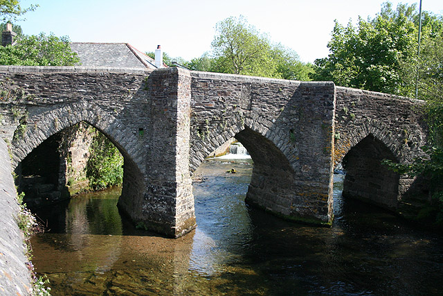
River Walkham

The Walkham is a river whose source is on Dartmoor, Devon, England. It rises in the wide gap between Roos Tor and Great Mis Tor and flows almost due south...

Horrabridge

Horrabridge is a village in West Devon, England with a population of 2,115 people in 2006, down from 2,204 in 1991. It is located approximately 12 miles...

Whitchurch, Devon

Whitchurch is a suburban village and civil parish to the south-east of the town of Tavistock, Devon, England. It lies in the West Devon local authority...

Nearby Amenities

Located within 500m of 50.516864,-4.1185086
Barrier: cattle_grid
Lat/Long: 50.514217/-4.1233641
Tourism: picnic_site
Lat/Long: 50.516364/-4.1251681
Tourism: information
Lat/Long: 50.5163367/-4.1250876
Tourism: viewpoint
Lat/Long: 50.5139967/-4.1233281
Power: pole
Source: bing
Transformer: distribution
Lat/Long: 50.5160036/-4.1173397
Power: pole
Source: bing
Lat/Long: 50.5156881/-4.1160455
Power: pole
Source: bing
Lat/Long: 50.5154331/-4.1151094
Power: pole
Source: bing
Lat/Long: 50.5151364/-4.113999
Power: pole
Source: bing
Lat/Long: 50.5211677/-4.1182235
Power: pole
Source: bing
Lat/Long: 50.5208471/-4.1191354
Power: pole
Source: bing
Lat/Long: 50.5205196/-4.117915
Power: pole
Source: bing
Lat/Long: 50.520182/-4.1166464
Power: pole
Source: bing
Lat/Long: 50.5198716/-4.1154206
Poles: bipole
Power: pole
Source: bing
Lat/Long: 50.519128/-4.1126204
The data included in this document is from www.openstreetmap.org. The data is made available under ODbL.

Have you been to Birchcleave Wood?

Leave your review of Birchcleave Wood below (or comments, questions and feedback).