Barton Wood

Wood, Forest in Devon West Devon

England

Barton Wood

West Devon : Bridge over the A30 A bridge with a lorry on it crossing the A30 dual carriageway.
West Devon : Bridge over the A30 Credit: Lewis Clarke

Barton Wood is a picturesque forest located in the county of Devon, England. Spanning over a vast area, this woodland offers a tranquil escape for nature enthusiasts and avid hikers alike. With its dense canopy and diverse flora and fauna, Barton Wood is a haven for wildlife and an important habitat for many species.

The forest is characterized by its rich biodiversity, featuring a variety of trees such as oak, beech, and birch. These towering giants create a majestic atmosphere, providing shade and shelter to the woodland floor below. Blanketed by a carpet of vibrant wildflowers, the forest is particularly stunning during the spring and summer months.

Barton Wood is renowned for its well-maintained walking trails, allowing visitors to explore the natural beauty at their own pace. The pathways wind through the forest, offering glimpses of small clearings and babbling brooks along the way. Birdwatchers will delight in the opportunity to spot a wide range of avian species, including woodpeckers, owls, and various songbirds.

For those seeking a deeper connection with nature, Barton Wood also offers designated camping areas, allowing visitors to spend a night under the starry Devonshire sky. As the sun sets and darkness envelops the forest, the nocturnal creatures of Barton Wood come alive, providing a unique experience for those willing to venture beyond daylight hours.

Overall, Barton Wood is a pristine and enchanting destination that allows visitors to immerse themselves in the beauty of nature. With its diverse ecosystems and tranquil ambiance, this forest in Devon is a true gem for outdoor enthusiasts and nature lovers.

If you have any feedback on the listing, please let us know in the comments section below.
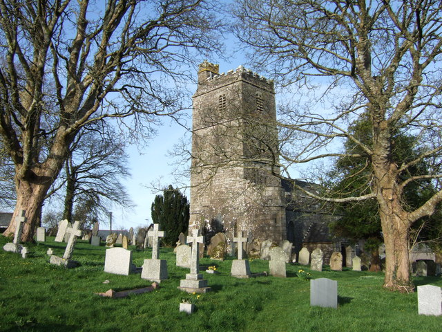
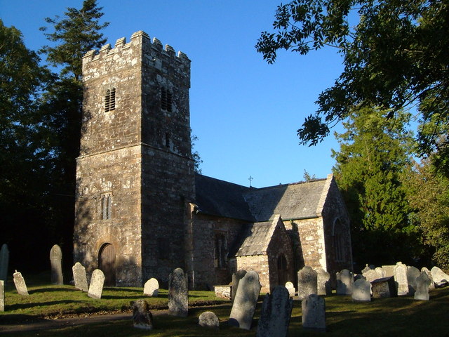
Barton Wood Images

Images are sourced within 2km of 50.701228/-4.1748746 or Grid Reference SX4691. Thanks to Geograph Open Source API. All images are credited.

West Devon : Bridge over the A30 A bridge with a lorry on it crossing the A30 dual carriageway.
West Devon : Bridge over the A30
A bridge with a lorry on it crossing the A30 dual carriageway.
Looking east along the A30 near Bratton Clovelly The lorry on the accommodation bridge is a more or less permanent fixture with an advertising banner on its side.
Looking east along the A30 near Bratton Clovelly
The lorry on the accommodation bridge is a more or less permanent fixture with an advertising banner on its side.
Clovelly Inn A very nice spot to visit, (the fireplace is a must see).
Clovelly Inn
A very nice spot to visit, (the fireplace is a must see).
A30 south of Ellacott Barton
A30 Farm bridge south of Ellacott Barton I put this picture in because it looks like the same lorry as Lewis Clark's photo: 'West Devon : Bridge over the A30' <a title="https://www.geograph.org.uk/photo/2490790" href="https://www.geograph.org.uk/photo/2490790">Link</a>. Either it's a very slow moving lorry, or it's parked there permanently, or it's a coincidence?
A30 Farm bridge south of Ellacott Barton
I put this picture in because it looks like the same lorry as Lewis Clark's photo: 'West Devon : Bridge over the A30' Link. Either it's a very slow moving lorry, or it's parked there permanently, or it's a coincidence?
The A30 westbound
The A30 westbound
The A30 westbound
The A30 westbound
Ordnance Survey Cut Mark This OS cut mark can be  found on St Mary's Church. It marks a point 178.338m above mean sea level.
Ordnance Survey Cut Mark
This OS cut mark can be found on St Mary's Church. It marks a point 178.338m above mean sea level.
West Devon : A30 Roadside Looking towards the roadside of the A30 where police seem to have pulled somebody over.
West Devon : A30 Roadside
Looking towards the roadside of the A30 where police seem to have pulled somebody over.
Approaching farm bridge near Ellacott Barton The cattle truck on the bridge appears to be a permanent fixture - it's on Google maps as well
Approaching farm bridge near Ellacott Barton
The cattle truck on the bridge appears to be a permanent fixture - it's on Google maps as well
Bridge over the A30 at Ellacott From other pictures it appears the van with advertisement emblazoned on the side is a semi-permanent feature.
Bridge over the A30 at Ellacott
From other pictures it appears the van with advertisement emblazoned on the side is a semi-permanent feature.
Thrushelton : A30 The A30 heads through the Thrushelton parish.
Thrushelton : A30
The A30 heads through the Thrushelton parish.
Thrushelton : A30 The A30 heads through the Thrushelton parish.
Thrushelton : A30
The A30 heads through the Thrushelton parish.
Thrushelton : A30 Taken from a layby in the Thrushelton Parish.
Thrushelton : A30
Taken from a layby in the Thrushelton Parish.
Thrushelton : A30 Taken from a layby in the Thrushelton Parish.
Thrushelton : A30
Taken from a layby in the Thrushelton Parish.
Fursdon Bratton Clovelly Bridleway 13 descends towards the farmhouse at Fursdon Farm. Fursdon consists of 2 farms and a number of cottages.
Fursdon
Bratton Clovelly Bridleway 13 descends towards the farmhouse at Fursdon Farm. Fursdon consists of 2 farms and a number of cottages.
Field at Fursdon Seen from Bratton Clovelly Bridleway 13 as it passes Fursdon Farm, this view looks across the northern edge of the square past a small wood on the right.
Field at Fursdon
Seen from Bratton Clovelly Bridleway 13 as it passes Fursdon Farm, this view looks across the northern edge of the square past a small wood on the right.
Near Domons The edge of field beside a garden at one of the properties at Domons, once the rectory for Bratton Clovelly, although a kilometre east of the village. The shallow valley drains west (right) towards the village to meet a tributary of the Thrushel.
Near Domons
The edge of field beside a garden at one of the properties at Domons, once the rectory for Bratton Clovelly, although a kilometre east of the village. The shallow valley drains west (right) towards the village to meet a tributary of the Thrushel.
Show me another place!

Barton Wood is located at Grid Ref: SX4691 (Lat: 50.701228, Lng: -4.1748746)

Administrative County: Devon

District: West Devon

Police Authority: Devon and Cornwall

What 3 Words

///output.zinc.cherry. Near Lifton, Devon

Related Wikis

Bratton Clovelly

Bratton Clovelly is a village, parish and former manor in the west part of Devon, England. It is situated about 8 miles (13 km) south-west of Okehampton...

Germansweek

Germansweek is a village and civil parish in the West Devon district, to the west of Okehampton in the county of Devon, England.The place-name Germansweek...

Great Bidlake Manor

Great Bidlake Manor is a Grade II* listed manor house in the parish of Bridestowe on the north western edge of Dartmoor in the county of Devon, England...

Boasley Cross

Boasley Cross is a village in Devon, England. == External links == Media related to Boasley Cross at Wikimedia Commons

Eworthy

Eworthy is a hamlet in Devon, England. It is situated close to Germansweek. There is a Methodist chapel in the hamlet. == References ==

Thrushelton

Thrushelton or Thruselton is a village and civil parish about 2 and a half miles north of Coryton railway station, in the West Devon district, in the county...

Burley Wood

Burley Wood is the site of an Iron Age hill fort north of Lydford in Devon, England. The fort occupies much of a hilltop some 220 metres above sea level...

Broadbury Castle

Broadbury Castle (grid reference SX48379580) is an archaeological earthwork close to Beaworthy in Devon, England. It comprises a single bank and ditch...

Related Videos

Bratton Clovelly Church - Churches of Devon

The church we see today at Bratton Clovelly, near Okehampton in Devon, was built in Norman times however it was enlarged in ...

Nearby Amenities

Located within 500m of 50.701228,-4.1748746
Bratton Clovelly
Created By: Potlatch 0.10f
Place: village
Lat/Long: 50.704808/-4.1760561
Power: pole
Lat/Long: 50.6974125/-4.1758695
Power: pole
Lat/Long: 50.6989398/-4.1770846
Power: pole
Lat/Long: 50.6996482/-4.1776344
Power: pole
Lat/Long: 50.7004399/-4.1782486
Power: pole
Lat/Long: 50.7013827/-4.1775298
Power: pole
Lat/Long: 50.7022287/-4.1769102
Power: pole
Lat/Long: 50.7028199/-4.176473
Power: pole
Lat/Long: 50.7033126/-4.1760975
Power: pole
Lat/Long: 50.7038884/-4.1756764
Power: pole
Lat/Long: 50.7048788/-4.1748932
Power: pole
Lat/Long: 50.7055837/-4.1747403
Generator Method: photovoltaic
Generator Output Electricity: yes
Generator Source: solar
Generator Type: solar_photovoltaic_panel
Location: roof
Power: generator
Lat/Long: 50.7012785/-4.179287
Generator Method: photovoltaic
Generator Output Electricity: yes
Generator Source: solar
Generator Type: solar_photovoltaic_panel
Location: roof
Power: generator
Lat/Long: 50.7013139/-4.1792505
Generator Method: photovoltaic
Generator Output Electricity: yes
Generator Source: solar
Generator Type: solar_photovoltaic_panel
Location: roof
Power: generator
Lat/Long: 50.7013492/-4.1792377
The data included in this document is from www.openstreetmap.org. The data is made available under ODbL.

Have you been to Barton Wood?

Leave your review of Barton Wood below (or comments, questions and feedback).