Barton Wood

Wood, Forest in Devon West Devon

England

Barton Wood

Over the fields to Lew Wood The view is north over a hedge, then beyond and above Coryton Barton to Lew Wood. On the lower left of the photo, there is a benchmark on the stone gatepost just above the lower hinge. <span class="nowrap"><a title="https://www.bench-marks.org.uk/bm160299" rel="nofollow ugc noopener" href="https://www.bench-marks.org.uk/bm160299">Link</a><img style="margin-left:2px;" alt="External link" title="External link - shift click to open in new window" src="https://s1.geograph.org.uk/img/external.png" width="10" height="10"/></span>
Over the fields to Lew Wood Credit: Neville Goodman

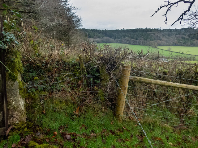
Barton Wood, located in Devon, England, is a stunning and expansive forest that covers a vast area of land. This woodland, often referred to as Barton Forest, is known for its natural beauty and diverse range of flora and fauna.

The forest boasts an impressive variety of tree species, including oak, beech, and pine, which create a dense and rich canopy overhead. This lush vegetation provides a habitat for numerous animal species, such as deer, foxes, and a variety of bird species. It is also home to a wide array of smaller creatures like squirrels, rabbits, and hedgehogs.

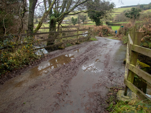
Barton Wood is a popular destination for nature enthusiasts and outdoor adventurers. Visitors can enjoy a range of recreational activities, including hiking, birdwatching, and picnicking. The forest is crisscrossed with a network of well-maintained walking trails, allowing visitors to explore the woodland at their leisure.

The woodland's natural beauty is further enhanced by the presence of several small streams and ponds, which add to the tranquility of the area. Additionally, the forest offers breathtaking views from various vantage points, allowing visitors to immerse themselves in the picturesque surroundings.

Barton Wood is not only a haven for wildlife and a place of natural beauty, but it also serves as an important ecological site. The forest plays a crucial role in preserving biodiversity and maintaining the delicate balance of the local ecosystem.

Overall, Barton Wood in Devon is a captivating destination for nature lovers, offering a peaceful and enchanting experience amidst the wonders of the natural world.

If you have any feedback on the listing, please let us know in the comments section below.

Barton Wood Images

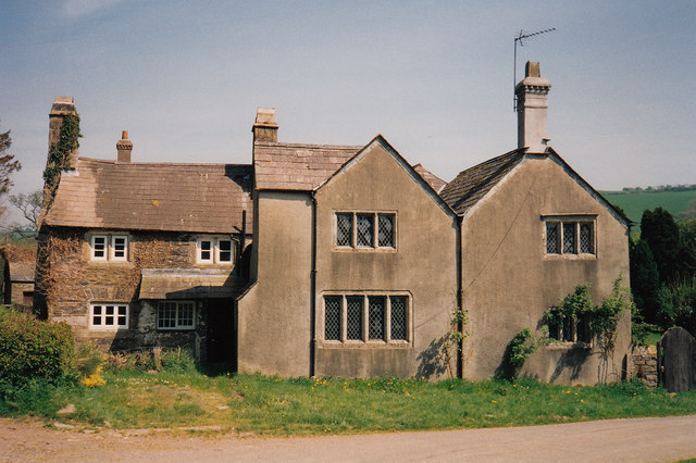
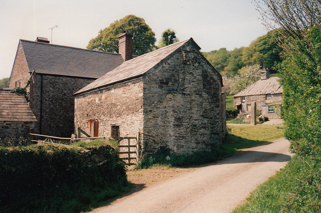
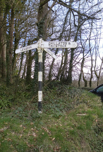
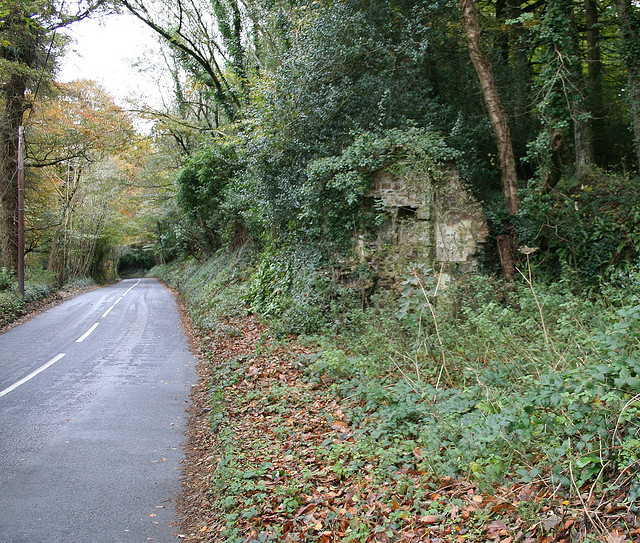
Images are sourced within 2km of 50.655312/-4.1749877 or Grid Reference SX4686. Thanks to Geograph Open Source API. All images are credited.

Over the fields to Lew Wood The view is north over a hedge, then beyond and above Coryton Barton to Lew Wood. On the lower left of the photo, there is a benchmark on the stone gatepost just above the lower hinge. <span class="nowrap"><a title="https://www.bench-marks.org.uk/bm160299" rel="nofollow ugc noopener" href="https://www.bench-marks.org.uk/bm160299">Link</a><img style="margin-left:2px;" alt="External link" title="External link - shift click to open in new window" src="https://s1.geograph.org.uk/img/external.png" width="10" height="10"/></span>
Over the fields to Lew Wood
The view is north over a hedge, then beyond and above Coryton Barton to Lew Wood. On the lower left of the photo, there is a benchmark on the stone gatepost just above the lower hinge. LinkExternal link
Bridge over the River Lew This bridge over the River Lew is near the Dower House <a href="https://www.geograph.org.uk/photo/5723279">SX4686 : Lewtrenchard: Dower House at Lew Mill</a>. There used to be a cut benchmark on the left hand (NE) parapet, but the parapet has been replaced -- perhaps washed away in a flood sometime? <span class="nowrap"><a title="https://www.bench-marks.org.uk/bm160323" rel="nofollow ugc noopener" href="https://www.bench-marks.org.uk/bm160323">Link</a><img style="margin-left:2px;" alt="External link" title="External link - shift click to open in new window" src="https://s1.geograph.org.uk/img/external.png" width="10" height="10"/></span>
Bridge over the River Lew
This bridge over the River Lew is near the Dower House SX4686 : Lewtrenchard: Dower House at Lew Mill. There used to be a cut benchmark on the left hand (NE) parapet, but the parapet has been replaced -- perhaps washed away in a flood sometime? LinkExternal link
Overgrown Lane Middle Raddon Walking from East Raddon then passing Middle Raddon, there is a track entrance on the right. It is marked on the map, going through eventually to a minor road a little south of Lewdown. About 100m along it, there is a benchmark on a gatepost (according to the OS). We fought our way through nettles and brambles - it was December; it would have been impenetrable in summer. We found the gate, but not the gatepost. There is another benchmark further along, which has the description of being in "OVERGROWN LANE". I don't know if that is its proper name (there is nothing on the map), or if that's what the OS surveyors thought. <span class="nowrap"><a title="https://www.bench-marks.org.uk/bm160326" rel="nofollow ugc noopener" href="https://www.bench-marks.org.uk/bm160326">Link</a><img style="margin-left:2px;" alt="External link" title="External link - shift click to open in new window" src="https://s1.geograph.org.uk/img/external.png" width="10" height="10"/></span>
Overgrown Lane Middle Raddon
Walking from East Raddon then passing Middle Raddon, there is a track entrance on the right. It is marked on the map, going through eventually to a minor road a little south of Lewdown. About 100m along it, there is a benchmark on a gatepost (according to the OS). We fought our way through nettles and brambles - it was December; it would have been impenetrable in summer. We found the gate, but not the gatepost. There is another benchmark further along, which has the description of being in "OVERGROWN LANE". I don't know if that is its proper name (there is nothing on the map), or if that's what the OS surveyors thought. LinkExternal link
Lewtrenchard Manor This Jacobean manor house is now an upmarket hotel. We had an excellent afternoon tea here.
Lewtrenchard Manor
This Jacobean manor house is now an upmarket hotel. We had an excellent afternoon tea here.
Entrance to Jethro's
Lewdown : The Redcliffes A road heading out from Lewdown.
Lewdown : The Redcliffes
A road heading out from Lewdown.
Lewdown : The Redcliffes A road heading into Lewdown.
Lewdown : The Redcliffes
A road heading into Lewdown.
Lewtrenchard: Dower House at Lew Mill
Lewtrenchard: Lew Mill Buildings, formerly a water mill
Lewtrenchard: Lew Mill
Buildings, formerly a water mill
Old Direction Sign - Signpost by ruined toll house, Coryton Parish Ball finial - 3 arms; Devon compass points by the UC road, in parish of Coryton (West Devon District), Coryton Barton, by ruins of tollhouse, under trees.

Surveyed

Milestone Society National ID: DV_SX4584
Old Direction Sign - Signpost by ruined toll house, Coryton Parish
Ball finial - 3 arms; Devon compass points by the UC road, in parish of Coryton (West Devon District), Coryton Barton, by ruins of tollhouse, under trees. Surveyed Milestone Society National ID: DV_SX4584
Old Milestone by the former A30, Lewdown, Lewtrenchard Carved stone post by the UC road (was A30), in parish of LEWTRENCHARD (WEST DEVON District), Lewdown, 50m West of Victory Hall, by path, under hedge, on North side of road. Launceston gable, erected by the Launceston turnpike trust in the 18th century. 

Inscription reads:- : LAUNCESTON / 8 / OKEHAMPTON 10½ :  

Milestone Society National ID: DV_LAOK08
Old Milestone by the former A30, Lewdown, Lewtrenchard
Carved stone post by the UC road (was A30), in parish of LEWTRENCHARD (WEST DEVON District), Lewdown, 50m West of Victory Hall, by path, under hedge, on North side of road. Launceston gable, erected by the Launceston turnpike trust in the 18th century. Inscription reads:- : LAUNCESTON / 8 / OKEHAMPTON 10½ : Milestone Society National ID: DV_LAOK08
Old Milestone near Lobhill Cross, Thrushelton Carved stone post by the UC road (was A30), in parish of THRUSHELTON (WEST DEVON District), just East of Lobhill Cross, 50m up (West) from Lobhill Lodge, in hedge bank, on North side of road. Launceston gable, erected by the Launceston turnpike trust in the 19th century. 

Inscription reads:-  : LAUNCESTON / 9 / OKEHAMPTON 9½ : 

Milestone Society National ID: DV_LAOK09.
Old Milestone near Lobhill Cross, Thrushelton
Carved stone post by the UC road (was A30), in parish of THRUSHELTON (WEST DEVON District), just East of Lobhill Cross, 50m up (West) from Lobhill Lodge, in hedge bank, on North side of road. Launceston gable, erected by the Launceston turnpike trust in the 19th century. Inscription reads:- : LAUNCESTON / 9 / OKEHAMPTON 9½ : Milestone Society National ID: DV_LAOK09.
Old Boundary Marker by Lobhillcross, Lewtrenchard parish Parish Boundary Marker by the UC road (was A30), in parish of Lewtrenchard (West Devon District), Lobhillcross, 50m West of Lobhill lodge, on grass verge/bank above path by fence.

Devon & Dartmoor HER.
HER Number: MDV59500 <span class="nowrap"><a title="https://www.heritagegateway.org.uk/Gateway/Results_Single.aspx?uid=MDV59500&resourceID=104" rel="nofollow ugc noopener" href="https://www.heritagegateway.org.uk/Gateway/Results_Single.aspx?uid=MDV59500&resourceID=104">Link</a><img style="margin-left:2px;" alt="External link" title="External link - shift click to open in new window" src="https://s1.geograph.org.uk/img/external.png" width="10" height="10"/></span>

Carved benchmark on lower East face.

Surveyed

Milestone Society National ID: DV_LAEX07pb
Old Boundary Marker by Lobhillcross, Lewtrenchard parish
Parish Boundary Marker by the UC road (was A30), in parish of Lewtrenchard (West Devon District), Lobhillcross, 50m West of Lobhill lodge, on grass verge/bank above path by fence. Devon & Dartmoor HER. HER Number: MDV59500 LinkExternal link Carved benchmark on lower East face. Surveyed Milestone Society National ID: DV_LAEX07pb
Old Toll House west of Coryton Barton Toll House in the parish of Coryton (West Devon District), ruin of tollhouse, Coryton Barton junction, beside the River Lew.

Devon & Dartmoor HER.
HER Number: MDV112457 <span class="nowrap"><a title="https://www.heritagegateway.org.uk/Gateway/Results_Single.aspx?uid=MDV112457&resourceID=104" rel="nofollow ugc noopener" href="https://www.heritagegateway.org.uk/Gateway/Results_Single.aspx?uid=MDV112457&resourceID=104">Link</a><img style="margin-left:2px;" alt="External link" title="External link - shift click to open in new window" src="https://s1.geograph.org.uk/img/external.png" width="10" height="10"/></span>

Surveyed

Milestone Society National ID: DV.COR
Old Toll House west of Coryton Barton
Toll House in the parish of Coryton (West Devon District), ruin of tollhouse, Coryton Barton junction, beside the River Lew. Devon & Dartmoor HER. HER Number: MDV112457 LinkExternal link Surveyed Milestone Society National ID: DV.COR
A flooded quarry On the map, this looks as if it's an ornamental lake in the grounds of the hotel. Far from it. It's an old quarry (Lew Quarry), well fenced off. I tried to look up some information on the internet, but couldn't get past the adverts for the various self-catering cottages in the vicinity.
A flooded quarry
On the map, this looks as if it's an ornamental lake in the grounds of the hotel. Far from it. It's an old quarry (Lew Quarry), well fenced off. I tried to look up some information on the internet, but couldn't get past the adverts for the various self-catering cottages in the vicinity.
Track through Wooda Farm This track runs up the hillside beyond Wooda Farm. There is a cut benchmark low down on the whitewashed wall lower right <a href="https://www.geograph.org.uk/photo/6561075">SX4685 : Well preserved cut benchmark</a>.
Track through Wooda Farm
This track runs up the hillside beyond Wooda Farm. There is a cut benchmark low down on the whitewashed wall lower right SX4685 : Well preserved cut benchmark.
Well preserved cut benchmark The OS description is NE ANG FM WOODA W SIDE TK. The surroundings are shown in <a href="https://www.geograph.org.uk/photo/6561072">SX4685 : Track through Wooda Farm</a>.
Well preserved cut benchmark
The OS description is NE ANG FM WOODA W SIDE TK. The surroundings are shown in SX4685 : Track through Wooda Farm.
Benchmark on St Peter's Church As I walked around the church tower, I saw the oil tank. For a moment, I thought that the tank would obscure the benchmark, but it didn't. The benchmark is on the facing wall, low down, just above the level of the slate leaning against the west face <a href="https://www.geograph.org.uk/photo/6561087">SX4586 : Benchmark by the oil tank</a>. There is a fuller image of the church <a href="https://www.geograph.org.uk/photo/1730138">SX4586 : St. Peter's, Lewtrenchard, Devon</a>.
Benchmark on St Peter's Church
As I walked around the church tower, I saw the oil tank. For a moment, I thought that the tank would obscure the benchmark, but it didn't. The benchmark is on the facing wall, low down, just above the level of the slate leaning against the west face SX4586 : Benchmark by the oil tank. There is a fuller image of the church SX4586 : St. Peter's, Lewtrenchard, Devon.
Show me another place!

Barton Wood is located at Grid Ref: SX4686 (Lat: 50.655312, Lng: -4.1749877)

Administrative County: Devon

District: West Devon

Police Authority: Devon and Cornwall

What 3 Words

///downturn.smooth.petrified. Near Lifton, Devon

Nearby Locations

Dower House Barton Wood

Related Wikis

Lewtrenchard

Lewtrenchard is a village and civil parish in the West Devon district, in the county of Devon, England. Most of the larger village of Lewdown is in the...

Combebow

Combebow is a small settlement in Devon, England. It is situated by the River Lew. == External links == Media related to Combebow at Wikimedia Commons...

Thrushelton

Thrushelton or Thruselton is a village and civil parish about 2 and a half miles north of Coryton railway station, in the West Devon district, in the county...

Coryton, Devon

Coryton is a hamlet and civil parish in the West Devon district of Devon, England, to the north west of Tavistock. Coryton is in the valley of the River...

Stowford

Stowford is a village and civil parish in the district of West Devon in the English county of Devon. It is situated to the west of Dartmoor. Stowford is...

Liddaton Halt railway station

Liddaton Halt was a railway station opened in 1938 by the Great Western Railway to serve the hamlet of Liddaton that lies between Coryton and Lydford in...

Burley Wood

Burley Wood is the site of an Iron Age hill fort north of Lydford in Devon, England. The fort occupies much of a hilltop some 220 metres above sea level...

Bratton Clovelly

Bratton Clovelly is a village, parish and former manor in the west part of Devon, England. It is situated about 8 miles (13 km) south-west of Okehampton...

Nearby Amenities

Located within 500m of 50.655312,-4.1749877
Power: pole
Lat/Long: 50.6525301/-4.171181
Power: pole
Lat/Long: 50.6553309/-4.1700518
Power: pole
Lat/Long: 50.6552527/-4.1706473
Power: pole
Lat/Long: 50.6551983/-4.1712239
Power: pole
Lat/Long: 50.6542426/-4.1712964
Power: pole
Lat/Long: 50.6551898/-4.1713473
Power: pole
Lat/Long: 50.6559737/-4.1713768
Power: pole
Lat/Long: 50.6566896/-4.1714117
Power: pole
Lat/Long: 50.6569633/-4.1714734
Power: pole
Lat/Long: 50.6576911/-4.1714278
Power: pole
Lat/Long: 50.6584903/-4.1715485
Post Box
Brand: Royal Mail
Brand Wikidata: Q638098
Brand Wikipedia: en:Royal Mail
Collection Times: Mo-Fr 09:00; Sa 07:00; Su off
Drive Through: no
Operator: Royal Mail
Operator Wikidata: Q638098
Post Box Design: type_c
Post Box Mounting: building
Post Box Type: wall
Ref: EX20 32D
Source: survey;streetlevel imagery;aerial imagery
Lat/Long: 50.6552204/-4.1689635
The data included in this document is from www.openstreetmap.org. The data is made available under ODbL.

Have you been to Barton Wood?

Leave your review of Barton Wood below (or comments, questions and feedback).