Alscott Copse

Wood, Forest in Devon Torridge

England

Alscott Copse

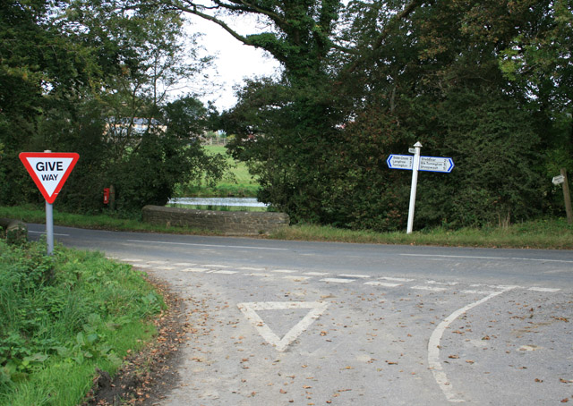
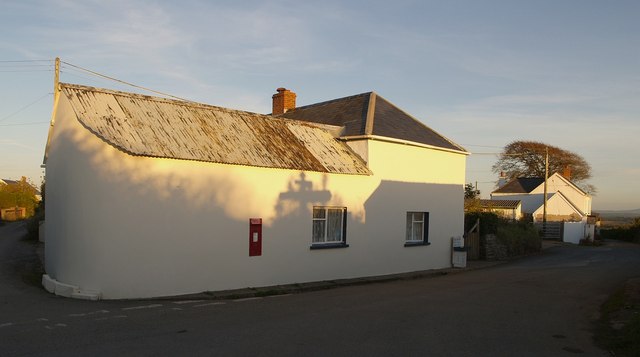
Smoky House, road junction
Smoky House, road junction Credit: Alex McGregor

Alscott Copse is a picturesque woodland located in the county of Devon, England. Covering an area of approximately 50 acres, the copse is renowned for its natural beauty and tranquil atmosphere. Nestled on the outskirts of a small village, it provides a peaceful retreat for visitors and locals alike.

The copse is dominated by a variety of native tree species, including oak, beech, and ash. These majestic trees create a dense canopy that filters sunlight, casting a dappled shade on the forest floor. The woodland is also home to a rich undergrowth of ferns, bluebells, and wildflowers, which burst into a riot of color during the spring months.

A network of footpaths and trails wind their way through Alscott Copse, allowing visitors to explore its natural wonders. The paths are well-maintained and offer a pleasant walking experience for all ages and abilities. Birdwatchers will be delighted by the copse's avian residents, such as woodpeckers, buzzards, and tawny owls, which can often be heard or spotted among the treetops.

Alscott Copse is not only a haven for nature enthusiasts but also a valuable habitat for a range of wildlife. Squirrels scamper through the branches, while foxes and badgers can occasionally be glimpsed at dusk. The copse also supports a diverse insect population, with butterflies and dragonflies flitting about in the summer months.

Whether it's for a leisurely stroll, a family picnic, or simply to reconnect with nature, Alscott Copse offers a truly enchanting experience. Its idyllic setting, abundant wildlife, and stunning scenery make it a must-visit destination for anyone seeking solace in the heart of Devon's countryside.

If you have any feedback on the listing, please let us know in the comments section below.

Alscott Copse Images

Images are sourced within 2km of 50.888657/-4.1933071 or Grid Reference SS4512. Thanks to Geograph Open Source API. All images are credited.

Smoky House, road junction
Rosehill, road junction
Turning for Berry
Turning for Berry
Turning for Shebbear Pottery
Rowden Chapel, road junction
Rowden Chapel
Rowden Chapel
Oak tree and gate near Paddon By the lane between Stibb Cross and Rosehill.
Oak tree and gate near Paddon
By the lane between Stibb Cross and Rosehill.
Forches cross
Forches cross
Bible Christian chapel, Stonemoor Cross The tablet over the door gives the date of erection as 1870. Curiously, no building is shown on the 1:25000 map. As the 1:50000 does not show it as a cross (unlike the 1940 map), I suspect it is now a private residence, although it is not very clear from the outside.
Bible Christian chapel, Stonemoor Cross
The tablet over the door gives the date of erection as 1870. Curiously, no building is shown on the 1:25000 map. As the 1:50000 does not show it as a cross (unlike the 1940 map), I suspect it is now a private residence, although it is not very clear from the outside.
Week Barton Modern barns seen from the farm lane, which leads only to here and a couple of bungalows. The farm lies at the side of one of the headwaters of the Mussel Brook.
Week Barton
Modern barns seen from the farm lane, which leads only to here and a couple of bungalows. The farm lies at the side of one of the headwaters of the Mussel Brook.
Pond near Rowden Farm At junction of road from Caute and road between Battledown Cross and Stibb Cross
Pond near Rowden Farm
At junction of road from Caute and road between Battledown Cross and Stibb Cross
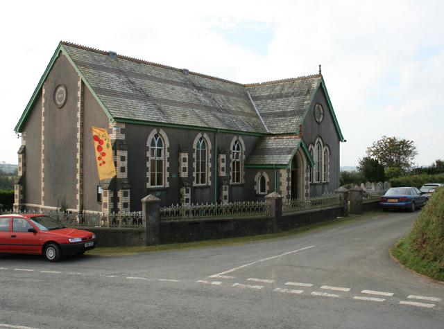
Rowden Bible Christian Chapel Built 1905 -  the flag is a mystery.
Rowden Bible Christian Chapel
Built 1905 - the flag is a mystery.
Field beside Mussel Brook A mixture of woods and fields make this an attractive valley. The stream flows south to meet the Torridge near Sheepwash. Seen from Buckland Filleigh Bridleway 2 below Awsland.
Field beside Mussel Brook
A mixture of woods and fields make this an attractive valley. The stream flows south to meet the Torridge near Sheepwash. Seen from Buckland Filleigh Bridleway 2 below Awsland.
Young woodland at Awsland The mown area on the right provides one of the walks through this charming young plantation beside the Mussel Brook. Species include ash, oak and Guelder Rose. The owner tells me that the trees have to be planted in straight lines and with set distances in order for payment to be made under the South West Forest scheme. Awsland is one of Devon Wildlife Trust's "approved farm businesses".
Young woodland at Awsland
The mown area on the right provides one of the walks through this charming young plantation beside the Mussel Brook. Species include ash, oak and Guelder Rose. The owner tells me that the trees have to be planted in straight lines and with set distances in order for payment to be made under the South West Forest scheme. Awsland is one of Devon Wildlife Trust's "approved farm businesses".
Alscott Farm The farm is in the valley of Mussel Brook. Seen from the lane between Farthingland and Woollaton.
Alscott Farm
The farm is in the valley of Mussel Brook. Seen from the lane between Farthingland and Woollaton.
Field boundaries near Little East Badworthy Sections of bank have survived if surmounted by beeches, with sizeable gaps in between, giving a slightly surreal effect. These fields are beside the lane between Rosehill and Forches Cross.
Field boundaries near Little East Badworthy
Sections of bank have survived if surmounted by beeches, with sizeable gaps in between, giving a slightly surreal effect. These fields are beside the lane between Rosehill and Forches Cross.
Badworthy Moor Cross A lonely road junction in an obscure part of North Devon. Just to clarify, straight ahead goes to Torrington - eventually.
Badworthy Moor Cross
A lonely road junction in an obscure part of North Devon. Just to clarify, straight ahead goes to Torrington - eventually.
Common Moor The wooded west section of the patch of access land, seen across a field from a gateway by an exceptionally muddy track near East Badworthy.
Common Moor
The wooded west section of the patch of access land, seen across a field from a gateway by an exceptionally muddy track near East Badworthy.
Show me another place!

Alscott Copse is located at Grid Ref: SS4512 (Lat: 50.888657, Lng: -4.1933071)

Administrative County: Devon

District: Torridge

Police Authority: Devon and Cornwall

What 3 Words

///behind.beaters.typified. Near Great Torrington, Devon

Nearby Locations

Alscott Copse

Related Wikis

Woollaton

Woollaton is a village in Devon, England.

Peters Marland

Peters Marland is a small village and civil parish in the local government district of Torridge, Devon, England. The parish, which lies about four miles...

Loxhore

Loxhore is a small village, civil parish and former manor in the local government district of North Devon in the county of Devon, England. The parish,...

Berry Cross

Berry Cross is a village in Devon, England.

Have you been to Alscott Copse?

Leave your review of Alscott Copse below (or comments, questions and feedback).