Nanny Parson's Grove
Wood, Forest in Cornwall
England
Nanny Parson's Grove
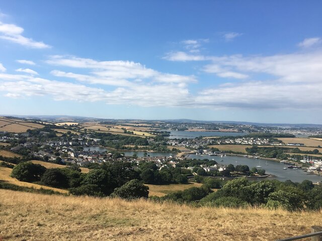
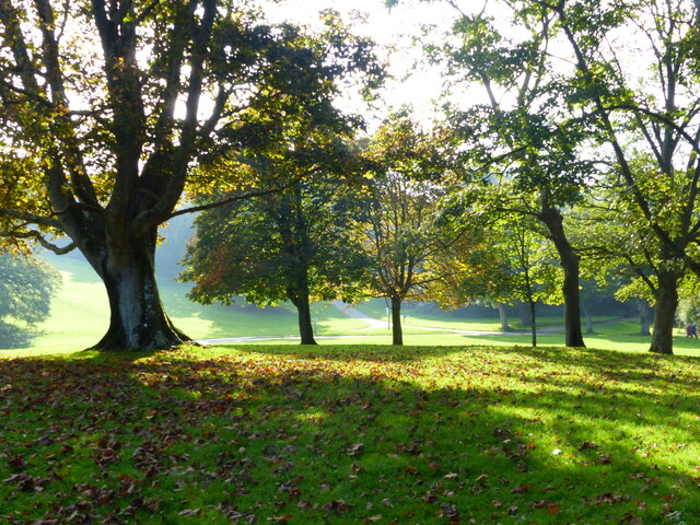
Nanny Parson's Grove, located in Cornwall, England, is a pristine woodland area that offers visitors a tranquil escape into nature. Covering a sprawling area of lush greenery, this wood or forest is known for its scenic beauty and abundant wildlife.
The grove is named after Nanny Parson, a local figure known for her deep connection to nature and her dedication to preserving the natural environment. Her love for the area is evident in the well-maintained trails and the careful conservation efforts that have been undertaken in the grove.
Visitors to Nanny Parson's Grove can expect to be greeted by a diverse range of flora and fauna. The woodland is home to a variety of tree species, including oak, beech, and birch, which create a dense canopy overhead. The forest floor is adorned with carpets of wildflowers, adding bursts of color to the already picturesque setting.
Walking through the grove, visitors may encounter a range of wildlife, such as squirrels, rabbits, and various species of birds. The area is particularly popular with birdwatchers, as it provides an ideal habitat for many bird species, including woodpeckers and owls.
Nanny Parson's Grove is also a favored spot for hikers and nature enthusiasts, offering a network of well-marked trails that wind through the wood. These trails cater to all levels of fitness and provide opportunities for a leisurely stroll or a more challenging hike.
Overall, Nanny Parson's Grove is a haven of tranquility and natural beauty, providing a rejuvenating experience for all who visit.
If you have any feedback on the listing, please let us know in the comments section below.
Nanny Parson's Grove Images
Images are sourced within 2km of 50.350983/-4.1878962 or Grid Reference SX4452. Thanks to Geograph Open Source API. All images are credited.


Nanny Parson's Grove is located at Grid Ref: SX4452 (Lat: 50.350983, Lng: -4.1878962)
Unitary Authority: Cornwall
Police Authority: Devon and Cornwall
What 3 Words
///unable.donor.frozen. Near Millbrook, Cornwall
Nearby Locations
Related Wikis

St Mary's and St Julian's Church, Maker
St Mary's and St Julian's Church is a Church of England parish church in Maker, Cornwall, England, UK. The church dates to the 15th century and has been...

Maker, Cornwall
Maker (Cornish: Magor) is a village between Cawsand and Rame Head, Rame Peninsula, Cornwall, England, United Kingdom. The name means a ruin or old wall...
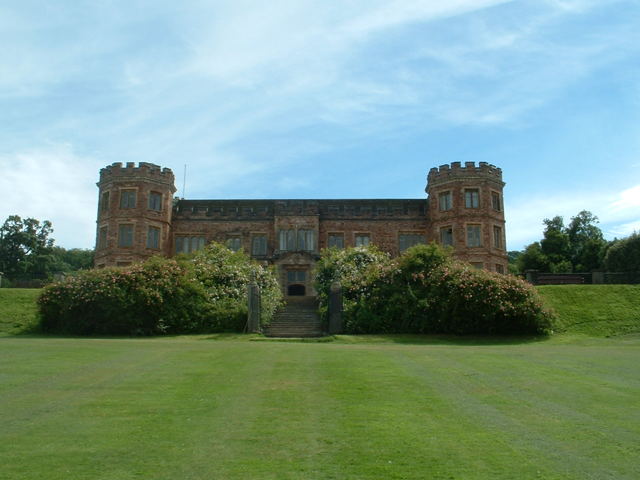
Mount Edgcumbe House
Mount Edgcumbe House is a stately home in south-east Cornwall and is a Grade II listed building, whilst its gardens and parkland are listed as Grade I...
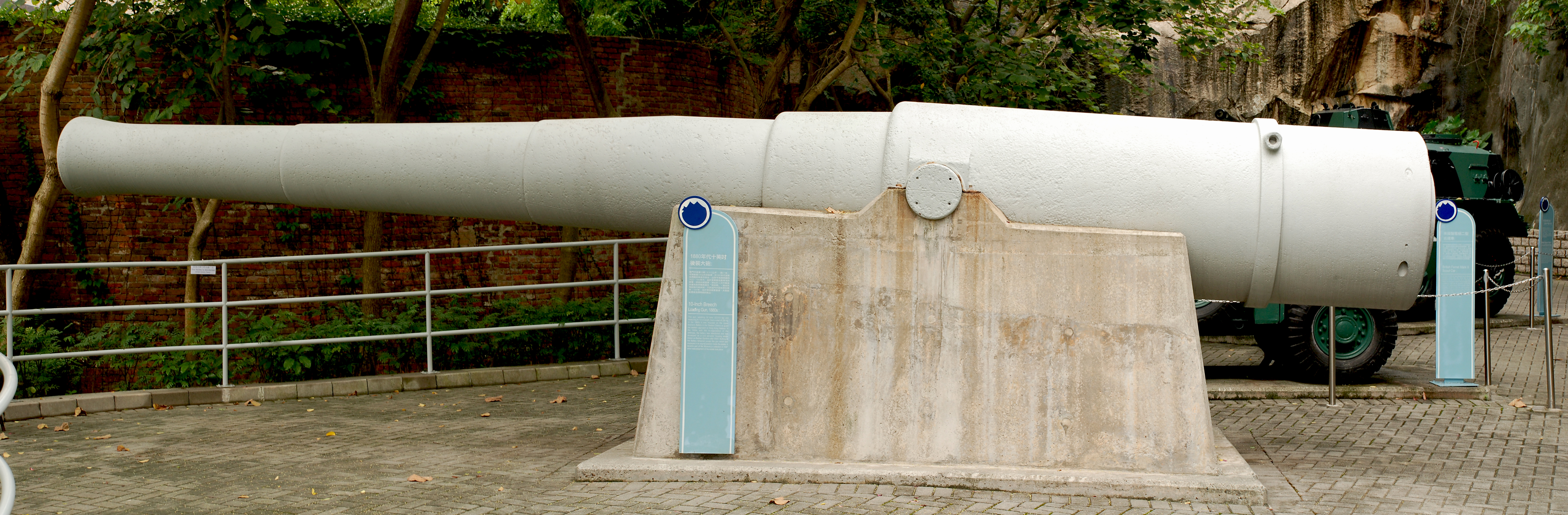
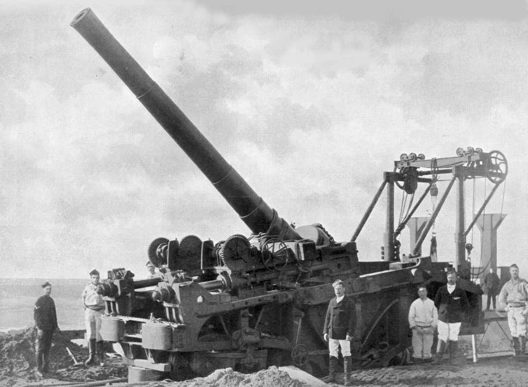
Raleigh Battery
Raleigh Battery is a former coastal artillery battery, built to defend the Royal Naval Dockyard at Devonport. The battery was constructed between March...
Hawkins Battery
Hawkins Battery is a former coastal artillery battery, built to defend the Royal Naval Dockyard at Devonport. The battery was originally built between...
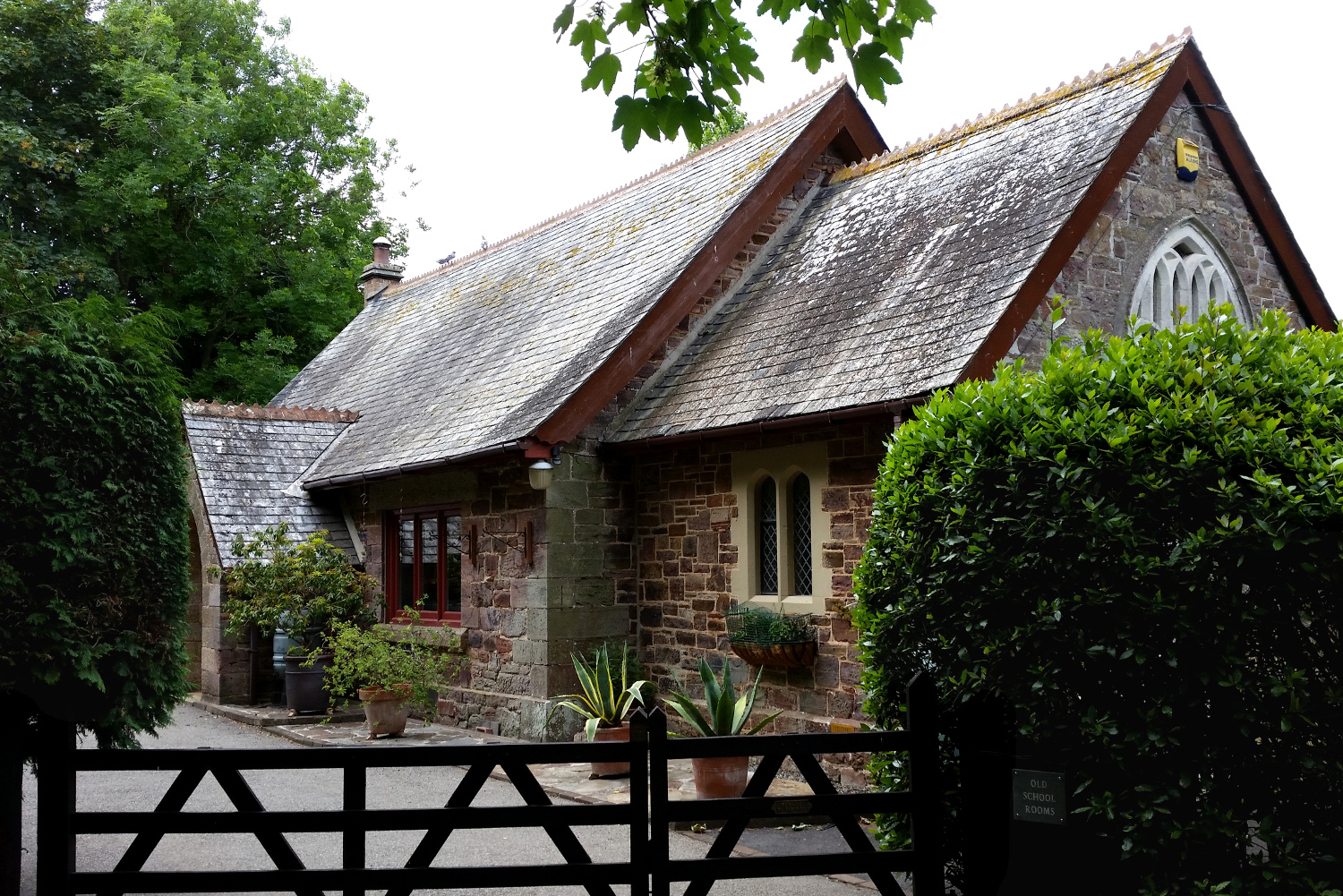
Cremyll School and Chapel
Cremyll School and Chapel is a former schoolroom and chapel in Cremyll, Cornwall, England. It was erected in 1867 and is now a private residence, known...

Cremyll
Cremyll (pronounced ) is a small coastal village in south-east Cornwall, England, United Kingdom. Cremyll is on the Rame Peninsula facing Plymouth Sound...
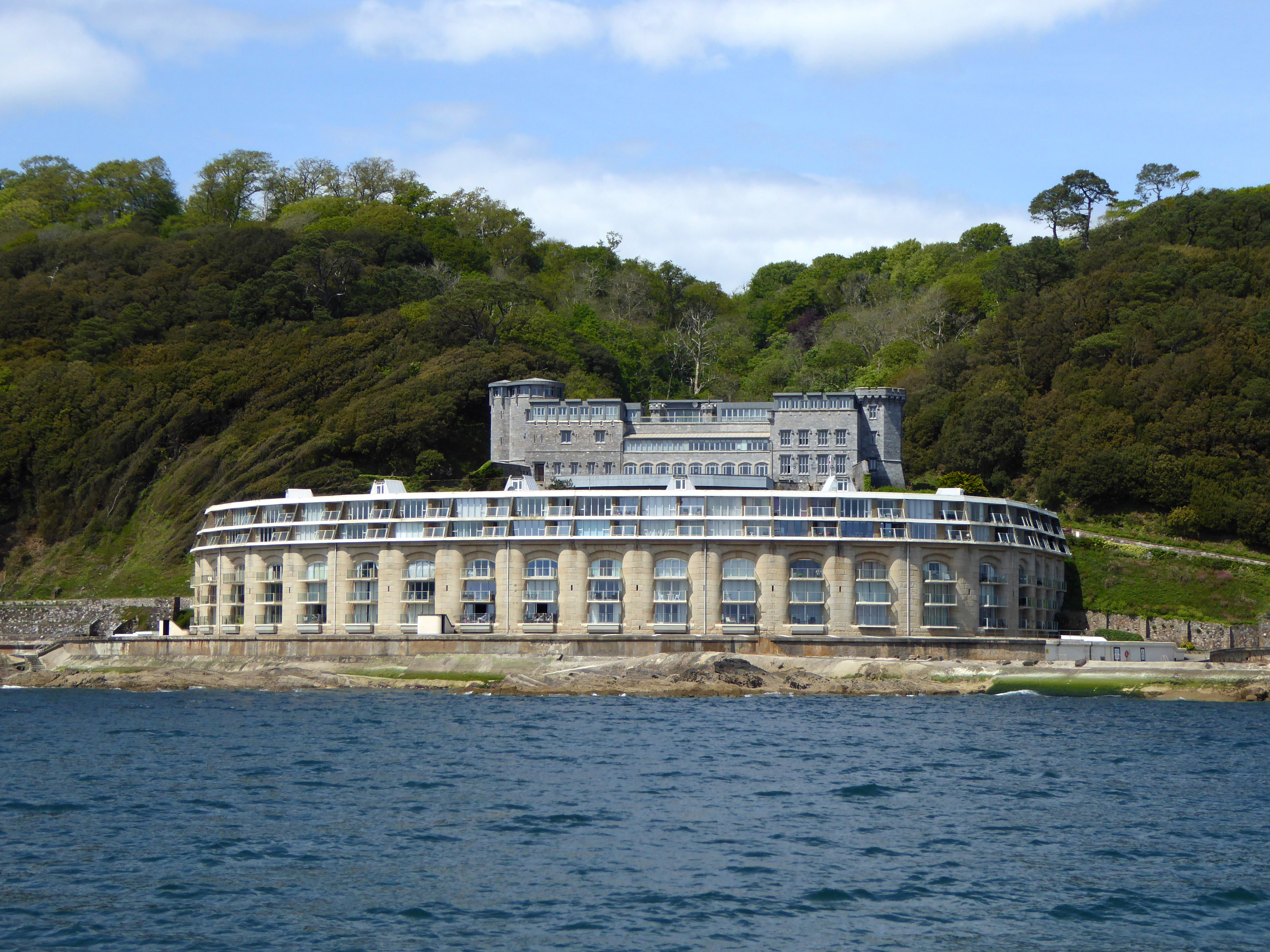
Picklecombe Fort
Fort Picklecombe stands on the extreme south eastern coast of Cornwall, a couple of miles west of the city of Plymouth. The fort has been a residential...
Nearby Amenities
Located within 500m of 50.350983,-4.1878962Have you been to Nanny Parson's Grove?
Leave your review of Nanny Parson's Grove below (or comments, questions and feedback).