Cherrybank

Settlement in Perthshire

Scotland

Cherrybank

Field alongside the M90 near Broxden
Field alongside the M90 near Broxden Credit: Douglas Nelson

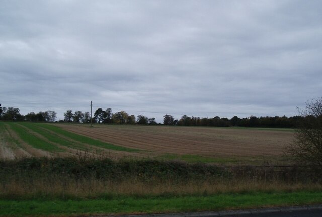
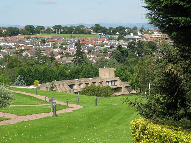
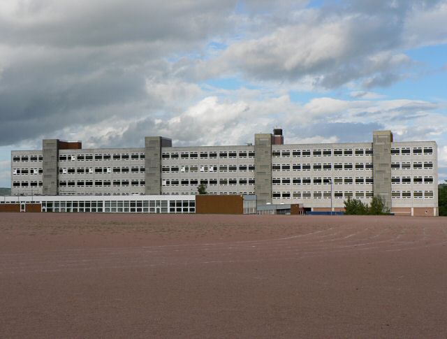
Cherrybank is a small village located in the county of Perthshire, Scotland. Situated on the banks of the Tay River, it is approximately 2 miles west of the city of Perth. The village enjoys a picturesque setting, surrounded by beautiful countryside and rolling hills.

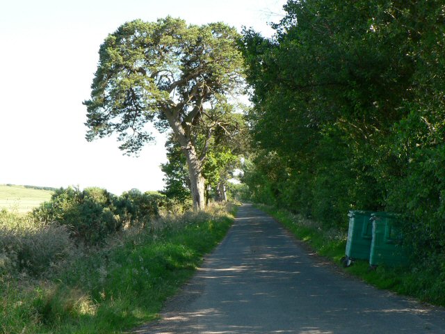
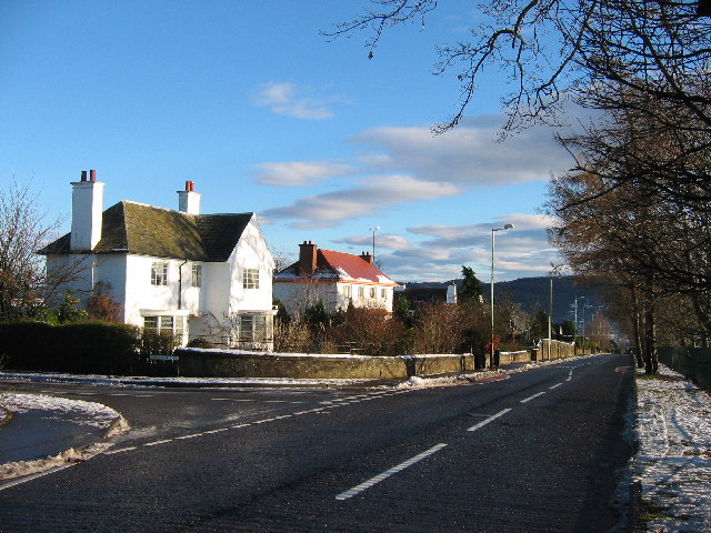
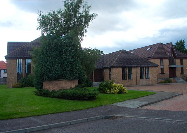
Cherrybank is known for its charming and quaint atmosphere, with traditional stone houses lining the streets. The village has a close-knit community, with a population of around 500 residents. It offers a peaceful and tranquil environment, making it an ideal place for those seeking a quieter lifestyle.

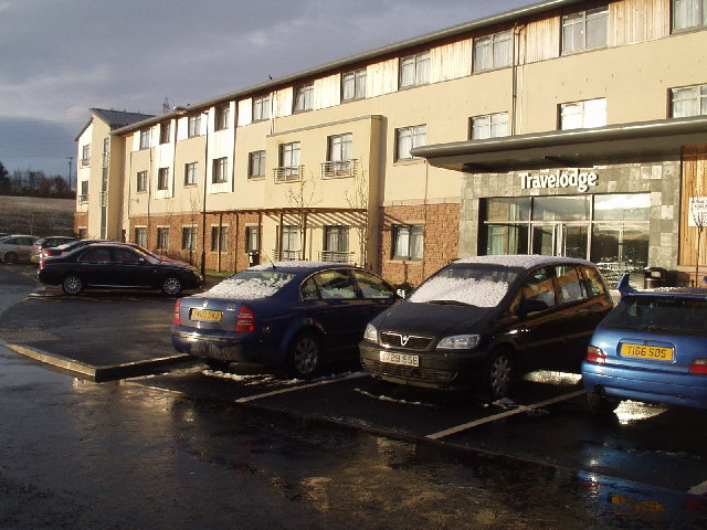
Despite its small size, Cherrybank has a few amenities to cater to its residents. There is a local convenience store for daily essentials, and a pub that serves as a social hub for the community. For more extensive shopping, the city of Perth is just a short drive away.

Nature lovers will appreciate the natural beauty that surrounds Cherrybank. The Tay River offers opportunities for fishing and boating, while nearby woodlands provide walking and cycling trails. The village is also close to the Perthshire countryside, which is renowned for its stunning scenery and outdoor activities.

Cherrybank's location provides easy access to major transportation links. The A9 road runs nearby, connecting the village to other parts of Scotland. Additionally, Perth has a train station with regular services to major cities like Edinburgh and Glasgow.

Overall, Cherrybank offers a peaceful and scenic lifestyle in the heart of Perthshire. Its close proximity to Perth and its natural surroundings make it an attractive place to live for those seeking a balance between rural tranquility and urban amenities.

If you have any feedback on the listing, please let us know in the comments section below.

Cherrybank Images

Images are sourced within 2km of 56.392321/-3.454157 or Grid Reference NO1023. Thanks to Geograph Open Source API. All images are credited.

Field alongside the M90 near Broxden
Perth Travelodge A new travelodge in the sun and the snow!
Perth Travelodge
A new travelodge in the sun and the snow!
Perth Academy Perth Academy is the white building with the central clock tower. The lower red brick buildings in front are Viewlands Primary School.
Between them they straddle the corners of four squares, but they seem to take up more space on this square than the others. This picture was taken from outside the office buildings at NO098222.
Perth Academy
Perth Academy is the white building with the central clock tower. The lower red brick buildings in front are Viewlands Primary School. Between them they straddle the corners of four squares, but they seem to take up more space on this square than the others. This picture was taken from outside the office buildings at NO098222.
Private road to Woodhead Looking south from junction with B9112.
Private road to Woodhead
Looking south from junction with B9112.
Perth High School
Perth High School
New housing on the western edge of Perth A lot of new houses have been built on this side of Perth in recent years.
New housing on the western edge of Perth
A lot of new houses have been built on this side of Perth in recent years.
Letham
Letham
Santa's eye-view of Viewlands, Perth Looking east across Perth towards Kinnoull Hill, Christmas Day 2005
Santa's eye-view of Viewlands, Perth
Looking east across Perth towards Kinnoull Hill, Christmas Day 2005
Athollbank Drive Street in Viewlands, Perth on Christmas Day 2005
Athollbank Drive
Street in Viewlands, Perth on Christmas Day 2005
Perth Academy Viewlands Road and Perth Academy on New Year's Day 2006 at 11.50am. The school straddles four squares, with the clocktower at NO100230 usefully pinpointing the time.
Perth Academy
Viewlands Road and Perth Academy on New Year's Day 2006 at 11.50am. The school straddles four squares, with the clocktower at NO100230 usefully pinpointing the time.
Viewlands Road Beautiful crisp start to 2006 as we head off for a stroll at exactly 12 noon
Viewlands Road
Beautiful crisp start to 2006 as we head off for a stroll at exactly 12 noon
Pitheavlis office building Looking down at the main entrance. The building is stepped into the hillside, with the entrance on the fourth floor. To further blend it into its surroundings in accordance with planning regulations, rooftop gardens were planted (and are still maintained) on the lower floors. The building was completed in June 1983 as the head office of General Accident. The architects were James Parr and Partners of Dundee.

For a close up of the water features next to the entrance see <a href="https://www.geograph.org.uk/photo/532862">NO0922 : Ornamental fish pond</a>
Pitheavlis office building
Looking down at the main entrance. The building is stepped into the hillside, with the entrance on the fourth floor. To further blend it into its surroundings in accordance with planning regulations, rooftop gardens were planted (and are still maintained) on the lower floors. The building was completed in June 1983 as the head office of General Accident. The architects were James Parr and Partners of Dundee. For a close up of the water features next to the entrance see NO0922 : Ornamental fish pond
Perth Baptist Church Centre This modern church centre is in the middle of a residential district on the western edge of Perth.
Perth Baptist Church Centre
This modern church centre is in the middle of a residential district on the western edge of Perth.
Pitheavlis roof gardens Looking up the hill at the Pitheavlis office building, with a view of the roof gardens that blend it into the landscape.
Pitheavlis roof gardens
Looking up the hill at the Pitheavlis office building, with a view of the roof gardens that blend it into the landscape.
Training Centre, Pitheavlis This building was originally designed to provide residential training facilities for General Accident. It is no longer needed for this purpose and the lower part of the site is advertised as suitable for redevelopment. 

The playing fields visible over the rooftops belong to Perth Academy.
Training Centre, Pitheavlis
This building was originally designed to provide residential training facilities for General Accident. It is no longer needed for this purpose and the lower part of the site is advertised as suitable for redevelopment. The playing fields visible over the rooftops belong to Perth Academy.
Ornamental fish pond One of the ponds either side of the entrance to this building <a href="https://www.geograph.org.uk/photo/236378">NO0922 : Pitheavlis office building</a>
The net over the water is essential to keep the fish safe from marauding herons.
Ornamental fish pond
One of the ponds either side of the entrance to this building NO0922 : Pitheavlis office building The net over the water is essential to keep the fish safe from marauding herons.
The Travelodge Hotel, Broxden Junction, Perth
Leisure centre, Pitheavlis When General Accident opened their Head Office at Pitheavlis this was built as the on-site sports and social club. In more recent years it has operated independently, with a membership drawn from across Perth. Its future is now uncertain.
Leisure centre, Pitheavlis
When General Accident opened their Head Office at Pitheavlis this was built as the on-site sports and social club. In more recent years it has operated independently, with a membership drawn from across Perth. Its future is now uncertain.
Show me another place!

Cherrybank is located at Grid Ref: NO1023 (Lat: 56.392321, Lng: -3.454157)

Unitary Authority: Perth and Kinross

Police Authority: Tayside

What 3 Words

///tilt.decks.famed. Near Perth, Perth & Kinross

Nearby Locations

Cherrybank

Related Wikis

Viewlands House

Viewlands House is an historic building in the Viewlands area immediately to the west of the centre of Perth, Perth and Kinross, Scotland. Located on Viewlands...

Pitheavlis Castle

Pitheavlis Castle, located in Perth, Scotland, was built in the late 16th century. Now a Category A listed building, it stands in a residential neighbourhood...

Perth Royal Infirmary

Perth Royal Infirmary is a district hospital in Perth. The Royal Infirmary serves a population of around 182,000 across the City of Perth and the wider...

Craigie, Perth, Scotland

Craigie (formerly Craigie Knowes) is a residential area of Perth, Scotland, immediately to the south and southwest of the city centre, beyond the South...

Perth Leisure Pool

Perth Leisure Pool is the main indoor public leisure and recreation centre in the city of Perth, Scotland, one of the most popular visitor attractions...
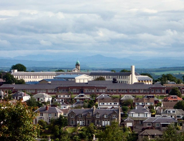
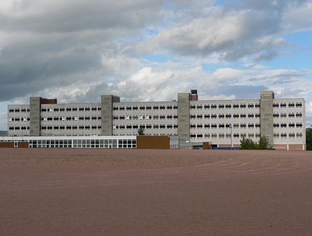
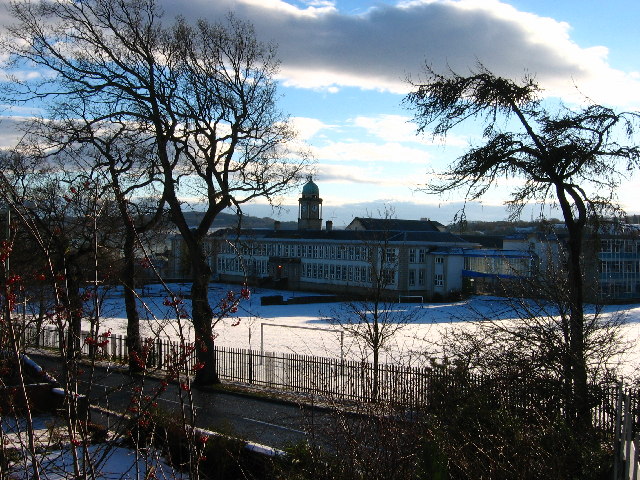
Perth High School

Perth High School is a six-year, non-denominational comprehensive secondary school in Perth, Scotland. Established in 1950 at Gowans Terrace in a post...

Perth Carriage Servicing Depot

Perth Carriage Servicing Depot is a depot and stabling point located in Perth, Perthshire, Scotland. The depot is on the eastern side of the Highland Main...

Wellshill Cemetery

Wellshill Cemetery is a 19th-century cemetery in the Scottish city of Perth, Perth and Kinross. Located on Feus Road, the cemetery is still operational...

Nearby Amenities

Located within 500m of 56.392321,-3.454157
Traffic Signals
Traffic Signals: signal
Lat/Long: 56.3902031/-3.4519323
Direction: both
Traffic Calming: cushion
Lat/Long: 56.3899668/-3.44769
Direction: both
Traffic Calming: cushion
Lat/Long: 56.3897377/-3.4496491
Mini Roundabout
Lat/Long: 56.3896573/-3.449959
Traffic Calming: bump
Lat/Long: 56.3926187/-3.4474077
Direction: both
Traffic Calming: bump
Lat/Long: 56.3922546/-3.4489084
Noexit: yes
Lat/Long: 56.393466/-3.4521997
Traffic Calming: bump
Lat/Long: 56.3928423/-3.447971
Noexit: yes
Lat/Long: 56.3947876/-3.448247
Noexit: yes
Lat/Long: 56.3929024/-3.4461536
Noexit: yes
Lat/Long: 56.3886659/-3.4567662
Noexit: yes
Lat/Long: 56.3885385/-3.4565565
Noexit: yes
Lat/Long: 56.3892466/-3.4569504
Turning Circle
Lat/Long: 56.3883184/-3.4505892
Crossing
Crossing: traffic_signals
Source: survey
Tactile Paving: yes
Lat/Long: 56.393278/-3.4508289
Noexit: yes
Lat/Long: 56.3946104/-3.4566223
Noexit: yes
Lat/Long: 56.3946649/-3.4558847
Noexit: yes
Lat/Long: 56.3930125/-3.4547883
Noexit: yes
Lat/Long: 56.3930393/-3.4545455
Noexit: yes
Lat/Long: 56.3929149/-3.4535179
Noexit: yes
Lat/Long: 56.3931812/-3.4535167
Viewlands
Is In: Perth, Scotland
Place: suburb
Lat/Long: 56.3933246/-3.4564371
Mini Roundabout
Lat/Long: 56.3948388/-3.4546366
Restaurant
Lat/Long: 56.3961058/-3.4536698
Pharmacy
Lat/Long: 56.3962678/-3.4524378
School
Perth Academy
Addr City: Perth
Addr Postcode: PH1 1NJ
Addr Street: Murray Place
Email: perthacademy@pkc.gov.uk
Fhrs Id: 941647
Operator: Perth and Kinross Council
Operator Type: government
Operator Wikidata: Q7170911
Phone: +44 1738 458000
Ref GB Uprn: 124009146
Ref Seedcode: 5350638
Religion: none
School: secondary
Website: https://www.perthacademy.org.uk/
Lat/Long: 56.3909618/-3.4590869
School
Viewlands Primary School
Addr City: Perth
Addr Postcode: PH1 1BU
Addr Street: Oakbank Crescent
Email: viewlands@pkc.gov.uk
Fhrs Id: 941657
Operator: Perth and Kinross Council
Operator Type: government
Operator Wikidata: Q7170911
Phone: +44 1738 473080
Ref GB Uprn: 124037480
Ref Seedcode: 5347920
Religion: none
School: primary
Website: https://www.viewlands.pkc.sch.uk/
Lat/Long: 56.3898453/-3.4591727
Rowanlea Guesthouse
Addr City: Perth
Addr Housenumber: 87
Addr Postcode: PH2 0PQ
Addr Street: Glasgow Road
Fhrs Id: 960368
Tourism: guest_house
Website: http://www.rowanlea-guesthouse.co.uk/
Lat/Long: 56.3950987/-3.4501896
Post Box
Collection Plate: CP7D
Collection Plate Date: 2022-09-21
Collection Times: Mo-Fr 09:00; Sa 07:00
Manufacturer: Carron Company Stirlingshire
Operator: Royal Mail
Operator Wikidata: Q638098
Post Box Mounting: lamp_post
Post Box Type: lamp
Ref: PH1 73D
Royal Cypher: scottish_crown
Source: survey;local knowledge
Lat/Long: 56.3902271/-3.4525628
Post Box
Collection Plate: CP1D
Collection Plate Date: 2018-02-27
Collection Times: Mo-Fr 09:00; Sa 07:00
Manufacturer: W T Allen & Co London
Operator: Royal Mail
Post Box Type: wall
Ref: PH1 9D
Royal Cypher: VR
Royal Cypher Wikidata: Q33102356
Source: survey;local knowledge
Lat/Long: 56.3929865/-3.4510966
Traffic Calming: bump
Lat/Long: 56.392461/-3.4461682
School
Fairview School
Addr City: Perth
Addr Postcode: PH1 1DF
Addr Street: Oakbank Crescent
Email: fairview@pkc.gov.uk
Fhrs Id: 941648
Operator: Perth and Kinross Council
Operator Type: government
Operator Wikidata: Q7170911
Phone: +44 1738 473050
Ref GB Uprn: 124080399
Ref Seedcode: 5340047
Religion: none
Website: https://blogs.glowscotland.org.uk/pk/FairviewSchool/
Lat/Long: 56.3905465/-3.4607933
Bus Stop
Braeside Gardens
Bus: yes
Naptan AtcoCode: 64802058
Naptan NaptanCode: 73723549
Public Transport: platform
Lat/Long: 56.3884914/-3.4540122
Bus Stop
Murray Place
Bus: yes
Naptan AtcoCode: 64802059
Naptan NaptanCode: 73723489
Public Transport: platform
Lat/Long: 56.3906816/-3.4518854
Barrier: yes
Lat/Long: 56.3908367/-3.4572509
Direction: both
Traffic Calming: cushion
Lat/Long: 56.3898943/-3.4483652
Direction: backward
Traffic Calming: bump
Lat/Long: 56.3924486/-3.4497157
Direction: forward
Traffic Calming: bump
Lat/Long: 56.3925272/-3.4495132
Direction: backward
Traffic Calming: bump
Lat/Long: 56.3925592/-3.4498425
Traffic Calming: bump
Lat/Long: 56.3933248/-3.4488829
Give Way
Direction: forward
Lat/Long: 56.3898905/-3.4481181
Give Way
Direction: forward
Lat/Long: 56.3900647/-3.4505333
Give Way
Direction: forward
Lat/Long: 56.3901634/-3.4504037
Give Way
Direction: forward
Lat/Long: 56.3902923/-3.4530601
Give Way
Direction: forward
Lat/Long: 56.3903608/-3.4530383
Give Way
Direction: forward
Lat/Long: 56.3905379/-3.4546066
Give Way
Direction: forward
Lat/Long: 56.3907206/-3.456212
Give Way
Direction: backward
Lat/Long: 56.3900426/-3.4572503
Give Way
Direction: forward
Lat/Long: 56.388232/-3.4543929
Give Way
Direction: backward
Lat/Long: 56.3890006/-3.4529885
Give Way
Direction: forward
Lat/Long: 56.3892983/-3.4510247
Give Way
Direction: backward
Lat/Long: 56.3909045/-3.4478388
Give Way
Direction: forward
Lat/Long: 56.3915844/-3.4485251
Give Way
Direction: backward
Lat/Long: 56.3925116/-3.4496963
Give Way
Direction: forward
Lat/Long: 56.3926809/-3.4509636
Stop
Direction: forward
Lat/Long: 56.3930558/-3.4509824
Give Way
Direction: forward
Lat/Long: 56.3930901/-3.4508285
Give Way
Direction: forward
Lat/Long: 56.3934467/-3.4508428
Give Way
Direction: backward
Lat/Long: 56.3926222/-3.4524323
Give Way
Direction: backward
Lat/Long: 56.3922196/-3.4541547
Give Way
Direction: backward
Lat/Long: 56.3919836/-3.4558583
Give Way
Direction: forward
Lat/Long: 56.3920544/-3.4559763
Give Way
Direction: forward
Lat/Long: 56.3923613/-3.459709
Give Way
Direction: forward
Lat/Long: 56.3924955/-3.4614297
Give Way
Direction: forward
Lat/Long: 56.389419/-3.4537897
Give Way
Direction: forward
Lat/Long: 56.3943492/-3.4611158
Give Way
Direction: backward
Lat/Long: 56.3935059/-3.4592557
Give Way
Direction: forward
Lat/Long: 56.3931431/-3.457905
Give Way
Direction: forward
Lat/Long: 56.3933013/-3.4515245
Give Way
Direction: forward
Lat/Long: 56.3937026/-3.4505495
Give Way
Direction: forward
Lat/Long: 56.3940555/-3.4506099
Give Way
Direction: forward
Lat/Long: 56.3943536/-3.4515843
Give Way
Direction: backward
Lat/Long: 56.3945223/-3.4487393
Give Way
Direction: backward
Lat/Long: 56.3951035/-3.4494189
Give Way
Direction: forward
Lat/Long: 56.3955539/-3.4488037
Give Way
Direction: forward
Lat/Long: 56.388989/-3.4558817
Bus Stop
Darnhall Drive (at)
Bus: yes
Naptan AtcoCode: 64801151
Naptan NaptanCode: 73724365
Public Transport: platform
Ref: 73724958
Lat/Long: 56.3896898/-3.4478261
Bus Stop
Lovat Hotel
Bench: no
Bin: no
Bus: yes
Lit: no
Naptan AtcoCode: 64801158
Naptan NaptanCode: 73724623
Public Transport: platform
Shelter: no
Tactile Paving: no
Lat/Long: 56.3935791/-3.4506478
Bus Stop
Murray Place
Bus: yes
Naptan AtcoCode: 64801241
Naptan NaptanCode: 73723486
Public Transport: platform
Lat/Long: 56.390708/-3.4516915
Bus Stop
Braeside Gardens
Bus: yes
Naptan AtcoCode: 64802057
Naptan NaptanCode: 73725639
Public Transport: platform
Lat/Long: 56.3881122/-3.4544502
Bus Stop
Lovat Hotel
Bench: yes
Bin: yes
Bus: yes
Lit: no
Naptan AtcoCode: 64801159
Naptan NaptanCode: 73723857
Public Transport: platform
Shelter: yes
Tactile Paving: no
Lat/Long: 56.3936117/-3.4508036
Bus Stop
Viewlands Place
Bus: yes
Public Transport: platform
Lat/Long: 56.3903294/-3.4532207
Bus Stop
Murray Terrace
Bus: yes
Naptan AtcoCode: 64803019
Naptan NaptanCode: 73759258
Public Transport: platform
Lat/Long: 56.3914597/-3.4561087
Bus Stop
Viewlands House
Bus: yes
Public Transport: platform
Lat/Long: 56.3921794/-3.4549153
Bus Stop
Viewlands Place
Bus: yes
Public Transport: platform
Lat/Long: 56.3911509/-3.4543716
Bus Stop
Academy
Bus: yes
Naptan AtcoCode: 64803985
Naptan NaptanCode: 73726568
Public Transport: platform
Lat/Long: 56.3903202/-3.4571946
Bus Stop
Perth Academy
Bus: yes
Naptan AtcoCode: 64803980
Naptan NaptanCode: 73726542
Public Transport: platform
Lat/Long: 56.3925723/-3.4621159
Bus Stop
Athollbank Drive
Bus: yes
Naptan AtcoCode: 64803983
Naptan NaptanCode: 73726565
Public Transport: platform
Lat/Long: 56.3935538/-3.4590589
Bus Stop
Pitheavlis Terrace
Bus: yes
Naptan AtcoCode: 64803997
Naptan NaptanCode: 73726768
Public Transport: platform
Lat/Long: 56.3903088/-3.4500135
Bus Stop
Pitheavlis Terrace
Bus: yes
Naptan AtcoCode: 64803998
Naptan NaptanCode: 73726769
Public Transport: platform
Lat/Long: 56.3902851/-3.4498169
Give Way
Direction: forward
Lat/Long: 56.3885047/-3.4549463
Give Way
Direction: backward
Lat/Long: 56.3885509/-3.4548564
Power: substation
Lat/Long: 56.3904677/-3.4511715
Generator Method: photovoltaic
Generator Output Electricity: yes
Generator Source: solar
Generator Type: solar_photovoltaic_panel
Power: generator
Lat/Long: 56.3899197/-3.4491374
Crossing
Crossing: unmarked
Crossing Island: yes
Crossing Markings: no
Tactile Paving: yes
Lat/Long: 56.3902106/-3.4504316
Crossing
Crossing: unmarked
Crossing Island: yes
Crossing Markings: no
Tactile Paving: yes
Lat/Long: 56.3910798/-3.446829
Direction: both
Traffic Calming: bump
Lat/Long: 56.3917658/-3.4487201
Direction: both
Traffic Calming: bump
Lat/Long: 56.3914382/-3.4484338
Direction: both
Traffic Calming: bump
Lat/Long: 56.3905737/-3.4503419
Crossing
Crossing: unmarked
Crossing Island: yes
Crossing Markings: no
Tactile Paving: yes
Lat/Long: 56.3891964/-3.4528515
Give Way
Direction: backward
Lat/Long: 56.3952154/-3.4527045
Give Way
Direction: backward
Lat/Long: 56.3950884/-3.4533241
Give Way
Direction: forward
Lat/Long: 56.39494/-3.4535832
Addr Housenumber: 54
Addr Street: Glasgow Road
Lat/Long: 56.3952233/-3.4489367
Addr Housenumber: 52
Addr Street: Glasgow Road
Lat/Long: 56.3952427/-3.4488979
Addr Housenumber: 50
Addr Street: Glasgow Road
Lat/Long: 56.3953282/-3.4487203
Addr Housenumber: 48
Addr Street: Glasgow Road
Lat/Long: 56.3953475/-3.4486796
Addr Housename: Garthbank
Addr Housenumber: 46
Addr Street: Glasgow Road
Lat/Long: 56.3954264/-3.4484971
Addr Housenumber: 44
Addr Street: Glasgow Road
Lat/Long: 56.3954439/-3.4484462
Pub
Ghlas Bar
Lat/Long: 56.3934191/-3.4505318
The data included in this document is from www.openstreetmap.org. The data is made available under ODbL.

Have you been to Cherrybank?

Leave your review of Cherrybank below (or comments, questions and feedback).