Badpark Wood

Wood, Forest in Devon West Devon

England

Badpark Wood

The A30 west approaching Stowford Cross junction
The A30 west approaching Stowford Cross junction Credit: Roy Hughes

Badpark Wood is a charming woodland area located in Devon, England. Covering an area of approximately 100 acres, this captivating forest is known for its natural beauty and diverse ecosystem. It is situated near the village of Badpark, which lends its name to the wood.

The wood is predominantly composed of native broadleaf trees, including oak, beech, and ash. These towering trees create a dense canopy, providing a cool and shaded environment for visitors to explore. The forest floor is adorned with an array of wildflowers, ferns, and mosses, creating a vibrant and picturesque setting.

Badpark Wood is home to a variety of wildlife, making it a popular spot for nature enthusiasts and birdwatchers. Bird species such as woodpeckers, nuthatches, and tawny owls can be spotted among the branches, while the forest floor is frequented by mammals like squirrels, rabbits, and deer.

The wood also boasts a network of well-maintained footpaths and trails, allowing visitors to easily navigate through the dense vegetation. These paths lead to hidden glades, tranquil streams, and small ponds, offering peaceful spots for picnics or relaxation.

Badpark Wood is open to the public throughout the year, providing a peaceful escape from the hustle and bustle of everyday life. Its natural beauty, diverse wildlife, and tranquil atmosphere make it an ideal destination for nature lovers and those seeking a respite in the heart of Devon.

If you have any feedback on the listing, please let us know in the comments section below.

Badpark Wood Images

Images are sourced within 2km of 50.663386/-4.2316807 or Grid Reference SX4287. Thanks to Geograph Open Source API. All images are credited.

The A30 west approaching Stowford Cross junction
The A30 west at Stowford Cross junction
Buttercup field Looking across a field of buttercups towards Rexon and Broadwoodwidger from a lane just off the A30.
Buttercup field
Looking across a field of buttercups towards Rexon and Broadwoodwidger from a lane just off the A30.
Bridge over A30 and road to Rexon Cross The lorry is entering the on slip for eastbound traffic
Bridge over A30 and road to Rexon Cross
The lorry is entering the on slip for eastbound traffic
The road to Rexon Cross Broadwoodwidger is on the skyline ahead
The road to Rexon Cross
Broadwoodwidger is on the skyline ahead
Rexon Cross road junction There are four roads meeting here, but they are staggered as two junctions
Rexon Cross road junction
There are four roads meeting here, but they are staggered as two junctions
Houses at Rexon Cross
Bridge over River Wolf near Broadwoodwidger
Road to Broadwoodwidger
Detail of carved knife showing IXL feature A curious detail, only just visible in the photo, was added to the knife blade - the letters IXL which Hems adopted for his own self-promotion (inditing his proud boast... namely:- "I excel"). The letters, with an asterisk as in I*XL, were initially a corporate mark formally registered to his mother's Wostenholm family who ran a large and very successful Sheffield firm of cutlers. <a href="https://www.geograph.org.uk/photo/3360192">SX4387 : Bench end - St. John the Baptist</a>

<span class="nowrap"><a title="www.eggintongroup.co.uk/history/the-history-of-george-wostenholm.html" rel="nofollow ugc noopener" href="http://www.eggintongroup.co.uk/history/the-history-of-george-wostenholm.html">Link</a><img style="margin-left:2px;" alt="External link" title="External link - shift click to open in new window" src="https://s1.geograph.org.uk/img/external.png" width="10" height="10"/></span>

Harry Hems as a young boy had been unsuccessfully apprenticed to his grandparent's firm of cutlers but abandoned it to take up an apprenticeship with a Sheffield woodcarver.
Detail of carved knife showing IXL feature
A curious detail, only just visible in the photo, was added to the knife blade - the letters IXL which Hems adopted for his own self-promotion (inditing his proud boast... namely:- "I excel"). The letters, with an asterisk as in I*XL, were initially a corporate mark formally registered to his mother's Wostenholm family who ran a large and very successful Sheffield firm of cutlers. SX4387 : Bench end - St. John the Baptist LinkExternal link Harry Hems as a young boy had been unsuccessfully apprenticed to his grandparent's firm of cutlers but abandoned it to take up an apprenticeship with a Sheffield woodcarver.
Portgate, the Harris Arms, no longer a pub, on the right
Bus stop at Portgate, looking west
Old Milestone in Stowford Parish, West Devon Carved stone post by the UC road (was A30), in parish of STOWFORD (WEST DEVON District), Royal Exchange B&B car park, 50m West of minor road to Stowford, on grass verge by small wall, close to telegraph pole, on North side of road. Launceston gable, erected by the Launceston turnpike trust in the 18th century. 

Inscription reads:-
LAUNCESTON
7
OKEHAMPTON 11½
Carved benchmark on lower front face.

Devon & Dartmoor HER listed.
HER Number: MDV39608 <span class="nowrap"><a title="https://www.heritagegateway.org.uk/Gateway/Results_Single.aspx?uid=MDV39608&resourceID=104" rel="nofollow ugc noopener" href="https://www.heritagegateway.org.uk/Gateway/Results_Single.aspx?uid=MDV39608&resourceID=104">Link</a><img style="margin-left:2px;" alt="External link" title="External link - shift click to open in new window" src="https://s1.geograph.org.uk/img/external.png" width="10" height="10"/></span>

Milestone Society National ID: DV_LAOK07
Old Milestone in Stowford Parish, West Devon
Carved stone post by the UC road (was A30), in parish of STOWFORD (WEST DEVON District), Royal Exchange B&B car park, 50m West of minor road to Stowford, on grass verge by small wall, close to telegraph pole, on North side of road. Launceston gable, erected by the Launceston turnpike trust in the 18th century. Inscription reads:- LAUNCESTON 7 OKEHAMPTON 11½ Carved benchmark on lower front face. Devon & Dartmoor HER listed. HER Number: MDV39608 LinkExternal link Milestone Society National ID: DV_LAOK07
Old Milestone by the former A30, Portgate, Stowford parish Carved stone post by the UC road (was A30), in parish of STOWFORD (WEST DEVON District), Portgate, 50m East of Harris Arms PH, on grass verge/bank back from road, on North side of road. Launceston gable, erected by the Launceston turnpike trust in the 18th century. 

Inscription reads:-
LAUNCESTON
6
OKEHAMPTON
12½

Devon & Dartmoor HER.
HER Number: MDV39612 <span class="nowrap"><a title="https://www.heritagegateway.org.uk/Gateway/Results_Single.aspx?uid=MDV39612&resourceID=104" rel="nofollow ugc noopener" href="https://www.heritagegateway.org.uk/Gateway/Results_Single.aspx?uid=MDV39612&resourceID=104">Link</a><img style="margin-left:2px;" alt="External link" title="External link - shift click to open in new window" src="https://s1.geograph.org.uk/img/external.png" width="10" height="10"/></span>


Milestone Society National ID: DV_LAOK06.
Old Milestone by the former A30, Portgate, Stowford parish
Carved stone post by the UC road (was A30), in parish of STOWFORD (WEST DEVON District), Portgate, 50m East of Harris Arms PH, on grass verge/bank back from road, on North side of road. Launceston gable, erected by the Launceston turnpike trust in the 18th century. Inscription reads:- LAUNCESTON 6 OKEHAMPTON 12½ Devon & Dartmoor HER. HER Number: MDV39612 LinkExternal link Milestone Society National ID: DV_LAOK06.
Fields below Portgate With a view of Dartmoor on the far horizon.
Fields below Portgate
With a view of Dartmoor on the far horizon.
A bend in the road from Allerford to Portgate
The C16th Harris Arms at Portgate On a much quieter road now that the old A30 has been by-passed but its reputation for good food and wines means that plenty of people are happy to go off the beaten track.
The C16th Harris Arms at Portgate
On a much quieter road now that the old A30 has been by-passed but its reputation for good food and wines means that plenty of people are happy to go off the beaten track.
The garden of the Harris Arms A party of walkers making the most of a beautiful November day in the south facing garden of this popular public house.
The garden of the Harris Arms
A party of walkers making the most of a beautiful November day in the south facing garden of this popular public house.
Show me another place!

Badpark Wood is located at Grid Ref: SX4287 (Lat: 50.663386, Lng: -4.2316807)

Administrative County: Devon

District: West Devon

Police Authority: Devon and Cornwall

What 3 Words

///closets.robots.starfish. Near Lifton, Devon

Related Wikis

Hayne, Stowford

Hayne in the parish of Stowford in Devon, is an historic manor, about 11 miles (18 km) south-west of Okehampton. The surviving manor house, a Grade II...

Stowford

Stowford is a village and civil parish in the district of West Devon in the English county of Devon. It is situated to the west of Dartmoor. Stowford is...

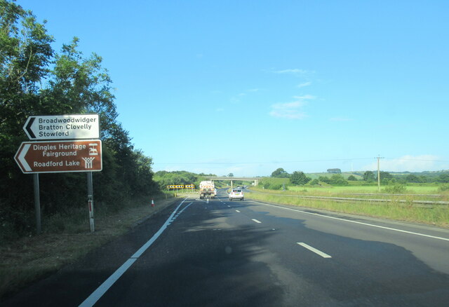
Dingles Fairground Heritage Centre

Dingles Fairground Museum, formerly known as Dingles Steam Village and Fairground Heritage Centre, is a museum that features a collection of historical...

Thrushelton

Thrushelton or Thruselton is a village and civil parish about 2 and a half miles north of Coryton railway station, in the West Devon district, in the county...

Nearby Amenities

Located within 500m of 50.663386,-4.2316807
Arracott
Place: locality
Lat/Long: 50.6647385/-4.2348712
The data included in this document is from www.openstreetmap.org. The data is made available under ODbL.

Have you been to Badpark Wood?

Leave your review of Badpark Wood below (or comments, questions and feedback).