Anagach
Settlement in Morayshire
Scotland
Anagach

Anagach is a picturesque area located in Morayshire, Scotland. It is renowned for its natural beauty and diverse wildlife, making it a popular destination for outdoor enthusiasts and nature lovers. The name "Anagach" is derived from the Gaelic word for "a narrow place," which aptly describes the landscape of this region.
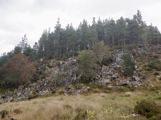
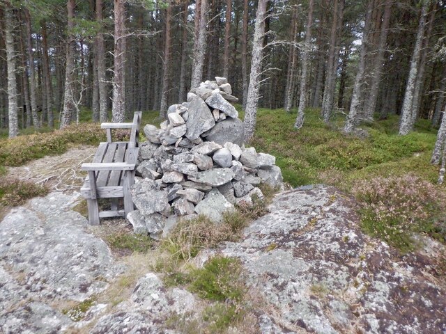
Covering an area of approximately 1,400 hectares, Anagach encompasses various habitats, including ancient Caledonian pine forest, heathland, and wetlands. The forest itself is a designated Site of Special Scientific Interest (SSSI) due to its importance in preserving native Scottish flora and supporting a wide range of wildlife.
Visitors to Anagach can enjoy a network of well-maintained trails that wind through the forest, providing opportunities for walking, hiking, and cycling. These paths offer stunning views of the surrounding countryside, including the nearby Cairngorm Mountains. Along the way, visitors may encounter a plethora of wildlife, including red squirrels, deer, and a variety of bird species, such as capercaillie and ospreys.
In addition to its natural beauty, Anagach also boasts historical significance. The area is home to the ruins of Grantown Castle, which dates back to the 15th century and was once the stronghold of the Clan Grant. Exploring these ancient remains adds a touch of heritage to the Anagach experience.
Overall, Anagach is a captivating destination that combines breathtaking landscapes, biodiversity, and historical charm. Whether seeking solitude in nature or embarking on an adventure, this Morayshire gem offers something for everyone to enjoy.
If you have any feedback on the listing, please let us know in the comments section below.
Anagach Images
Images are sourced within 2km of 57.314218/-3.612045 or Grid Reference NJ0326. Thanks to Geograph Open Source API. All images are credited.


Anagach is located at Grid Ref: NJ0326 (Lat: 57.314218, Lng: -3.612045)
Unitary Authority: Highland
Police Authority: Highlands and Islands
What 3 Words
///round.punk.mailers. Near Grantown-on-Spey, Highland
Nearby Locations
Related Wikis
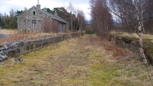
Grantown-on-Spey (East) railway station
Grantown-on-Spey (East) railway station served the town of Grantown-on-Spey, in Scotland. It was one of two railway stations serving the town, the other...

Grantown-on-Spey (West) railway station
Grantown-on-Spey (West) railway station was opened with the Inverness and Perth Junction Railway in 1863. Originally appearing on timetables as 'Grantown...
Inverallan
Inverallan is one of the parishes which formed the ecclesiastical (later civil) parish of "Cromdale, Inverallan and Advie" in Morayshire in Scotland. It...

Grantown-on-Spey
Grantown-on-Spey (Scottish Gaelic: Baile nan Granndach) is a town in the Highland Council Area, historically within the county of Moray. It is located...
Nearby Amenities
Located within 500m of 57.314218,-3.612045Have you been to Anagach?
Leave your review of Anagach below (or comments, questions and feedback).