East Banbury Plantation

Wood, Forest in Devon Torridge

England

East Banbury Plantation

A road to Roadford Lake This is one of the approach roads to the Roadford Lake reservoir, built in 1989. The road now disappears into the lake <a href="https://www.geograph.org.uk/photo/603481">SX4290 : End of the road!</a>. There is a benchmark <a href="https://www.geograph.org.uk/photo/7045738">SX4390 : A difficult benchmark</a> on the stone gatepost, to the left of the wooden gatepost that has replaced it.
A road to Roadford Lake Credit: Neville Goodman

East Banbury Plantation is a woodland area located in Devon, England. Situated in the eastern part of Banbury, this plantation covers a vast expanse of land, encompassing a diverse range of trees and natural vegetation.

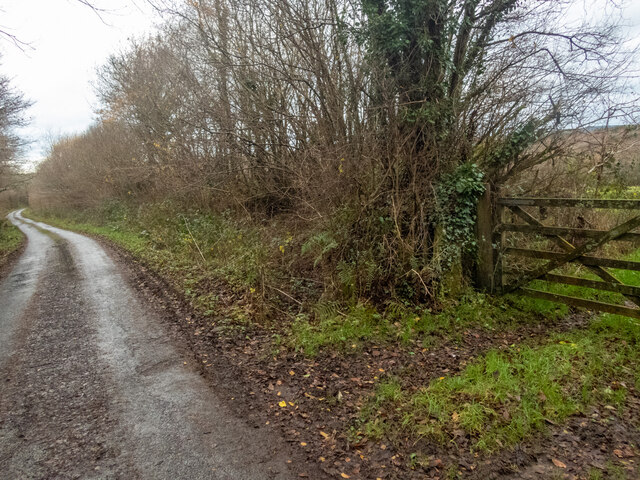
The primary feature of East Banbury Plantation is its dense forest, consisting mainly of broadleaf trees such as oak, beech, and ash. These trees create a picturesque landscape, with their vibrant green leaves providing shade and shelter for a variety of wildlife. The plantation is also home to a multitude of smaller plants and shrubs, adding to the overall biodiversity of the area.

The woodland is crisscrossed by several walking trails, allowing visitors to explore the natural beauty of the plantation. These trails are well-maintained and provide the opportunity to observe the local flora and fauna up close. Throughout the plantation, there are also designated picnic areas and benches, providing a peaceful spot for visitors to relax and enjoy the tranquility of the surroundings.

East Banbury Plantation is not only a haven for nature enthusiasts but also serves as an important habitat for wildlife. The forest is home to a wide range of animals, including deer, foxes, rabbits, and various bird species. Birdwatchers can spot species such as woodpeckers, owls, and thrushes, making it a popular destination for birdwatching enthusiasts.

Overall, East Banbury Plantation offers a serene and natural environment for visitors to escape the hustle and bustle of everyday life. With its diverse range of trees, walking trails, and abundant wildlife, it is an ideal location for outdoor activities, nature walks, and peaceful picnics amidst the beauty of Devon's woodlands.

If you have any feedback on the listing, please let us know in the comments section below.

East Banbury Plantation Images

Images are sourced within 2km of 50.683033/-4.2385163 or Grid Reference SX4189. Thanks to Geograph Open Source API. All images are credited.

A road to Roadford Lake This is one of the approach roads to the Roadford Lake reservoir, built in 1989. The road now disappears into the lake <a href="https://www.geograph.org.uk/photo/603481">SX4290 : End of the road!</a>. There is a benchmark <a href="https://www.geograph.org.uk/photo/7045738">SX4390 : A difficult benchmark</a> on the stone gatepost, to the left of the wooden gatepost that has replaced it.
A road to Roadford Lake
This is one of the approach roads to the Roadford Lake reservoir, built in 1989. The road now disappears into the lake SX4290 : End of the road!. There is a benchmark SX4390 : A difficult benchmark on the stone gatepost, to the left of the wooden gatepost that has replaced it.
A difficult benchmark Many of the benchmarks in this part of Devon are on granite gateposts. Unfortunately, many of the gateposts have since fallen into disuse. This gatepost has been replaced by wooden posts <a href="https://www.geograph.org.uk/photo/7045729">SX4390 : A road to Roadford Lake</a>. It's leaning over, was covered in moss and ivy, and awkwardly is facing and close to its wooden replacement. Assiduous gardening revealed it. <span class="nowrap"><a title="https://www.bench-marks.org.uk/bm160282" rel="nofollow ugc noopener" href="https://www.bench-marks.org.uk/bm160282">Link</a><img style="margin-left:2px;" alt="External link" title="External link - shift click to open in new window" src="https://s1.geograph.org.uk/img/external.png" width="10" height="10"/></span>
A difficult benchmark
Many of the benchmarks in this part of Devon are on granite gateposts. Unfortunately, many of the gateposts have since fallen into disuse. This gatepost has been replaced by wooden posts SX4390 : A road to Roadford Lake. It's leaning over, was covered in moss and ivy, and awkwardly is facing and close to its wooden replacement. Assiduous gardening revealed it. LinkExternal link
The A30 west approaching Stowford Cross junction
The A30 west at Stowford Cross junction
Buttercup field Looking across a field of buttercups towards Rexon and Broadwoodwidger from a lane just off the A30.
Buttercup field
Looking across a field of buttercups towards Rexon and Broadwoodwidger from a lane just off the A30.
Inlet & Headland Roadford Lake As viewed from just north of the Cafe.
Inlet & Headland Roadford Lake
As viewed from just north of the Cafe.
Path along Roadford dam A path, separated from the road by a crash barrier, runs along the top of the  dam. The sign on the left indicates the start of a footpath to Goodacre Wood, although this doesn't appear on the current DCC rights of way map or the 1:25000 map, and I'm not sure whether this would get one as far as the Watersports Centre at Lower Goodacre.

The overflow tower is in <a href="https://www.geograph.org.uk/gridref/SX4290">SX4290</a>.
Path along Roadford dam
A path, separated from the road by a crash barrier, runs along the top of the dam. The sign on the left indicates the start of a footpath to Goodacre Wood, although this doesn't appear on the current DCC rights of way map or the 1:25000 map, and I'm not sure whether this would get one as far as the Watersports Centre at Lower Goodacre. The overflow tower is in SX4290.
Footpath to Goodacre Wood A view of the start of the path shown in <a href="https://www.geograph.org.uk/photo/2800879">SX4190 : Path along Roadford dam</a> from the other direction, with a seat a few metres along the path, and Goodacre Wood in the background..
Footpath to Goodacre Wood
A view of the start of the path shown in SX4190 : Path along Roadford dam from the other direction, with a seat a few metres along the path, and Goodacre Wood in the background..
Promontory, Roadford Lake A low projection into the reservoir southeast of Lower Goodacre, seen from the same spot as <a href="https://www.geograph.org.uk/photo/2801025">SX4290 : Overflow tower, Roadford</a>. A couple of boats are out from the watersports centre, where masts can be seen.
Promontory, Roadford Lake
A low projection into the reservoir southeast of Lower Goodacre, seen from the same spot as SX4290 : Overflow tower, Roadford. A couple of boats are out from the watersports centre, where masts can be seen.
Meadow by Roadford Lake The gate leads into a field crossed by the path indicated in <a href="https://www.geograph.org.uk/photo/2800921">SX4190 : Footpath to Goodacre Wood</a>. On the left is Goodacre Wood.
Meadow by Roadford Lake
The gate leads into a field crossed by the path indicated in SX4190 : Footpath to Goodacre Wood. On the left is Goodacre Wood.
Grass by the road, Goodacre Wood From the spot where <a href="https://www.geograph.org.uk/photo/2801115">SX4190 : Meadow by Roadford Lake</a> was taken. A field boundary of trees runs out from Goodacre Wood to meet the road from the dam. Across the road is Slew Wood.
Grass by the road, Goodacre Wood
From the spot where SX4190 : Meadow by Roadford Lake was taken. A field boundary of trees runs out from Goodacre Wood to meet the road from the dam. Across the road is Slew Wood.
Road across Roadford Dam From the area where <a href="https://www.geograph.org.uk/photo/2801310">SX4190 : Grass by the road, Goodacre Wood</a> was taken, looking in the other direction to where the road crosses the dam.
Road across Roadford Dam
From the area where SX4190 : Grass by the road, Goodacre Wood was taken, looking in the other direction to where the road crosses the dam.
Cottages near Broadwoodwidger A group of cottages on the lane to Broadwoodwidger, just south of where it leaves the road across Roadford Dam.
Cottages near Broadwoodwidger
A group of cottages on the lane to Broadwoodwidger, just south of where it leaves the road across Roadford Dam.
Field near Goodacre By the junction of the lane from Broadwoodwidger and the road that crosses the Roadford Dam. In the distance, across two valleys, is Vennmoor Plantation.
Field near Goodacre
By the junction of the lane from Broadwoodwidger and the road that crosses the Roadford Dam. In the distance, across two valleys, is Vennmoor Plantation.
Cottage and road near Goodacre Rose Cottage is just north of the junction mentioned in <a href="https://www.geograph.org.uk/photo/2801364">SX4190 : Field near Goodacre</a>. Some hedge-trimming and flailing work is taking place opposite.
Cottage and road near Goodacre
Rose Cottage is just north of the junction mentioned in SX4190 : Field near Goodacre. Some hedge-trimming and flailing work is taking place opposite.
Sheds at Buddle These sheds on either side of the lane can be seen in <a href="https://www.geograph.org.uk/photo/2802791">SX4089 : Buildings at Buddle</a>.
Sheds at Buddle
These sheds on either side of the lane can be seen in SX4089 : Buildings at Buddle.
Show me another place!

East Banbury Plantation is located at Grid Ref: SX4189 (Lat: 50.683033, Lng: -4.2385163)

Administrative County: Devon

District: Torridge

Police Authority: Devon and Cornwall

What 3 Words

///gong.flasks.panoramic. Near Lifton, Devon

Related Wikis

Broadwoodwidger

Broadwoodwidger is a village and civil parish in the Torridge district of Devon, England. According to the 2001 census it had a population of 548. The...

Hayne, Stowford

Hayne in the parish of Stowford in Devon, is an historic manor, about 11 miles (18 km) south-west of Okehampton. The surviving manor house, a Grade II...

Stowford

Stowford is a village and civil parish in the district of West Devon in the English county of Devon. It is situated to the west of Dartmoor. Stowford is...

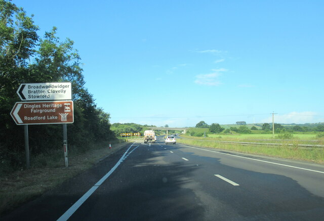
Dingles Fairground Heritage Centre

Dingles Fairground Museum, formerly known as Dingles Steam Village and Fairground Heritage Centre, is a museum that features a collection of historical...

Nearby Amenities

Located within 500m of 50.683033,-4.2385163
Power: pole
Lat/Long: 50.6872159/-4.2360663
Power: pole
Lat/Long: 50.6866025/-4.2344919
Power: pole
Lat/Long: 50.686995/-4.2353797
Power: pole
Lat/Long: 50.6871394/-4.2367986
The data included in this document is from www.openstreetmap.org. The data is made available under ODbL.

Have you been to East Banbury Plantation?

Leave your review of East Banbury Plantation below (or comments, questions and feedback).